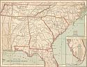
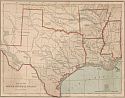
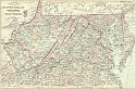
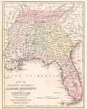
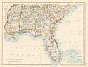
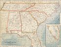
Viewing Options
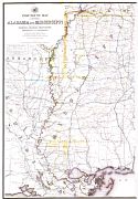
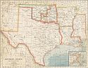
Main Author:
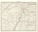
Nicholson, W.L.
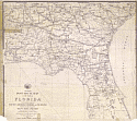
Title/Description:
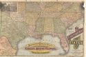
Preliminary post route map of the State of Florida with adjacent parts of South Carolina, Georgia, and Alabama
Publication Info:
[Washington: U.S. Government Printing Office], 1876
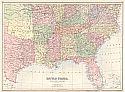
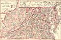
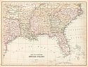
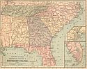
Viewing Options
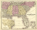
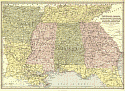
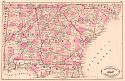
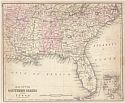
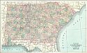
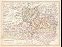
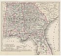
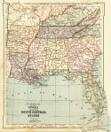
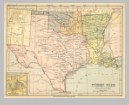
Title/Description:
Map of the Southern States Except Texas
Publication Info:
Unknown publisher, c1876; page from an unidentified atlas
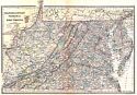
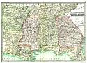
Viewing Options
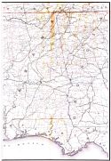
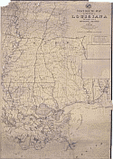
Main Author:
Kile, Anthony
Title/Description:
Post Route Map of the States of Alabama and Mississippi [Eastern Half]
Publication Info:
[Washington: U.S. Government Printing Office, 1876]
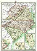
Viewing Options
Main Author:
Kile, Anthony
Title/Description:
Post Route Map of the States of Alabama and Mississippi [Western Half]
Publication Info:
[Washington: U.S. Government Printing Office, 1876]
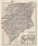
Viewing Options
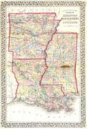
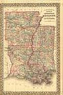
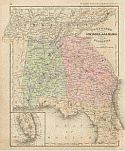
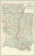
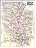
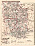
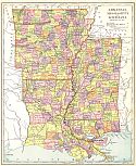
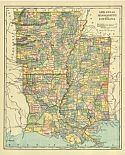
Main Author:
Mitchell, Samuel Augustus
Title/Description:
County Map of the States of Arkansas, Mississippi, and Louisiana
Publication Info:
Philadelphia: S.A. Mitchell, 1876
Viewing Options
Main Author:
McNally, Francis
Title/Description:
Mississippi, Louisiana, & Arkansas
Publication Info:
New York: A.S. Barnes and Co., 1876; from An Improved System of Geography
Viewing Options
Main Author:
McNally, Francis
Title/Description:
Tennessee, Georgia, Alabama, and Florida
Publication Info:
New York: A.S. Barnes & Co., 1876; from An Improved System of Geography
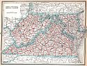
Viewing Options
Main Author:
McNally, Francis
Title/Description:
W. Virginia, Virginia, N. Carolina, and S. Carolina
Publication Info:
New York: A.S. Barnes & Co., 1876; from An Improved System of Geography
Viewing Options
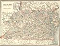
Main Author:
Gordon, Charles E.
Title/Description:
Post Route Map of the State of Tennessee [Eastern Half]
Publication Info:
[Washington: U.S. Government Printing Office, 1877]
Viewing Options
Main Author:
Gordon, Charles E.
Title/Description:
Post Route Map of the State of Tennessee [Western Half]
Publication Info:
[Washington: U.S. Government Printing Office, 1877]
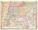
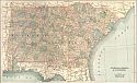
Viewing Options
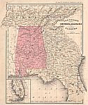
Main Author:
von Steinwehr, A., D.G. Brinton
Title/Description:
Southeastern States
Publication Info:
Cincinatti: Van Antwerp, Bragg and Company, 1877; from An Intermediate Geography with Lessons in Map Drawing
Viewing Options
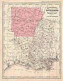
Main Author:
von Steinwehr, A., D.G. Brinton
Title/Description:
South Central States
Publication Info:
Cincinatti: Van Antwerp, Bragg and Company, 1877; from An Intermediate Geography with Lessons in Map Drawing
Viewing Options
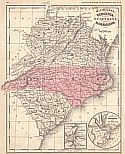
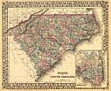
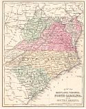
Main Author:
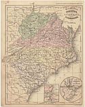
Mitchell, Samuel Augustus
Title/Description:
North and South Carolina
Publication Info:
[Philadelphia: S.A. Mitchell], 1878
Original Source:
From the personal collection of Robert M. Baker
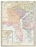
Viewing Options
Main Author:
Mitchell, Samuel Augustus
Title/Description:
County Map of the States of Arkansas, Mississippi, and Louisiana
Publication Info:
[Philadelphia: S.A. Mitchell], 1878
Original Source:
From the personal collection of Robert M. Baker
Viewing Options
Main Author:
Bartholomew, John
Title/Description:
United States, Southern Section
Publication Info:
Edinburgh: A. & C. Black, 1879
Viewing Options
Main Author:
Society for the Diffusion of Useful Knowledge
Title/Description:
North America, Sheet X, Parts of Missouri, Illinois, Kentucky, Tennessee, Alabama, Mississippi and Arkansas
Publication Info:
London: Thomas Letts, 1879
Viewing Options
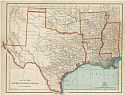
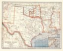
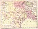
Main Author:
Nicholson, W.L.
Title/Description:
Post Route Map of Louisiana with adjacent parts of Mississippi, Arkansas, and Texas
Publication Info:
[Washington: U.S. Government Printing Office], 1880
Viewing Options
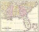
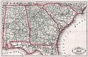
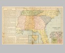
Title/Description:
Southern States, Eastern Part
Publication Info:
[Unknown publisher]
Viewing Options
Main Author:
Stieler, Adolf
Title/Description:
[Southeast United States]
Publication Info:
Gotha: Justus Perthes, 1880; from Stieler's Hand Atlas
Viewing Options
Main Author:
Bartholomew, John
Title/Description:
Tennessee, Georgia, Mississippi, Louisiana, Alabama, Arkansas, and Northern Part of Florida
Publication Info:
Philadelphia: T. Ellwood Zell, 1881
Viewing Options
Main Author:
Swinton, William
Title/Description:
Southern States, Western Division
Publication Info:
New York: Ivison, Blakeman, Taylor and Company, 1881; from Swinton's Grammer School Geography
Viewing Options
Main Author:
von Steinwehr, A.
Title/Description:
Map of the South Eastern States
Publication Info:
Cincinnati: Von Antwerp, Bragg and Company, 1881; from Eclectic Series, School Geography No. 3
Viewing Options
Main Author:
von Steinwehr, A.
Title/Description:
Map of the South Central States
Publication Info:
Cincinnati: Von Antwerp, Bragg and Company, 1881; from Eclectic Series, School Geography No. 3
Viewing Options
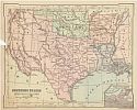
Main Author:
Rand McNally and company
Title/Description:
Map of the Southern States
Publication Info:
Chicago: Rand McNally and Company, c. 1881
Viewing Options
Main Author:
McNally, Francis
Title/Description:
W. Virginia, Virginia, N. Carolina and S. Carolina
Publication Info:
Chicago: A.S. Barnes and Company, 1882; from McNally's System of Geography
Viewing Options
Main Author:
McNally, Francis
Title/Description:
Tennessee, Georgia, Alabama and Florida
Publication Info:
Chicago: A.S. Barnes and Company, 1882; from McNally's System of Geography
Viewing Options
Main Author:
McNally, Francis
Title/Description:
Mississippi, Louisiana and Arkansas
Publication Info:
Chicago: A.S. Barnes and Company, 1882; from McNally's System of Geography
Viewing Options
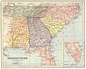
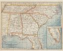
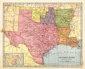
Main Author:
Cram, George F.
Title/Description:
New Railroad and County Map of Alabama, Georgia, South Carolina, and Northern Florida
Publication Info:
Chicago: George F. Cram, 1882
Viewing Options
Main Author:
Cram, George F.
Title/Description:
A New Rail Road and County Map of Alabama, Georgia, S. Carolina and Northern Florida
Publication Info:
[Chicago: George F. Cram & Co., 1883]
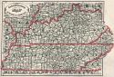
Viewing Options
Main Author:
Cram, George F.
Title/Description:
New Rail Road and County Map of Kentucky and Tennessee
Publication Info:
[Chicago: George F. Cram & Co., 1883]
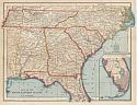
Viewing Options
Title/Description:
The Southern States, Eastern Section
Publication Info:
Cincinnati: Von Antwerp, Bragg and Company, 1883; from The Eclectic Complete Geography
Viewing Options
Main Author:
Van Antwerp, Bragg and Company
Title/Description:
Southern States, Western Section
Publication Info:
New York: American Book Company, 1883; from The Eclectic Complete Geography
Viewing Options
Title/Description:
Map of the Southern States
Publication Info:
Philadelphia: Cowperthwait and Company, 1884; from Warren's Common-School Geography
Viewing Options
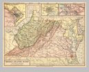
Main Author:
Tunison, Henry Cuthbert
Title/Description:
Virginia, West Virginia, Maryland, Delaware and District of Columbia
Publication Info:
Jacksonville, IL: H.C. Tunison, 1885
Viewing Options
Main Author:
Bartholomew, J.
Title/Description:
United States, Southern Section
Publication Info:
Edinburgh: A. & C. Black, 1885; from Black's General Atlas of the World
Viewing Options
Main Author:
Watson, Gaylord
Title/Description:
Alabama, Georgia and South Carolina
Publication Info:
New York: Gaylord Watson and R.A. Tenney, 1885; from The new and Complete Illustrated Atlas of the World
Viewing Options
Main Author:
Monteith, James
Title/Description:
Southern States
Publication Info:
New York: A.S. Barnes and Company, 1885; from Monteith's Independent Course Comprehensive Geography
Viewing Options
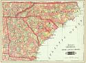
Main Author:
Monteith, James
Title/Description:
North Carolina, South Carolina, Georgia, and Florida
Publication Info:
New York: A.S. Barnes and Co., 1886; from Barnes' Complete Geography
Viewing Options
Main Author:
Monteith, James
Title/Description:
Virginia, West Virginia, Maryland, and Delaware
Publication Info:
New York: A.S. Barnes and Co., 1886; from Barnes' Complete Geography
Viewing Options
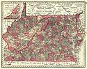
Main Author:
Mitchell, S. Augustus
Title/Description:
County map of the States of Delaware, Maryland, Virginia and West Virginia
Publication Info:
Philadelphia: Wm. M. Bradley and Bro., 1886
Viewing Options
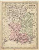
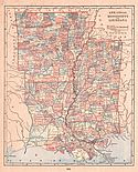
Main Author:
Mitchell, S. Augustus
Title/Description:
County Map of the States of Arkansas, Mississippi and Louisiana
Publication Info:
Philadelphia: Wm. M. Bradley and Bro., 1886
Viewing Options
Main Author:
Gamble, William H.
Title/Description:
County Map of the States of Delaware, Maryland, Virginia and West Virginia
Publication Info:
Philadelphia: William M. Bradley & Brother, 1888
Viewing Options
Main Author:
William M. Bradley and Brothers
Title/Description:
Delaware, Maryland, Virginia and West virginia
Publication Info:
Philadelphia: William Bradley & Brother, [1888]
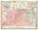
Viewing Options
Main Author:
Mitchell, S. Augustus
Title/Description:
Map of Maryland, Virginia, North Carolina and South Carolina
Publication Info:
Philadelphia: E.H. Butler and Company, 1888; from Mitchell's A System of Modern Geography
Viewing Options
Main Author:
Mitchell, S. Augustus
Title/Description:
Map of Georgia, Florida, Alabama, Mississippi and Tennessee
Publication Info:
Philadelphia: E.H. Butler and Company, 1888; from Mitchell's A System of Modern Geography
Viewing Options
Main Author:
Mitchell, S. Augustus
Title/Description:
Map of Louisiana, Texas, Arkansas and Indian Territory
Publication Info:
Philadelphia: E.H. Butler and Company, 1888; from Mitchell's A System of Modern Geography
Viewing Options
Main Author:
Collins, William
Title/Description:
South Eastern United States
Publication Info:
London: William Collins, Sons, and Company, c.1888; from Collins' Complete Atlas
Viewing Options
Main Author:
Collins, William
Title/Description:
Border States
Publication Info:
London: William Collins, Sons, and Company, c.1888; from Collins' Complete Atlas
Viewing Options
Main Author:
Johnson, A.J.
Title/Description:
Map of Arkansas, Louisiana and Mississippi
Publication Info:
New York: A.J. Johnson & Son, [1889]; for Johnson's Encyclopedia
Viewing Options
Main Author:
Mast, Crowell and Kirkpatrick
Title/Description:
Arkansas, Mississippi and Louisiana
Publication Info:
Springfield, Ohio: Mast, Crowell and Kirkpatrick, 1889; from Peerless Atlas of the World
Viewing Options
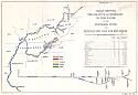
Main Author:
The Norris Peters Company
Title/Description:
Chart Showing the Relative Accessibility to Tide Water of the Tennessee River and Pennsylvania Coal and Iron Fields
Publication Info:
Washington: The Norris Peters Co., [1890]
Viewing Options
Main Author:
Johnston, William and Alexander Keith
Title/Description:
United States (S.E.)
Publication Info:
Edinburgh: W. and A.K. Johnston, c.1890
Viewing Options
Main Author:
Bartholomew, John
Title/Description:
Virginia, West Virginia, North Carolina, South Carolina and Southern Part of Florida
Publication Info:
London: MacMillan and Co., 1890; from The Library Reference Atlas of the World
Viewing Options
Main Author:
Bartholomew, John
Title/Description:
Tennessee, Georgia, Mississippi, Louisiana, Alabama, Arkansas, and Northern Part of Florida
Publication Info:
London: MacMillan and Co., 1890; from The Library Reference Atlas of the World
Viewing Options
Main Author:
Colton, J.H.
Title/Description:
United States, Section No. 4 (West Virginia, Virginia, Maryland, Delaware, North Carolina and South Carolina)
Publication Info:
New York: Sheldon and Company, 1890; from Colton's Common School Geography
Viewing Options
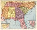
Main Author:
Colton, J.H.
Title/Description:
United States, Section No. 5 (Alabama, Georgia and Florida)
Publication Info:
New York: Sheldon and Company, 1890; from Colton's Common School Geography
Viewing Options
Main Author:
Colton, J.H.
Title/Description:
United States, Section No.6 (Mississippi, Louisiana, and Arkansas)
Publication Info:
New York: Sheldon and Company, 1890; from Colton's Common School Geography
Viewing Options
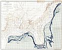
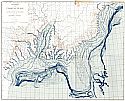
Title/Description:
Physiography of the Coastal Plain of Southeastern United States during the Post-Lafayette and Pre-Columbia Period
Publication Info:
Washington: Department of the Interior, U.S. Geological Survey, 1891; Twelfth Annual Report Pl.XI
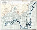
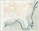
Viewing Options
Title/Description:
Physiography of the Coastal Plain of Southeastern United States during the Lafayette Period
Publication Info:
Washington: Department of the Interior, U.S. Geological Survey, 1891; Twelfth Annual Report Pl. XXXIX
Viewing Options
Title/Description:
Physiography of the Coastal Plain of Southeastern United States during the Columbia Period
Publication Info:
Washington: Department of the Interior, U.S. Geological Survey, 1891; Twelfth Annual Report Pl. XLI
Viewing Options
Title/Description:
Physiography of the Coastal Plain of Southeastern United States
Publication Info:
Washington: Department of the Interior, U.S. Geological Survey, 1891; Twelfth Annual Report Pl. XXXII
Viewing Options
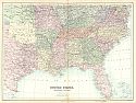
Main Author:
Appleton, D.
Title/Description:
Southern States
Publication Info:
New York: D. Appleton and Company, c.1891; from Appleton's Standard Higher Geography
Viewing Options
Main Author:
Bartholomew, J.
Title/Description:
Tennessee, Georgia, Mississippi, Louisiana, Alabama and Arkansas
Publication Info:
New York: Thomas Nelson and Sons, 1891; from The Popular Hand Atlas of the World
Viewing Options
Main Author:
Swinton, William
Title/Description:
Georgia and The South Central States
Publication Info:
New York: Ivison, Blakeman and Company, 1892; from A Complete Course in Geography
Viewing Options
Main Author:
Cram, George F.
Title/Description:
Virginia, West Virginia, Maryland and Delaware
Publication Info:
Waterbury, Conn: P.J. Bolan, 1892; from The Columbian World's Fair Atlas
Viewing Options
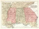
Title/Description:
Middle Atlantic States, Southern Division
Publication Info:
New York: University Publishing Company, 1892; from Manual of Geography
Original Source:
Geological Survey of Alabama
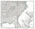
Viewing Options
Title/Description:
Southern States, Eastern Division
Publication Info:
New York: University Publishing Company, 1892; from Manual of Geography
Original Source:
Geological Survey of Alabama
Viewing Options
Title/Description:
Southern States, Western Division
Publication Info:
New York: University Publishing Company, 1892; from Manual of Geography
Original Source:
Geological Survey of Alabama
Viewing Options
Main Author:
Gaskell, C.A.
Title/Description:
Virginia, West Virginia, Maryland and Delaware
Publication Info:
Chicago: U.S. Publishing House, 1893; from The Family and Business Atlas of the World
Viewing Options
Main Author:
Gaskell, C.A.
Title/Description:
Alabama, Georgia and South Carolina
Publication Info:
Chicago: U.S. Publishing House, 1893; from The Family and Business Atlas of the World
Viewing Options
Main Author:
Fisk and Company
Title/Description:
Arkansas, Mississippi, and Louisiana
Publication Info:
New York: Hunt and Eaton, c.1893; from The Columbian Atlas of the World We Live In
Viewing Options
Title/Description:
Arkansas, Mississippi and Louisiana
Publication Info:
Philadelphia: Historical Publishing Company, 1896; from The Historical Atlas
Viewing Options
Main Author:
American Book Company
Title/Description:
The Southern States, Eastern Section
Publication Info:
New York: American Book Company, 1896; from The Eclectic Complete Geography
Viewing Options
Main Author:
Frye, Alexis Everett
Title/Description:
Southern States, Western Section
Publication Info:
Boston: Ginn and Company, 1896; from Frye's Complete Geography
Viewing Options
Main Author:
Frye, Alexis Everett
Title/Description:
Southern States, Eastern Section
Publication Info:
Boston: Ginn and Company, 1896; from Frye's Complete Geography
Viewing Options
Main Author:
American Book Company
Title/Description:
The Southern States, Western Section
Publication Info:
New York: American Book Company, 1896; from The Eclectic Complete Geography
Viewing Options
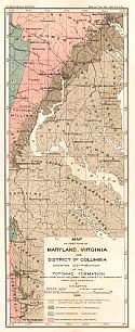
Main Author:
U.S. Geological Survey
Title/Description:
Map of Portions of Maryland, Virginia and District of Columbia showing Distribution of the Potomac Formation
Publication Info:
Washington: Department of the Interior, U.S. Geological Survey, 1896; Bulletin 145 Plate I
Viewing Options
Main Author:
Tunison, Henry C.
Title/Description:
Tunison's Georgia, North & South Carolina
Publication Info:
New York: H.C.. Tunison, 1900