Viewing Options
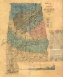
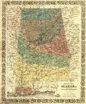
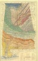
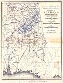
Main Author:
Tuomey, Michael
Title/Description:
Geological Map of Alabama
Publication Info:
New York: Ackerman's Lithogr., 1849
Viewing Options
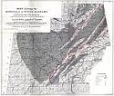
Main Author:
Taylor, R.C.
Title/Description:
Map of the Bituminous Coal Fields of Alabama
Publication Info:
Philadelphia: J.W. Moore, 1855; from Statistics of Coal
Orginal Source:
Courtesy of Whitney Telle, Northport, Alabama
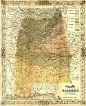
Viewing Options
Main Author:
Colton, Justin Hutchins
Title/Description:
Geological Map of the State of Alabama
Publication Info:
New York: J.H. Colton & Co., 1858
Viewing Options
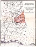
Main Author:
Smith, Eugene A.
Title/Description:
Map Showing the S.W. Termination of the Coosa Coal Field
Publication Info:
Tuscaloosa: Geological Survey of Alabama, 1876
Viewing Options
Main Author:
Smith, Eugene A.
Title/Description:
Geological Map of Alabama
Publication Info:
New York: G.W. and C.B. Colton & Co., 1878; from Berney's Hand Book of Alabama
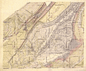
Viewing Options
Title/Description:
[Alabama]
Publication Info:
Chicago: Henry S. Stebbins, 1887
Viewing Options
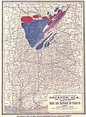
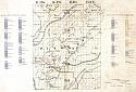
Main Author:
Wilson, F.J.
Title/Description:
[Coal Resources of Central Alabama, T9-12S, R2W-2E]
Publication Info:
For G.D. Fitzhugh, Engineer, Louisville and Nashville Railroad; one of a series of maps from 1888
Viewing Options
Main Author:
Wilson, F.J.
Title/Description:
[Coal Resources of Central Alabama, T8-11S, R1E-4E]
Publication Info:
For G.D. Fitzhugh, Engineer, Louisville and Nashville Railroad; one of a series of maps from 1888
Viewing Options
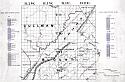
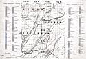
Main Author:
Wilson, F.J.
Title/Description:
[Coal Resources of Central Alabama, T11-15S, R2W-2E]
Publication Info:
For G.D. Fitzhugh, Engineer, Louisville and Nashville Railroad; one of a series of maps from 1888
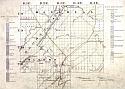
Viewing Options
Main Author:
Wilson, F.J.
Title/Description:
[Coal Resources of Central Alabama, T13-17S, R2W-2E]
Publication Info:
For G.D. Fitzhugh, Engineer, Louisville and Nashville Railroad; one of a series of maps from 1888
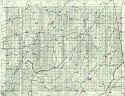
Viewing Options
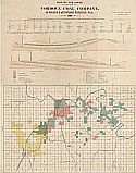
Main Author:
Cordova Coal Company
Title/Description:
Map of the Lands of the Cordova Coal Company, in Walker and Jefferson Counties, Ala.
Viewing Options
Main Author:
Squire, Joseph
Title/Description:
Map of the Cahaba Coal Field
Publication Info:
New York: Julius Bien and Co., 1890; for the Geological Survey of Alabama
Viewing Options
Main Author:
Alber, Hermann
Title/Description:
Map Showing the Minerals of North Alabama
Publication Info:
Birmingham: Hermann Alber, 1890
Viewing Options
Main Author:
Squire, Joseph
Title/Description:
Map of the Cahaba Coal Field
Publication Info:
New York: Bien and Co., 1890; manuscript map of the SW quarter of the original of 1890; for the Geological Survey of Alabama
Viewing Options
Main Author:
Squire, Joseph
Title/Description:
[Geography and Geology of the Coal Bearing Region of Alabama]
Publication Info:
unpublished manuscript maps
Orginal Source:
Courtesy of Ken Penhale, Helena, Alabama
Viewing Options
Main Author:
Smith, Eugene A.
Title/Description:
Geological Map of North Eastern Alabama with adjacent portions of Tennessee and Georgia
Publication Info:
Tuscaloosa: Geological Survey of Alabama, 1891
Viewing Options
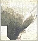
Main Author:
Phillips, William B.
Title/Description:
Sketch Map of the Alabama Crystalline Schists to Illustrate Preliminary Report of the Gold Region of Alabama
Publication Info:
Tuscaloosa: Geological Survey of Alabama, 1892

Viewing Options
Main Author:
Wilson, H.F. Jr.
Title/Description:
Map of Blount Mountain and Contiguous Areas
Publication Info:
Tuscaloosa: Geological Survey of Alabama, 1893; for a report on Blount Mountain by A.M. Gibson
Front
Back
Main Author:
Geological Survey of Alabama
Title/Description:
Geological Map of Alabama
Publication Info:
New York: J. Bien & Co., 1894
Areal Geology
Economic Geology
Structure Geology
Topography
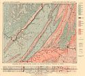
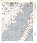
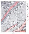
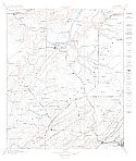
Main Author:
U.S. Geological Survey
Title/Description:
Stevenson (Folio 19)
Publication Info:
Washington: Department of the Interior, U.S. Geological Survey, 1895
Viewing Options
Main Author:
Smith, Eugene A.
Title/Description:
Map of the School Indemnity Land Secured to the State and Selected by John H. Caldwell
Publication Info:
hand drawn map dated 1896
Viewing Options
Main Author:
McCalley, Henry
Title/Description:
Sketch map of Alabama to illustrate report on the Valle Regions Paleozoic Strata of Alabama
Publication Info:
Tuscaloosa: Geological Survey of Alabama, 1896
Areal Geology
Economic Geology
Structure Geology
Topography
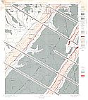
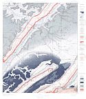
Main Author:
U.S. Geological Survey
Title/Description:
Gadsden (Folio 35)
Publication Info:
Washington: Department of the Interior, U.S. Geological Survey, 1896
Viewing Options
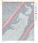
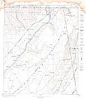
Main Author:
McCalley, Henry
Title/Description:
Structure Sections N.W. and S.E. Across the Paleozoic Strata of Alabama
Publication Info:
Tuscaloosa: Geological Survey of Alabama, 1897
Viewing Options
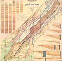
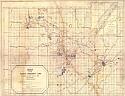
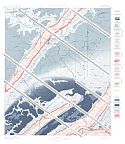
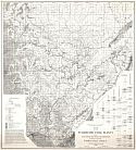
Main Author:
McCalley, Henry
Title/Description:
Map of the Warrior Coal Basin
Publication Info:
New York: Julius Bien and Co., 1898; for the Geological Survey of Alabama
Viewing Options
Main Author:
McCalley, Henry
Title/Description:
Map of the Warrior Coal Basin
Publication Info:
New York: Julius Bien and Co., 1898