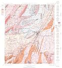
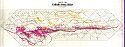
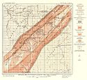
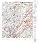
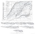
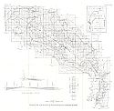
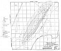
Economic Geology
Historical Geology
Structure Geology
Topography
Main Author:
U.S. Geological Survey
Title/Description:
Rome, GA (Folio 78)
Publication Info:
Washington: Department of the Interior, U.S. Geological Survey, 1901
Viewing Options
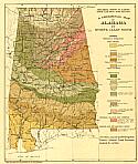
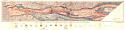
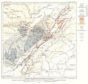
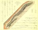
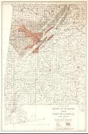
Main Author:
[Birmingham Mineral Land Co.]
Title/Description:
A Geological Map of Alabama [With Territory Covered by Birmingham District Land Referece Enclosed by Red Line]
Publication Info:
Baltimore: A. Hoen and Company, 1904
Viewing Options
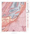
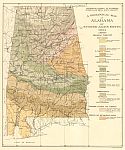
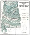
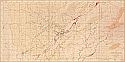
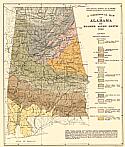
Main Author:
Smith, Eugene A.
Title/Description:
A Geological Map of Alabama
Publication Info:
Baltimore: A. Hoen and Company, 1904
Viewing Options
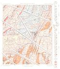
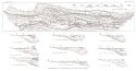
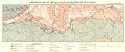
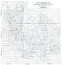
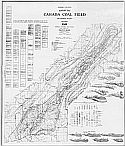
Main Author:
Squire, Joseph
Title/Description:
Revised Map of Part of the Cahaba Coal Fields
Publication Info:
Tuscaloosa: Geological Survey of Alabama, 1905
Viewing Options
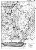
Main Author:
Smith, Eugene A.
Title/Description:
Geological and Artesian Water Map of Alabama
Publication Info:
Tuscaloosa: Geological Survey of Alabama, 1906; from Underground Water Resources Plate 1
Viewing Options
Title/Description:
Map of the Cahaba Coal Field
Publication Info:
Birmingham: 1906
Viewing Options
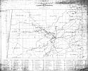
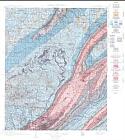
Main Author:
U.S. Geological Survey
Title/Description:
General Geologic Map of Birmingham Valley, Alabama
Publication Info:
Washington: Department of the Interior, U.S. Geological Survey, 1907
Viewing Options
Main Author:
Butts, Charles
Title/Description:
Map and Sections of the Northern Part of the Cahaba Coal Field, Alabama
Publication Info:
Washington: Department of the Interior, U.S. Geological Survey 1907; from Bulletin No.318 Plate V
Viewing Options
Title/Description:
Map Showing Location of Mines in Operation by Alabama Coal Operators
Viewing Options
Main Author:
Butts, Charles, Ernest F. Burchard and Hoyt S. Gale
Title/Description:
Geologic Map of Woodstock Brown Ore Area, Alabama
Publication Info:
Washington: Department of the Interior, U.S. Geological Survey, 1908
Viewing Options
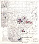
Main Author:
U.S. Geological Survey
Title/Description:
Map of Birmingham District, Alabama showing outlines and relations of areas of iron ore, coal, limeston and other economical features
Publication Info:
Washington: Department of the Interior, U.S. Geological Survey, 1908; from Bulletin 400 Plate 1
Viewing Options
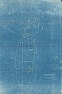
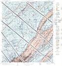
Title/Description:
Hog Mountain, Tallapoosa Co., Ala.
Publication Info:
Blueprint of Original
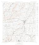
Areal Geology
Economic Geology
Structure Geology
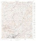
Topography
Main Author:
U.S. Geological Survey
Title/Description:
Birmingham Folio of 1910 (Folio 175)
Publication Info:
Washington: Department of the Interior, U.S. Geological Survey, 1910
Viewing Options
Main Author:
Prouty, William F.
Title/Description:
Map SHowing General Distribution of Road Materials in Alabama
Publication Info:
Tuscaloosa: Geological Survey of Alabama, 1911; from Bulletin No. XI, Plate I
Viewing Options
Main Author:
Butts, Charles
Title/Description:
Map and Sections of the Southern Part of Cahaba Coal Field, Alabama
Publication Info:
Washington: Department of the Interior, U.S. Geological Survey, 1911; from Bulletin 431 Plate IV
Viewing Options
Main Author:
Prouty, William Frederick
Title/Description:
Map of the Coosa Coal Field
Publication Info:
Baltimore: A. Hoen and Co., 1912
Viewing Options
Main Author:
McCusker, I.P.
Title/Description:
Part of Alabama's Mineral Districts
Publication Info:
Birmingham: Sourthern Railway, 1916
Viewing Options
Main Author:
Prouty, W.F.
Title/Description:
Preliminary Map of the Crystalline Marble Deposits of Alabama
Publication Info:
Tuscaloosa: Geological Survey of Alabama, 1916
Viewing Options
Main Author:
Hopkins, Oliver B.
Title/Description:
Geologic Map and Sections of the Hatchetigbee Anticline, Alabama
Publication Info:
Washington: Department of the Interior, U.S. Geological Survey, 1917; from Bulletin 611 Plate XXVI
Viewing Options
Main Author:
Lesher, C.E.
Title/Description:
State of Alabama and Part of Georgia, Coal Fields and Producing Districts
Publication Info:
Washington: Department of the Interior, U.S. Geological Survey, 1919
Viewing Options
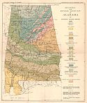
Main Author:
Smith, Eugene A.
Title/Description:
A Geological Map of Alabama
Publication Info:
Baltimore: A. Hoen and Company, 1920
Viewing Options
Title/Description:
Geologic Structure Map of Portions of Fayette and Tuscaloosa Counties
Publication Info:
based on work from the Sinclair Oil and Refining Company
Viewing Options
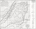
Main Author:
Jewell, William R. and A.E. Morrow
Title/Description:
Structure Map of Aldrich Dome
Viewing Options
Title/Description:
General Map of the Raccoon Mountain District of Alabama (photocopy)
Publication Info:
Chicago: Robert W. Hunt and Co., 1920
Viewing Options
Main Author:
Burg, Ralph E.
Title/Description:
Geological and Mining Map of the Cahaba Coal Field and Adjacent Regions
Publication Info:
Birmingham: Ralph E. Burg, 1922
Viewing Options
Main Author:
Sloss-Sheffield Company
Title/Description:
[Lands of the Sloss-Sheffield Company]
Publication Info:
unpublished manuscript map on 1898 Warrior Coal Basin map