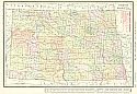
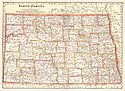
Viewing Options
Main Author:
Rand McNally & Company
Title/Description:
North Dakota
Publication Info:
Chicago: Rand McNally & Co., c.1911; from Rand McNally's Indexed Atlas
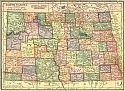
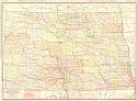
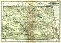
Viewing Options
Main Author:
C.S. Hammond and Company
Title/Description:
North Dakota
Publication Info:
New York: C.S. Hammond and Company, 1911; from Hammond's Modern Atlas of the World
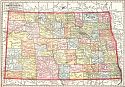
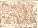
Viewing Options
Main Author:
The Geographical Publishing Company
Title/Description:
North Dakota
Publication Info:
Chicago: Geographical Publishing Company, 1911
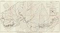
Viewing Options
Main Author:
U.S. Geological Survey
Title/Description:
Map of North Dakota Showing Location of Gas Wells
Publication Info:
Washington: Department of the Interior, U.S. Geological Survey, 1911; Bulletin 431
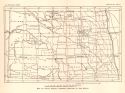
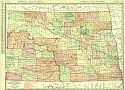
Viewing Options
Main Author:
Cram, George F.
Title/Description:
North Dakota
Publication Info:
Chicago: George F. Cram, 1911; from Cram's Unrivaled Atlas of the World
Viewing Options
Main Author:
Rand McNally and Company
Title/Description:
North Dakota
Publication Info:
Chicago: Rand McNally and Company, 1912; from The Commercial Atlas of America
Viewing Options
Main Author:
Rand McNally and Company
Title/Description:
North Dakota
Publication Info:
Chicago: Rand McNally and Company, 1912; from The Rand McNally Imperial Atlas of the World
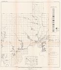
Viewing Options
Main Author:
U.S. Geological Survey
Title/Description:
Map of that part of Fort Berthold Indian Reservation, North Dakota, lying North of the Missouri River
Publication Info:
Washington: Department of the Interior, U.S. Geological Survey, 1912; Bulletin 471 Plate XIII
Viewing Options
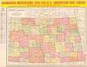
Main Author:
Rand McNally & Company
Title/Description:
Rand McNally's New Map of North Dakota
Publication Info:
Chicago: Rand McNally & Co., 1913; from Rand McNally's Bankers' Directory and List of Attorneys
Viewing Options
Main Author:
The Century Company
Title/Description:
North Dakota
Publication Info:
New York: The Century Company, 1913; from The Century Atlas of the World
Viewing Options
Main Author:
U.S. Geological Survey
Title/Description:
Map of the Williston Lignite Field, Williams County, North Dakota
Publication Info:
Washington: Department of the Interior, U.S. Geological Survey, 1913; Bulletin 531, Plate X
Viewing Options
Main Author:
Rand McNally and Company
Title/Description:
North Dakota
Publication Info:
Chicago: Rand McNally and Co., 1914; from The Commercial Atlas of America
Viewing Options
Main Author:
Reynolds, Francis J.
Title/Description:
North Dakota
Publication Info:
New York: P.F. Collier and Son, 1914; from The New Encyclopedic Atlas and Gazetteer of the World

Viewing Options
Main Author:
C.S Hammond and Company
Title/Description:
North Dakota
Publication Info:
New York: C.S. Hammond and Company, 1914; from Hammond's Commercial and Library Atlas of the World
Viewing Options
Main Author:
Rand McNally & Co.
Title/Description:
New Commercial Atlas Map of North Dakota
Publication Info:
Chicago: Rand McNally & Co., 1915

