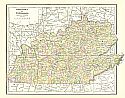
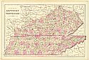
Viewing Options
Main Author:
Cram, George F.
Title/Description:
New Railroad and County Map of Kentucky and Tennessee
Publication Info:
Chicago: George F. Cram, 1881

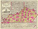
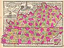
Viewing Options
Main Author:
Rand McNally and Company
Title/Description:
New County and Railroad Map of Kentucky / Map of the State of Tennessee
Publication Info:
Chicago: Rand McNally and Company, 1881

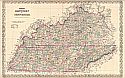
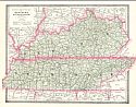
Viewing Options
Main Author:
Cram, George F.
Title/Description:
Cram's Railroad and County Map of Kentucky and Tennessee
Publication Info:
Chicago: George F. Cram, 1881

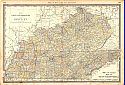
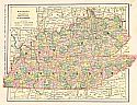
Viewing Options
Main Author:
Rand McNally and Company
Title/Description:
Kentucky and Tennessee
Publication Info:
Chicago: Rand McNally and Company, 1881; from New Indexed Business Atlas and Shippers Guide
Viewing Options
Main Author:
Phillips and Hunt
Title/Description:
Kentucky & Tennessee
Publication Info:
New York: Phillips and Hunt, 1882

Viewing Options
Main Author:
Hoeing, J.B.
Title/Description:
Washington and Marion Counties
Publication Info:
Frankfort: Geological Survey of Kentucky, 1882

Viewing Options
Main Author:
Cram, George F.
Title/Description:
Railroad and County Map of Kentucky and Tennessee
Publication Info:
Chicago: George F. Cram, 1882
Viewing Options
Main Author:
Tunison, Henry C.
Title/Description:
Tunison's Kentucky
Publication Info:
Jacksonville, IL: H.C. Tunison, c.1883
Viewing Options
Main Author:
Colton, Joseph Hutchins
Title/Description:
Colton's Kentucky and Tennessee
Publication Info:
New York: J.H. Colton & Co., 1883
Viewing Options
Main Author:
Hardesty, H.H.
Title/Description:
County and Railroad Map of Kentucky, Tennessee
Publication Info:
New York: H.H. Hardesty & Co., 1883; from Hardesty's Historical and Geographical Encyclopedia

Viewing Options
Main Author:
Gray, Ormando W.
Title/Description:
Kentucky and Tennessee
Publication Info:
Philadelphia: O.W. Gray and Son, 1883; from The National Atlas

Viewing Options
Main Author:
Gamble, W.H.
Title/Description:
County Map of Kentucky and Tennessee
Publication Info:
Philadelphia: Samuel Augustus Mitchell, 1883

Viewing Options
Main Author:
Watson, Gaylord
Title/Description:
Kentucky
Publication Info:
Boston: Perry and Spaulding, 1883; from New Indexed Family Atlas of the United States with Maps of the World
Viewing Options
Main Author:
Gamble, William H.
Title/Description:
County Map of Kentucky
Publication Info:
Philadelphia: S.A. Mitchell, 1884

Viewing Options
Main Author:
Black, A. & C.
Title/Description:
Kentucky and Tennessee
Publication Info:
Edinburgh: Adam and Charles Black, 1884; from Black's General Atlas of the World

Viewing Options
Main Author:
Cram, George F.
Title/Description:
Railroad and County Map of Kentucky and Tennessee
Publication Info:
Chicago: Peoples Publishing Company, 1884; from The People's Unrivaled Family Atlas of the World

Viewing Options
Main Author:
Rand McNally and Company
Title/Description:
Kentucky
Publication Info:
Chicago: Rand McNally and Company, 1884; from The New Household Atlas of the World
Viewing Options
Main Author:
Tunison, Henry C.
Title/Description:
Tunison's Kentucky and Tennessee
Publication Info:
Jacksonville, IL: H.C. Tunison, 1885
Viewing Options
Main Author:
Cram, George F.
Title/Description:
Railroad and County Map of Kentucky and Tennessee
Publication Info:
Chicago: George F. Cram, 1885
Viewing Options
Main Author:
Cram, George F.
Title/Description:
Watson's Atlas Map of Kentucky and Tennessee
Publication Info:
Chicago: Gaylord Watson, 1885; from Watson's New and Complete Illustrated Atlas of the World
Viewing Options
Main Author:
Hoeing, J.B.
Title/Description:
Map of the Jackson Purchase
Publication Info:
Geological Survey of Kentucky, 1885
Viewing Options
Main Author:
Wilmore, J.A.
Title/Description:
Map of Kentucky
Publication Info:
Richmond, Virginia: J.A. Wilmore, 1885

Viewing Options
Main Author:
Cram, George F.
Title/Description:
Kentucky and Tennessee
Publication Info:
Chicago: The People's Publishing Company, 1885

Viewing Options
Title/Description:
Railroad Map of Kentucky and a portion of Tennessee, showing Middlesborough's Railroad Facilities
Publication Info:
unknown c.1885

Viewing Options
Main Author:
Cram, George F.
Title/Description:
Railroad Map of Kentucky and Tennessee
Publication Info:
Chicago: George F. Cram, 1885

Viewing Options
Main Author:
Linney, W.M.
Title/Description:
Map of Mason County
Publication Info:
Frankfort: Geological Survey of Kentucky, c. 1885

Viewing Options
Main Author:
Hoeing, J.B.
Title/Description:
Boyle and Mercer Counties
Publication Info:
Frankfort: Geological Survey of Kentucky, c. 1885

Viewing Options
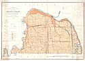
Main Author:
Hoeing, J.B.
Title/Description:
Agricultural Map of the Jackson Purchase
Publication Info:
Frankfort: Geological Survey of Kentucky, 1886