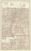
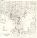
Viewing Options
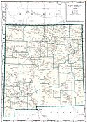
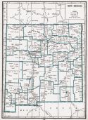
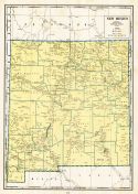
Main Author:
C.S. Hammond and Company
Title/Description:
New Mexico
Publication Info:
New York: C.S. Hammond and Company, c. 1930; from The New World Loose Leaf Atlas, Sixth Edition
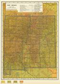
Viewing Options
Main Author:
C.S. Hammond and Company
Title/Description:
New Mexico
Publication Info:
New York: C.S. Hammond and Company, c. 1930; from The New World Loose Leaf Atlas, Sixth Edition
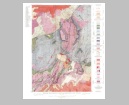
Viewing Options
Main Author:
Winchester, Dean E.
Title/Description:
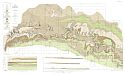
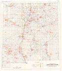
Oil and Gas Map of New Mexico
Publication Info:
Socorro: New Mexico School of Mines, 1931; Bulletin No. 9
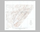
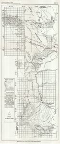
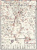
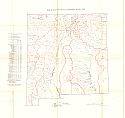
Viewing Options
Main Author:
Winchester, Dean E.
Title/Description:
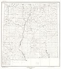
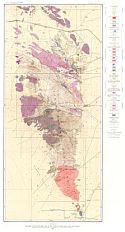
Geologic Map of New Mexico
Publication Info:
Socorro: New Mexico School of Mines, 1931; Bulletin No. 9
Viewing Options
Main Author:
Geographical Publishing Company
Title/Description:
New Mexico
Publication Info:
Chicago: Geographical Publishing Company1931; from Commercial Atlas of the World
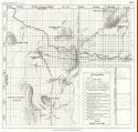
Viewing Options
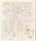
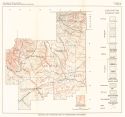
Main Author:
U.S. Geological Survey
Title/Description:
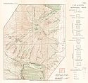
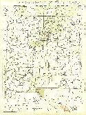
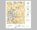
Magdalena District, Socorro County, New Mexico
Publication Info:
Washington: Department of the Interior, U.S. Geological Survey, 1932
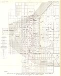
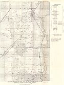
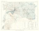
Viewing Options
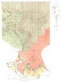
Main Author:
U.S. Geological Survey
Title/Description:
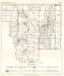
Map of the City of Roswell showing original area of artesian flow, areas of flow in 1916 and 1926, and location of artesian wells
Publication Info:
Washington: Department of the Interior, U.S. Geological Survey, 1932; Water Supply Paper No. 639 Plate 40
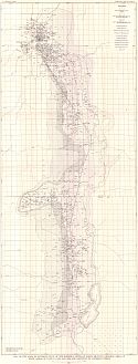
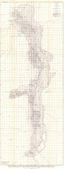
Viewing Options
Main Author:
U.S. Geological Survey
Title/Description:
Map of the area of artesian flow of the Roswell artesian basin, showing original area of flow, areas of flow in 1916 and 1926, and location of artesian wells
Publication Info:
Washington: Department of the Interior, U.S. Geological Survey, 1932; Water Supply Paper No. 639 Plate 39
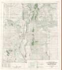
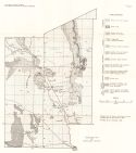
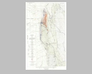
Viewing Options
Main Author:
U.S. Geological Survey
Title/Description:
Contour Map of the Upper Surface of the Picacho Limestone and Sections Across the Roswell Area of Artesian Flow
Publication Info:
Washington: Department of the Interior, U.S. Geological Survey, 1932; Water Supply Paper No. 639 Plate 25
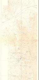
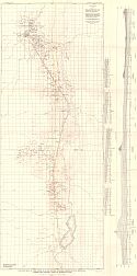
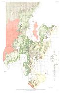
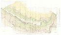
Viewing Options
Main Author:
U.S. Geological Survey
Title/Description:
Reconnaissance Map of the Roswell Alluvial Basin showing the areal relations of the Lakewood, Orchard Park and Blackdom Terraces and the gravel-copped Mesas
Publication Info:
Washington: Department of the Interior, U.S. Geological Survey, 1932; Water Supply Paper No. 639 Plate 4
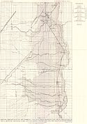
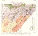
Viewing Options
Main Author:
U.S. Geological Survey
Title/Description:
Reconnaissance Geologic Map of the Eastern part of the Roswell Artesian Basin, New Mexico
Publication Info:
Washington: Department of the Interior, U.S. Geological Survey, 1932; Water Supply Paper No. 639 Plate 3
Viewing Options
Main Author:
U.S. Geological Survey
Title/Description:
Map of Roswell Artesian Area showing irrigated Areas and height above or depth below land surface to which artesian water would rise in tightly cased wells
Publication Info:
Washington: Department of the Interior, U.S. Geological Survey, 1932; Water Supply Paper No. 639 Plate 45
Viewing Options
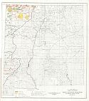
Main Author:
New Mexico School of Mines
Title/Description:
Map of Northwestern San Juan County showing Geologic Structure
Publication Info:
Socorro: New Mexico School of Mines, 1933; Bulletin No. 9
Viewing Options
Main Author:
New Mexico School of Mines
Title/Description:
Map of Part of Rio Arriba County showing Geologic Structure
Publication Info:
Socorro: New Mexico School of Mines, 1933; Bulletin No.9
Viewing Options
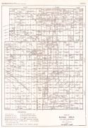
Main Author:
Winchester, Dean E.
Title/Description:
Map of Jal Area, Lea County, New Mexico
Publication Info:
Socorro: New Mexico School of Mines, 1933; Bulletin No. 9
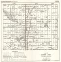
Viewing Options
Main Author:
Winchester, Dean E
Title/Description:
Map of Cooper Area, Lea County, New Mexico
Publication Info:
Socorro: New Mexico School of Mines, 1933; Bulletin No. 9
Viewing Options
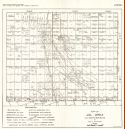
Main Author:
Winchester, Dean E.
Title/Description:
Map of Eunice Area, Lea County, New Mexico
Publication Info:
Socorro: New Mexico School of Mines, 1933; Bulletin No. 9
Viewing Options
Main Author:
Winchester, Dean E.
Title/Description:
Map of Maljamar Area, Eddy and Lea Counties, New Mexico
Publication Info:
Socorro: New Mexico School of Mines, 1933; Bulletin No. 9
Viewing Options
Main Author:
Highway Map Company
Title/Description:
Highway Map of New Mexico
Publication Info:
Topeka: Highway Map Company, c. 1933
Original Source:
Murray Hudson
Viewing Options
Main Author:
U.S. Geological Survey
Title/Description:
Geologic map and sections of the coal field eastward from Gallup in the southern part of the San Juan Basin, New Mexico
Publication Info:
Washingto: Department of the Interior, US Geological Survey, 1934; Bulletin 860, Plate 1
Viewing Options
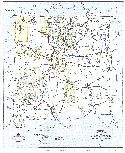
Main Author:
Harley, George Townsend
Title/Description:
General Geologic Map of Sierra County
Publication Info:
Socorro: New Mexico School of Mines, 1934; Bulletin No. 10
Viewing Options
Main Author:
Harley, George Townsend
Title/Description:
Topographic and Geologic Map of the Hillsboro (Las Animas) Lode Mining District
Publication Info:
Socorro: New Mexico School of Mines, 1934; Bulletin No. 10
Viewing Options
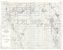
Main Author:
Dunham, Kinglsey Charles
Title/Description:
Geologic Map of the Organ Mining District
Publication Info:
Socorro: New Mexico School of Mines, 1935; Bulletin No. 11
Viewing Options
Main Author:
Dunham, Kingsley Charles
Title/Description:
Geologic Map of Dona Ana County
Publication Info:
Socorro: New Mexico School of Mines, 1935; Bulletin No. 11
Viewing Options
Main Author:
U.S. Geological Survey
Title/Description:
Geologic map of the Bayard Area of the Central Mining District, Grant County, New Mexico
Publication Info:
Washington: Department of the Interior, US Geological Survey, 1936; Bulletin 870, Plate 1
Viewing Options
Main Author:
U.S. Geological Survey
Title/Description:
Geologic Map of the Eastern Part of the Mount Taylor Coal Field, in the Southern Part of the San Juan Basin, New Mexico
Publication Info:
Washington: Department of the Interior, US Geological Survey, 1936; Bulletin 860, Plate 19
Viewing Options
Main Author:
U.S. Geological Survey
Title/Description:
Geologic map of the western part of the Mount Taylor Coal Field, in the Southern part of the San Juan Basin, New Mexico
Publication Info:
Washington, D.C: Department of the Interior, US Geological Survey, 1936; Bulletin 860, Plate 18
Viewing Options
Main Author:
U.S. Geological Survey
Title/Description:
Geologic Map of the LaVentana-Chacra Mesa Coal Field of the southern part of the San Juan Basin, New Mexico
Publication Info:
Washington: Department of the Interior, US Geological Survey, 1936; Bulletin 860, Plate 39
Viewing Options
Main Author:
Branom, Frederick K. and Lloyd Edwin Smith
Title/Description:
New Mexico
Publication Info:
Chicago: Geographical Publishing Company, 1936; from Capper's 1936 Atlas of the World
Viewing Options
Main Author:
Standard Oil Company of Texas
Title/Description:
New Mexico
Publication Info:
Chicago: H.M. Gousha Company, 1936
Original Source:
Murray Hudson
Viewing Options
Main Author:
Rand McNally and Company
Title/Description:
Standard Map of New Mexico
Publication Info:
Chicago: Rand McNally and Company, 1936
Viewing Options
Main Author:
Talmage, Sterling B. and Thomas P. Wootton
Title/Description:
Map Showing Distribution of Non-Metallic Minerals in New Mexico
Publication Info:
Socorro: New Mexico School of Mines, 1937; Bulletin No. 12
Viewing Options
Main Author:
U.S. Geological Survey
Title/Description:
State of New Mexico
Publication Info:
Washington: Department of the Interior, U.S. Geological Survey, 1940; compiled 1921 and 1922
Viewing Options
Main Author:
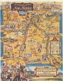
New Mexico State Tourist Bureau
Title/Description:
Historical Trails Through New Mexico The Land of Enchantment
Publication Info:
Sante Fe: State Highway Department, c.1940
Viewing Options
Main Author:
Harley, Geroge Townsend
Title/Description:
Geologic and Topographic Map of Northeastern New Mexico
Publication Info:
Socorro: New Mexico School of Mines, 1940; Bulletin No. 15
Viewing Options
Main Author:
New Mexico State Highway Department
Title/Description:
Official Road Map of New Mexico
Publication Info:
Santa Fe: New Mexico State Highway Department, 1940
Original Source:
Murray Hudson
Viewing Options
Main Author:
New Mexico School of Mines
Title/Description:
[Oil and Gas Fields of] Southeastern New Mexico
Publication Info:
Socorro: New Mexico School of Mines, 1942; Bulletin No. 18
Viewing Options
Main Author:
Geographical Publishing Company
Title/Description:
New Mexico
Publication Info:
Chicago: Geographical Publishing Company, 1942; from The New International Atlas of the World, War Edition
Viewing Options
Main Author:
Bates, Robert L. after Winchester
Title/Description:
Oil and Gas Map of New Mexico
Publication Info:
Socorro: New Mexico School of Mines, 1942; Bulletin No. 18
Viewing Options
Main Author:
New Mexico School of Mines
Title/Description:
Map of part of Rio Arriba County showing Geologic Structure
Publication Info:
Socorro: New Mexico School of Mines, 1942; Bulletin No. 18
Viewing Options
Main Author:
New Mexico School of Mines
Title/Description:
Map of Northwestern San Juan County showing Geologic Structure
Publication Info:
Socorro: New Mexico School of Mines, 1942; Bulletin No. 18
Viewing Options
Main Author:
New Mexico School of Mines
Title/Description:
Map of Northeastern San Juan County showing Oil and Gas Fields
Publication Info:
Socorro: New Mexico School of Mines, 1942; Bulletin No. 18
Viewing Options
Main Author:
New Mexico School of Mines
Title/Description:
Map of Southern San Juan Basin in McKinley, Valencia, and Sandoval Counties, showing Geologic Structure
Publication Info:
Socorro: New Mexico School of Mines, 1942; Bulletin No. 18
Viewing Options
Main Author:
Bureau of the Census
Title/Description:
New Mexico Irrigation by Drainage Basins, 1939
Publication Info:
Washington: U.S. Government Printing Office, 1942
Viewing Options
Main Author:
U.S. Department of the Interior
Title/Description:
Water Resources Development, Colorado River Basin, New Mexico
Publication Info:
Washington: Department of the Interior, Bureau of Reclamation, 1946; from The Colorado River, A Natural Menace Becomes a National Resource
Viewing Options
Main Author:
U.S. Geological Survey
Title/Description:
Geologic Map of the Iron Mountain District, Sierra and Socorro Counties, New Mexico
Publication Info:
Washington: Department of the Interior, US Geological Survey, 1946; Bulletin 946, Plate 17
Viewing Options
Main Author:
U.S. Geological Survey
Title/Description:
Geologic and topographic map of the Little Hatchet Mountains, New Mexico
Publication Info:
Washington: Department of the Interior, US Geological Survey, 1947; Professional Paper 208, Plate 1
Viewing Options
Main Author:
U.S. Geological Survey
Title/Description:
Geologic Map and Section of the Nash Draw Quadrangle, Eddy County, New Mexico
Publication Info:
Washington: Department of the Interior, U.S. Geological Survey, 1962; Bulletin 1141-B Plate 1