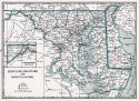
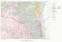
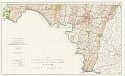
Viewing Options
Main Author:
Clason Map Company
Title/Description:
Best Roads of Maryland and Delaware
Publication Info:
Chicago: Clason Map Company, c. 1927; from Clason's Touring Atlas
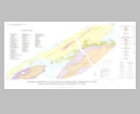
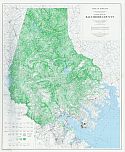
Viewing Options
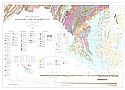
Main Author:
Maryland Geological Survey
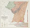
Title/Description:
Map of Carroll County Showing the Geological Formations
Publication Info:
Baltimore: Maryland Geological Survey, 1928
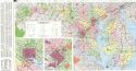
Viewing Options
Main Author:
Mathews, Edward Bennett
Title/Description:
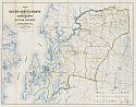
Map of Maryland Showing State Road System
Publication Info:
Baltimore: Maryland Geological Survey, 1930
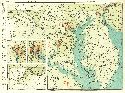
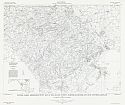
Viewing Options
Main Author:
National Map Company
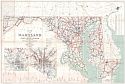
Title/Description:
Maryland
Publication Info:
Indianapolis: National Map Company, 1930; from Official Paved Road and Commercial Survey of the United States

Viewing Options
Main Author:
C.S. Hammond and Company
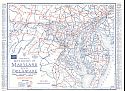
Title/Description:
Maryland and Delaware
Publication Info:
New York: C.S. Hammond and Company, c. 1930; from The New World Loose Leaf Atlas, Sixth Edition
Viewing Options
Main Author:
C.S. Hammond and Company
Title/Description:
Maryland
Publication Info:
New York: C.S. Hammond and Company, c. 1930; from The New World Loose Leaf Atlas, Sixth Edition

Viewing Options
Main Author:
Geographical Publishing Company
Title/Description:
Maryland
Publication Info:
Chicago: Geographical Publishing Company1931; from Commercial Atlas of the World
Viewing Options
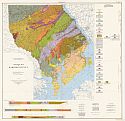
Main Author:
Maryland Geological Survey
Title/Description:
Map of Maryland Showing Geological Formations
Publication Info:
Baltimore: Maryland Geological Survey, 1933
Viewing Options
Main Author:
Maryland Geological Survey
Title/Description:
Map of Maryland Showing Surface Elevation
Publication Info:
Baltimore: Maryland Geological Survey, 1935
Main Author:
Maryland Geological Survey
Title/Description:
Maryland Geologcial Survey Election Maps
Publication Info:
Baltimore: Maryland Geological Survey, 1935-1967
Viewing Options
Main Author:
Branom, Frederick K. and Lloyd Edwin Smith
Title/Description:
Maryland, Delaware, and District of Columbia
Publication Info:
Chicago: Geographical Publishing Company, 1936; from Capper's 1936 Atlas of the World
Viewing Options
Main Author:
Rand McNally and Company
Title/Description:
Standard Map of Maryland and Delaware, and District of Columbia
Publication Info:
Chicago: Rand McNally and Company, 1936
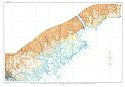
Viewing Options
Main Author:
Darton, N.H.
Title/Description:
Map Showing the Distribution of gravel and sand deposits of northeastern Maryland
Publication Info:
Washington: Department of the Interior, US Geological Survey, 1938; Bulletin 906, Plate 9

Viewing Options
Main Author:
Darton, N.H.
Title/Description:
Map Showing the Distribution of gravel and sand deposits of southeast and south of Washington DC
Publication Info:
Washington: Department of the Interior, US Geological Survey, 1938; Bulletin 906, Plate 10

Viewing Options
Main Author:
Darton, N.H.
Title/Description:
Map Showing the Distribution of gravel and sand deposits between Washington DC and Baltimore Maryland
Publication Info:
Washington: Department of the Interior, US Geological Survey, 1938; Bulletin 906, Plate 6

Viewing Options
Main Author:
Geographical Publishing Company
Title/Description:
Maryland, Delaware, and District of Columbia
Publication Info:
Chicago: Geographical Publishing Company, 1942; from The New International Atlas of the World, War Edition
Viewing Options
Main Author:
Maryland State Road Commission
Title/Description:
Map of Maryland
Publication Info:
Annapolis: Maryland State Road Commission, 1949
Original Source:
Murray Hudson

Viewing Options
Main Author:
Amsden, T.W.
Title/Description:
Geologic Map of Garrett County
Publication Info:
Baltimore: Department of Geology, Mines, and Water Resources, 1953

Viewing Options
Main Author:
Cloos, E. and C.W. Cooke
Title/Description:
Geologic Map of Montgomery County and the District of Columbia
Publication Info:
Baltimore: Department of Geology, Mines, and Water Resources, 1953
Viewing Options
Main Author:
U.S. Geological Survey
Title/Description:
Geologic Map of Brandywine Area, Southern Maryland
Publication Info:
Washington: Department of the Interior, U.S. Geological Survey; Professional Paper 267
Viewing Options
Main Author:
U.S. Geological Survey
Title/Description:
Mineral Deposits in the Central Serpentine Districts of the Maryland-Pennsylvania Piedmont Upland
Publication Info:
Washington: Department of the Interior, U.S. Geological Survey, 1960; Bulletin 1082-K Plate 41

Viewing Options
Main Author:
U.S. Geological Survey
Title/Description:
Mineral Deposits in the Southern Serpentine Districts of the Maryland Piedmont Upland
Publication Info:
Washington: Department of the Interior, U.S. Geological Survey, 1960; Bulletin 1082-K Plate 40
Viewing Options
Main Author:
Maryland State Roads Commission
Title/Description:
State of Maryland, State Highway System
Publication Info:
[Annapolis]: Maryland State Roads Commission, 1963

Viewing Options
Main Author:
Bromery, R.W., A.J. Petty, and C.J. Smith
Title/Description:
Aeromagnetic Map of Bel Air and Vicinity, Harford, Baltimore, and Cecil Counties, Maryland
Publication Info:
Washington: Department of the Interior, U.S. Geological Survey, 1964; Geophysical Investigations Map GP-482
Viewing Options
Main Author:
Bromery, R.W., A.J. Petty, and F.P. Gilbert
Title/Description:
Natural Gamma Aeroradioactivity Map of Bel Air
Publication Info:
Washington: Department of the Interior, U.S. Geological Survey, 1964; Geophysical Investigations Map GP-484
Viewing Options
Main Author:
Maryland Geological Survey
Title/Description:
Geologic Map of Maryland
Publication Info:
Baltimore: Maryland Geologic Survey, 1968
Viewing Options
Main Author:
Richardson, C.A., E.T. Cleaves, and J. Edwards, Jr.
Title/Description:
Topographic Map of Carroll County
Publication Info:
Baltimore: Maryland Geological Survey, 1968
Viewing Options
Main Author:
Southwick, D.L. and J.P. Owens
Title/Description:
Geologic Map of Harford County
Publication Info:
Baltimore: Maryland Geological Survey, 1968
Viewing Options
Main Author:
Edwards, J., Jr., and E.T. Cleaves
Title/Description:
Topographic Map of Queen Anne's County
Publication Info:
Baltimore: Maryland Geological Survey, 1968
Viewing Options
Main Author:
Cleaves, E.T.
Title/Description:
Topographic Map of Washington County
Publication Info:
Baltimore: Maryland Geological Survey, 1968
Viewing Options
Main Author:
Maryland Geological Survey
Title/Description:
Slope Map of Baltimore County
Publication Info:
Baltimore: Maryland Geological Survey, 1969

Viewing Options
Main Author:
McLennan, J.D.
Title/Description:
Topographic Map of Charles County
Publication Info:
Baltimore: Maryland Geological Survey, 1969

Viewing Options
Main Author:
Cleaves, E.T. and J. Edwards, Jr.
Title/Description:
Topographic Map of Prince Georges County
Publication Info:
Baltimore: Maryland Geological Survey, 1969

Viewing Options
Main Author:
McLennan, J.
Title/Description:
Topographic Map of Calvert County
Publication Info:
Baltimore: Maryland Geological Survey, 1970

Viewing Options
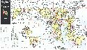
Main Author:
Brush, Grace Somers, Cecilia Lenk and Joanna Smith
Title/Description:
Vegetation Map of Maryland, The Existing Natural Forests
Publication Info:
Baltimore: The Department of Geography and Environmental Engineering, The Johns Hopkins University, 1976