Viewing Options
Main Author:
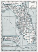
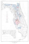
Florida State Department of Agriculture
Title/Description:
Historical Map of Florida
Publication Info:
St Augustine: The Record Company, 1931
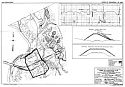
Viewing Options
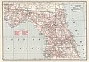
Main Author:
U.S. Army Corps of Engineers
Title/Description:
Choctawhatchee & Pea Rivers, FL & AL; Town of Caryville, FL; Flood Protection
Publication Info:
Montgomery: US Engineer Office, 1931
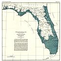
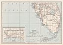
Viewing Options
Main Author:
Leverett, Frank
Title/Description:
Map of the Pensacola Sea in Florida
Publication Info:
Tallahassee: Florida State Geological Survey, 1931; from Bulletin No. 7
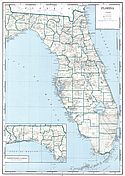
Viewing Options
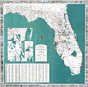
Main Author:
Geographical Publishing Company
Title/Description:
Florida
Publication Info:
Chicago: Geographical Publishing Company1931; from Commercial Atlas of the World
Viewing Options
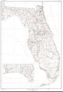
Main Author:
C.S. Hammond and Company
Title/Description:
Florida - Northern Part
Publication Info:
New York: C.S. Hammond and Company, 1931
Viewing Options
Main Author:
C.S. Hammond and Company
Title/Description:
Florida - Southern Part
Publication Info:
New York: C.S. Hammond and Company, 1931
Viewing Options
Main Author:
Hagstrom Company
Title/Description:
Florida Counties, Cities, Towns
Publication Info:
New York: Hagstrom Company, c.1931
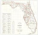
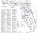
Viewing Options
Main Author:
Florida State Road Department
Title/Description:
Official Road Map of Florida
Publication Info:
Tallahassee: Florida State Road Department, 1934
Viewing Options
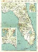
Main Author:
Branom, Frederick K. and Lloyd Edwin Smith
Title/Description:
Florida
Publication Info:
Chicago: Geographical Publishing Company, 1936; from Capper's 1936 Atlas of the World
Viewing Options
Main Author:
Florida State Road Department
Title/Description:
Official Road Map of Florida
Publication Info:
Tallahassee: Florida State Road Department, 1936
Viewing Options
Main Author:
Rand McNally and Company
Title/Description:
Standard Map of Florida
Publication Info:
Chicago: Rand McNally and Company, 1936
Viewing Options
Main Author:
Hassan, A.F.
Title/Description:
Florida
Publication Info:
Washington: U.S. Department of the Interior, Geological Survey, 1940
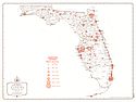
Viewing Options
Main Author:
U.S. Geological Survey
Title/Description:
Map of Florida showing distribution of phosphate deposits and some related formations
Publication Info:
Washington, D.C: Department of the Interior, US Geological Survey, 1940; Bulletin 934, Plate 5
Viewing Options
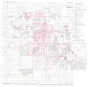
Main Author:
U.S. Geological Survey
Title/Description:
Ownership map, Pebble Phosphate Field in Hardee, Hillsborough, Manatee and Polk Counties, Florida
Publication Info:
Washington, D.C: Department of the Interior, US Geological Survey, 1940; Bulletin 934, Plate 7