Viewing Options
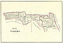
Title/Description:
No. 4. Florida
Publication Info:
Washington: W.J. Stone. 1841
Viewing Options
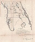
Main Author:
Cannay, T.S.
Title/Description:
A Plat of the Peninsula of Florida
Publication Info:
Tallahassee: U.S. Surveyor General, 1843
Viewing Options
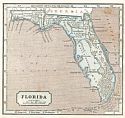
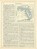
Main Author:
Morse, Sidney E.
Title/Description:
Florida
Publication Info:
New York: Harper and Brothers, 1844; from the System of Geography for the Use of Schools
Viewing Options
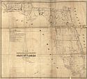
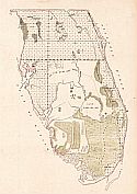
Main Author:
Butler, Robert
Title/Description:
A Plat Exhibiting the State of the Surveys in the State of Florida with References
Publication Info:
St. Augustine: Surveyor General's Office, 1845
Viewing Options
Main Author:
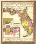
Mitchell, Samuel Augustus
Title/Description:
Florida
Publication Info:
Philadelphia: S.A. Mitchell, 1846
Viewing Options
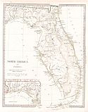
Main Author:
Society for the Diffusion of Useful Knowledge
Title/Description:
North America Sheet XIV Florida
Publication Info:
London: Charles Knight & Co., 1846
Viewing Options
Main Author:
General Land Office
Title/Description:
Public Land Survey - Map of Southern Florida
Publication Info:
Washington: General Land Office, 1850
Viewing Options
Main Author:
Goodrich, S.G.
Title/Description:
Florida
Publication Info:
New York: George Savage, 1850; from A Comprehensive Geography and History Ancient and Modern