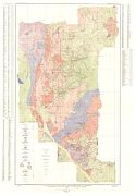
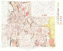
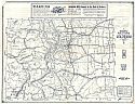
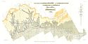
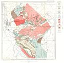
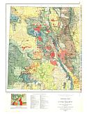
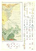
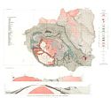
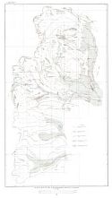
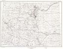
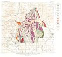
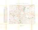
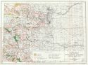
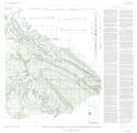
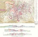
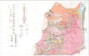
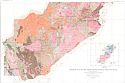
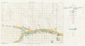
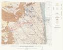
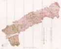
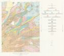
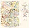
Home  |  Help  |  Graphics Tutorial  |  Aerial Photography  |  Historical Maps  |  Contemporary Maps  |  About this site  | 

Historical Maps of Other Southeastern States

Selected Colorado Out-of-Print Quadrangles
USGS or Army Map Service

After 1930
Before 1880
1880-1890
1891-1900
1901-1905
1906-1910
1911-1915
1916-1920
1921-1925
1926-1930
After 1930

Previous Page

  Main Author:   U.S. Geological Survey
  Title/Description:   Geologic and Topographic Map Showing Surveyed Mining Claims and Underground Development in the Bonanza District, Saguache County, Colorado
  Publication Info:   Washington: Department of the Interior, U.S. Geological Survey, 1931; Professional Paper 169, Plate 1
  Date:   1931
  Scale:   1:12,000
  Original Source:   Geological Survey of Alabama
Viewing options:


  Main Author:   U.S. Geological Survey
  Title/Description:   Geologic map of the San Juan Mountains, Colorado, Showing Distribution of Late Tertiary and Quaternary Formations
  Publication Info:   Washington: Department of the Interior, U.S. Geological Survey, 1931; Professional Paper 166, Plate 1
  Date:   1931
  Scale:   1:250,000
  Original Source:   Geological Survey of Alabama
Viewing options:


  Main Author:   Mid-West Map Company
  Title/Description:   Highway Map and Guide of Colorado
  Publication Info:   Aurora, Mo.: Mid-West Map Company, c. 1931
  Date:   1931
  Scale:   1:1,267,200
  Original Source:   W. S. Hoole Special Collections Library
Viewing options:


  Main Author:   U.S. Geological Survey
  Title/Description:   Geologic Map and Sections of Book Cliffs Coal Field, Colorado
  Publication Info:   Washington: Department of the Interior, U.S. Geological Survey, 1933; Bulletin 851, Plate 1
  Date:   1933
  Scale:   1:63,360
  Original Source:   Geological Survey of Alabama
Viewing options:


  Main Author:   U.S. Geological Survey
  Title/Description:   Geologic Map of the Most Productive Part of the Breckenridge Mining District, Colorado
  Publication Info:   Washington: Department of the Interior, U.S. Geological Survey, 1934; Professional Paper 174, Plate 2
  Date:   1934
  Scale:   1:12,000
  Original Source:   Geological Survey of Alabama
Viewing options:


  Main Author:   U.S. Geological Survey
  Title/Description:   Geologic Map of the San Juan Region, Colorado
  Publication Info:   Washington: Department of the Interior, U.S. Geological Survey, 1935; Bulletin 843, Plate 1
  Date:   1935
  Scale:   1:250,000
  Original Source:   Geological Survey of Alabama
Viewing options:


  Main Author:   U.S. Geological Survey
  Title/Description:   Index Map Showing Mineralized and Prospected Areas, Drainage and Location of Hot Springs in San Juan Region, Colorado
  Publication Info:   Washington: Department of the Interior, U.S. Geological Survey, 1935; Bulletin 843, Plate 3
  Date:   1935
  Scale:   1:500,000
  Original Source:   Geological Survey of Alabama
Viewing options:


Main Author:   U.S. Geological Survey
Title/Description:   Geological Map of Colorado
Publication Info:   Washington: Department of the Interior, U.S. Geological Survey, 1935
Date:   1935
Scale:   1:500,000
Original Source:   University of Alabama Map Library
West
East
Viewing options:
Viewing options:
JPEG or Plugin
JPEG or Plugin


  Main Author:   U.S. Geological Survey
  Title/Description:   Geologic Map and Sections of Snowmass Mountain Area, Colorado
  Publication Info:   Washington: Department of the Interior, U.S. Geological Survey, 1937; Bulletin 894, Plate 1
  Date:   1937
  Scale:   1:31,680
  Original Source:   Geological Survey of Alabama
Viewing options:


  Main Author:   U.S. Geological Survey
  Title/Description:   Geologic Map of the Alma-Horseshoe District, Colorado
  Publication Info:   Washington: Department of the Interior, U.S. Geological Survey, 1940; Bulletin 911, Plate 1
  Date:   1940
  Scale:   1:24,000
  Original Source:   Geological Survey of Alabama
Viewing options:


  Main Author:   U.S. Geological Survey
  Title/Description:   Colorado
  Publication Info:   Washington: Department of the Interior, U.S. Geological Survey, 1940
  Date:   1940
  Scale:   1:1,000,000
  Original Source:   University of Alabama Map Library
Viewing options:


  Main Author:   U.S. Geological Survey
  Title/Description:   Geologic Map of Beaver-Tarryall Area, Park County, Colorado
  Publication Info:   Washington: Department of the Interior, U.S. Geological Survey, 1942; Bulletin 928, Plate 1
  Date:   1942
  Scale:   1:31,680
  Original Source:   Geological Survey of Alabama
Viewing options:


  Main Author:   Bureau of the Census
  Title/Description:   Colorado Irrigation by Drainage Basin,1939
  Publication Info:   Washington: U.S. Government Printing Office, 1942
  Date:   1942
  Scale:   1:950,400
  Original Source:   Amelia Gayle Gorgas Library
Viewing options:


  Main Author:   U.S. Department of Interior
  Title/Description:   Water Resources Development, Colorado Basin, Colorado
  Publication Info:   Washington: Department of the Interior, Bureau of Reclamation, 1946; from The Colorado River, A Natural Menace Becomes a Natural Resource
  Date:   1946
  Scale:   1:1,000,000
  Original Source:   University of Alabama Map Library
Viewing options:


  Main Author:   Stokes, W.L and D.A. Phoenix
  Title/Description:   Geology of the Egnar-Gypsum Valley Area, San Miguel and Montrose Counties, Colorado
  Publication Info:   Washington: Department of the Interior, U.S. Geological Survey, 1948
  Date:   1948
  Scale:   1:48,000
  Original Source:   Geological Survey of Alabama
Viewing options:


  Main Author:   U.S. Geological Survey
  Title/Description:   Geologic Map and Structure Sections of the La Plata District, Colorado
  Publication Info:   Washington: Department of the Interior, U.S. Geological Survey, 1949; Professional Paper 219, Plate 2
  Date:   1949
  Scale:   1:31,680
  Original Source:   Geological Survey of Alabama
Viewing options:


  Main Author:   U.S. Geological Survey
  Title/Description:   Geologic Map Front Plate of the Forest Range Mineral Belt, Colorado (North Half)
  Publication Info:   Washington: Department of the Interior, U.S. Geological Survey, 1950; Professional Paper 223, Plate 2
  Date:   1950
  Scale:   1:62,500
  Original Source:   Geological Survey of Alabama
Viewing options:


  Main Author:   U.S. Geological Survey
  Title/Description:   Geologic Map and Structure Sections of the La Plata District, Colorado
  Publication Info:   Washington: Department of the Interior, U.S. Geological Survey, 1950; Professional Paper 223, Plate 2
  Date:   1950
  Scale:   1:62,500
  Original Source:   Geological Survey of Alabama
Viewing options:


  Main Author:   U.S. Geological Survey
  Title/Description:   Geologic Map and Section of the Wray Area, Colorado-Nebraska
  Publication Info:   Washington: Department of the Interior, U.S. Geological Survey, 1953; Bulletin No. 1001
  Date:   1953
  Scale:   1:63,360
  Original Source:   Geological Survey of Alabama
Viewing options:


  Main Author:   U.S. Geological Survey
  Title/Description:   Map Showing Geologic and Geographic Setting of the Boulder County Tungsten District and Chief Tungsten Producing Areas, Colorado
  Publication Info:   Washington: Department of the Interior, U.S. Geological Survey, 1953; Professional Paper 245
  Date:   1953
  Scale:   1:62,500
  Original Source:   Geological Survey of Alabama
Viewing options:


  Main Author:   U.S. Geological Survey
  Title/Description:   Geologic Map of the Boulder County, Colorado
  Publication Info:   Washington: Department of the Interior, U.S. Geological Survey, 1953; Professional Paper 245
  Date:   1953
  Scale:   1:12,000
  Original Source:   Geological Survey of Alabama
Viewing options:


  Main Author:   U.S. Geological Survey
  Title/Description:   Surficial Geologic Map of the Louisville Quadrangle, Colorado
  Publication Info:   Washington: Department of the Interior, U.S. Geological Survey, 1954; Bulletin No. 996
  Date:   1954
  Scale:   1:24,000
  Original Source:   Geological Survey of Alabama
Viewing options:


  Main Author:   U.S. Geological Survey
  Title/Description:   Map of Pleistocene and Recent Deposits in the Denver Area, Colorado
  Publication Info:   Washington: Department of the Interior, U.S. Geological Survey, 1954; Bulletin No. 996
  Date:   1954
  Scale:   1:63,360
  Original Source:   Geological Survey of Alabama
Viewing options:

Previous Page


© University of Alabama
To purchase map reproductions, submit a quote request.
Download MrSID Plugin