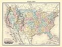
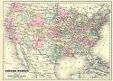
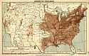
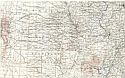
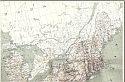
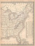
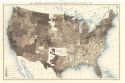
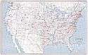
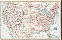
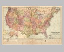
Viewing Options
Main Author:
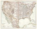
Rand McNally and Company
Title/Description:
United States
Publication Info:
Chicago: Rand McNally & Co., 1888; 02654; from Rand McNally & Co.'s New Indexed Atlas of the World
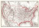
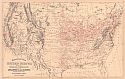
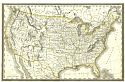
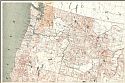
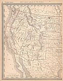
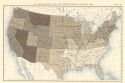
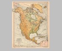
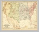
Viewing Options
Main Author:
Mitchell, Samuel Augustus
Title/Description:
Map of the United States and Territories Together with Canada &c.
Publication Info:
Boston: William M. Bradley, 1888
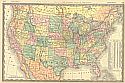
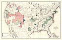
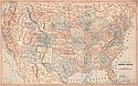
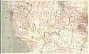
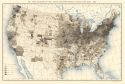
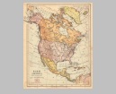
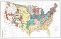
Viewing Options
Main Author:
Johnson, Alvin J.
Title/Description:
Map of the United States
Publication Info:
New York: A.J. Johnson, c. 1888; drawn and engraved on Copper-Plate Expressly for Johnson's Cyclopaedia
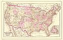
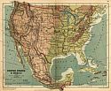
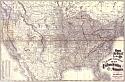
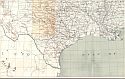
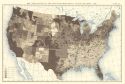
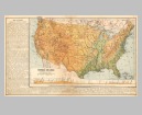
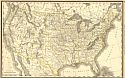
Viewing Options
Main Author:
Bradley, William M.
Title/Description:
Railroad Map of the United States Showing the Through Lines of Communication from the Atlantic to the Pacific
Publication Info:
Boston: William M. Bradley, 1888
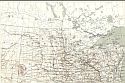
Viewing Options
Main Author:
U.S. Geological Survey
Title/Description:
Map of the United States Showing the Progress of Topographic Survey during the Fiscol Year 1888-89
Publication Info:
Washington, D.C.: U.S. Geological Survey, 1889
Viewing Options
Main Author:
Longmans, Green and Company
Title/Description:
United States and Mexico
Publication Info:
London: Longmans, Green and Co., 1889; from Longmans New Atlas, Political and Physical
Viewing Options
Main Author:
Longmans, Green and Company
Title/Description:
[United States] Density of Population
Publication Info:
London: Longmans, Green and Co., 1889; from Longmans New Atlas, Political and Physical
Viewing Options
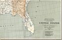
Main Author:
Rand McNally and Company
Title/Description:
United States
Publication Info:
Chicago: Rand McNally and Co., 1889; from the Enlarged Business Atlas and Shippers Guide
Viewing Options
Main Author:
Mast, Crowell and Kirkpatrick
Title/Description:
United States
Publication Info:
Springfield, Ohio: Mast, Crowell and Kirkpatrick, 1889; from Peerless Atlas of the World
Viewing Options
Main Author:
Rand McNally and Company
Title/Description:
Handy Railroad Map of the United States of America
Publication Info:
Chicago: Rand McNally & Co., 1890
Viewing Options
Title/Description:
United States
Publication Info:
Washington : Department of the Interior, United States Geological Survey, 1890
Viewing Options
Title/Description:
United States
Publication Info:
Washington : Department of the Interior, United States Geological Survey, 1890
Viewing Options
Title/Description:
United States
Publication Info:
Washington : Department of the Interior, United States Geological Survey, 1890
Viewing Options
Title/Description:
United States
Publication Info:
Washington : Department of the Interior, United States Geological Survey, 1890
Viewing Options
Title/Description:
United States
Publication Info:
Washington : Department of the Interior, United States Geological Survey, 1890
Viewing Options
Title/Description:
United States
Publication Info:
Washington : Department of the Interior, United States Geological Survey, 1890
Viewing Options
Title/Description:
United States
Publication Info:
Washington : Department of the Interior, United States Geological Survey, 1890
Viewing Options
Title/Description:
United States
Publication Info:
Washington, D.C.: Department of the Interior, United States Geological Survey, 1890
Viewing Options
Main Author:
Rand McNally and Company
Title/Description:
United States
Publication Info:
Chicago: Rand McNally & Co., 1890; from Rand McNally & Co.'s Family Atlas of the World
Viewing Options
Main Author:
Rand McNally and Company.
Title/Description:
United States
Publication Info:
Chicago: Rand McNally & Co., 1890; from Rand McNally & Co.'s Family Atlas of the World
Viewing Options
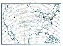
Main Author:
U.S. Coast Survey
Title/Description:
Map Showing Longitude Stations and Connections determined by means of electronic telegraph between 1846 and June 30, 1889
Publication Info:
Washington D.C.: U.S. Coast and Geodetic Survey, 1890; 25227; NAV Charts
Viewing Options
Main Author:
U.S. Coast and Geodetic Survey
Title/Description:
Map Showing Positions of Magnetic Stations Occupied between 1844 and June 30, 1889
Publication Info:
Washington D.C.: U.S. Coast and Geodetic Survey, 1890; NAV Charts
Viewing Options
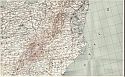
Main Author:
U.S. Geological Survey
Title/Description:
Geological Map of Arkansas, Louisiana, Tennessee, Mississippi and Alabama
Publication Info:
Washington, D.C.: U.S. Department of the Interior, U.S. Geological Survey, 1890; Plate XLII
Viewing Options
Main Author:
U.S. Geological Survey
Title/Description:
Geological Map of Minnesota, Wisconsin and Michigan
Publication Info:
Washington, D.C.: U.S. Department of the Interior, U.S. Geological Survey, 1890; Plate XLIV
Viewing Options
Main Author:
U.S. Geological Survey
Title/Description:
Geological Map of Iowa, Missouri, Illinois, Indiana, Ohio and Kentucky
Publication Info:
Washington, D.C.: U.S. Department of the Interior, U.S. Geological Survey, 1890; Plate XLIII
Viewing Options
Main Author:
U.S. Coast and Geodetic Survey
Title/Description:
Sketch of General Progress (Eastern Sheet)
Publication Info:
Washington, D.C.: U.S. Coast and Geodetic Survey, 1890
Viewing Options
Main Author:
Stieler, Adolf
Title/Description:
Vereinigte Staaten von Amerika (map 1 of 6)
Publication Info:
Gotha: Justus Perthes, 1891 from his Hand Atlas of 1891
Viewing Options
Main Author:
Stieler, Adolf
Title/Description:
Vereinigte Staaten von Amerika (map 2 of 6)
Publication Info:
Gotha: Justus Perthes, 1891 from his Hand Atlas of 1891
Viewing Options
Main Author:
Stieler, Adolf
Title/Description:
Vereinigte Staaten von Amerika (map 3 of 6)
Publication Info:
Gotha: Justus Perthes, 1891 from his Hand Atlas of 1891
Viewing Options
Main Author:
Stieler, Adolf
Title/Description:
Die Vereinigte Staaten von Amerika (map 4 of 6)
Publication Info:
Gotha: Justus Perthes, 1891 from his Hand Atlas of 1891
Viewing Options
Main Author:
Stieler, Adolf
Title/Description:
Vereinigte Staaten von Amerika (map 5 of 6)
Publication Info:
Gotha: Justus Perthes, 1891 from his Hand Atlas of 1891
Viewing Options
Main Author:
Stieler, Adolf
Title/Description:
Vereinigte Staaten von Amerika (map 6 of 6)
Publication Info:
Gotha: Justus Perthes, 1891 from his Hand Atlas of 1891
Viewing Options
Main Author:
U.S. Geological Survey
Title/Description:
Map of the United States Showing the Progress of Geologic Mapping
Publication Info:
Washington D.C.: U.S. Department of the Interior, U.S. Geological Survey, 1891; Thirteenth Annual Report, Plate II
Viewing Options
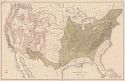
Main Author:
Appleton, D.
Title/Description:
Physical Map of the United States
Publication Info:
New York: D. Appleton and Company, c. 1891; from Appleton's Standard Higher Geography
Viewing Options
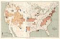
Main Author:
Gannett, Henry
Title/Description:
Assessed Valuation on Real and Personal Property per Capita: 1890
Publication Info:
Washington: Bureau of the Census, C. 1891
Viewing Options
Main Author:
Gannett, Henry
Title/Description:
True Valuation of Real and Personal Property per Capita: 1890
Publication Info:
Washington: Bureau of the Census, c. 1891
Viewing Options
Main Author:
Gannett, Henry
Title/Description:
True Valuation of Real Estate and Improvements Thereon per Acre: 1890
Publication Info:
Washington: Bureau of the Census, c. 1891
Viewing Options
Main Author:
Gannett, Henry
Title/Description:
True Valuation of Real Estate and Improvement Thereon per Capita: 1890
Publication Info:
Washington: Bureau of the Census, c. 1891
Viewing Options
Main Author:
Mohr, Charles
Title/Description:
Map Showing Distribution of Pinus Taeda (Loblolly Pine)
Publication Info:
Washington: U.S.D.A. Division of Forestry, 1891
Viewing Options
Main Author:
Mohr, Charles
Title/Description:
Map Showing the Distribution of Pinus Echinata (Shortleaf Pine)
Publication Info:
Washington: U.S.D.A. Division of Forestry, 1891
Viewing Options
Main Author:
Bartholomew, J.
Title/Description:
United States
Publication Info:
New York: Thomas Nelson and Sons, 1891; from The Popular Hand Atlas of the World
Viewing Options
Main Author:
U.S. Geological Survey
Title/Description:
Mineral Spring Resorts of the United States
Publication Info:
Washington D.C.: U.S. Department of the Interior, U.S. Geological Survey, 1892; Fourteenth Annual Report, Plate III
Viewing Options
Main Author:
U.S. Geological Survey
Title/Description:
Mineral Springs of the United States, the Waters of Which Are Used Commercially
Publication Info:
Washington, D.C.: U.S. Department of the Interior, U.S. Geological Survey, 1892; Fourteenth Annual Report, Plate IV
Viewing Options
Main Author:
US Geological Survey
Title/Description:
Map of the United States Showing the Progress of Topographic Survey During the Fiscol Year 1891-92
Publication Info:
Washington, D.C.: U.S. Geological Survey, 1892
Viewing Options
Main Author:
Sargent, C.S.
Title/Description:
Map Showing the Distribution of the Genus Juglans (The Walnuts) in North America Exculsive of Mexico
Publication Info:
Washington, D.C.: Department of the Interior, c.1892
Viewing Options
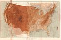
Main Author:
Gannett, Henry
Title/Description:
Relief Map of the United States
Publication Info:
Washington: Department of the Interior, U.S. Geological Survey, 1892, from 13th Annual Report
Viewing Options
Main Author:
Cram, George F.
Title/Description:
United States
Publication Info:
Waterbury, Conn: P.J. Bolan, 1892; from The Columbian World's Fair Atlas
Viewing Options
Title/Description:
North America, Physical Map
Publication Info:
New York: University Publishing Company, 1892; from Manual of Geography
Original Source:
Geological Survey of Alabama
Viewing Options
Title/Description:
North America, Political Map
Publication Info:
New York: University Publishing Company, 1892; from Manual of Geography
Original Source:
Geological Survey of Alabama
Viewing Options
Title/Description:
United States, Physical Map
Publication Info:
New York: University Publishing Company, 1892; from Manual of Geography
Original Source:
Geological Survey of Alabama
Viewing Options
Title/Description:
United States, Political Map
Publication Info:
New York: University Publishing Company, 1892; from Manual of Geography
Original Source:
Geological Survey of Alabama
Viewing Options
Title/Description:
Principal Routes of Transportation and Travel
Publication Info:
New York: University Publishing Company, 1892; from Manual of Geography
Original Source:
Geological Survey of Alabama
Viewing Options
Main Author:
U.S. Geological Survey
Title/Description:
Reconnaissance Map of the United States Showing the Distribution of the Geologic System so far as known
Publication Info:
Washington D.C.: U.S. Department of the Interior, U.S. Geological Survey, 1893; Fourteenth Annual Report, Plate II
Viewing Options
Main Author:
Rand McNally and Company
Title/Description:
United States
Publication Info:
Chicago: Rand McNally and Co., 1893; from Rand McNally and Company's Englarged Business Atlas and Shippers Guide
Viewing Options
Main Author:
U.S. Geological Survey
Title/Description:
Map Showing Condition and Progress of Topographic Survey for the Fiscal Year 1894-95
Publication Info:
Washington, D.C.: U.S. Geological Survey, 1895
Viewing Options
Main Author:
Rand McNally and Company.
Title/Description:
United States
Publication Info:
Chicago: Rand McNally & Co., 1895; from Rand McNally's New General Atlas of the World
Viewing Options
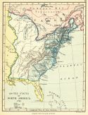
Main Author:
Gardiner, Samuel Rawson
Title/Description:
United States of North America, 1783
Publication Info:
London: Longmans, Green, and Company, 1895; from A School Atlas of British History
Viewing Options
Main Author:
Newell, F.H.
Title/Description:
United States Showing disposition of lands
Publication Info:
Washington, D.C.: Department of the Interior, US Geological Survey, 1895; 16th Annual Report, Part 2, Plate 35
Viewing Options
Main Author:
Maloney, J.E.
Title/Description:
Basin of the Great Lake and of the Saint Lawrence and Hudson Rivers in Relation to the Surrounding Drainage Systems
Publication Info:
Chicago: U.S. Deep Waterway Commission, 1896
Viewing Options
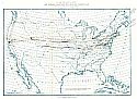
Main Author:
Gannett, Henry
Title/Description:
Distribution of the Magnetic Declination in the United States in 1900
Publication Info:
Washington, D.C.: Department of the Interior, US Geological Survey, 1896; 17th Annual Report, Part 1, Plate 2
Viewing Options
Main Author:
American Book Company
Title/Description:
Commercial Map of the United States, Canada and Mexico
Publication Info:
New York: American Book Company, 1896; from the Eclectic Complete Geography
Viewing Options
Main Author:
Rand McNally and Company
Title/Description:
United States
Publication Info:
Chicago: Rand McNally and Company, 1896; from Enlarged Business Atlas
Viewing Options
Main Author:
Perthes, Justus
Title/Description:
Etats Unis et Mexique
Publication Info:
Gotha: Justus Perthes, 1897; from Atlas-General
Viewing Options
Main Author:
Rand McNally and Company
Title/Description:
Discoveries and Settlements in Canada and The United States
Publication Info:
Chicago: Rand McNally & Co., 1898; from a Rand McNally Indexed Atlas
Viewing Options
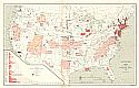
Main Author:
Rand McNally and Company.
Title/Description:
Map of the United States Showing the Increase and Decrease of Population, 1880 to 1890
Publication Info:
Chicago: Rand McNally & Co., 1898
Viewing Options
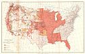
Main Author:
Rand McNally and Company.
Title/Description:
Map of the United States Showing, in Six Degrees, the Density of Population, 1890
Publication Info:
Chicago: Rand McNally & Co., 1898
Viewing Options
Main Author:
U.S. Geological Survey
Title/Description:
Map Showing the Condition and Progress of Topographic Surveys and Location of Gaging Stations
Publication Info:
Washington, D.C.: U.S. Department of the Interior, U.S. Geological Survey; Nineteenth Annual Report, Part I, Plate I
Viewing Options
Main Author:
Mast, Crowell and Kilpatrick
Title/Description:
Map of the United States
Publication Info:
Philadelphia: Mast, Crowell, & Kirkpatrick, 1898; from Peerless Atlas of the World
Viewing Options
Main Author:
U.S. Geological Survey
Title/Description:
Map Showing Conditions and Progress of astronomic locations, primary triangulation, primary traverse and precise leveling
Publication Info:
Washington, D.C.: Department of the Interior, US Geological Survey, 1898; 19th Annual Report, Part 1, Plate 2
Viewing Options
Main Author:
Smith, Benjamin E.
Title/Description:
United States
Publication Info:
New York: The Century Company, 1899; from The Century Atlas of the World
Viewing Options
Main Author:
The Times London
Title/Description:
United States (General Map)
Publication Info:
The Times London, 1899