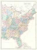
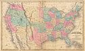
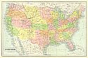
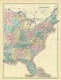
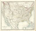
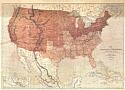
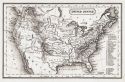
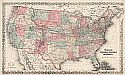
Viewing Options
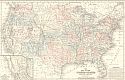
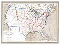
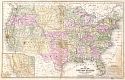
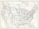
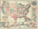
Main Author:
Boynton, George W.
Title/Description:
[United States]
Publication Info:
Boston: G.W. Boynton, c.1851
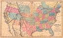
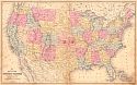
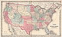
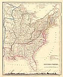
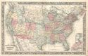
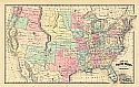
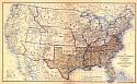
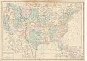
Viewing Options
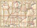
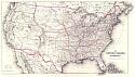
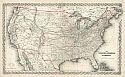
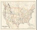
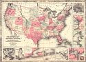
Main Author:
Mitchell, Samuel Augustus
Title/Description:
United States
Publication Info:
Philadelphia: S.A. Mitchell, 1851
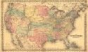
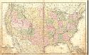
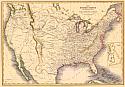
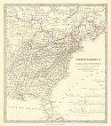
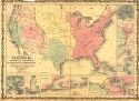
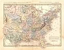
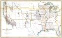
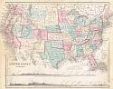
Viewing Options
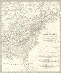
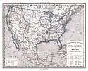
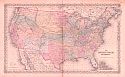
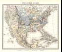
Main Author:
Morse, Sidney
Title/Description:
United States
Publication Info:
New York: Sidney Morse, 1851
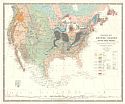
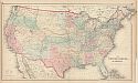
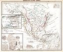
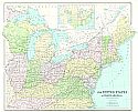
Viewing Options
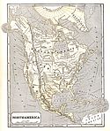
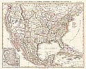
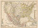
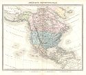
Main Author:
Morse, Sidney E.
Title/Description:
North America
Publication Info:
New York: Harper and Brothers 1851; from Morse's School Geography
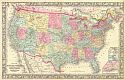
Viewing Options
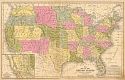
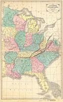
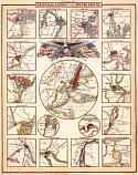
Main Author:
Drake, Ira S.
Title/Description:
Mitchell's New Traveller's Guide Through the United States
Publication Info:
Philadelphia: Thomas, Cowperthwait and Co., 1851
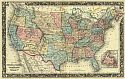
Viewing Options
Main Author:
Mitchell, S. Augustus
Title/Description:
Map of the United States
Publication Info:
Philadelphia: S. Augustus Mitchell, 1852
Viewing Options
Main Author:
Society for the Diffusion of Useful Knowledge
Title/Description:
North America - Canada and the United States
Publication Info:
London: Charles Knight, 1852; from the General Atlas
Viewing Options
Main Author:
Dufour, A.H. and T. Duvotenay
Title/Description:
Estados-Unidos
Publication Info:
Madrid: Gaspar y Roig, 1852; from El Globo, Atlas Historico Universal de Geografica
Viewing Options
Main Author:
Colton, Joseph Hutchins
Title/Description:
The United States of America
Publication Info:
New York: J.H. Colton & Co., 1853
Viewing Options
Main Author:
Stieler, Adolf
Title/Description:
Verein-Staaten Von Nord - America, Mexico, Yucatan U. A.
Publication Info:
Gotha: Justus Perthes, 1853; from Stieler's Hand Atlas (No. 466)
Viewing Options
Main Author:
Mitchell, Samuel Augustus
Title/Description:
No. 5 Map of the United States
Publication Info:
Philadelphia: S.A. Mitchell, 1853; engraved to illustrate Mitchell's School and Family Geography
Viewing Options
Main Author:
Hitchcock, Edward
Title/Description:
A Geological Map of the United States and Canada
Publication Info:
[Boston]: 1853
Viewing Options
Main Author:
Williams, W.
Title/Description:
A New Map of the United States
Publication Info:
Philadelphia: Lippincott, Grambo, & Co., 1853
Viewing Options
Title/Description:
United States
Publication Info:
New York: Phelps, Fanning and Company, 1853; from Fanning's Illustrated Gazetteer of the United States
Viewing Options
Main Author:
Daniels, J.H.
Title/Description:
Map of the United States
Publication Info:
Boston: S. Walker, [1854]
Viewing Options
Main Author:
Black, Adam and Charles
Title/Description:
United States
Publication Info:
Edinburgh: A. and C. Black, 1854; from the General Atlas of the World by Hall and Hughes
Viewing Options
Main Author:
Burgess, Daniel
Title/Description:
Map of the United States and Canada
Publication Info:
Hartford: Daniel Burgess, 1854; designed to accompany Smith's Geography for Schools
Viewing Options
Main Author:
Colton, Joseph Hutchins
Title/Description:
The United States of America
Publication Info:
New York: J.H. Colton & Co., 1855
Viewing Options
Main Author:
Cornell, Sarah Sophia
Title/Description:
Southern and Western States
Publication Info:
New York: D. Appleton & Co., 1855; designed to accompany Cornell's High School Geography
Viewing Options
Main Author:
Boynton, George W.
Title/Description:
United States
Publication Info:
Boston: S.G. Goodrich, 1855
Viewing Options
Main Author:
Cornell, Sarah Sophia
Title/Description:
United States
Publication Info:
New York: D. Appleton & Co., 1855; designed to accompany Cornell's High School Geography
Viewing Options
Main Author:
Colton, J.H.
Title/Description:
The United States of America
Publication Info:
New York: J.H. Colton & Co., 1855
Viewing Options
Main Author:
Johnston, William and Alexander Keith
Title/Description:
Geological Map of the United States and British North America
Publication Info:
Edinburgh: William Blackwood & Sons, 1855
Viewing Options
Main Author:
Dufour, A.H.
Title/Description:
Mexique Antilles, Ètats-Unis
Publication Info:
Paris: Armand Le Chevalies, 1855
Viewing Options
Main Author:
Smith, Calvin
Title/Description:
Map of the United States of America, Showing Railroads
Publication Info:
New York: J. Calvin Smith, 1855; to Illustrate Harper's Gazetteer
Viewing Options
Main Author:
Marcou, Jules
Title/Description:
Carte Geologique des Ètats-Unis et des Provinces Anglaises de L'Amerique du Nord
Publication Info:
Paris: c.1855
Viewing Options
Main Author:
Cornell, Sarah Sophia
Title/Description:
The United States
Publication Info:
New York: D. Appleton and Company, c. 1855; from Cornell's Intermediate Geography
Viewing Options
Main Author:
Mitchell, S. Augustus
Title/Description:
Map of the United States
Publication Info:
Philadelphia: Cowperthwait, Desilver and Butler, 1855
Viewing Options
Main Author:
Colton, J.H.
Title/Description:
The United States of America
Publication Info:
New York: J.H. Colton and Company, 1855
Viewing Options
Main Author:
Sydow, E. von
Title/Description:
Vereinigte Staaten von Nord-Amerika und Mexico
Publication Info:
Gotha: Justus Perthes, 1855; from E. von Sydow's Schul-Atlas in Acht und Dreissig Karten
Viewing Options
Main Author:
Cornell, Sarah Sophia
Title/Description:
Principal Cities of the United States
Publication Info:
New York: D. Appleton & Co., [1856]; for her High School Geography
Viewing Options
Main Author:
Dussieux, Louis Etienne
Title/Description:
Carte Des Ètats-Unis
Publication Info:
Paris: L.E. Dussieux, 1856; from Atlas General par L. Dussieux
Viewing Options
Main Author:
Swanston, G.H.
Title/Description:
United States, North America
Publication Info:
Edinburgh: A. Fullarton and Company, 1856
Viewing Options
Main Author:
Colton, J.H.
Title/Description:
The United States of America
Publication Info:
New York: J.H. Colton and Company, Colton's Atlas of the World
Viewing Options
Title/Description:
Vereinigte Staaten von Nord-America
Publication Info:
Hildburghausen: Meyer, 1857; from Meyer's Groschen Atlas
Viewing Options
Title/Description:
United States
Publication Info:
New Orleans: Morse & Gaston, 1857
Viewing Options
Title/Description:
A New Map of the United States of America
Publication Info:
Philadelphia: Charles Desilver, 1857
Viewing Options
Main Author:
Bibliographisches Institut
Title/Description:
Vereinigte Staaten von Nord-America und Mexico
Publication Info:
Hildburghausen: Bibliographisches Institut, 1850-1860; from Atlas der Geographie
Viewing Options
Title/Description:
Map Exhibiting the Lines of March Passed Over by the Troops of the United States During the Year Ending June 30th 1858
Publication Info:
Washington D.C: War Department, 1858; prepared by the order of Hon. J.B. Floyd, Sec War Department Nov. 1858
Viewing Options
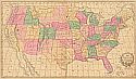
Main Author:
Olney, Jesse
Title/Description:
Map of the United States, Canada, and a Part of Mexico
Publication Info:
New York: Oakley, Pratt, & Co., 1858; to illustrate Olney's School Geography
Viewing Options
Main Author:
Young, James H.
Title/Description:
No. 5 Map of the United States
Publication Info:
Philadelphia: S.A. Mitchell, c.1858; Engraved to illustrate Mitchell's School and Family Geography
Viewing Options
Main Author:
Mitchell, S. Augustus
Title/Description:
Map of the United States
Publication Info:
Philadelphia: S. Augustus Mitchell, 1858; from Mitchell's School and Family Geography
Viewing Options
Main Author:
Colton, J.H.
Title/Description:
The United States of America
Publication Info:
New York: J.H. Colton and Company, 1858
Viewing Options
Main Author:
Hughes, William
Title/Description:
United States
Publication Info:
London: George Philip & Sons, 1859
Viewing Options
Main Author:
Colton, J.H.
Title/Description:
Colton's Map of the United States of America
Publication Info:
New York: Johnson & Browning, 1859
Viewing Options
Title/Description:
The United States and the Relative Position of the Oregon and Texas
Publication Info:
London: James Wyld, [c.1860]
Viewing Options
Main Author:
Mitchell, Samuel Augustus, Jr.
Title/Description:
Map of the United States, and Territories Together with Canada &c.
Publication Info:
Philadelphia: S.A. Mitchell, Jr., 1860
Viewing Options
Main Author:
Hall, Sidney
Title/Description:
United States
Publication Info:
Edinburgh: A.&C. Black, c.1860
Viewing Options
Title/Description:
United States
Publication Info:
London: Orr & Company, c.1860
Viewing Options
Main Author:
Society for the Diffusion of Useful Knowledge
Title/Description:
North America, Canada and the United States
Publication Info:
London: Edward Stanford, c.1860
Viewing Options
Title/Description:
The United States
Publication Info:
New York: S.F. Baker, c.1860
Viewing Options
Main Author:
U.S. Coast Survey
Title/Description:
Sketch Showing the Progress of the Survey on the Atlantic, Gulf of Mexico, and Pacific Coast
Publication Info:
Washington: U.S. Coast Survey, 1860
Viewing Options
Main Author:
Vuillemin, Alexandre
Title/Description:
Carte dressee pour l'intelligence du voyage au Pays des Mormons, de Monsieur Jules Remy
Publication Info:
Philadelphia: 1860; Map designed to accompany the Journey to Mormon Land
Viewing Options
Main Author:
Warren, D.M.
Title/Description:
Physical Map of the United States showing it's Mountains, Plains, Rivers, Isothermal Lines, etc.
Publication Info:
Philadelpia: H. Cowperthwait and Company, 1860; from A System of Physical Geography
Viewing Options
Title/Description:
United States
Publication Info:
New York: A.S. Barnes and Company, 1860; from McNally's System of Geography
Viewing Options
Main Author:
Stanford, Edward
Title/Description:
The United States of North America
Publication Info:
London: Edward Stanford, 1860
Viewing Options
Main Author:
Mitchell, Samuel Augustus Jr.
Title/Description:
Map of the United States and Territories together with Canada
Publication Info:
Philadelphia: Samuel Augustus Mitchell, Jr., 1860
Viewing Options
Main Author:
Bibliographisches Institut
Title/Description:
Bergketten in Nord Amerika
Publication Info:
Hildburghausen: Bibliographisches Institut, 1850-1860; from Atlas der Geographie
Viewing Options
Main Author:
Johnson and Ward
Title/Description:
Johnson's New military map of the United States
Publication Info:
New York: Johnson and Ward, 1861
Viewing Options
Title/Description:
Map of the United States of North America, June 1, 1861
Publication Info:
London: 1861; Supplement to the Illustrated London News
Viewing Options
Main Author:
Daniels. J.H.
Title/Description:
Map of the United States
Publication Info:
Boston: Samuel Walker, 1861; from Walker's edition of Malte-Brun's System of Geography
Viewing Options
Main Author:
Weller, Edward
Title/Description:
United States
Publication Info:
London: Longman and Co., c.1861
Viewing Options
Main Author:
Mitchell, S. Augustus, Jr.
Title/Description:
Map of the United States and Territories together with Canada etc.
Publication Info:
Philadelphia: S. Augustus Mitchell, Jr., 1861; from Mitchell's New General Atlas
Viewing Options
Main Author:
Johnson, Alvin Jewitt
Title/Description:
Johnson's New Military Map of the United States showing the Forts, Military Ports & C.
Publication Info:
New York: Johnson and Browning, 1861
Viewing Options
Main Author:
Vuillemin, A and Malte-Brun
Title/Description:
Amerique Septentrionale
Publication Info:
Paris: Frune, 1861; from Atlas Universal de Gèographie Ancienne et Moderne
Viewing Options
Main Author:
Vuillemin, A and Malte-Brun
Title/Description:
Ètats-Unis & Mexique
Publication Info:
Paris: Frune, 1861; from Atlas Universal de Gèographie Ancienne et Moderne
Viewing Options
Main Author:
Johnson, A.J.
Title/Description:
Johnson's New Military Map of the United States
Publication Info:
New York: Johnson and Ward, [1862]
Viewing Options
Main Author:
Bohn, Henry G.
Title/Description:
United States
Publication Info:
London: Henry G. Bohn, 1862; from A Pictorial Hand-Book of Modern Geography
Viewing Options
Title/Description:
Map of the United States of America showing the Boundaries of the Union and Confederate Geographical Divisions and Departments
Publication Info:
New York: Julius Bien and Co.; Plate CLXX from the atlas to accompany the official records of the Union and Confederate Armies, 1861-1865
Viewing Options
Title/Description:
Map of the Public Land Status and Territories
Publication Info:
Washington: General Land Office, 1864
Viewing Options
Main Author:
Bartholomew, John
Title/Description:
The United Stated of North America (North Eastern Division)
Publication Info:
London: George Philip & Son, c.1864
Viewing Options
Main Author:
Colton, J.H.
Title/Description:
Colton's United States of America
Publication Info:
New York: J.H. Colton, 1864
Viewing Options
Main Author:
Drioux, M.M. and Charles Leroy
Title/Description:
Carte Physique et Politique des Ètats-Unis Canada et Partie du Mexique
Publication Info:
Paris: E. Belin, c.1864

Viewing Options
Main Author:
Colton, J.H.
Title/Description:
United States of America (Physical)
Publication Info:
New York: Ivison, Phinney, Blakeman and Company, 1865; from American School Quarto Georgraphy
Viewing Options
Main Author:
Colton, J.H.
Title/Description:
United States of America
Publication Info:
New York: Ivison, Phinney, Blakeman and Company, 1865; from American School Quarto Georgraphy