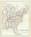
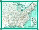
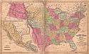
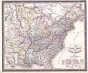
Viewing Options
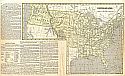
Main Author:
Unknown Author
Title/Description:
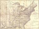
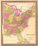
Carte des Etats-Unis D'Amerique
Publication Info:
[Paris?: 1836?]
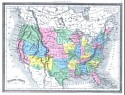
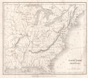
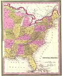
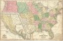
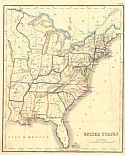
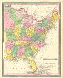
Viewing Options
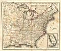
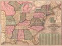
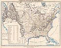
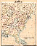
Main Author:
Boynton, George W.
Title/Description:
United States
Publication Info:
Hartford: F.J. Huntington, 1836;from the The Malte-Brun School Geography
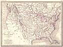
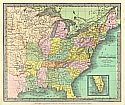
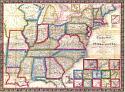
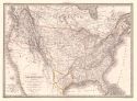
Viewing Options
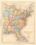
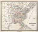
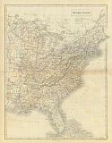
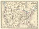
Main Author:
Findlay, Alexander
Title/Description:
United States
Publication Info:
London: Thomas Kelly, c.1836
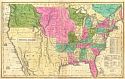
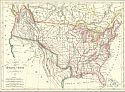
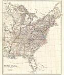
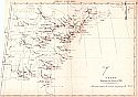
Viewing Options
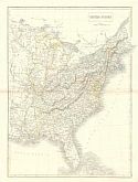
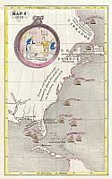
Main Author:
Sealey, R.B. and W. Burnside
Title/Description:
The United States of America
Publication Info:
London: R.B. Sealey and W. Burnside, 1836
Orginal Source:
Courtesy of John McFarland, Gadsden, Alabama
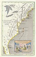
Viewing Options
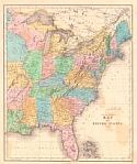
Main Author:
Burr, David H.
Title/Description:
United States
Publication Info:
New York: Illman & Pilbrow, 1837
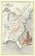
Viewing Options
Main Author:
Malte-Brun, Conrad
Title/Description:
Carte des Etar-unis D'Amerique
Publication Info:
Aime Andre: Paris, 1837
Viewing Options
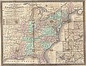
Main Author:
Mitchell, Samuel Augustus
Title/Description:
Mitchell's Map of the United States
Publication Info:
Philadelphia: S.A. Mitchell, 1838
Viewing Options
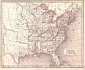
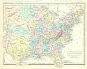
Main Author:
Tanner, Henry Schenck
Title/Description:
United States
Publication Info:
Philadelphia: H.S. Tanner, [1839]; from his Universal Atlas of 1846
Viewing Options
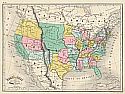
Main Author:
Burgess, Daniel
Title/Description:
Map of the United States and Texas
Publication Info:
New York: Paine and Burgess; from The Geography for Schools
Viewing Options
Main Author:
Sherman, G.E.
Title/Description:
Middle; with part of the Southern & Western States
Publication Info:
New Haven: G.E. Sherman, 1839
Viewing Options
Main Author:
Stiles, Sherman & Smith
Title/Description:
Map of the United States and Texas
Publication Info:
Hartford: Daniel Burgess, c.1839; designed to accomany Smith's Geography for Schools
Viewing Options
Main Author:
Mitchell, Samuel Augustus
Title/Description:
Map of the United States and Texas
Publication Info:
Philadelphia: Samuel Augustus Mitchell, 1839; from Mitchell's School and Family Geography
Viewing Options
Main Author:
Phelps and Ensign
Title/Description:
Phelps and Ensign's Travellers Guide and Map of the United States
Publication Info:
New York: Phelps and Ensign, 1840
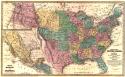
Viewing Options
Main Author:
Arrowsmith, John
Title/Description:
United States
Publication Info:
London: John Arrowsmith, 1840
Viewing Options
Main Author:
Tanner, Henry Schenck
Title/Description:
Map of the Canals and Rail Roads of the United States
Publication Info:
[Philadelphia]: T.R. Tanner and J. Disturnell, 1840
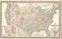
Viewing Options
Title/Description:
United States of America
Publication Info:
Philadelphia: H.S. Tanner, 1840
Viewing Options
Main Author:
Archer, John
Title/Description:
United States
Publication Info:
London: H.G. Collins, c.1840
Viewing Options
Main Author:
Hall, Sidney
Title/Description:
United States
Publication Info:
Edinburgh: A. & C. Black, c.1840
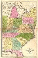
Viewing Options
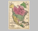
Main Author:
Mitchell, Samuel Augustus
Title/Description:
Map of North America
Publication Info:
Philadelphia: Thomas Cowperthwait and Company, 1840; From Mitchell's School Atlas
Orginal Source:
University of Alabama Map Library
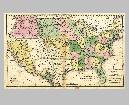
Viewing Options
Main Author:
Mitchell, Samuel Augustus
Title/Description:
Map of the United States and Texas
Publication Info:
Philadelphia: Thomas Cowperthwait and Company, 1840; From Mitchell's School Atlas
Orginal Source:
University of Alabama Map Library
Viewing Options
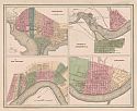
Main Author:
Bradford, Thomas Gamaliel
Title/Description:
Washington, Louisville and Jeffersonville, New Orleans, Cincinnati
Publication Info:
New York: Wiley & Long, 1841
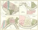
Viewing Options
Main Author:
Bradford, Thomas G. & Goodrich S.G.
Title/Description:
Washington, Louisville & Jeffersonville, New Orleans & Cinncinatti
Publication Info:
Boston: C. B. Strong, 1841; from A General Atlas of the World
Viewing Options
Title/Description:
Map of the United States of North America
Publication Info:
London: James Wyld, [1842]
Viewing Options
Title/Description:
United States
Publication Info:
London: c.1842; Plate XXVII
Viewing Options
Main Author:
Lapie, Alexander Emile
Title/Description:
Carte des Etats-Unis d'Amerique
Publication Info:
Paris: P.C. Lehuby, 1842
Viewing Options
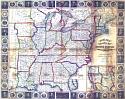
Title/Description:
Chart Illustrating the Weather of 1843 (The arrows indicate the direction and force of the Wind)
Publication Info:
unknown, Feb. 15th 3P.M. 1843
Viewing Options
Main Author:
Mitchell, Samuel Augustus
Title/Description:
Selected Cities of the United States
Publication Info:
Philadelphia: S.A. Mitchell, 1843
Viewing Options
Main Author:
Mitchell, S. Augustus
Title/Description:
Mitchell's National Map of the American Republic
Publication Info:
Philadelphia: S.A. Mitchell, 1843
Viewing Options
Title/Description:
United States
Publication Info:
London: James Wyld, 1843; from An Atlas of Modern Geography
Viewing Options
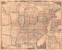
Main Author:
Woodbridge, William C.
Title/Description:
Physical Map of the United States
Publication Info:
Hartford: Belknap and Hamersley, 1843; from School Atlas, to accompany the Modern School Geography

Viewing Options
Main Author:
Boynton, George W.
Title/Description:
United States
Publication Info:
Portland, ME: Wm. Hyde, 1844
Viewing Options
Main Author:
Morse, Sidney Edwards
Title/Description:
United States
Publication Info:
New York: Harper & Brothers, 1844; from S.E. Morse's A System of Geography for the Use of Schools
Viewing Options
Main Author:
Charle, J.B.L
Title/Description:
Ètats-Unis par Charle, Geographie
Publication Info:
Paris: J.B.L. Charle, 1845; Plate 58 from his Atlas Elementaire
Viewing Options
Main Author:
Gellatly, J.
Title/Description:
United States
Publication Info:
Edinburgh: W. and R. Chambers, [1846]
Viewing Options
Main Author:
Tanner, Henry Schenck
Title/Description:
United States
Publication Info:
Philadelphia: H.S. Tanner, 1846
Viewing Options
Main Author:
Hall, Sidney
Title/Description:
United States
Publication Info:
Edinburgh: A & C Black, 1847
Viewing Options
Viewing Options
Viewing Options
Viewing Options
Viewing Options
Viewing Options
Viewing Options
Viewing Options
Viewing Options
Viewing Options
Viewing Options
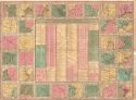
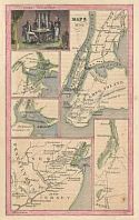
Main Author:
Willard, Emma (Hart)
Title/Description:
Plates from History of the United States or Republic of America
Publication Info:
New York: A.S. Barnes & Co. and H.W. Derby & Co., 1847; from Willard's History of the United States, or Republic of America
Viewing Options
Main Author:
Mitchell, Samuel Augustus
Title/Description:
United States
Publication Info:
Philadelphia: S.A. Mitchell, 1847; from Mitchell's Universal Atlas
Viewing Options
Main Author:
Flemming, Carl
Title/Description:
Vereinigte Staaten Von Nord-America
Publication Info:
Glogau: Carl Flemming, c.1847
Viewing Options
Main Author:
Antonie, Louis
Title/Description:
Ètats-Unis et Nouvelle Bretagne
Publication Info:
Paris: Monin &Vuilemin, c.1848; from Atlas de Geographie
Viewing Options
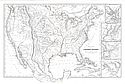
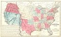
Title/Description:
[Military Map of the U.S. with Sea Routes]
Publication Info:
Washington, D.C.: [1848]
Viewing Options
Title/Description:
Phelps's National Map of the United States and Travellers Guide
Publication Info:
New York: Ensign and Thayer, 1850
Viewing Options
Main Author:
Cruchley, George Frederick
Title/Description:
United States with Upper & Lower Canada
Publication Info:
London: G.F. Cruchley, 1850
Viewing Options
Title/Description:
Gall & Inglis' Map of the United States. 1850.
Publication Info:
Edinburgh: Gall & Inglis, 1850; 00536
Viewing Options
Main Author:
Hall, Sidney
Title/Description:
United States
Publication Info:
London: Longman and Company, c.1850

Viewing Options
Main Author:
Cruchley, G.F.
Title/Description:
United States with Upper & Lower Canada
Publication Info:
London: G.F. Cruchley, 1850
Viewing Options
Main Author:
Smith, Roswell C.
Title/Description:
Map of the United States and Canada
Publication Info:
New York: Cady and Burgess, 1850 from A Concise and Practical System of Geography for Common Schools, Academies and Families
Viewing Options
Title/Description:
A New Map of the United States of America
Publication Info:
Philadelphia: Cowperthwait, Desilver, and Butler, 1850
Viewing Options
Main Author:
Johnstone, John
Title/Description:
New Map for Travellers Through the United States of America
Publication Info:
Liverpool: George Philip and Son, 1850