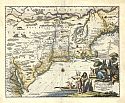
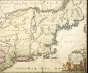
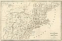
Viewing Options
Main Author:
Montanus, Arnoldus
Title/Description:
Novi Belgii Quod Nunc Novi Jorck Vocatur
Publication Info:
Amsterdam: J. Meurs, 1671
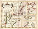
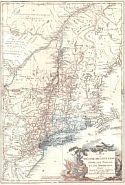
Viewing Options
Main Author:
Sutton, Nicholls
Title/Description:
New Map of the Most Considerable Plantations of the English in America
Publication Info:
[Oxford:1701]
Viewing Options
Main Author:
Bellin, Jacques Nicolas
Title/Description:
Carte de la Nouvelle Angleterre, Nouvelle Yorck, et Pensilvanie, pour servir à l'Histoire Générale des Voyages
Publication Info:
Paris: Didot, c1757; 25271
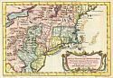
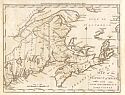
Viewing Options
Main Author:
Homann, Johann Baptist
Title/Description:
Nova Anglia
Publication Info:
Norimbergae [Homann Erben, between 1759 and 1784]
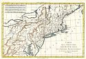
Viewing Options
Main Author:
de la Tour, Brion Louis
Title/Description:
Carte du Théatre de la Guerre entre las Anglais Guerre entre les Anglais et les Américains
Publication Info:
Paris, 1778
Viewing Options
Main Author:
Bonne, Rigobert
Title/Description:
Carte de la Partie Nord, des Etats Unis, de L'Amérique Septentrionale
Publication Info:
Paris: Rigobert Bonne, c.1785
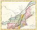
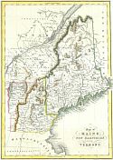
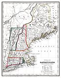
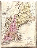
Viewing Options
Main Author:
Morse, Jedediah
Title/Description:
A Map of the District of Maine with New Brunswick & Nova Scotia
Publication Info:
Boston: Thomas & Andrews, 1796; Engraved for Morse's Universal Geography
Viewing Options
Main Author:
Botta, Carlo Guiseppe Guglielmo
Title/Description:
Le Provincie Settentrionali degli Stati Uniti
Publication Info:
Italy: c.1809
Viewing Options
Title/Description:
The United States with Part of Canada
Publication Info:
Philadelphia: Warner & Johnson, 1814
Viewing Options
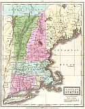
Main Author:
Olney, Jesse
Title/Description:
Eastern States
Publication Info:
New York: Robinson, Pratt and Company, 1829
Viewing Options
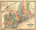
Main Author:
Fenner, Sears and Company
Title/Description:
Map of Maine, New Hampshire and Vermont
Publication Info:
London: I.T. Hinton, Simpkin and Marshall, 1832
Viewing Options
Main Author:
Olney, Jesse
Title/Description:
Middle States
Publication Info:
New York: Robinson, Pratt and Co., 1837; from The New and Improved School Atlas
Viewing Options
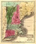
Main Author:
Olney, Jesse
Title/Description:
Eastern States
Publication Info:
New York: Robinson, Pratt and Co., 1837; from The New and Improved School Atlas
Viewing Options
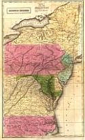
Main Author:
Evans, W. Gardner
Title/Description:
The Middle States
Publication Info:
New York: W. Gardner Evans, 1838
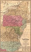
Viewing Options
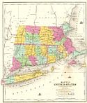
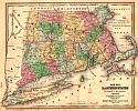
Main Author:
Brown and Parsons
Title/Description:
Map of Massachusetts, Connecticut, and Rhode Island constructed from the latest authorities
Publication Info:
Hartford: Brown & Parsons, 1838
Viewing Options
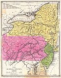
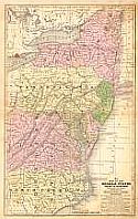
Main Author:
Mitchell, Samuel Augustus
Title/Description:
No. 7 Map of the Middle States and Part of the Southern
Publication Info:
Philadelphia: S.A. Mitchell, 1839; Engraved to Illustrate Mitchell's School and Family Geography
Viewing Options
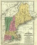
Main Author:
Mitchell, S. Augustus
Title/Description:
No. 6 Map of the New England or Eastern States
Publication Info:
Philadelphia: Thomas, Cowperthwait and Co., 1839; from Mitchell's School Atlas
Viewing Options
Main Author:
Woodbridge, William C.
Title/Description:
Political Map of the Eastern States
Publication Info:
Hartford: Belknap and Hamersley, 1843; from School Atlas, to accompany the Modern School Geography
Viewing Options
Title/Description:
Map of the Middle States
Publication Info:
Hartford: John Paine, 1844; from Smith's Atlas designed to accompany The Geography for Schools
Viewing Options
Main Author:
Young, James H.
Title/Description:
No. 8 Map of the New England or Eastern States
Publication Info:
Philadelphia: S.A. Mitchell, 1844; Engraved to Illustrate Mitchell's School and Family Geography
Viewing Options
Title/Description:
Map 1. Eastern States
Publication Info:
Hartford: John Paine, 1844; from Smith's Atlas designed to accompany The Geography for Schools
Viewing Options
Title/Description:
Map 2 Eastern States
Publication Info:
Hartford: John Paine, 1844; from Smith's Atlas designed to accompany The Geography for Schools
Viewing Options
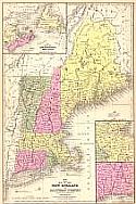
Main Author:
Morse, Sidney E.
Title/Description:
New England, Southern Part Boston and Vicinity
Publication Info:
New York: Harper and Brothers, 1844; from The System of Geography for the Use of Schools
Viewing Options
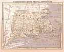
Main Author:
Morse, Sidney E.
Title/Description:
Massachusetts, Rhode Island and Connecticutt
Publication Info:
New York: Harper and Brothers, 1844; from The System of Geography for the Use of Schools
Viewing Options
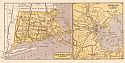
Main Author:
Story & Atwood
Title/Description:
Physical & Political Map of N. Eastern States, adapted to Woodbridge's Geography
Publication Info:
New York: Story & Atwood, 1845
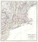
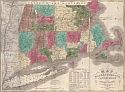
Viewing Options
Main Author:
Society for the Diffusion of Useful Knowledge
Title/Description:
North America Sheet VI New-York, Vermont, Maine, New-Hampshire, Massachusetts, Connecticut, Rhode-Island, and New-Jersey
Publication Info:
London: Charles Knight & Co., 1846