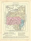
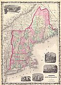
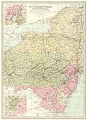
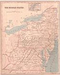
Viewing Options
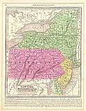
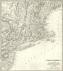
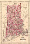
Main Author:
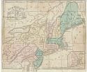
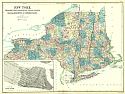
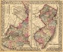
Goodrich, S.G.
Title/Description:
The Middle States
Publication Info:
New York: George Savage, 1850; from A Comprehensive Geography and History Ancient and Modern
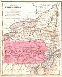
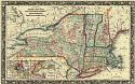
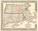
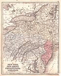
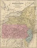
Viewing Options
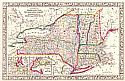
Main Author:
Smith, Roswell C.
Title/Description:
Map No. 3 United States (New York, Pennsylvania and New Jersey)
Publication Info:
New York: Cady and Burgess, 1850 from A Concise and Practical System of Geography for Common Schools, Academies and Families
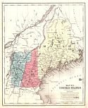
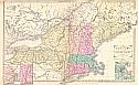
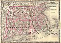
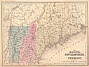
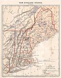
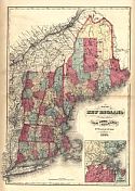
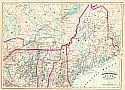
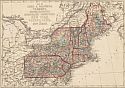
Viewing Options
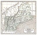
Main Author:
Smith, Roswell C.
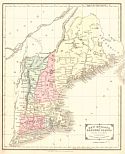
Title/Description:
Map No. 1 United States (Maine, Vermont and New Hampshire)
Publication Info:
New York: Cady and Burgess, 1850 from A Concise and Practical System of Geography for Common Schools, Academies and Families
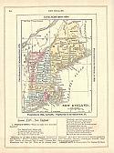
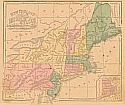
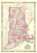
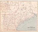
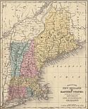
Viewing Options
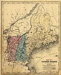
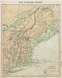
Main Author:
Goodrich, S.G.
Title/Description:
New England
Publication Info:
New York: George Savage, 1850; from A Comprehensive Geography and History Ancient and Modern
Viewing Options
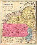
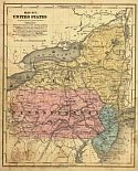
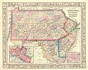
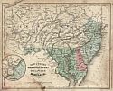
Main Author:
Mitchell, Samuel Augustus
Title/Description:
New York, Pennsylvania, New Jersey and Delaware
Publication Info:
Philadelphia: S.A. Mitchell, 1851
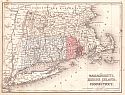
Viewing Options
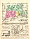
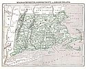
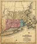
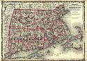
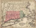
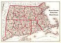
Main Author:
Mitchell, Samuel Augustus
Title/Description:
Massachusetts, Rhode Island and Connecticut
Publication Info:
Philadelphia: S.A. Mitchell, 1851
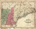
Viewing Options
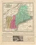
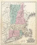
Main Author:
Mitchell, Samuel Augustus
Title/Description:
Maine, New Hampshire, and Vermont
Publication Info:
Philadelphia: S.A. Mitchell, 1851; 23383
Viewing Options
Main Author:
Morse, Sidney E.
Title/Description:
Maine, New Hampshire and Vermont
Publication Info:
New York: Harper and Brothers 1851; from Morse's School Geography
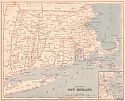
Viewing Options
Main Author:
Morse, Sidney E.
Title/Description:
Massachusetts, Connecticut and Rhode Island
Publication Info:
New York: Harper and Brothers 1851; from Morse's School Geography
Viewing Options
Main Author:
Society for the Diffusion of Useful Knowledge
Title/Description:
New York, Vermont, Maine, New Hampshire, Massachusetts, Connecticut, Rhode Island and New Jersey
Publication Info:
London: Charles Knight, 1852; from The General Atlas
Viewing Options
Main Author:
Society for the Diffusion of Useful Knowledge
Title/Description:
Pennsylvania, New Jersey, Maryland, Columbia and part of Virginia
Publication Info:
London: Charles Knight, 1852; from The General Atlas
Viewing Options
Main Author:
Burgess, Daniel
Title/Description:
Map No. 3 United States
Publication Info:
New York: Daniel Burgess, 1854
Viewing Options
Main Author:
Black, Adam and Charles
Title/Description:
New York, Vermont, New Hampshire, Rhode Island, Massachusetts, and Connecticut
Publication Info:
Edinburgh: A. and C. Adams, 1854; from The General Atlas of the World by Hall and Hughes
Viewing Options
Main Author:
Cornell, Sarah Sophia
Title/Description:
Eastern Division of the United States
Publication Info:
New York: D. Appleton & Co., 1855; designed to accompany Cornell's High School Geography
Viewing Options
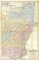
Main Author:
Mitchell, S. Augustus
Title/Description:
Map of the Middle States and Part of the Southern
Publication Info:
Philadelphia: Cowperthwait, Desilver and Butler, 1855
Viewing Options
Main Author:
Cornell, Sarah Sophia
Title/Description:
Northern or Middle States
Publication Info:
New York: D. Appleton & Co., 1855; designed to accompany Cornell's High School Geography
Viewing Options
Main Author:
Cornell, Sarah Sophia
Title/Description:
New England or Eastern States
Publication Info:
New York: D. Appleton & Co., 1855; designed to accompany Cornell's High School Geography
Viewing Options
Main Author:
Smith, Roswell C.
Title/Description:
Map No. 1 United States (Vermont, New Hampshire and Maine)
Publication Info:
New York: Daniel Burgess and Co., 1855; from A Concise and Practical System of Geography for Schools, Academies and Families
Viewing Options
Main Author:
Smith, Roswell C.
Title/Description:
Map No. 2 United States (Massachusetts, Connecticut and Rhode Island)
Publication Info:
New York: Daniel Burgess and Co., 1855; from A Concise and Practical System of Geography for Schools, Academies and Families
Viewing Options
Main Author:
Smith, Roswell C.
Title/Description:
Map No. 3 United States (New York, Pennsylvania and New Jersey)
Publication Info:
New York: Daniel Burgess and Co., 1855; from A Concise and Practical system of Geography for Schools, Academies and Families
Viewing Options
Main Author:
Cornell, Sarah Sophia
Title/Description:
New England and Middle States
Publication Info:
New York: D. Appleton and Company, c.1855; from Cornell's Intermediate Geography
Viewing Options
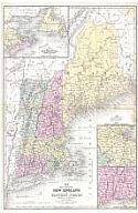
Main Author:
Mitchell, Samuel Augustus
Title/Description:
Map of the New England and Eastern States
Publication Info:
Philadelphia: Cowperthwait, Desilver, and Butler, 1855; from Mitchell's School Atlas
Viewing Options
Main Author:
Malte-Brun, Victor
Title/Description:
Etats-Unis Region du Nord
Publication Info:
Paris: Gustave Barba, 1856
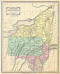
Viewing Options
Main Author:
Wells, Edward
Title/Description:
N. Eastern Division of the United States
Publication Info:
New York: D. Appleton & Co., c.1857; Designed to Accompany Cornell's High School Geography
Viewing Options
Main Author:
Bartholomew, John
Title/Description:
New York, Vermont, New Hampshire, Rhode Island Massachusetts and Connecticut
Publication Info:
Edinburgh: A. and C. Black, c.1857
Viewing Options
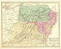
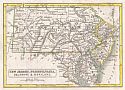
Main Author:
Boynton, George W.
Title/Description:
New Jersey, Pennsylvania, Delaware, and Maryland
Publication Info:
Boston: G.W. Boynton and Co., 1860
Viewing Options
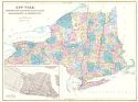
Main Author:
Williams, Wellington
Title/Description:
County Map of the States of New York, New Hampshire, Vermont, Massachusetts, Rhode Id., and Connecticut
Publication Info:
Philadelphia: S.A. Mitchell, 1860
Viewing Options
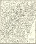
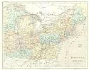
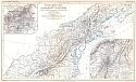
Main Author:
Sandoz, Ernest
Title/Description:
Psysikalische Karte Alleghany - Systems
Publication Info:
Gotha: Justus Perthes, 1860; from Peterman's Geographische Mittheilungen
Viewing Options
Title/Description:
New England & Middle States
Publication Info:
New York: S.F. Baker, c.1860
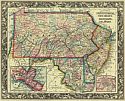
Viewing Options
Main Author:
Mitchell, Samuel Augustus
Title/Description:
County Map of Pennsylvania, New Jersey, Maryland and Delaware
Publication Info:
Philadelphia: S.A. Mitchell, 1861
Viewing Options
Main Author:
Mitchell, S. Augustus, Jr.
Title/Description:
County Map of Pennsylvania, New Jersey, Maryland and Delaware
Publication Info:
Philadelphia: S. Augustus Mitchell, Jr., 1861; from Mitchell's New General Atlas
Viewing Options
Main Author:
Mitchell, S. Augustus, Jr.
Title/Description:
County Map of the States of New York, New Hampshire, Vermont, Massachusetts, Rhode Island and Connecticut
Publication Info:
Philadelphia: S. Augustus Mitchell, Jr., 1861; from Mitchell's New General Atlas
Viewing Options
Main Author:
Johnson, Alvin J.
Title/Description:
Johnson's New England
Publication Info:
New York: Johnson and Browning, 1826
Viewing Options
Main Author:
Johnson and Ward
Title/Description:
Johnson's Massachusetts, Connecticut and Rhode Island
Publication Info:
New York: Johnson and Ward, 1862
Viewing Options
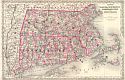
Main Author:
Gamble, William H.
Title/Description:
County Map of Massachusetts, Connecticut, and Rhode Island
Publication Info:
Philadelphia: S.A. Mitchell, c.1863
Viewing Options
Main Author:
Johnson, Alvin J.
Title/Description:
Johnson's Vermont, New Hampshire, Massachusetts, Rhode Island, and Connecticut
Publication Info:
New York: Johnson and Ward, 1864
Viewing Options
Main Author:
Johnson, A.J.
Title/Description:
Johnson's Massachusetts, Connecticut and Rhode Island
Publication Info:
New York: Johnson and Ward, 1864; from Johnson's New Illustrated Family Atlas
Viewing Options
Main Author:
McNally, Francis
Title/Description:
New Jersey, Pennsylvania, Delaware and Maryland
Publication Info:
New York: A.S. Barnes and Burr, 1865; from An Improved System of Geography
Viewing Options
Main Author:
Cornell, Sarah Sophia
Title/Description:
Maine, New Hampshire, and Vermont (VIII)
Publication Info:
New York: D. Appleton & Co., c.1865
Viewing Options
Main Author:
McNally, Francis
Title/Description:
Maine, New Hampshire, Vermont
Publication Info:
New York: A.S. Barnes and Burr, 1865; from An Improved System of Geography
Viewing Options
Main Author:
McNally, Francis
Title/Description:
Massachusetts, Connecticut and Rhode Island
Publication Info:
New York: A.S. Barnes and Burr, 1865; from An Improved System of Geography
Viewing Options
Main Author:
Colton, J.H.
Title/Description:
Vermont, Massachusetts, Rhode Island and Connecticut
Publication Info:
New York: Ivison, Phinney, Blakeman and Company, 1865; from The American School Quarto Georgraphy
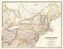
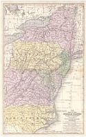
Viewing Options
Main Author:
Calvin, Smith & Tanner
Title/Description:
United States North America; The North Eastern States Comprising Maine, New Hampshire, Rhode Island, Connecticut, New Jersey, Delaware, Pennsylvania, Maryland, Ohio, and Part of Virginia and Michigan
Publication Info:
Edinburgh: A. Fullarton & Co., c.1865
Viewing Options
Main Author:
Mitchell, Samuel Augustus
Title/Description:
No. 10 Map of the Middle States and Part of the Southern
Publication Info:
Philadelphia: S.A. Mitchell, 1866
Viewing Options
Main Author:
Johnson, Alvin J.
Title/Description:
Johnson's Vermont, New Hampshire, Massachusetts, Rhode Island, and Connecticut
Publication Info:
New York: A.J. Johnson, 1866
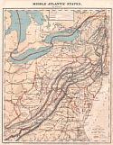
Viewing Options
Title/Description:
Middle Atlantic States
Publication Info:
New York: Charles Scribner & Co., 1868; from Guyot's Common-School Geography
Viewing Options
Title/Description:
New England States
Publication Info:
New York: Charles Scribner & Co., 1868; from Guyot's Common-School Geography
Viewing Options
Main Author:
Colton, G.W. & C.B. Colton
Title/Description:
Colton's Massachusetts, Connecticut, and Rhode Island
Publication Info:
New York: G.W. & C.B. Colton, 1869
Viewing Options
Main Author:
Bartholomew, John
Title/Description:
(Middle States) New York, New Jersey, Pennsylvania, Maryland & Delaware with Environs of New York and Philadelphia
Publication Info:
Philadelphia: T. Ellwood Zell, c.1870

Viewing Options
Main Author:
S. Augustus Mitchell
Title/Description:
Maine, New Hampshire and Vermont
Publication Info:
Philadelphia: E.H. Butler and Company, 1870; from Mitchell's New School Atlas
Viewing Options
Main Author:
S. Augustus Mitchell
Title/Description:
Massachusetts, Rhode Island and Connecticut
Publication Info:
Philadelphia: E.H. Butler and Company, 1870; from Mitchell's New School Atlas
Viewing Options
Main Author:
S. Augustus Mitchell
Title/Description:
New York, New Jersey, Pennsyvania and Delaware
Publication Info:
Philadelphia: E.H. Butler and Company, 1870; from Mitchell's New School Atlas
Viewing Options
Main Author:
Walling, H.F. and O.W. Gray
Title/Description:
Map of New England with adjacent portions of New York and Canada
Publication Info:
Boston: Stedman, Brown and Lyon, 1871; from The Official Topographical Atlas of Massachusetts
Viewing Options
Main Author:
Hall, Mary L.
Title/Description:
The Middle States
Publication Info:
Boston: Ginn Brothers, 1872; from Our World No. 2 or Second Series of Lessons in Geography
Viewing Options
Main Author:
Asher & Adams
Title/Description:
Asher and Adams' Maine and Part of Quebec
Publication Info:
Philadelphia: Asher & Adams, 1872
Viewing Options
Main Author:
Hall, Mary L.
Title/Description:
Northern New England
Publication Info:
Boston: Ginn Brothers, 1872; from Our World No.2 or Second Series of Lessons in Geography
Viewing Options
Main Author:
Hall, Mary L.
Title/Description:
Southern New England
Publication Info:
Boston: Ginn Brothers, 1872; from Our World No. 2 or Second Series of Lessons in Geography
Viewing Options
Main Author:
Asher and Adams
Title/Description:
New Hampshire, Vermont, Massachusetts, Rhode Island
Publication Info:
New York: Asher and Adams, 1872; from New Statistical Atlas of the United States
Viewing Options
Main Author:
McNally, Francis
Title/Description:
New Jersey, Pennsylvania, Delaware and Maryland
Publication Info:
Chicago: A.S. Barnes and Company, 1873; from An Improved System of Geography
Viewing Options
Main Author:
Lloyd, H.H. and Company
Title/Description:
County Map of New England and the Provinces of Quebec, New Brunswick, Nova Scotia, and Prince Edward Island
Publication Info:
Chicago: Warner & Beers, c1873; from H.H. Lloyd and Co.'s Atlas of the United States
Viewing Options
Main Author:
Jones, Charles H.
Title/Description:
Map of Maine, New Hampshire, Vermont, Massachusetts, Rhode Island and Connecticut
Publication Info:
New York: J. David Williams, 1873; The Peoples' Pictorial Atlas
Viewing Options
Main Author:
Jones, Charles H.
Title/Description:
Map of New York, Pennsylvania and New Jersey
Publication Info:
New York: J. David Williams, 1873; The Peoples' Pictorial Atlas
Viewing Options
Main Author:
Bartholomew, John
Title/Description:
New England States and Long Island
Publication Info:
Philadelphia: T. Ellwood Zell, 1873; from A Descriptive Hand Atlas of the World
Viewing Options
Main Author:
Bartholomew, John
Title/Description:
New York, New Jersey, Pennsylvania, Maryland and Delaware
Publication Info:
Philadelphia: T. Ellwood Zell, 1873; from A Descriptive Hand Atlas of the World
Viewing Options
Main Author:
Mitchell, S. Augustus
Title/Description:
County Map of Massachusetts, Connecticut, and Rhode Island
Publication Info:
Philadelphia: S. A. Mitchell, 1873; from Mitchell's New General Atlas
Viewing Options
Main Author:
Mitchell, S. Augustus
Title/Description:
County Map of New Jersey, County Map of Maryland and Delaware
Publication Info:
Philadelphia: S. A. Mitchell, 1873; from Mitchell's New General Atlas
Viewing Options
Title/Description:
New England States
Publication Info:
New York: Scribner, Armstrong and Company, c. 1874; from Guyot's Intermediate Geography
Viewing Options
Main Author:
Mitchell, S. Augustus
Title/Description:
Map of the Middle States
Publication Info:
Philadelphia: J.H. Butler and Company, 1875; from A System of Modern Geography
Viewing Options
Main Author:
Jones, Charles H. and Theodore F. Hamilton
Title/Description:
Map of Maine, N. Hampshire, Vermont, Massachusetts, Rhode Island, Connecticut, New York, Pennsylvania and New Jersey
Publication Info:
Chicago: H.H. Hardesty, 1875; from The Historical Atlas of the World Illustrated
Viewing Options
Main Author:
Mitchell, S. Augustus
Title/Description:
Map of the New England or Eastern States
Publication Info:
Philadelphia: J.H. Butler and Company, 1875; from A System of Modern Geography
Viewing Options
Main Author:
Hardesty, H.H.
Title/Description:
Massachusetts, Connecticut, and Rhode Island
Publication Info:
Chicago: H.H. Hardesty and Company, 1875; from Historical Atlas of the World Illustrated

