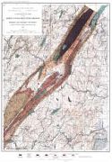
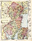
Viewing Options
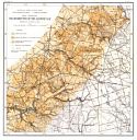
Main Author:
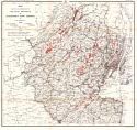
Kummel, Henry B. and Stuart Weller
Title/Description:
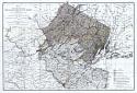
A Geological Map of the Green Pond Mountain Region in Morris and Passaic Counties
Publication Info:
Trenton: Geological Survey of New Jersey, 1901; for the Annual Report of the State Geologist
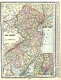
Viewing Options
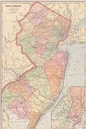
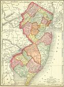
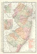
Main Author:
Cram, George F.
Title/Description:
New Jersey
Publication Info:
Chicago: The Fort Dearborn Publishing Co., 1901; from The National Standard Family and Business Atlas of the World
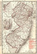
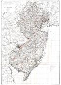
Viewing Options
Main Author:
Rand McNally and Company
Title/Description:
New Jersey
Publication Info:
Chicago: Rand McNally and Co., 1901; from The Enlarged Business and Shippers Guide
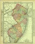
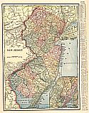
Viewing Options
Main Author:
Rand McNally and Company
Title/Description:
New Jersey
Publication Info:
Chicago: Rand McNally and Co., 1901; from The Universal Atlas of the World
Viewing Options
Main Author:
Cram, George F.
Title/Description:
New Jersey
Publication Info:
Chicago: George F. Cram, 1901; from Cram's Atlas of the World Ancient and Modern
Viewing Options
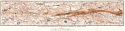
Title/Description:
Map Showing the Distribution of the Alloway Clay
Publication Info:
Trenton: Geological Survey of New Jersey, 1902; labeled Volume VI Plate XIII
Viewing Options
Main Author:
Kummel, Henry B.
Title/Description:
Map Showing the Clay Formations near Keyport and Matawan
Publication Info:
Trenton: Geological Survey of New Jersey, 1902; labeled Volume VI Plate XII,
Viewing Options
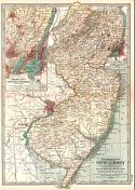
Main Author:
The Century Company
Title/Description:
New Jersey
Publication Info:
Buffalo: The Matthews-Northrup Co., 1902; from the 1902 edition of the Century Atlas
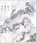
Viewing Options
Main Author:
Salisbury, Rollin D.
Title/Description:
Map Showing the Distribution of the Glacial Drift of New Jersey
Publication Info:
Trenton: Geological Survey of New Jersey, 1902; Vol. 5, Plate XXVIII
Viewing Options
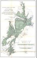
Main Author:
Geological Survey of New Jersey
Title/Description:
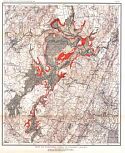
Map of Flooded Lands in Passaic Valley
Publication Info:
Trenton: Geological Survey of New Jersey, 1903;for the Annual Report of the State Geologist, Plate V
Viewing Options
Main Author:
Geological Survey of New Jersey
Title/Description:
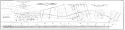
Map of Flooded Lands in Passaic Valley/Survey for a Tide Waterway between Bay Head and Manasquan Inlet
Publication Info:
Trenton: Geological Survey of New Jersey, 1903; for the Annual Report of the State Geologist, Plate II,
Viewing Options
Main Author:
U.S. Geological Survey
Title/Description:
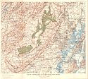
Map of Flooded Areas in Central Basin, New Jersey
Publication Info:
Washington: Department of the Interior, U.S. Geological Survey, 1903; Water Supply Paper No. 88 Plate 11
Viewing Options
Main Author:
Cram, George F.
Title/Description:
New Jersey
Publication Info:
Philadelphia: The Philadelphia Inquirer,1903; from Pictorial Atlas of the Greater United States and the World
Viewing Options
Main Author:
Kummel, Henry B.
Title/Description:
A Map of the Clay Formations in Northeastern Middlesex County
Publication Info:
Trenton: Geological Survey of New Jersey, 1904; labeled Vol. VI Plate XI
Viewing Options
Main Author:
Geological Survey of New Jersey
Title/Description:
Map Showing the Distribution of Clay Pits and Clay Manufactures in New Jersey in 1903
Publication Info:
Trenton: Geological Survey of New Jersey, 1904; labeled Vol. VI Plate XA
Viewing Options
Main Author:
Miller, J. Martin
Title/Description:
New Jersey
Publication Info:
Unknown, 1904; from the Twentieth Century Atlas and Illustrated World
Viewing Options
Main Author:
Geological Survey of New Jersey
Title/Description:
Map Showing the Distribution of White Limestone in Sussex County
Publication Info:
Trenton: Geological Survey of New Jersey, 1905; Plate XXVII from the Annual Report of the State Geologist
Viewing Options
Main Author:
McCourt, W.E.
Title/Description:
Map Showing the Distribution of the Peat Deposits of Northern New Jersey
Publication Info:
Trenton: Geological Survey of New Jersey, 1905; Plate XXIV from the Annual Report of the State Geologist
Viewing Options
Main Author:
Geological Survey of New Jersey
Title/Description:
Plan of Proposed Passaic Lake
Publication Info:
Trenton: Geological Survey of New Jersey, 1905; Plate XXVIII from the Annual Report of the State Geologist
Viewing Options
Main Author:
Rand McNally and Company
Title/Description:
New Jersey
Publication Info:
Chicago: Rand McNally and Co., 1905; from The Unrivaled Atlas of the World
Viewing Options
Main Author:
Rand McNally and Company
Title/Description:
New Jersey
Publication Info:
Chicago: Rand McNally and Company, 1905; from The Enlarged Business Atlas and Shippers Guide

