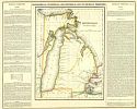
Viewing Options
Main Author:
Finlayson, James
Title/Description:
Geographical, Statistical, and Historical Map of Michigan Territory
Publication Info:
Philadelphia: Carey & Lea, 1822; first separate map of Michigan
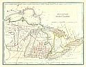
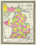
Viewing Options
Main Author:
Bradford, Thomas Gamaliel
Title/Description:
Michigan and the Great Lakes
Publication Info:
Boston: William D. Ticknor and Wiley & Long, 1835; from T.G. Bradford's A Comprehensive Atlas Geographical, Historical & Commercial
Viewing Options
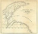
Main Author:
Berrien, J.M.
Title/Description:
Survey of Havre Bay, Michigan
Publication Info:
[Washington]: 1836; 25th Congress, 2nd Session, Senate Document No. 175
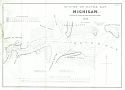
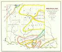
Viewing Options
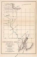
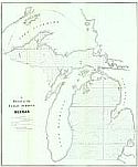
Main Author:
General Land Office
Title/Description:
Sketch of the Public Surveys in the North Part of Michigan
Publication Info:
Washington: General Land Office, 1837; Report to 25th Congress, 2nd Session
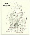
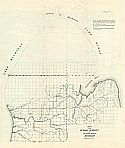
Viewing Options
Title/Description:
No. 2 Michigan
Publication Info:
Washington: General Land Office, 1841
Viewing Options
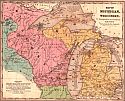
Title/Description:
Map of Michigan and Wisconsin
Publication Info:
Hartford: John Paine, 1844; from Smith's Atlas designed to accompany the Geography for Schools
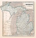
Viewing Options
Main Author:
Morse, Sidney E.
Title/Description:
Michigan
Publication Info:
New York: Harper and Brothers, 1844; from the System of Geography for the Use of Schools
Viewing Options
Main Author:
[General Land Office]
Title/Description:
F - Sketch of the Public Surveys in Michigan
Publication Info:
[Washington]:[General Land Office, 1845]
Viewing Options
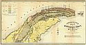
Main Author:
E. Weber & Company
Title/Description:
Geological Map of Townships in the Northern Peninsula of Michigan in the Year 1845
Publication Info:
Baltimore: E. Weber & Co., c.1845
Viewing Options
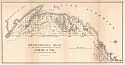
Main Author:
Foster, J.W. and J.D. Whitney
Title/Description:
Geological Map of Keweenaw Point, Lake Superior, Michigan
Publication Info:
Philadelphia: P.S. Duval, c.1845
Viewing Options
Main Author:
Burt, William A., Surveyor
Title/Description:
Geological Map of Township Lines in the Northern Peninsula of Michigan
Publication Info:
Washington: Department of the Interior, U.S. Geological Survey, 1845
Viewing Options
Main Author:
Hubbard & Ives
Title/Description:
Geological Map of the District Subdivided by Messrs
Publication Info:
Washington: Department of the Interior, U.S. Geological Survey, 1845
Viewing Options
Main Author:
Burt William A.
Title/Description:
Geological Map of a District of Township Lines in the Northern Peninsula of Michigan
Publication Info:
Baltimore: E. Weber & Co., 1846
Viewing Options
Main Author:
Mitchell, Samuel Augustus
Title/Description:
A New Map of Michigan with Its Canals, Roads, & Distances
Publication Info:
Philadelphia: S.A. Mitchell, 1847; from Mitchell's Universal Atlas
Viewing Options
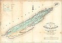
Main Author:
Foster, J.W. and J.D. Whitney
Title/Description:
Geological Map of Isle Royale, Lake Superior, Michigan
Publication Info:
New York: Ackerman Lith., c.1847; Made pursuant to the Act of Congress approved, March 1st, 1847
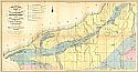
Viewing Options
Main Author:
Foster, J.W. and J.D. Whitney
Title/Description:
Geological Map of the District Between Portage Lake and Montreal River, Lake Superior, Michigan
Publication Info:
Philadelphia: P.S. Duval, c1849
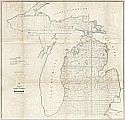
Viewing Options
Main Author:
Surveyor General's Office
Title/Description:
Sketch of the Public Survey in Michigan
Publication Info:
Detroit: Surveyor General's Office, 1849

