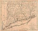
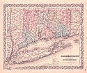
Viewing Options
Title/Description:
A New Map of Connecticut from the Best Authorities 1799
Publication Info:
New York: J. Low, 1799; Engraved for Payne's Geograpghy
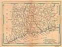
Viewing Options
Main Author:
Carey, Mathew
Title/Description:
Connecticut
Publication Info:
Philadelphia: Mathew Carey, 1814; from Carey's American Pocket Atlas
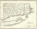
Viewing Options
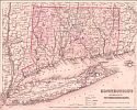
Main Author:
Bradford, Thomas G.
Title/Description:
Connecticut and Rhode Island
Publication Info:
Boston: William D. Ticknor, 1835; from A Comprehensive Atlas Geographical, Historical and Commercial
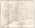
Viewing Options
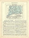
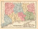
Main Author:
Percival, J.G.
Title/Description:
A Geological Map of Connecticut
Publication Info:
New Haven: Osborn and Baldwin, 1842; from Report on the Geology of the State of Connecticut
Viewing Options
Main Author:
Goodrich, S.G.
Title/Description:
Connecticut
Publication Info:
New York: George Savage, 1850; from A Comprehensive Geography and History Ancient and Modern
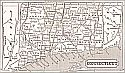
Viewing Options
Title/Description:
Connecticut
Publication Info:
New York: Phelps, Fanning and Company, 1853; from Fanning's Illustrated Gazetteer of the United States
Viewing Options
Main Author:
Desilver, Charles
Title/Description:
Map of Connecticut
Publication Info:
Philadelphia: Charles Desilver, c1856
Viewing Options
Main Author:
Colton, J.H.
Title/Description:
Connecticut
Publication Info:
New York: J.H. Colton and Company, Colton's Atlas of the World
Viewing Options
Main Author:
Colton, G.W.
Title/Description:
Connecticut
Publication Info:
New York: J.H. Colton and Company, 1858; from The General Atlas
Viewing Options
Main Author:
Mitchell, S. Augustus
Title/Description:
Connecticut
Publication Info:
Philadelphia: S. Augustus Mitchell, 1865; from Mitchell's New Intermediate Geography
Viewing Options
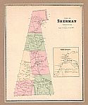
Main Author:
Beers, Ellis, and Soule
Title/Description:
Town of Sherman, Fairfield Co. Connecticut
Publication Info:
New York: Beers, Ellis, and Soule, 1868
Viewing Options
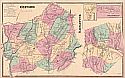
Main Author:
Beers, Ellis, and Soule
Title/Description:
Oxford, Naugatuck
Publication Info:
New York: Beers, Ellis, and Soule, 1868
Viewing Options
Main Author:
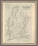
Beers, Ellis, and Soule
Title/Description:
Plan of the Fair Haven Water Co.'s Reservoirs and Maltby Park
Publication Info:
New York: Beers, Ellis, and Soule, 1868
Viewing Options
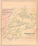
Main Author:
Beers, Ellis, and Soule
Title/Description:
Hazardville
Publication Info:
New York: Beers, Ellis, and Soule, 1868
Viewing Options
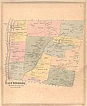
Main Author:
Beers, Ellis, and Soule
Title/Description:
East Windsor, Hartford County, Conn.
Publication Info:
New York: Beers, Ellis, and Soule, 1868
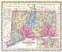
Viewing Options
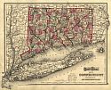
Main Author:
Gray, Ormando W.
Title/Description:
Connecticut
Publication Info:
Philadelphia: Stedman, Brown and Lyon 1873; from Gray's Atlas of the United States with General Maps of the World

Viewing Options
Title/Description:
Connecticut
Publication Info:
Philadelphia: Stedman, Brown and Lyon, 1873; from Gray's Atlas of the United States, with General Maps of the World, Accompanied by Descriptions Geographical, Historical, Scientific and Statistical

