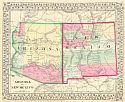
Viewing Options
Main Author:
Mitchell, Samuel Augustus
Title/Description:
Arizona and New Mexico
Publication Info:
Philadelphia: S.A. Mitchell, 1867

Viewing Options
Title/Description:
Map of Arizona with part of Sonora and California
Publication Info:
Washington: U.S. Engineer Department, 1871; to accompany R. Pumpelly's Narrative
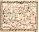
Viewing Options
Main Author:
Mitchell, S. Augustus
Title/Description:
County map of Arizona and New Mexico
Publication Info:
Philadelphia: S. Augustus Mitchell, 1872
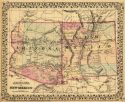
Viewing Options
Main Author:
Mitchell, S. Augustus
Title/Description:
County Map of Arizona and New Mexico
Publication Info:
Philadelphia: S. A. Mitchell,1873; from Mitchell's New General Atlas

Viewing Options
Main Author:
Berland, Eric
Title/Description:
Sketch Showing Location of Section for Current Observations at Camp Mohave, Arizona
Publication Info:
Washington: U.S. Army Corps of Engineers, 1875
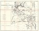
Viewing Options
Title/Description:
Territory of Arizona
Publication Info:
Washington: Department of the Interior, General Land Office, 1876
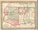
Viewing Options
Main Author:
Mitchell, Samuel Augustus
Title/Description:
County Map of Arizona and New Mexico
Publication Info:
Philadelphia: S.A. Mitchell, 1877
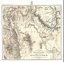
Viewing Options
Main Author:
Wheeler, George M.
Title/Description:
Map Showing Routes of the River and Land Parties engaged in Exploring the Grand Cañon of the Colorado
Publication Info:
Washington: U.S. Army Corps of Engineers, 1878

Viewing Options
Main Author:
U.S. Geological Survey
Title/Description:
The Moqui Mesas, "Province of Tusayan," Arizona Ter.
Publication Info:
Washington: Department of the Interior, U.S. Geological Survey of the Territories, 1878; 10th Annual Report
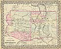
Viewing Options
Main Author:
Gamble, William H.
Title/Description:
County Map of Arizona and New Mexico
Publication Info:
Philadelphia: S.A. Mitchell, 1879
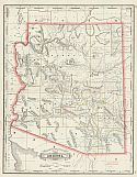
Viewing Options
Main Author:
Cram, George F.
Title/Description:
Railroad and County Map of Arizona
Publication Info:
Chicago: George F. Cram, 1879

Viewing Options
Main Author:
Mitchell, Samuel Augustus
Title/Description:
County and Township Map of Arizona and New Mexico
Publication Info:
Philadelphia: Samuel Augustus Mitchell, 1880; from Mitchell's New General Atlas
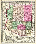
Viewing Options
Main Author:
Tunison, Henry C.
Title/Description:
Tunison's Arizona
Publication Info:
Jacksonville, IL: H.C. Tunison, 1881
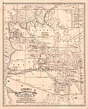
Viewing Options
Main Author:
Cram, George F.
Title/Description:
Railroad and Township Map of Arizona
Publication Info:
Chicago: George F. Cram, 1881

Viewing Options
Main Author:
Bradley, William
Title/Description:
County Map of Arizona and New Mexico
Publication Info:
Philadelphia: William M. Bradley and Company, 1881
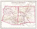
Viewing Options
Main Author:
Gray, Frank A.
Title/Description:
Arizona and New Mexico
Publication Info:
Philadelphia: O.W. Gray and Son, c. 1881
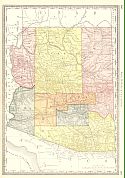
Viewing Options
Main Author:
Rand McNally and Company
Title/Description:
Arizona
Publication Info:
Chicago: Rand McNally and Company, 1881; from New Indexed Business Atlas and Shippers Guide

Viewing Options
Main Author:
Mitchell, Samuel Augustus
Title/Description:
County and Township Map of Arizona and New Mexico
Publication Info:
Philadelphia: S.A. Mitchell, 1882
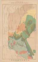
Viewing Options
Main Author:
Dutton, Clarence E.
Title/Description:
Geologic Map of the Western par of the Plateau Province
Publication Info:
Washington: Department of the Interior, U.S. Geological Survey, 1882, from the Atlas to Accompany the Monograph on the Tertiary History of the Grand Canon District
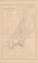
Viewing Options
Main Author:
Dutton, Clarence E.
Title/Description:
Sketch map of the Western Part of the Plateau Province showing the Faults of the Grand Canon District and High Plateaus
Publication Info:
Washington: Department of the Interior, U.S. Geological Survey, 1882, from the Atlas to Accompany the Monograph on the Tertiary History of the Grand Canon District

Viewing Options

Viewing Options
Main Author:
Dutton, Clarence E.
Title/Description:
Map of the Uinkaret Plateau
Publication Info:
Washington: Department of the Interior, U.S. Geological Survey, 1882, from the Atlas to Accompany the Monograph on the Tertiary History of the Grand Cañon District

Viewing Options

Viewing Options

Viewing Options

Viewing Options
Main Author:
Dutton, Clarence E.
Title/Description:
Geologic Map of the Grand Cañon in the Kaibab Plateau
Publication Info:
Washington: Department of the Interior, U.S. Geological Survey, 1882, from the Atlas to Accompany the Monograph on the Tertiary History of the Grand Cañon District

Viewing Options
Main Author:
Dutton, Clarence E.
Title/Description:
Geologic Map of the Colorado Plateau and San Francisco Mountains
Publication Info:
Washington: Department of the Interior, U.S. Geological Survey, 1882, from the Atlas to Accompany the Monograph on the Tertiary History of the Grand Canon District

Viewing Options
Main Author:
Dutton, Clarence E.
Title/Description:
Geologic Map showing the Kanab, Paria, and Marble Canon Platforms
Publication Info:
Washington: Department of the Interior, U.S. Geological Survey, 1882, from the Atlas to Accompany the Monograph on the Tertiary History of the Grand Canon District

Viewing Options
Main Author:
Dutton, Clarence E.
Title/Description:
Geologic Map of the Mesozoic Terraces of the Grand Canon District
Publication Info:
Washington: Department of the Interior, U.S. Geological Survey, 1882, from the Atlas to Accompany the Monograph on the Tertiary History of the Grand Canon District

Viewing Options
Main Author:
Dutton, Clarence E.
Title/Description:
Geologic Map Showing the South-Western Portion of the Mesozoic Terraces
Publication Info:
Washington: Department of the Interior, U.S. Geological Survey, 1882, from the Atlas to Accompany the Monograph on the Tertiary History of the Grand Canon District

Viewing Options
Main Author:
Cram, George F.
Title/Description:
New Railroad and County Map of Southern California and Arizona
Publication Info:
Chicago: George F. Cram, 1882
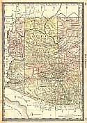
Viewing Options
Main Author:
Hardesty, H.H.
Title/Description:
Map of Arizona
Publication Info:
New York: H.H. Hardesty & Co., 1883; from Hardesty's Historical and Geographical Encyclopedia
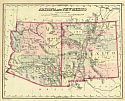
Viewing Options
Title/Description:
Arizona and New Mexico
Publication Info:
Philadelphia: O.W. Gray and Son, 1883; from The National Atlas
Viewing Options
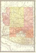
Main Author:
Rand McNally & Company
Title/Description:
Arizona from Rand McNally Indexed Atlas of the World
Publication Info:
Chicago: Rand McNally & Co., 1884
Original Source:
From the personal collection of Dr. Gerald Webster

Viewing Options
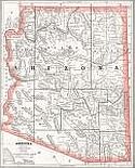
Main Author:
Mitchell, S. Augustus
Title/Description:
County and Township Map of Arizona and New Mexico
Publication Info:
Philadelphia: William M. Bradley and Bro., 1884; from Mitchell's Atlas of the World
Viewing Options
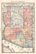
Main Author:
Cram, George F.
Title/Description:
Arizona
Publication Info:
Chicago: Henry S. Stebbins, 1884; from The Unrivaled Family Atlas of the World
Viewing Options
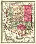
Main Author:
Rand McNally and Company
Title/Description:
Arizona
Publication Info:
Chicago: Rand McNally and Company, 1884; from The New Household Atlas of the World
Viewing Options
Main Author:
Tunison, Henry Cuthbert
Title/Description:
Arizona
Publication Info:
Jacksonville, IL: H.C. Tunison, 1885
Viewing Options
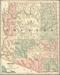
Main Author:
Cram, George F.
Title/Description:
Arizona
Publication Info:
Chicago: Henry S. Stebbins, 1885; from The Unrivaled Family Atlas of the World
Viewing Options
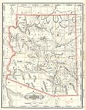
Main Author:
Cram George F.
Title/Description:
Railroad and Township Map of Arizona
Publication Info:
Chicago: George F. Cram, c. 1885
Viewing Options
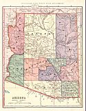
Main Author:
Monteith, James
Title/Description:
Arizona
Publication Info:
New York: A.S. Barnes and Company, 1885; from Monteith's Independent Course Comprehensive Geography

Viewing Options
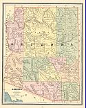
Title/Description:
Arizona and New Mexico
Publication Info:
Philadelphia: Stedman and Brown, 1886; from The National Atlas
Viewing Options
Main Author:
Cram, George F.
Title/Description:
Arizona
Publication Info:
Chicago: George F. Cram, 1886; from Cram's Unrivaled Family Atlas of the World

Viewing Options
Main Author:
Mitchell, Samuel Augustus
Title/Description:
County and Township Map of Arizona and New Mexico
Publication Info:
Philadelphia: William M. Bradley and Brothers, 1886
Viewing Options
Main Author:
Cram, George F.
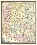
Title/Description:
Arizona
Publication Info:
Chicago: Henry S. Stebbins, 1887; from Cram's Universal Atlas of the World
Viewing Options
Main Author:
The Peoples Publishing Company
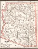
Title/Description:
Arizona
Publication Info:
Chicago: The Peoples Publishing Company, 1887; from The Peoples Unrivaled Family Atlas of the World

Viewing Options
Main Author:
Mitchell, Samuel Augustus
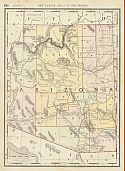
Title/Description:
County and Township Map of Arizona and New Mexico
Publication Info:
Philadelphia: William M. Bradley and Brothers, 1887; from Mitchell's New General Atlas
Viewing Options
Main Author:
Cram, George F.
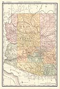
Title/Description:
Arizona
Publication Info:
Boston: George V. Jones and Co., 1888; from The Peoples Illustrated and Descriptive Family Atlas of the World
Viewing Options
Main Author:
Rand McNally and Company
Title/Description:
Arizona
Publication Info:
Chicago: Rand McNally and Copany, 1888; from Indexed Atlas of the World
Viewing Options
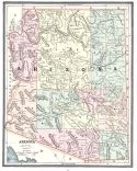
Main Author:
Cram, George F.
Title/Description:
Arizona
Publication Info:
Kansas City: Edwin Williamson, 1888; from Cram's Unrivaled Atlas of the World
Viewing Options
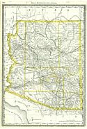
Title/Description:
Arizona
Publication Info:
Chicago: Rand McNally and Co., 1889; from the Enlarged Business Atlas and Shippers Guide
Viewing Options
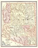
Main Author:
Cram, George F.
Title/Description:
Arizona
Publication Info:
Chicago: George F. Cram, 1889

Viewing Options
Main Author:
Mast, Crowell and Kirkpatrick
Title/Description:
Map of Arizona, Map of Utah
Publication Info:
Springfield, Ohio: Mast, Crowell and Kirkpatrick, 1889; from Peerless Atlas of the World

