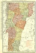
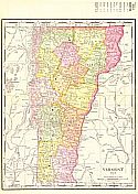
Viewing Options
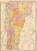
Main Author:
Rand McNally and Company
Title/Description:
Vermont
Publication Info:
Chicago: Rand McNally and Co., 1911; from The Commercial Atlas of America
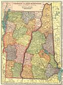
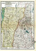
Viewing Options
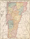
Main Author:
C.S. Hammond and Company
Title/Description:
Vermont and New Hampshire
Publication Info:
New York: C.S. Hammond and Company, 1911; from Hammond's Modern Atlas of the World
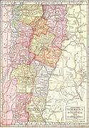
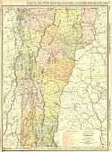
Viewing Options
Main Author:
The Geographical Publishing Company
Title/Description:
Vermont
Publication Info:
Chicago: Geographical Publishing Company, 1911
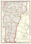
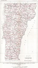
Viewing Options
Main Author:
Cram, George F.
Title/Description:
Vermont
Publication Info:
Chicago: George F. Cram, 1911; from Cram's Unrivaled Atlas of the World
Viewing Options
Main Author:
Rand McNally and Company
Title/Description:
Vermont
Publication Info:
Chicago: Rand McNally and Co., 1912; from The Library Atlas of the World
Viewing Options
Main Author:
Rand McNally and Company
Title/Description:
Vermont
Publication Info:
Chicago: Rand McNally and Company, 1912; from The Rand McNally Imperial Atlas of the World
Viewing Options
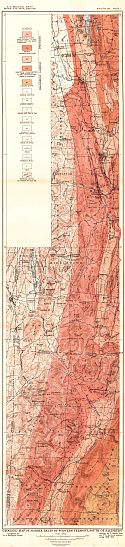
Main Author:
U.S. Geological Survey
Title/Description:
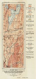
Geologic Map of Marble Belts of Westen Vermont, South of Salisbury
Publication Info:
Washington: Department of the Interior, U.S. Geological Survey, 1912; Bulletin 521 Plate I
Viewing Options
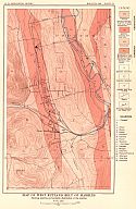
Main Author:
U.S. Geological Survey
Title/Description:
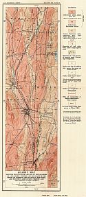
Map of West Rutland Belt of Marbles
Publication Info:
Washington: Department of the Interior, U.S. Geological Survey, 1912; Bulletin 521 Plate IV
Viewing Options
Main Author:
Rand McNally and Company
Title/Description:
Vermont
Publication Info:
Chicago: Rand McNally & Co., 1913
Viewing Options
Main Author:
The Century Company
Title/Description:
Vermont and New Hampshire
Publication Info:
New York: The Century Company, 1913; from The Century Atlas of the World
Viewing Options
Main Author:
Rand McNally and Company
Title/Description:
Vermont
Publication Info:
Chicago: Rand McNally and Co., 1914; from The Commercial Atlas of America
Viewing Options
Main Author:
U.S. Geological Survey
Title/Description:
Map of Vermont Showing Outcrops and Quarries of Calcite Marble and Dolomite in the Eastern Part of the State
Publication Info:
Washington: Department of the Interior, U.S. Geological Survey, 1914; Bulletin 589 Plate I
Viewing Options
Main Author:
U.S. Geological Survey
Title/Description:
Quarry Map Showing the Location and Size of the Quarries of Sea-Green, Purple and Red Slate in the Towns of Hampton and Granville, New York and Poultney and Pawlet, Vermont and the Geology of the Vicinity
Publication Info:
Washington: Department of the Interior, U.S. Geological Survey, 1914; Bulletin 586 Plate XX
Viewing Options
Main Author:
U.S. Geological Survey
Title/Description:
Quarry Map showing the Location and Size of Important Slate Quarries in the Unfading Green Slate Belt between Poultney and West Castleton, Vermont and a few of the Sea-Green Slate Quarries near Poultney
Publication Info:
Washington: Department of the Interior, U.S. Geological Survey, 1914; Bulletin 586 Plate XXI

