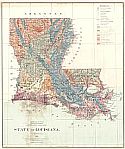
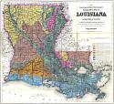
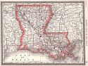
Viewing Options
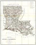
Title/Description:
State of Louisiana
Publication Info:
New York: Julius Bien & Co., 1876
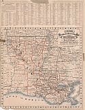
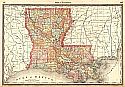
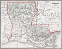
Viewing Options
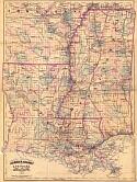
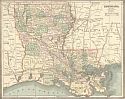
Main Author:
Asher & Adams
Title/Description:
Louisiana and Mississippi
Publication Info:
New York: Asher & Adams, 1878
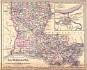
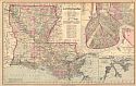
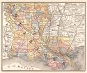
Viewing Options
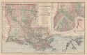
Main Author:
Gray, Frank A.
Title/Description:
Gray's New Map of Louisiana
Publication Info:
Philadelphia: G.W. Gray and Son, 1878
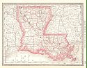
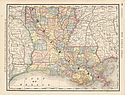
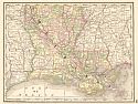
Viewing Options
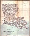
Main Author:
Roeser, Charles
Title/Description:
State of Louisiana
Publication Info:
[Washington]: U.S. Department of the Interior, General Land Office, 1879
Viewing Options
Title/Description:
State of Louisiana (with physiographic regions)
Publication Info:
Washington: Department of the Interior, General Land Office, 1879; hand drawn annotation of physiographic regions on G.L.O. basemap
Viewing Options
Main Author:
Cram, George F.
Title/Description:
Cram's Railroad and Township Map of Louisiana
Publication Info:
Chicago: George F. Cram, 1879
Viewing Options
Main Author:
Atwood, J.M.
Title/Description:
Map of the State of Louisiana
Publication Info:
Philadelphia: T.H. Butler and Co., 1881
Viewing Options
Main Author:
Rand McNally and Company
Title/Description:
Louisiana
Publication Info:
Chicago: Rand McNally and Company, 1881; from New Indexed Business Atlas and Shippers Guide

Viewing Options
Main Author:
Rand, McNally & Co.
Title/Description:
Louisiana
Publication Info:
Chicago: Rand, McNally & Co., 1882; from Rand, McNally & Co.'s Indexed County Map of Louisiana
Viewing Options
Main Author:
Lockett, S.H.
Title/Description:
The Louisiana State University Topographical Map of Louisiana
Publication Info:
New York: G.W. & C.B. Colton & Co., 1883
Viewing Options
Main Author:
Hardesty, H.H.
Title/Description:
Map of Louisiana
Publication Info:
New York: H.H. Hardesty & Co., 1883; from Hardesty's Historical and Geographical Encyclopedia
Viewing Options
Title/Description:
Louisiana
Publication Info:
Philadelphia: O.W. Gray and Son, 1883; from The National Atlas

Viewing Options
Main Author:
Hardesty, H.H.
Title/Description:
Map of Louisiana
Publication Info:
Chicago: H.H. Hardesty & Company, 1883; from Hardesty's Historical & Geographical Encyclopedia, Illustrated
Viewing Options
Main Author:
Watson, Gaylord
Title/Description:
Louisiana
Publication Info:
Boston: Perry and Spaulding, 1883; from New Indexed Family Atlas of the United States with Maps of the World
Viewing Options
Main Author:
Rand McNally & Company
Title/Description:
Louisiana
Publication Info:
Chicago: Rand McNally & Co., 1884; from Rand McNally Indexed Atlas of the World
Original Source:
From the personal collection of Dr. Gerald Webster
Viewing Options
Main Author:
Cram, George F.
Title/Description:
Louisiana
Publication Info:
Chicago: Henry S. Stebbins, 1884; from The Unrivaled Family Atlas of the World
Viewing Options
Main Author:
Rand McNally and Company
Title/Description:
Louisiana
Publication Info:
Chicago: Rand McNally and Company, 1884; from The New Household Atlas of the World
Viewing Options
Main Author:
Rand McNally & Company
Title/Description:
Louisiana
Publication Info:
Chicago: Rand McNally & Co., c.1885
Viewing Options
Main Author:
Cram, George F.
Title/Description:
Louisiana
Publication Info:
Chicago: Henry S. Stebbins, 1885; from The Unrivaled Family Atlas of the World