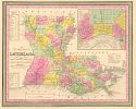
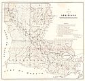
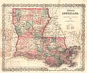
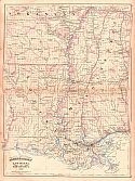
Viewing Options
Main Author:
Mitchell, Samuel Augustus
Title/Description:
A New Map of Louisiana with It's Canals, Roads, and Distances from Place to Place, Along the Stage and Stream Boat Routes
Publication Info:
Philadelphia: Thomas Cowperthwait & Co., 1850
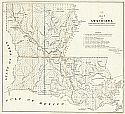
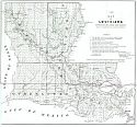
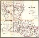
Viewing Options
Title/Description:
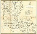
(I) Map of Louisiana Representing the Several Land Districts
Publication Info:
Donaldsonville, LA: Surveyor General's Office, 1851; Prepared to Accompany the Surveyor General's Annual Report
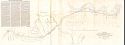
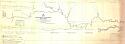
Viewing Options
Main Author:
Phelps, Augustus and W. Sidney Smith
Title/Description:
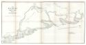
Sketch Showing the Proposed Location of the Portion of the New Orleans, Opelousas, and Great Western Rail Way Between Algiers and Thibodaux
Publication Info:
New Orleans: 1852
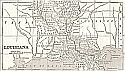
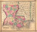
Viewing Options
Main Author:
Phelps, Fanning and Company
Title/Description:
Louisiana
Publication Info:
New York: Phelps, Fanning and Company, 1853; from Fanning's Illustrated Gazetteer of the United States
Viewing Options
Main Author:
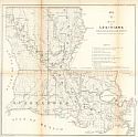
McCulloh, William J.
Title/Description:
Map of Louisiana Representing the Several Land Districts
Publication Info:
Washington: Robert Armstrong, Printer, 1853; from Senate Ex. doc. 1. 33rd Congress, 1st Session, Maps and Views to Accompany Message and Document
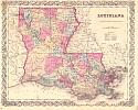
Viewing Options
Main Author:
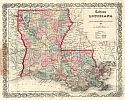
Colton, Joseph Hutchins
Title/Description:
Louisiana
Publication Info:
New York: J.H. Colton & Co., 1854
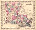
Viewing Options
Main Author:
McCulloh, William J.
Title/Description:
(H) Map of Louisiana Representing the Several Land Districts
Publication Info:
Donaldsville, LA: Surveyor General's Office, 1854; prepared to accompany the Surveyor General's Annual Report
Viewing Options
Main Author:
Colton, Joseph Hutchins
Title/Description:
Colton's Louisiana
Publication Info:
New York: J.H. Colton, 1855
Viewing Options
Main Author:
Fuller, Charles
Title/Description:
Map of the Red River with its Bayous and Lakes in the Vicinity of the Raft
Publication Info:
Washington: The Senate, 1855; Senate Executive Document No. 1, 1st Section, 34th Congress
Viewing Options
Main Author:
McCulloh, William J.
Title/Description:
No. 8 (H) Map of Louisiana Representing the Several Land Districts
Publication Info:
Washington: C.B. Graham, 1857; prepared to accompany the Surveyor General's Annual Report
Viewing Options
Main Author:
McCulloh, William J.
Title/Description:
No. 8 (H) Map of Louisiana Representing the Several Land Districts
Publication Info:
Donaldsonville, LA: Surveyor General's Office, 1860; Prepared to Accompany the Surveyor General's Annual Report
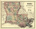
Viewing Options
Main Author:
Colton, J.H.
Title/Description:
Colton's Louisiana
Publication Info:
New York: J.H. Colton & Co., 1860
Viewing Options
Title/Description:
Colton's Louisiana
Publication Info:
New York: J.H. Colton, 1863; from Colton's Map of Louisiana
Viewing Options
Title/Description:
Louisiana
Publication Info:
New York: Schonberg and Company, 1864
Viewing Options
Main Author:
U.S. Department of the Interior, General Land Office
Title/Description:
Map of Louisiana
Publication Info:
Washington: Government Printing Office, 1866; for the Corps of Engineers
Viewing Options
Main Author:
Hezlep, John K.
Title/Description:
A Map of Bayou Manchac, Amite River and Pass Manchac
Publication Info:
[Washington: U.S. Government Printing Office], 1868
Viewing Options
Main Author:
Asher and Adams
Title/Description:
Louisiana and Mississippi
Publication Info:
New York: Asher and Adams, 1872; from New Statistical Atlas of the United States
Viewing Options
Title/Description:
Louisiana
Publication Info:
Philadelphia: Stedman, Brown and Lyon, 1873; from Gray's Atlas of the World, Accompanied by Descriptions Geographical, Historical, Scientific and Statistical