Geology 1875-1895

Before 1850
1850-1875
1876-1890
1891-1900
After 1900
Geology 1875-1895
Geology 1896-1905
Geology 1906-1915
Geology After 1915

Previous Page
Next Page

  Main Author:   Geological Survey of Queensland
  Title/Description:   No. 1 Geological Sketch Map of Part of the Charters Towers Goldfield
  Publication Info:   Brisbane: Geological Survey of Queensland, 1878
  Date:   1878
  Scale:   1:31,680
  Original Source:   Geological Survey of Alabama
Viewing options:


  Main Author:   Geological Survey of Queensland
  Title/Description:   Bowen River Coal Field, Queensland
  Publication Info:   Brisbane: Geological Survey of Queensland, 1879
  Date:   1879
  Scale:   1:316,800
  Original Source:   Geological Survey of Alabama
Viewing options:


  Main Author:   Geological Survey of Queensland
  Title/Description:   Map of Little River Coal Field Near Cooktown
  Publication Info:   Brisbane: Geological Survey of Queensland, 1882
  Date:   1882
  Scale:   1:190,000
  Original Source:   Geological Survey of Alabama
Viewing options:


  Main Author:   Geological Survey of Queensland
  Title/Description:   Map No. 1, Geological Sketch Map to Accompany Reports on the Geological Features of part of the District to be Traversed by the Proposed Transcontinental Railroad
  Publication Info:   Brisbane: Geological Survey of Queensland, 1882
  Date:   1882
  Scale:   1:31,680
  Original Source:   Geological Survey of Alabama
Viewing options:


  Main Author:   Geological Survey of Queensland
  Title/Description:   Map No. 2, Geological Sketch Map to Accompany Reports on the Geological Features of part of the District to be Traversed by the Proposed Transcontinental Railroad
  Publication Info:   Brisbane: Geological Survey of Queensland, 1882
  Date:   1882
  Scale:   1:250,000
  Original Source:   Geological Survey of Alabama
Viewing options:


  Main Author:   Geological Survey of Queensland
  Title/Description:   Map No. 3, Geological Sketch Map to Accompany Reports on the Geological Features of part of the District to be Traversed by the Proposed Transcontinental Railroad
  Publication Info:   Brisbane: Geological Survey of Queensland, 1882
  Date:   1882
  Scale:   1:1,000,000
  Original Source:   Geological Survey of Alabama
Viewing options:


  Main Author:   Geological Survey of Queensland
  Title/Description:   Map No. 2, Western District to Accompany Report of the Tin Mines of Herbeton, Western, and Thompson Creek Districts and the Silver Mines of the Dry River
  Publication Info:   Brisbane: Geological Survey of Queensland, 1883
  Date:   1883
  Scale:   1:7,920
  Original Source:   Geological Survey of Alabama
Viewing options:


  Main Author:   Geological Survey of Queensland
  Title/Description:   Map No. 1, Herberton District
  Publication Info:   Brisbane: Geological Survey of Queensland, 1883
  Date:   1883
  Scale:   1:6,336
  Original Source:   Geological Survey of Alabama
Viewing options:


  Main Author:   Geological Survey of Queensland
  Title/Description:   Plan to Accompany Report on Mount Morgan
  Publication Info:   Brisbane: Geological Survey of Queensland, 1884
  Date:   1884
  Scale:   1:6,336
  Original Source:   Geological Survey of Alabama
Viewing options:


  Main Author:   Jack, Robert L.
  Title/Description:   Geological Map of the Hodgkinson Gold Field
  Publication Info:   Brisbane: Geological Survey of Queensland, 1884
  Date:   1884
  Scale:   1:250,000
  Original Source:   Geological Survey of Alabama
Viewing options:


  Main Author:   Jack, Robert L.
  Title/Description:   Geological Map No. 2 of the Hodgkinson Gold Field
  Publication Info:   Brisbane: Geological Survey of Queensland, 1884
  Date:   1884
  Scale:   1:63,360
  Original Source:   Geological Survey of Alabama
Viewing options:


  Main Author:   Geological Survey of Queensland
  Title/Description:   Geological Map of the Hodgkinson Gold Field
  Publication Info:   Brisbane: Geological Survey of Queensland, 1884
  Date:   1884
  Scale:   1:253,440
  Original Source:   Geological Survey of Alabama
Viewing options:


  Main Author:   Geological Survey of Queensland
  Title/Description:   Geological Map to Accompany Report on the Mount Leyshon Gold Deposits
  Publication Info:   Brisbane: Geological Survey of Queensland, 1885
  Date:   1885
  Scale:   1:7,920
  Original Source:   Geological Survey of Alabama
Viewing options:


  Main Author:   Geological Survey of Queensland
  Title/Description:   No. 1 Plan Showing the Position of the Reefs and Alluvial Diccincs on the Raglan Goldfield
  Publication Info:   Brisbane: Geological Survey of Queensland, 1885
  Date:   1885
  Scale:   1:125,000
  Original Source:   Geological Survey of Alabama
Viewing options:


  Main Author:   Geological Survey of Queensland
  Title/Description:   No. 2, Plan of Calliope Goldfield
  Publication Info:   Brisbane: Geological Survey of Queensland, 1885
  Date:   1885
  Scale:   1:63,360
  Original Source:   Geological Survey of Alabama
Viewing options:


  Main Author:   Geological Survey of Queensland
  Title/Description:   No. 3., Geological Sketch Map, Milton (Norton) Goldfield
  Publication Info:   Brisbane: Geological Survey of Queensland, 1885
  Date:   1885
  Scale:   1:31,680
  Original Source:   Geological Survey of Alabama
Viewing options:


  Main Author:   Geological Survey of Queensland
  Title/Description:   Geological Map to Accompany Report on the Argentine (Star) Silver Mines Kennedy District
  Publication Info:   Brisbane: Geological Survey of Queensland, 1886
  Date:   1886
  Scale:   1:15,800
  Original Source:   Geological Survey of Alabama
Viewing options:


  Main Author:   Rands, William H.
  Title/Description:   Sketch Plan of Part of Eidsvold Goldfield
  Publication Info:   Brisbane: Geological Survey of Queensland, 1887
  Date:   1887
  Scale:   1:4,800
  Original Source:   Geological Survey of Alabama
Viewing options:


  Main Author:   Geological Survey of Queensland
  Title/Description:   Plan No. 1, Mt. Britten Goldfield, Plan No. 3 Hunter Island
  Publication Info:   Brisbane: Geological Survey of Queensland, 1887
  Date:   1887
  Scale:   1:8,000
  Original Source:   Geological Survey of Alabama
Viewing options:


  Main Author:   Geological Survey of Queensland
  Title/Description:   Plan No. 2, Showing Portion of Yatton Goldfield of the Mackay District
  Publication Info:   Brisbane: Geological Survey of Queensland, 1887
  Date:   1887
  Scale:   1:125,000
  Original Source:   Geological Survey of Alabama
Viewing options:


  Main Author:   Geological Survey of Queensland
  Title/Description:   Geological Sketch Map of the Mackay District
  Publication Info:   Brisbane: Geological Survey of Queensland, 1889
  Date:   1889
  Scale:   1:250,000
  Original Source:   Geological Survey of Alabama
Viewing options:


  Main Author:   Geological Survey of Queensland
  Title/Description:   Plan Showing Mining Operations at Taranganba to Accompany Report on Taranganba Gold Mine
  Publication Info:   Brisbane: Geological Survey of Queensland, 1889
  Date:   1889
  Scale:   1:3,960
  Original Source:   Geological Survey of Alabama
Viewing options:


  Main Author:   Geological Survey of Queensland
  Title/Description:   Geological Sketch Map of the Head of the Isaacs River
  Publication Info:   Brisbane: Geological Survey of Queensland, 1889
  Date:   1889
  Scale:   1:125,000
  Original Source:   Geological Survey of Alabama
Viewing options:


  Main Author:   Geological Survey of Queensland
  Title/Description:   Geological Sketch Map of the Head of Bee Creek Diggings
  Publication Info:   Brisbane: Geological Survey of Queensland, 1889
  Date:   1889
  Scale:   1:31,680
  Original Source:   Geological Survey of Alabama
Viewing options:


  Main Author:   Geological Survey of Queensland
  Title/Description:   Geological Map to Accompany Report on Sellheim Silver Mines
  Publication Info:   Brisbane: Geological Survey of Queensland, 1889
  Date:   1889
  Scale:   1:3,168
  Original Source:   Geological Survey of Alabama
Viewing options:


  Main Author:   Geological Survey of Queensland
  Title/Description:   Geological Sketch Map of Sellheim District to Accompany Report on Sellheim Silver Mines
  Publication Info:   Brisbane: Geological Survey of Queensland, 1889
  Date:   1889
  Scale:   1:125,000
  Original Source:   Geological Survey of Alabama
Viewing options:


  Main Author:   Geological Survey of Queensland
  Title/Description:   Geological Sketch Map of a Portion of the Kennedy and Leichhardt Districts
  Publication Info:   Brisbane: Geological Survey of Queensland, 1889
  Date:   1889
  Scale:   1:760,320
  Original Source:   Geological Survey of Alabama
Viewing options:


  Main Author:   Geological Survey of Queensland
  Title/Description:   Geological Map of the Cania Goldfield
  Publication Info:   Brisbane: Geological Survey of Queensland, 1890
  Date:   1890
  Scale:   1:125,000
  Original Source:   Geological Survey of Alabama
Viewing options:


  Main Author:   Geological Survey of Queensland
  Title/Description:   Geological Map of the Commissioners Hill, Gilberton
  Publication Info:   Brisbane: Geological Survey of Queensland, 1890
  Date:   1890
  Scale:   1:3,168
  Original Source:   Geological Survey of Alabama
Viewing options:


  Main Author:   Jack, Robert L.
  Title/Description:   No. 1, Geological Sketch Map to Accompany Second Report on the Tin Mines Near Cooktown
  Publication Info:   Brisbane: Geological Survey of Queensland, 1891
  Date:   1891
  Scale:   1:125,000
  Original Source:   Geological Survey of Alabama
Viewing options:


  Main Author:   Geological Survey of Queensland
  Title/Description:   Geological Sketch Map of the Upper Burdekin
  Publication Info:   Brisbane: Geological Survey of Queensland, 1891
  Date:   1891
  Scale:   1:500,000
  Original Source:   Geological Survey of Alabama
Viewing options:


  Main Author:   Rands, William H.
  Title/Description:   Geological Sketch Map of the Cape River Goldfield
  Publication Info:   Brisbane: Geological Survey of Queensland, 1891
  Date:   1891
  Scale:   1:125,000
  Original Source:   Geological Survey of Alabama
Viewing options:


  Main Author:   Geological Survey of Queensland
  Title/Description:   Geological Sketch Map of the Cooktown District
  Publication Info:   Brisbane: Geological Survey of Queensland, 1891
  Date:   1891
  Scale:   1:250,000
  Original Source:   Geological Survey of Alabama
Viewing options:


  Main Author:   Geological Survey of Queensland
  Title/Description:   Geological Sketch Map to Accompany Report on the Callide Creek Coal Deposits
  Publication Info:   Brisbane: Geological Survey of Queensland, 1891
  Date:   1891
  Scale:   1:63,360
  Original Source:   Geological Survey of Alabama
Viewing options:


  Main Author:   Geological Survey of Queensland
  Title/Description:   Geological Sketch Map of Part of the Kennedy District
  Publication Info:   Brisbane: Geological Survey of Queensland, 1891
  Date:   1891
  Scale:   1:506,880
  Original Source:   Geological Survey of Alabama
Viewing options:


  Main Author:   Geological Survey of Queensland
  Title/Description:   Plan of Mount Morgan, Queensland
  Publication Info:   Brisbane: Geological Survey of Queensland, 1892
  Date:   1892
  Scale:   1:792
  Original Source:   Geological Survey of Alabama
Viewing options:


  Main Author:   Geological Survey of Queensland
  Title/Description:   Geological Sketch Map of Magnetic Island, Cleveland Bay
  Publication Info:   Brisbane: Geological Survey of Queensland, 1892
  Date:   1892
  Scale:   1:42,000
  Original Source:   Geological Survey of Alabama
Viewing options:


  Main Author:   Geological Survey of Queensland
  Title/Description:   Geological Map of Kangaroo Hills District
  Publication Info:   Brisbane: Geological Survey of Queensland, 1892
  Date:   1892
  Scale:   1:15,840
  Original Source:   Geological Survey of Alabama
Viewing options:


  Main Author:   Geological Survey of Queensland
  Title/Description:   Geological Map of the Styx River Coalfield
  Publication Info:   Brisbane: Geological Survey of Queensland, 1892
  Date:   1892
  Scale:   1:63,360
  Original Source:   Geological Survey of Alabama
Viewing options:


  Main Author:   Geological Survey of Queensland
  Title/Description:   Plan of Normanby Goldfield
  Publication Info:   Brisbane: Geological Survey of Queensland, 1892
  Date:   1892
  Scale:   1:15,840
  Original Source:   Geological Survey of Alabama
Viewing options:


  Main Author:   Department of Mines, Water Conservation
  Title/Description:   Map of New South Wales Showing Artesian Wells
  Publication Info:   Sydney: Department of Mines, Water Conservation, 1892
  Date:   1892
  Scale:   1:1,520,640
  Original Source:   Geological Survey of Alabama
Viewing options:


  Main Author:   Geological Survey of Queensland
  Title/Description:   Geological Sketch Map to Accompany Report on the Russell River Goldfield
  Publication Info:   Brisbane: Geological Survey of Queensland, 1893
  Date:   1893
  Scale:   1:125,000
  Original Source:   Geological Survey of Alabama
Viewing options:


  Main Author:   Geological Survey of Queensland
  Title/Description:   Sketch Plans to Accompany Report on Grasstree Gold Field near Mackay
  Publication Info:   Brisbane: Geological Survey of Queensland, 1893
  Date:   1893
  Scale:   1:3,168
  Original Source:   Geological Survey of Alabama
Viewing options:


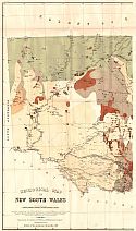
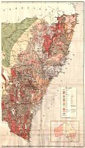
Main Author:   Department of Mines and Agriculture, New South Wales
Title/Description:   Geological Map of New South Wales
Publication Info:   Maitland: Department of Mines and Agricultures
Date:   1893
Scale:   1:101,760
Original Source:   Geological Survey of Alabama
West
East
Viewing options:
Viewing options:
JPEG or Plugin
JPEG or Plugin


  Main Author:   Geological Survey of Queensland
  Title/Description:   Sketch Plan of a Portion of the Mareeba Goldfield
  Publication Info:   Brisbane: Geological Survey of Queensland, 1894
  Date:   1894
  Scale:   1:2,400
  Original Source:   Geological Survey of Alabama
Viewing options:


  Main Author:   Geological Survey of Queensland
  Title/Description:   Geological Map to Accompany Report on the Ulam Gold Field
  Publication Info:   Brisbane: Geological Survey of Queensland, 1894
  Date:   1894
  Scale:   1:6,336
  Original Source:   Geological Survey of Alabama
Viewing options:


  Main Author:   Geological Survey of Queensland
  Title/Description:   Geological Map of the Eidsvold Goldfield
  Publication Info:   Brisbane: Geological Survey of Queensland, 1895
  Date:   1895
  Scale:   1:3,168
  Original Source:   Geological Survey of Alabama
Viewing options:


Previous Page
Next Page


© University of Alabama
To purchase map reproductions, submit a quote request.
Download MrSID Plugin