Geology 1906-1915

Before 1850
1850-1875
1876-1890
1891-1900
After 1900
Geology 1875-1895
Geology 1896-1905
Geology 1906-1915
Geology After 1915

Previous Page
Next Page

  Main Author:   Geological Survey of Western Australia
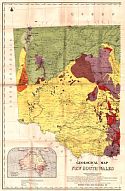
  Title/Description:   Geological Map of the Kimberley District
  Publication Info:   Perth: Geological Survey of Western Australia, 1906
  Date:   1906
  Scale:   1:760,320
  Original Source:   Geological Survey of Alabama
Viewing options:


  Main Author:   Geological Survey of Western Australia
  Title/Description:   Geological Sketch Map of Dandarga
  Publication Info:   Perth: Geological Survey of Western Australia, 1906
  Date:   1906
  Scale:   1:63,360
  Original Source:   Geological Survey of Alabama
Viewing options:


  Main Author:   Geological Survey of Western Australia
  Title/Description:   Geological Sketch Map of the Greenough River District
  Publication Info:   Perth: Geological Survey of Western Australia, 1906
  Date:   1906
  Scale:   1:63,360
  Original Source:   Geological Survey of Alabama
Viewing options:


  Main Author:   Geological Survey of Western Australia
  Title/Description:   Geological Sketch Map of Kintore and Kunanalling
  Publication Info:   Perth: Geological Survey of Western Australia, 1907
  Date:   1907
  Scale:   1:31,680
  Original Source:   Geological Survey of Alabama
Viewing options:


  Main Author:   Geological Survey of Western Australia
  Title/Description:   Geological Sketch Map of Bonnievale
  Publication Info:   Perth: Geological Survey of Western Australia, 1907
  Date:   1907
  Scale:   1:15,840
  Original Source:   Geological Survey of Alabama
Viewing options:


  Main Author:   Geological Survey of Western Australia
  Title/Description:   Sandstone and Nunngarra
  Publication Info:   Perth: Geological Survey of Western Australia, 1907
  Date:   1907
  Scale:   1:23,760
  Original Source:   Geological Survey of Alabama
Viewing options:


  Main Author:   Geological Survey of Western Australia
  Title/Description:   Day Dawn
  Publication Info:   Perth: Geological Survey of Western Australia, 1907
  Date:   1907
  Scale:   1:15,840
  Original Source:   Geological Survey of Alabama
Viewing options:


  Main Author:   Geological Survey of Western Australia
  Title/Description:   Geological Sketch Map Showing the Possible Artesian Water Area Between the Minylia and Ashburton Rivers
  Publication Info:   Perth: Geological Survey of Western Australia, 1907
  Date:   1907
  Scale:   1:1,584,000
  Original Source:   Geological Survey of Alabama
Viewing options:


  Main Author:   Geological Survey of Western Australia
  Title/Description:   Geological Sketch Map Showing the Possible Artesian Water Area to the North of Northampton
  Publication Info:   Perth: Geological Survey of Western Australia, 1907
  Date:   1907
  Scale:   1:1,584,000
  Original Source:   Geological Survey of Alabama
Viewing options:


  Main Author:   Geological Survey of Western Australia
  Title/Description:   Geological Sketch Map, the Geology of Princess Royal Harbour
  Publication Info:   Perth: Geological Survey of Western Australia, 1907
  Date:   1907
  Scale:   1:63,360
  Original Source:   Geological Survey of Alabama
Viewing options:


  Main Author:   Geological Survey of Western Australia
  Title/Description:   Cue
  Publication Info:   Perth: Geological Survey of Western Australia, 1907
  Date:   1907
  Scale:   1:15,840
  Original Source:   Geological Survey of Alabama
Viewing options:


  Main Author:   Geological Survey of Western Australia
  Title/Description:   Cudding Warra
  Publication Info:   Perth: Geological Survey of Western Australia, 1907
  Date:   1907
  Scale:   1:15,840
  Original Source:   Geological Survey of Alabama
Viewing options:


  Main Author:   Geological Survey of Western Australia
  Title/Description:   Geological Sketch Map of Sir Samuel
  Publication Info:   Perth: Geological Survey of Western Australia, 1907
  Date:   1907
  Scale:   1:15,840
  Original Source:   Geological Survey of Alabama
Viewing options:


  Main Author:   Geological Survey of Western Australia
  Title/Description:   Geological Sketch Map of Lawlers
  Publication Info:   Perth: Geological Survey of Western Australia, 1907
  Date:   1907
  Scale:   1:15,840
  Original Source:   Geological Survey of Alabama
Viewing options:


  Main Author:   Greenfield, W.H.
  Title/Description:   Queensland, Showing Principal Mining Centres and Railways
  Publication Info:   Brisbane: Geological Survey Office, 1908
  Date:   1908
  Scale:   1:6,019,200
  Original Source:   Geological Survey of Alabama
Viewing options:


  Main Author:   Greenfield, W.H.
  Title/Description:   Sketch Map of the Etheridge Goldfield
  Publication Info:   Brisbane: Geological Survey of Queensland, 1908
  Date:   1908
  Scale:   1:253,440
  Original Source:   Geological Survey of Alabama
Viewing options:


  Main Author:   Geological Survey of Western Australia
  Title/Description:   Barrambie
  Publication Info:   Perth: Geological Survey of Western Australia, 1908
  Date:   1908
  Scale:   1:15,840
  Original Source:   Geological Survey of Alabama
Viewing options:


  Main Author:   New South Wales Department of Mines and Agriculture, Geological Survey
  Title/Description:   Geological Map of the Drake Gold Field
  Publication Info:   Sydney: New South Wales Department of Mines and Agriculture, Geological Survey, 1908
  Date:   1908
  Scale:   1:23,760
  Original Source:   Geological Survey of Alabama
Viewing options:


  Main Author:   Geological Survey of Victoria
  Title/Description:   Sketch Map of the Alluvial and Deep Leads Systems, Stawell, Ararat, Raglan, Landsborough, etc.
  Publication Info:   Melbourne: Geological Survey of Victoria, 1909
  Date:   1909
  Scale:   1:125,000
  Original Source:   Geological Survey of Alabama
Viewing options:


  Main Author:   Geological Survey of Victoria
  Title/Description:   Sketch Map of the Alluvial and Deep Leads Systems, Beaufort, Avoca, Maryborough, Ballarat West, Berry-Moolort-London, Creswick, Marong etc.
  Publication Info:   Melbourne: Geological Survey of Victoria, 1909
  Date:   1909
  Scale:   1:125,000
  Original Source:   Geological Survey of Alabama
Viewing options:


  Main Author:   Geological Survey of Victoria
  Title/Description:   Sketch Map of the Alluvial and Deep Leads Systems, Bendigo-Huntly, Campaspe, Malmsbury, Kyneton, Trentham, etc.
  Publication Info:   Melbourne: Geological Survey of Victoria, 1909
  Date:   1909
  Scale:   1:125,000
  Original Source:   Geological Survey of Alabama
Viewing options:


  Main Author:   Geological Survey of Victoria
  Title/Description:   Sketch Map of the Alluvial and Deep Leads Systems, Rutherglen, Chiltern, Barambogie, El Dorado, Everton, etc.
  Publication Info:   Melbourne: Geological Survey of Victoria, 1909
  Date:   1909
  Scale:   1:125,000
  Original Source:   Geological Survey of Alabama
Viewing options:


  Main Author:   Geological Survey of Victoria
  Title/Description:   Sketch Map of the Alluvial and Deep Leads Systems, Pitfield, Rokewood, Mt. Mercer, Ballark, Meredith, etc.
  Publication Info:   Melbourne: Geological Survey of Victoria, 1909
  Date:   1909
  Scale:   1:125,000
  Original Source:   Geological Survey of Alabama
Viewing options:


  Main Author:   Geological Survey of Victoria
  Title/Description:   Sketch Map of the Alluvial and Deep Leads Systems, Dargo and Bogong
  Publication Info:   Melbourne: Geological Survey of Victoria, 1909
  Date:   1909
  Scale:   1:125,000
  Original Source:   Geological Survey of Alabama
Viewing options:


  Main Author:   Geological Survey of Western Australia
  Title/Description:   Ravensthorpe
  Publication Info:   Perth: Geological Survey of Western Australia, 1909
  Date:   1909
  Scale:   1:15,840
  Original Source:   Geological Survey of Alabama
Viewing options:


  Main Author:   Geological Survey of Western Australia
  Title/Description:   Desmond and Kundip
  Publication Info:   Perth: Geological Survey of Western Australia, 1909
  Date:   1909
  Scale:   1:15,840
  Original Source:   Geological Survey of Alabama
Viewing options:


  Main Author:   Geological Survey of Western Australia
  Title/Description:   Geological Sketch Map of the Country Along Route of Transcontinental Railway
  Publication Info:   Perth: Geological Survey of Western Australia, 1909
  Date:   1909
  Scale:   1:1,267,200
  Original Source:   Geological Survey of Alabama
Viewing options:


  Main Author:   Geological Survey of Western Australia
  Title/Description:   Geological Sketch Map of the Country Between Carnamah and Moora to the Coast
  Publication Info:   Perth: Geological Survey of Western Australia, 1909
  Date:   1909
  Scale:   1:190,000
  Original Source:   Geological Survey of Alabama
Viewing options:


  Main Author:   Geological Survey of Western Australia
  Title/Description:   Geological Map of the Country Between Arrino and Northampton (North Sheet)
  Publication Info:   Perth: Geological Survey of Western Australia, 1909
  Date:   1909
  Scale:   1:190,000
  Original Source:   Geological Survey of Alabama
Viewing options:


  Main Author:   Geological Survey of Western Australia
  Title/Description:   Geological Map of the Country Between Arrino and Northampton (South Sheet)
  Publication Info:   Perth: Geological Survey of Western Australia, 1909
  Date:   1909
  Scale:   1:190,000
  Original Source:   Geological Survey of Alabama
Viewing options:


  Main Author:   Geological Survey of Western Australia
  Title/Description:   Geological Map of Weerianna
  Publication Info:   Perth: Geological Survey of Western Australia, 1909
  Date:   1909
  Scale:   1:15,840
  Original Source:   Geological Survey of Alabama
Viewing options:


  Main Author:   Geological Survey of Western Australia
  Title/Description:   Geological Sketch Map of the Portion of the Eastern Division from Wiluna to Halls Creek (Sheet 1)
  Publication Info:   Perth: Geological Survey of Western Australia, 1910
  Date:   1910
  Scale:   1:950,400
  Original Source:   Geological Survey of Alabama
Viewing options:


  Main Author:   Geological Survey of Western Australia
  Title/Description:   Geological Sketch Map of the Portion of the Eastern Division from Wiluna to Halls Creek (Sheet 2)
  Publication Info:   Perth: Geological Survey of Western Australia, 1910
  Date:   1910
  Scale:   1:950,400
  Original Source:   Geological Survey of Alabama
Viewing options:


  Main Author:   Geological Survey of Western Australia
  Title/Description:   Geological Sketch Map of the Country Between Halls Creek and South Australian Border
  Publication Info:   Perth: Geological Survey of Western Australia, 1910
  Date:   1910
  Scale:   1:633,600
  Original Source:   Geological Survey of Alabama
Viewing options:


  Main Author:   Geological Survey of Western Australia
  Title/Description:   Geological Sketch Map of the West Pilbara Goldfield
  Publication Info:   Perth: Geological Survey of Western Australia, 1910
  Date:   1910
  Scale:   1:380,160
  Original Source:   Geological Survey of Alabama
Viewing options:


  Main Author:   Geological Survey of Western Australia
  Title/Description:   Geological Sketch Map of Kalgoorlie
  Publication Info:   Perth: Geological Survey of Western Australia, 1910
  Date:   1910
  Scale:   1:23,760
  Original Source:   Geological Survey of Alabama
Viewing options:


  Main Author:   Department of Mines, New South Wales
  Title/Description:   Geological Map of the Fordes-Parkes Gold Field
  Publication Info:   Sydney: Department of Mines, New South Wales, 1910
  Date:   1910
  Scale:   1:63,360
  Original Source:   Geological Survey of Alabama
Viewing options:


  Main Author:   Department of Mines, New South Wales
  Title/Description:   Geological Map of the Vegetable Creek (Emmaville) Tin Mining District (North Sheet)
  Publication Info:   Sydney: Department of Mines, New South Wales, 1910
  Date:   1910
  Scale:   1:63,360
  Original Source:   Geological Survey of Alabama
Viewing options:


  Main Author:   Department of Mines, New South Wales
  Title/Description:   Geological Map of the Vegetable Creek (Emmaville) Tin Mining District (South Sheet)
  Publication Info:   Sydney: Department of Mines, New South Wales, 1910
  Date:   1910
  Scale:   1:63,360
  Original Source:   Geological Survey of Alabama
Viewing options:


  Main Author:   Department of Mines, New South Wales
  Title/Description:   Geological Map of the Tin-Bearing District Surrounding Tingha, Stannifer, and Elsmore (North Sheet)
  Publication Info:   Sydney: Department of Mines, New South Wales, 1910
  Date:   1910
  Scale:   1:31,680
  Original Source:   Geological Survey of Alabama
Viewing options:


  Main Author:   Department of Mines, New South Wales
  Title/Description:   Geological Map of the Tin-Bearing District Surrounding Tingha, Stannifer, and Elsmore (South Sheet)
  Publication Info:   Sydney: Department of Mines, New South Wales, 1910
  Date:   1910
  Scale:   1:31,680
  Original Source:   Geological Survey of Alabama
Viewing options:


  Main Author:   Geological Survey Office, Department of Mines
  Title/Description:   Sketch Map of Goldfields in the Vicinity of Charters Towers
  Publication Info:   Brisbane: Geological Survey Office, Department of Mines, 1911
  Date:   1911
  Scale:   1:250,000
  Original Source:   Geological Survey of Alabama
Viewing options:


  Main Author:   Geological Survey of Western Australia
  Title/Description:   Geological Sketch Map of a Portion of Yilgarn Gold Field
  Publication Info:   Perth: Geological Survey of Western Australia, 1911
  Date:   1911
  Scale:   1:250,000
  Original Source:   Geological Survey of Alabama
Viewing options:


  Main Author:   Geological Survey of Western Australia
  Title/Description:   Geological Sketch Map of the Country in the Neighborhood of Lake Barlee (North Sheet)
  Publication Info:   Perth: Geological Survey of Western Australia, 1911
  Date:   1911
  Scale:   1:250,000
  Original Source:   Geological Survey of Alabama
Viewing options:


  Main Author:   Geological Survey of Western Australia
  Title/Description:   Geological Sketch Map of the Country in the Neighborhood of Lake Barlee (South Sheet)
  Publication Info:   Perth: Geological Survey of Western Australia, 1911
  Date:   1911
  Scale:   1:250,000
  Original Source:   Geological Survey of Alabama
Viewing options:


  Main Author:   Geological Survey of Western Australia
  Title/Description:   Geological Map of the Southern Cross District
  Publication Info:   Perth: Geological Survey of Western Australia, 1911
  Date:   1911
  Scale:   1:31,680
  Original Source:   Geological Survey of Alabama
Viewing options:


  Main Author:   Department of Mines, New South Wales
  Title/Description:   Geological Map of the Country in the Vicinity of Elouera
  Publication Info:   Sydney: Department of Mines, New South Wales, 1911
  Date:   1911
  Scale:   1:15,840
  Original Source:   Geological Survey of Alabama
Viewing options:


  Main Author:   Department of Mines, New South Wales
  Title/Description:   Geological Map of the Cobar Mining Field
  Publication Info:   Sydney: Department of Mines, New South Wales, 1911
  Date:   1911
  Scale:   1:31,680
  Original Source:   Geological Survey of Alabama
Viewing options:


  Main Author:   Department of Mines, New South Wales
  Title/Description:   Geological Map of the Country Between Cobar and the Peak
  Publication Info:   Sydney: Department of Mines, New South Wales, 1911
  Date:   1911
  Scale:   1:11,880
  Original Source:   Geological Survey of Alabama
Viewing options:


  Main Author:   Department of Mines, New South Wales
  Title/Description:   Geological Map of the Wilson's Downfall and Maryland Tin Field
  Publication Info:   Sydney: Department of Mines, New South Wales, 1911
  Date:   1911
  Scale:   1:63,360
  Original Source:   Geological Survey of Alabama
Viewing options:


  Main Author:   Geological Survey of Western Australia
  Title/Description:   Geological Map of the Country Between Coolgardie and Londonderry
  Publication Info:   Perth: Geological Survey of Western Australia, 1912
  Date:   1912
  Scale:   1:125,000
  Original Source:   Geological Survey of Alabama
Viewing options:


  Main Author:   Geological Survey of Western Australia
  Title/Description:   Geological Map of the Country Between Tindalls and Londonderry
  Publication Info:   Perth: Geological Survey of Western Australia, 1912
  Date:   1912
  Scale:   1:31,680
  Original Source:   Geological Survey of Alabama
Viewing options:


  Main Author:   Geological Survey of Western Australia
  Title/Description:   Geological Sketch Map of the Pilbara Goldfield
  Publication Info:   Perth: Geological Survey of Western Australia, 1912
  Date:   1912
  Scale:   1:1,267,200
  Original Source:   Geological Survey of Alabama
Viewing options:


  Main Author:   Geological Survey of Western Australia
  Title/Description:   Geological Sketch Map of Peak Hill Gold Field and Parts of Ashburton and Gascoyne Gold Fields
  Publication Info:   Perth: Geological Survey of Western Australia, 1912
  Date:   1912
  Scale:   1:950,400
  Original Source:   Geological Survey of Alabama
Viewing options:


  Main Author:   Geological Survey of Western Australia
  Title/Description:   Geological Sketch Map to Accompany Report on the Possibility of Obtaining Artesian Water in the Vicinity of Moora
  Publication Info:   Perth: Geological Survey of Western Australia, 1912
  Date:   1912
  Scale:   1:250,000
  Original Source:   Geological Survey of Alabama
Viewing options:


  Main Author:   Geological Survey of Western Australia
  Title/Description:   Topographical Map of the South West Portion of Western Australia
  Publication Info:   Perth: Geological Survey of Western Australia, 1912
  Date:   1912
  Scale:   1:1,267,200
  Original Source:   Geological Survey of Alabama
Viewing options:


  Main Author:   Geological Survey of Western Australia
  Title/Description:   Topographical Map of Part of the Swan River Valley
  Publication Info:   Perth: Geological Survey of Western Australia, 1912
  Date:   1912
  Scale:   1:79,200
  Original Source:   Geological Survey of Alabama
Viewing options:


  Main Author:   New South Wales Department of Mines and Agriculture, Geological Survey
  Title/Description:   Map of the State of New South Wales Showing Distribution of Tungsten Ores
  Publication Info:   Sydney: New South Wales Department of Mines and Agriculture, Geological Survey, 1912
  Date:   1912
  Scale:   1:9,187,200
  Original Source:   Geological Survey of Alabama
Viewing options:


  Main Author:   New South Wales Department of Mines and Agriculture, Geological Survey
  Title/Description:   Geological Map Showing the Mole Tableland Wolfram Deposits near Torrington
  Publication Info:   Sydney: New South Wales Department of Mines and Agriculture, Geological Survey, 1912
  Date:   1912
  Scale:   1:31,680
  Original Source:   Geological Survey of Alabama
Viewing options:


  Main Author:   Queensland Geological Survey
  Title/Description:   Geological Map of Country in the Neighborhood of Stanthorpe, Bellandean, and Wallangarra
  Publication Info:   Brisbane: Queensland Geological Survey, 1913
  Date:   1913
  Scale:   1:63,360
  Original Source:   Geological Survey of Alabama
Viewing options:


  Main Author:   Queensland Geological Survey
  Title/Description:   Geological Sketch Map of the Stanthorpe (Queensland) - Wilson's Downfall (New South Wales) Petrographical Province
  Publication Info:   Brisbane: Queensland Geological Survey, 1913
  Date:   1913
  Scale:   1:250,000
  Original Source:   Geological Survey of Alabama
Viewing options:


Main Author:   Department of Mines, New South Wales
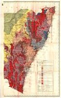
Title/Description:   Geological Map of New South Wales
Publication Info:   Sydney: Department of Mines, NSW, 1914
Date:   1914
Scale:   1:1,013,760
Original Source:   Geological Survey of Alabama
West
East
Viewing options:
Viewing options:
JPEG or Plugin
JPEG or Plugin


  Main Author:   Geological Survey of Western Australia
  Title/Description:   Geological Sketch Map of Part of the Murchison G.F.
  Publication Info:   Perth: Geological Survey of Western Australia, 1914
  Date:   1914
  Scale:   1:250,000
  Original Source:   Geological Survey of Alabama
Viewing options:


  Main Author:   Geological Survey of Western Australia
  Title/Description:   Geological Sketch Map of Poona Mining Centre
  Publication Info:   Perth: Geological Survey of Western Australia, 1914
  Date:   1914
  Scale:   1:15,840
  Original Source:   Geological Survey of Alabama
Viewing options:


  Main Author:   Geological Survey of Western Australia
  Title/Description:   Geological Sketch Map of the Coodardy Gold and Tin Leases
  Publication Info:   Perth: Geological Survey of Western Australia, 1914
  Date:   1914
  Scale:   1:15,840
  Original Source:   Geological Survey of Alabama
Viewing options:


  Main Author:   Geological Survey of Western Australia
  Title/Description:   Geological Map of Ora Banda, Broad Arrow G.F.
  Publication Info:   Perth: Geological Survey of Western Australia, 1914
  Date:   1914
  Scale:   1:11,880
  Original Source:   Geological Survey of Alabama
Viewing options:


  Main Author:   Geological Survey of Western Australia
  Title/Description:   Geological Sketch Map of Mulline, North Coolgardie G.F.
  Publication Info:   Perth: Geological Survey of Western Australia, 1914
  Date:   1914
  Scale:   1:31,680
  Original Source:   Geological Survey of Alabama
Viewing options:


  Main Author:   Geological Survey of Western Australia
  Title/Description:   Geological Sketch Map of the Country Between Kalgoorlie and Mulline
  Publication Info:   Perth: Geological Survey of Western Australia, 1914
  Date:   1914
  Scale:   1:250,000
  Original Source:   Geological Survey of Alabama
Viewing options:


  Main Author:   Geological Survey of Western Australia
  Title/Description:   General Geological Map of Yilgarn G.F.
  Publication Info:   Perth: Geological Survey of Western Australia, 1914
  Date:   1914
  Scale:   1:250,000
  Original Source:   Geological Survey of Alabama
Viewing options:


  Main Author:   Geological Survey of Western Australia
  Title/Description:   Geological Map of Marvel Loch Centre, Yilgarn G.F.
  Publication Info:   Perth: Geological Survey of Western Australia, 1914
  Date:   1914
  Scale:   1:31,680
  Original Source:   Geological Survey of Alabama
Viewing options:


  Main Author:   Geological Survey of Western Australia
  Title/Description:   Geological Map of Great Victoria and Parker's Range, Yilgarn G.F.
  Publication Info:   Perth: Geological Survey of Western Australia, 1914
  Date:   1914
  Scale:   1:31,680
  Original Source:   Geological Survey of Alabama
Viewing options:


  Main Author:   Geological Survey of Western Australia
  Title/Description:   Geological Map of Olga, Dulcie, and Cheriton's Centre, Yilgarn G.F.
  Publication Info:   Perth: Geological Survey of Western Australia, 1914
  Date:   1914
  Scale:   1:31,680
  Original Source:   Geological Survey of Alabama
Viewing options:


  Main Author:   Geological Survey of Western Australia
  Title/Description:   [Yilgarn Gold Field]
  Publication Info:   Perth: Geological Survey of Western Australia, 1914
  Date:   1914
  Scale:   1:633,600
  Original Source:   Geological Survey of Alabama
Viewing options:


  Main Author:   Geological Survey of Western Australia
  Title/Description:   Geological Map of Lennonville, Mount Magnet, and Boogardie, Murchison G.F.
  Publication Info:   Perth: Geological Survey of Western Australia, 1914
  Date:   1914
  Scale:   1:47,520
  Original Source:   Geological Survey of Alabama
Viewing options:


  Main Author:   Geological Survey of Western Australia
  Title/Description:   Map of Western Australia Showing the Goldfields and other Mining Districts
  Publication Info:   Perth: Geological Survey of Western Australia, 1915
  Date:   1915
  Scale:   1:4,742,000
  Original Source:   Geological Survey of Alabama
Viewing options:


  Main Author:   Geological Survey of Western Australia
  Title/Description:   Geological Sketch Map of the Extreme South Western Portion of Western Australia (North Sheet)
  Publication Info:   Perth: Geological Survey of Western Australia, 1915
  Date:   1915
  Scale:   1:250,000
  Original Source:   Geological Survey of Alabama
Viewing options:


  Main Author:   Geological Survey of Western Australia
  Title/Description:   Geological Sketch Map of the Extreme South Western Portion of Western Australia (South Sheet)
  Publication Info:   Perth: Geological Survey of Western Australia, 1915
  Date:   1915
  Scale:   1:250,000
  Original Source:   Geological Survey of Alabama
Viewing options:


Previous Page
Next Page


© University of Alabama
To purchase map reproductions, submit a quote request.
Download MrSID Plugin