Viewing Options
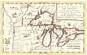
Main Author:
Coronelli, Vicenzo Maria
Title/Description:
La Louisiana, Parte Settentrionalle, Scoperta sotto la Protettione di Luigi...
Publication Info:
Venice: 1693
Viewing Options
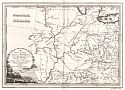
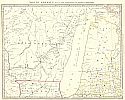
Title/Description:
Gli Stati Uniti Dell' America; Terzo Foglio che comprede Parte Della Virginia e Della Carolina
Publication Info:
Rome: Reffo la Calcografia Comerale, 1797
Viewing Options
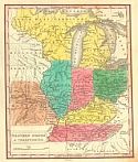
Main Author:
Young, James H.
Title/Description:
Western States & Territories
Publication Info:
Philadelphia: S.A. Mitchell, 1830
Viewing Options
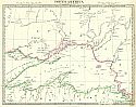
Main Author:
Society for the Diffusion of Useful Knowledge
Title/Description:
North America Sheet IV Lake Superior
Publication Info:
London: Chapman & Hall, 1832
Viewing Options
Main Author:
Society for the Diffusion of Useful Knowledge
Title/Description:
North America Sheet V The Northwest and Michigan Territories
Publication Info:
London: Baldwin & Cradock, 1833
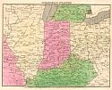
Viewing Options
Main Author:
Huntington, Eleazer
Title/Description:
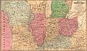
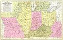
Western States
Publication Info:
Hartford: Eleazer Huntington, 1836; from Jesse Olney's A Practical System of Geography

Viewing Options
Main Author:
Huntington, F.J.
Title/Description:
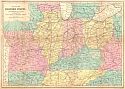
The Western States
Publication Info:
Hartford: F.J. Huntington, 1836
Viewing Options
Main Author:
Olney, Jesse
Title/Description:
Western States
Publication Info:
New York: Robinson, Pratt and Co., 1837; from New and Improved School Atlas

Viewing Options
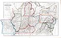
Main Author:
Burr, David H.
Title/Description:
Map Illustrating the Plan of the Defenses (sic) of the Western Frontier
Publication Info:
Washington: 1838; part of the report by Edmund P. Gaines
Viewing Options
Main Author:
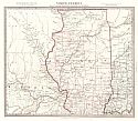
Mitchell, Samuel Augustus
Title/Description:
No. 9 Map of the Chief Part of the Western States and Part of Virginia
Publication Info:
Philadelphia: S.A. Mitchell, 1839; Engraved to Illustrate Mitchell's School and Family Geography
Viewing Options
Main Author:
Woodbridge, William C.
Title/Description:
Political Map of the Northern Division of the United States
Publication Info:
Hartford: Belknap and Hamersley, 1843; from School Atlas, to accompany the Modern School Geography
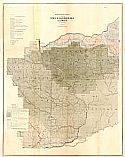
Viewing Options
Main Author:
Owen, David Dale
Title/Description:
Plate No. 21. Magnetical Chart Exhibiting the Observations Made by J. Locke During the Survey of the Mines of the United States
Publication Info:
Washington: US Department of Interior, Bureau of Mines, c.1844
Viewing Options
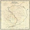
Main Author:
Owen, David Dale
Title/Description:
Plate No. 3, Geological Section from the Mouth of Rock River through the Blue Mounds to the Wisconsin River
Publication Info:
Baltimore: E. Weber & Co., 1844; in connection with a Geological chart of part of Iowa, Wisconsin and Illinois N.W. of the Section Line
Viewing Options
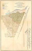
Main Author:
Owen, David Dale
Title/Description:
Plate No. 2, Geological Chart of Part of Iowa, Wisconsin, and Illinois
Publication Info:
Baltimore: E. Weber & Co., 1844
Viewing Options
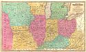
Title/Description:
Map of the Western States
Publication Info:
Hartford: John Paine, 1844; from Smith's Atlas designed to accompany the Geography for Schools
Viewing Options
Main Author:
Society for the Diffusion of Useful Knowledge
Title/Description:
North America Sheet V Parts of Wisconsin and Michigan
Publication Info:
London: Charles Knight & Co., 1846

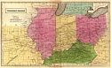
Viewing Options
Main Author:
Society for the Diffusion of Useful Knowledge
Title/Description:
North America Sheet VIII Ohio, with Parts of Kentucky and Virginia
Publication Info:
London: Charles Knight & Co., 1846
Viewing Options
Main Author:
Society for the Diffusion of Useful Knowledge
Title/Description:
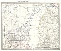
North America Sheet IX Parts of Missouri, Illinois and Indiana
Publication Info:
London: Charles Knight & Co., 1846
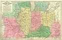
Viewing Options
Main Author:
Stiles, Sherman, & Smith
Title/Description:
Map of the Western States
Publication Info:
Hartford: Daniel Burgess, 1847; Designed to Accompany Smith's Geography for Schools
Viewing Options
Main Author:
Mitchell, Samuel Augustus
Title/Description:
No. 14 Map of the Chief Part of the Western States and Part of Virginia
Publication Info:
Philadelphia: S.A. Mitchell, 1848; Engraved to Illustrate Mitchell's School and Family Geography
Viewing Options
Main Author:
Williams, Wellington
Title/Description:
Map of the Western States
Publication Info:
Philadelphia: Appleton, 1849; Engraved to Accompany Appleton's Hand Book of American Travel

