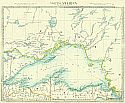
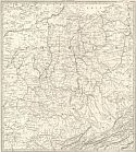
Viewing Options
Main Author:
Society for the Diffusion of Useful Knowledge
Title/Description:
North America Sheet IV Lake Superior
Publication Info:
London: Edward Stanford, c.1850
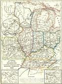
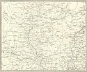
Viewing Options
Main Author:
Meyer, Joseph
Title/Description:
Die Staten von Missouri, Illinois, Indiana, Ohio, Kentucky & Tennessee
Publication Info:
Hildburghausen: Bibliographschen Instituts zu Hildburghausen, 1850; from Meyer's Zeitungs Atlas
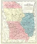
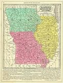
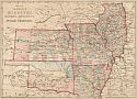
Viewing Options
Main Author:
Smith, Roswell C.
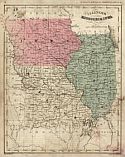
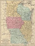
Title/Description:
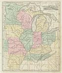
Map No. 8 United States (Iowa, Missouri and Illinois)
Publication Info:
New York: Cady and Burgess, 1850 from A Concise and Practical System of Geography for Common Schools, Academies and Families
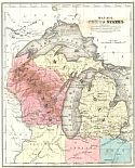
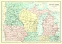
Viewing Options
Main Author:
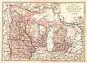
Smith, Roswell C.
Title/Description:
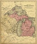
Map No. 9 United States (Wisconsin and Michigan)
Publication Info:
New York: Cady and Burgess, 1850 from A Concise and Practical System of Geography for Common Schools, Academies and Families
Viewing Options
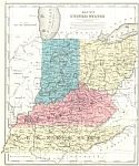
Main Author:
Smith, Roswell C.
Title/Description:
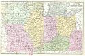
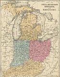
Map No. 7 United Statse (Indiana, Ohio, Kentucky and Tennessee)
Publication Info:
New York: Cady and Burgess, 1850 from A Concise and Practical System of Geography for Common Schools, Academies and Families
Viewing Options
Main Author:
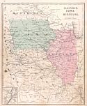
Mitchell, Samuel Augustus
Title/Description:
Illinois, Missouri, and Iowa
Publication Info:
Philadelphia: S.A. Mitchell, 1851
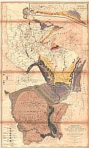
Viewing Options
Main Author:
U.S. Geological Corp
Title/Description:
Geological Map of Wisconsin, Iowa and Minnesota
Publication Info:
Washington: U.S. Department of the Treasury, 1851
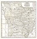
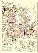
Viewing Options
Main Author:
Morse, Sidney E.
Title/Description:
Iowa, Illinois and Missouri
Publication Info:
New York: Harper and Brothers 1851; from Morse's School Geography
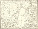
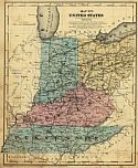
Viewing Options
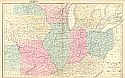
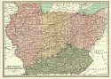
Main Author:
Society for the Diffusion of Useful Knowledge
Title/Description:
Ohio, with parts of Kentucky, Virginia and Indiana
Publication Info:
London: Charles Knight, 1852; from the General Atlas
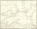
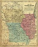
Viewing Options
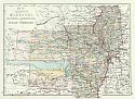
Main Author:
Society for the Diffusion of Useful Knowledge
Title/Description:
Parts of Missouri, Illinois, Iowa and Indiana
Publication Info:
London: Charles Knight, 1852; from the General Atlas
Viewing Options
Main Author:
Society for the Diffusion of Useful Knowledge
Title/Description:
Lake Superior
Publication Info:
London: Charles Knight, 1852; from the General Atlas
Viewing Options
Main Author:
Society for the Diffusion of Useful Knowledge
Title/Description:
Parts of Wisconsin and Michigan
Publication Info:
London: Charles Knight, 1852; from the General Atlas
Viewing Options
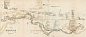
Main Author:
Owen, David Dale
Title/Description:
Sections on the Missouri River from No.1M to No.19M (Mississippi River to Kansas City)
Publication Info:
Philadelphia: Lippencott, Grambo and Company, 1852; from Report of a Geological Survey of Wisconsin, Iowa, and Minnesota
Viewing Options
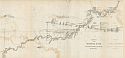
Main Author:
Owen, David Dale
Title/Description:
Sections on the Missouri River from No.20M to No. 40M (Kansas City to Sioux City)
Publication Info:
Philadelphia: Lippencott, Grambo and Company, 1852; from Report of a Geological Survey of Wisconsin, Iowa, and Minnesota
Viewing Options
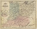
Main Author:
Smith, Roswell C.
Title/Description:
Map No. 7, United States (Ohio, Indiana, Kentucky and Tennessee)
Publication Info:
New York: Daniel Burgess and Co., 1855; from A concise and practical system of Geography for Schools, Academies and Families
Viewing Options
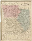
Main Author:
Smith, Roswell C.
Title/Description:
Map No. 8 United States (Illinois, Iowa, and Missouri)
Publication Info:
New York: Daniel Burgess and Co., 1855; from A concise and practical system of Geography for Schools, Academies and Families
Viewing Options
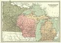
Main Author:
Smith, Roswell C.
Title/Description:
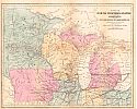
Map No. 9 United States (Michigan and Wisconsin)
Publication Info:
New York: Daniel Burgess and Co., 1855; from A concise and practical system of Geography for Schools, Academies and Families
Viewing Options
Main Author:
Cornell, Sarah Sophia
Title/Description:
Western States
Publication Info:
New York: D. Appleton and Company, c.1855; from Cornell's Intermediate Geography
Viewing Options
Main Author:
Mitchell, S. Augustus
Title/Description:
Map of the Chief Part of the Western States including Western Virgnia
Publication Info:
Philadelphia: Cowperthwait, Desilver and Butler, 1855
Viewing Options
Main Author:
Richards, T. Addison
Title/Description:
Map of the North-Western States including Minnesota and the Copper Region of Lake Superior
Publication Info:
New York: D. Appleton and Company, 1857; from Appleton's Illustrated Hand Book of American Travel
Viewing Options
Main Author:
Richards, T. Addison
Title/Description:
Map of the Western States
Publication Info:
New York: D. Appleton and Company, 1857; from Appleton's Illustrated Hand Book of American Travel
Viewing Options
Main Author:
Mitchell, S. Augustus, Jr.
Title/Description:
Illinois, Missouri, Iowa, Nebraska and Kansas
Publication Info:
Philadelphia: S. Augustus Mitchell, Jr., 1861; from Mitchell's New General Atlas
Viewing Options
Main Author:
Cornell, Sarah Sophia
Title/Description:
Western Division of the United States
Publication Info:
New York: Appleton and Co., 1864

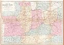
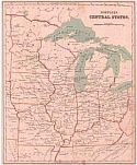
Viewing Options
Main Author:
Lloyd, H.H. and Company
Title/Description:
Map of the Central States
Publication Info:
New York: Warner & Beers, 1865; from H.H. Lloyd & Co.'s Atlas of the United States
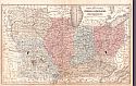
Viewing Options
Main Author:
McNally, Francis
Title/Description:
Ohio, Indiana, Kentucky, Tennessee
Publication Info:
New York: A.S. Barnes and Burr, 1865; from An Improved System of Geography
Viewing Options
Main Author:
McNally, Francis
Title/Description:
Illinois, Missouri and Iowa
Publication Info:
New York: A.S. Barnes and Burr, 1865; from An Improved System of Geography
Viewing Options
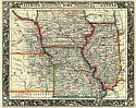
Main Author:
Colton, J.H.
Title/Description:
Illinois, Iowa and Missouri
Publication Info:
New York: Ivison, Phinney, Blakeman and Company, 1865; from American School Quarto Georgraphy
Viewing Options
Main Author:
Wells, Edward
Title/Description:
Western Division of the United States
Publication Info:
New York: D. Appleton & Co., 1866; designed to accompany Cornell's High School Geography
Viewing Options
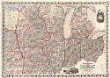
Main Author:
Colton, George W.
Title/Description:
Colton's New Railroad Map of the States of Ohio, Michigan, Indiana, Illinois, Missouri, Wisconsin, & Iowa, Minnesota, Nebraska, & Kansas
Publication Info:
New York: G.W. and C.B. Colton, 1866
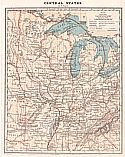
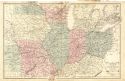
Viewing Options
Title/Description:
Central States
Publication Info:
New York: Charles Scribner & Co., 1868; from Guyot's Common-School Geography
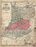
Viewing Options
Main Author:
S. Augustus Mitchell
Title/Description:
Ohio, Kentucky, Indiana, Illinois, Iowa and Missouri
Publication Info:
Philadelphia: E.H. Butler and Company, 1870; from Mitchell's New School Atlas
Viewing Options
Main Author:
Hall, Mary L.
Title/Description:
North Central States
Publication Info:
Boston: Ginn Brothers, 1872; from Our World No. 2 or Second Series of Lessons in Geography
Viewing Options
Main Author:
Jones, Charles H.
Title/Description:
Map of Michigan, Wisconsin, Minnesota and Iowa
Publication Info:
New York: J. David Williams, 1873; The Peoples Pictorial Atlas
Viewing Options
Main Author:
Bartholomew, John
Title/Description:
Ohio, Indiana, Illinois and Kentucky
Publication Info:
Philidelphia: T. Ellwood Zell, 1873; from A Discriptive Hand Atlas of the World
Viewing Options
Main Author:
Bartholomew, John
Title/Description:
Michigan, Wisconsin and Minnesota
Publication Info:
Philidelphia: T. Ellwood Zell, 1873; from A Discriptive Hand Atlas of the World
Viewing Options
Main Author:
McNally, Francis
Title/Description:
Ohio, Indiana, and Kentucky
Publication Info:
Chicago: A.S. Barnes and Company, 1873; from An Improved System of Geography
Viewing Options
Main Author:
McNally, Francis
Title/Description:
Illinois, Missouri and Iowa
Publication Info:
Chicago: A.S. Barnes and Company, 1873; from An Improved System of Geography
Viewing Options
Main Author:
Neuman, Louis E.
Title/Description:
Map of Illinois, Missouri, Kansas, Arkansas, and Indian Territory
Publication Info:
Jacksonville, IL: H.C. Tunison, 1875
Viewing Options
Main Author:
Bartholomew, John
Title/Description:
Western States. Michigan, Wisconsin, Minnesota, Iowa, with portions of Illinois & Indiana
Publication Info:
Edinburgh: A. & C. Black, c1875
Viewing Options
Main Author:
Hardesty, H.H.
Title/Description:
Special Map - Ohio, Indiana, Illinois, Wisconsin, and Michigan
Publication Info:
Chicago: H.H. Hardesty & Co., 1875
Viewing Options
Main Author:
Jones, Charles H. and Theodore F. Hamilton
Title/Description:
Map of Illinois, Missouri, Kansas, Arkansas and Indian Territory
Publication Info:
Chicago: H.H. Hardesty, 1875; from Historical Atlas of the World Illustrated
Viewing Options
Main Author:
Mitchell, S. Augustus
Title/Description:
Map of Ohio, Michigan, Indiana and Kentucky
Publication Info:
Philadelphia: J.H. Butler and Company, 1875; from A System of Modern Geography
Viewing Options
Main Author:
Mitchell, S. Augustus
Title/Description:
Illinois, Wisconsin, Iowa, Missouri and Minnesota
Publication Info:
Philadelphia: J.H. Butler and Company, 1875; from A System of Modern Geography
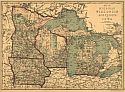
Viewing Options
Main Author:
Hardesty, H.H.
Title/Description:
Map of Michigan, Wisconsin, Minnesota and Iowa
Publication Info:
Chicago: H.H. Hardesty and Company, 1875; from Historical Atlas of the World Illustrated

