Viewing options:
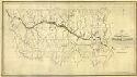
Main Author:
Lewis, Samuel
Title/Description:
Mississippi Territory / Engraved by D. Fairman, drawn by S. Lewis
Publication Info:
S.1. : s.n., 1804
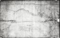
Viewing Options:
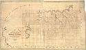
Main Author:
Hutchings, John and Charles Bright
Title/Description:
(Untitled Map of the Tennessee Valley)
Publication Info:
photocopy of a map date March 15, 1816
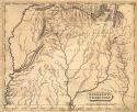
Viewing Options:
Main Author:
Peel & Sannoner (Philadelphia)
Title/Description:
Map of the late surveys in the Northern District of the Alabama Territory / drawn from the returns of the surveyors by Peel & Sannoner
Publication Info:
Philadelphia: Tanner, Vallance, Kearny & Co. Sc.
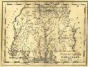
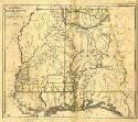
Viewing Options:
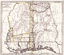
Main Author:
Shallus, Francis
Title/Description:
The State of Mississippi and Alabama Territory
Publication Info:
[Philadelphia: M. Cary and Son, 1817]
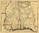
Viewing Options
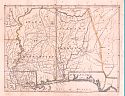
Main Author:
Darby, William
Title/Description:
[State of Mississippi & Alabama Territory]
Publication Info:
New York: J.D. Stout, c,1817
Viewing Options
Main Author:
Gradiner, John
Title/Description:
Map of the late surveys in the Southern District of the Alabama Territory
Publication Info:
Philadelphia: Tanner, Vallance, Kearny & Co.
Viewing Options
Main Author:
Melish, John
Title/Description:
Map of Alabama constructed from the surveys in the General Land Office and other documents
Publication Info:
Philadelphia: John Melish, 1818
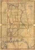
Viewing Options
Main Author:
Shallus, Francis
Title/Description:
The State of Mississippi and Alabama Territory