|
|
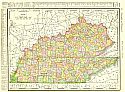
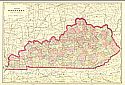
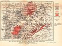
1901-1915 |
| Previous Page |
 |
|
||||||||||||||||||||||||
|
 |
|
||||||||||||||||||||||||
|
 |
|
||||||||||||||||||||||||
|
 |
|
||||||||||||||||||||||||
|
 |
|
||||||||||||||||||||||||
|
 |
|
||||||||||||||||||||||||
|
 |
|
||||||||||||||||||||||||
|
 |
|
||||||||||||||||||||||||
|
 |
|
||||||||||||||||||||||||
|
 |
|
||||||||||||||||||||||||
|
 |
|
||||||||||||||||||||||||
|
 |
|
||||||||||||||||||||||||
|
 |
|
||||||||||||||||||||||||
|
 |
|
||||||||||||||||||||||||
|
 |
|
||||||||||||||||||||||||
|
 |
|
||||||||||||||||||||||||
|
 |
|
||||||||||||||||||||||||
|
 |
|
||||||||||||||||||||||||
|
 |
|
||||||||||||||||||||||||
|
 |
|
||||||||||||||||||||||||
|
 |
|
||||||||||||||||||||||||
|
 |
|
||||||||||||||||||||||||
|
 |
|
||||||||||||||||||||||||
|
 |
|
||||||||||||||||||||||||
|
 |
|
||||||||||||||||||||||||
|
 |
|
||||||||||||||||||||||||
|
 |
|
||||||||||||||||||||||||
|
 |
|
||||||||||||||||||||||||
|
 |
|
|||||||||||||||||||||
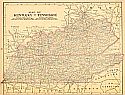
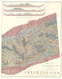
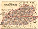
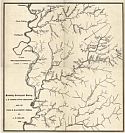
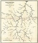
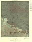
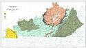
Sheet 3 |
||||||||||||||||||||||
| Viewing options: |
||||||||||||||||||||||
 |
 |
|||||||||||||||||||||
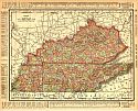
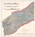
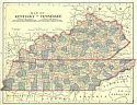
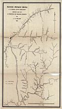
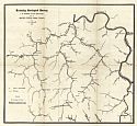
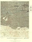
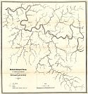
Sheet 2 |
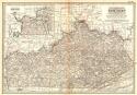
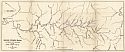
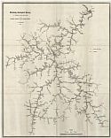
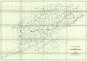
Sheet 4 |
|||||||||||||||||||||
| Viewing options: |
Viewing options: |
|||||||||||||||||||||
 |
||||||||||||||||||||||
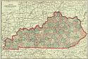
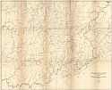
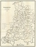
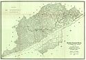
Sheet 1 |
||||||||||||||||||||||
| Viewing options: |
||||||||||||||||||||||
 |
|
||||||||||||||||||||||||
|
 |
|
||||||||||||||||||||||||
|
 |
|
||||||||||||||||||||||||
|
 |
|
||||||||||||||||||||||||
|
 |
|
||||||||||||||||||||||||
|
 |
|
||||||||||||||||||||||||
|
 |
|
||||||||||||||||||||||||
|
 |
|
||||||||||||||||||||||||
|
 |
|
||||||||||||||||||||||||
|
 |
|
||||||||||||||||||||||||
|
 |
|
||||||||||||||||||||||||
|
 |
|
||||||||||||||||||||||||
|
 |
|
||||||||||||||||||||||||
|
 |
|
||||||||||||||||||||||||
|
 |
|
||||||||||||||||||||||||
|
 |
|
||||||||||||||||||||||||
|
 |
|
||||||||||||||||||||||||
|
 |
|
||||||||||||||||||||||||
|
 |
|
||||||||||||||||||||||||
|
 |
|
||||||||||||||||||||||||
|
| Previous Page |