Historical Maps of Other Southeastern States

1891 - 1900
Before 1875
1875-1890
1891-1900
1901-1915
After 1915

Previous Page
Next Page

  Main Author:   Hoeing, J.B.
  Title/Description:   Preliminary Map of Kentucky
  Publication Info:   Frankfort: Kentucky Geological Survey, 1891
  Date:   1891
  Scale:   1:1,267,200
  Original Source:   Geological Survey of Alabama
Viewing options:


  Main Author:   Fisk and Company
  Title/Description:   Kentucky and Tennessee
  Publication Info:   New York: Hunt and Eaton, c. 1892
  Date:   1892
  Scale:   1:2,218,000
  Original Source:   Courtesy of Murray Hudson, Halls, Tennessee
Viewing options:


  Main Author:   Cram, George F.
  Title/Description:   Kentucky and Tennessee
  Publication Info:   Chicago: George F. Cram, 1893
  Date:   1893
  Scale:   1:1,584,000
  Original Source:   Courtesy of Murray Hudson, Halls, Tennessee
Viewing options:


  Main Author:   Gaskall, A.
  Title/Description:   Kentucky - Tennessee
  Publication Info:   Chicago: John F. Waite, 1893
  Date:   1893
  Scale:   1:2,534,000
  Original Source:   Courtesy of Murray Hudson, Halls, Tennessee
Viewing options:


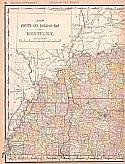
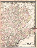
Main Author:   Rand McNally and Company
Title/Description:   New County and Railroad Map of Kentucky and Tennessee
Publication Info:   Chicago: Rand McNally and Company, 1893; from The Universal Atlas of the World
Date:   1893
Scale:   1:1,503,800
Original Source:   University of Alabama Map Library
West
East
Viewing options:
Viewing options:
JPEG or Plugin
JPEG or Plugin


  Main Author:   Mast, Crowell and Kirkpatrick
  Title/Description:   Map of Kentucky and Tennessee
  Publication Info:   New York: Mast, Crowell and Kirkpatrick, 1893; from The Popular Atlas
  Date:   1893
  Scale:   1:2,344,000
  Original Source:   Courtesy of Murray Hudson, Halls, Tennessee
Viewing options:


  Main Author:   Rand McNally and Company
  Title/Description:   Kentucky and Tennessee
  Publication Info:  

Chicago: Rand McNally and Company, 1893; from The Enlarged Business Atlas and Shippers Guide

  Date:   1893
  Scale:   1:1,203,840
  Original Source:   Courtesy of Murray Hudson, Halls, Tennessee
Viewing options:


  Main Author:   Rand McNally and Company
  Title/Description:   Kentucky and Tennessee
  Publication Info:   Chicago: Rand McNally and Co., c. 1895; from The Atlas of the World
  Date:   1895
  Scale:   1:2,534,000
  Original Source:   Courtesy of Murray Hudson, Halls, Tennessee
Viewing options:


  Main Author:   Rand McNally and Company
  Title/Description:   Kentucky
  Publication Info:   Chicago: The Encyclopedia Britannica Company, c. 1895
  Date:   1895
  Scale:   1:2,344,000
  Original Source:   Courtesy of Murray Hudson, Halls, Tennessee
Viewing options:


  Main Author:   Walker, H.B.
  Title/Description:   Kentucky and Tennessee, Western Half
  Publication Info:   Chicago: H.B. Walker, 1895; from The International Atlas
  Date:   1895
  Scale:   1:1,077,120
  Original Source:   Courtesy of Murray Hudson, Halls, Tennessee
Viewing options:


  Main Author:   Walker, H.B.
  Title/Description:   Kentucky and Tennessee, Eastern Half
  Publication Info:   Chicago: H.B. Walker, 1895; from The International Atlas
  Date:   1895
  Scale:   1:1,077,120
  Original Source:   Courtesy of Murray Hudson, Halls, Tennessee
Viewing options:


  Main Author:   Walker, H.B.
  Title/Description:   Kentucky and Tennessee
  Publication Info:   Chicago: H.B. Walker, 1895; from The International Atlas
  Date:   1895
  Scale:   1:1,393,920
  Original Source:   Courtesy of Murray Hudson, Halls, Tennessee
Viewing options:


  Main Author:   Rand McNally and Company.
  Title/Description:   Kentucky and Tennessee
  Publication Info:   Chicago: Rand McNally and Company, 1895
  Date:   1895
  Scale:   1:1,172,160
  Original Source:   Courtesy of Murray Hudson, Halls, Tennessee
Viewing options:


  Main Author:   The Century Company
  Title/Description:   Kentucky
  Publication Info:   Buffalo: The Matthews-Northup Company, c. 1897; from The Century Atlas
  Date:   1897
  Scale:   1:1,426,000
  Original Source:   Courtesy of Murray Hudson, Halls, Tennessee
Viewing options:


  Main Author:   Cram, George F.
  Title/Description:   Kentucky & Tennessee
  Publication Info:   Chicago: George F. Cram, 1898; from The Universal Atlas, Geographical, Astronomical and Historical
  Date:   1898
  Scale:   1:1,665,000
  Original Source:   Courtesy of Adams Antiques, Northport, Alabama
Viewing options:


  Main Author:   Mast, Crowell and Kirkpatrick
  Title/Description:   Map of Kentucky and Tennessee
  Publication Info:   Springfield, OH: Mast, Crowell and Kirkpatrick, 1898
  Date:   1898
  Scale:   1:2,408,000
  Original Source:   Courtesy of Murray Hudson, Halls, Tennessee
Viewing options:


  Main Author:   Funk and Wagnalls Company
  Title/Description:   Kentucky and Tennessee
  Publication Info:   New York: Funk and Wagnalls Company, 1898; from A Standard Atlas of the World
  Date:   1898
  Scale:   1:3,168,000
  Original Source:   University of Alabama Map Library
Viewing options:


  Main Author:   Cram, George F.
  Title/Description:   [Kentucky and Tennessee]
  Publication Info:   Chicago: George F. Cram, 1899; from 1899 Standard American Railway Atlas
  Date:   1899
  Scale:   1:1,200,000
  Original Source:   University of Alabama Map Library
Viewing options:


  Main Author:   Smith, Benjamin E.
  Title/Description:   Kentucky
  Publication Info:   New York: The Century Company, 1899; from The Century Atlas of the World
  Date:   1899
  Scale:   1:1,425,600
  Original Source:   University of Alabama Map Library
Viewing options:


  Main Author:   Cram, George F.
  Title/Description:   Kentucky and Tennessee
  Publication Info:   Chicago: George F. Cram, 1900
  Date:   1900
  Scale:   1:1,584,000
  Original Source:   Courtesy of Murray Hudson, Halls, Tennessee
Viewing options:
 

Previous Page
Next Page