Viewing Options
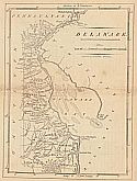
Main Author:
Doolittle, Amos
Title/Description:
Delaware
Publication Info:
Philadelphia: Mathew Carey, 1814; from Carey's American Pocket Atlas
Viewing Options
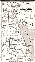
Title/Description:
Delaware
Publication Info:
New York: Phelps, Fanning and Company, 1853; from Fanning's Illustrated Gazetteer of the United States
Viewing Options
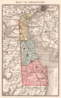
Main Author:
Rand McNally and Company
Title/Description:
Delaware
Publication Info:
Chicago: Rand McNally and Company, 1884; from The New Household Atlas of the World
Viewing Options
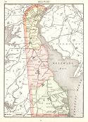
Main Author:
Rand McNally and Company
Title/Description:
Delaware
Publication Info:
Chicago: Rand McNally and Company, 1894; from Rand McNally and Company's Encyclopedia and Gazetteer
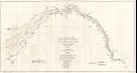
Viewing Options
Main Author:
U.S. Army Corps of Engineers
Title/Description:
The Delaware River from Philadelphia to Delaware Bay showing the proposed location for a channel 600 feet wide and 30 feet deep
Publication Info:
Washington: U.S. Senate 55th Congress, 2nd Session, Doc. No. 219
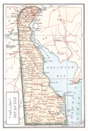
Viewing Options
Main Author:
The Bradstreet Company
Title/Description:
Delaware
Publication Info:
New York: The Bradstreet Company, 1899; from Bradstreet's Pocket Atlas of the United States
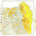
Viewing Options
Main Author:
U.S. Department of Agriculture
Title/Description:
Soil Map of Dover Delaware and Vicinity
Publication Info:
Washington, D.C.: U.S. Department of Agriculture, 1903
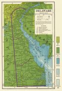
Viewing Options
Main Author:
C.S. Hammond and Company
Title/Description:
Delaware
Publication Info:
New York: C.S. Hammond and Company, c. 1930; from The New World Loose Leaf Atlas, Sixth Edition

