Use the menu to the right to browse our collection of out-of-print editions of U.S.G.S. Quadrangles. Please keep in mind that map coverage varies and may not be complete for all counties.
Out-of-Print Quadrangles
Main Author
Alabama Highway Dept.
Alabama Highway Dept.
Alabama Highway Dept.
Alabama Highway Dept.
Alabama Highway Dept.
Alabama Highway Dept.
Alabama Highway Dept.
Location
Tallapoosa County
Tallapoosa County
Tallapoosa County
Tallapoosa County
Tallapoosa County
Tallapoosa County
Tallapoosa County
Publication Information
Montgomery: ASHD
Montgomery: ASHD
Montgomery: ASHD
Montgomery: ASHD
Montgomery: ASHD
Montgomery: ASHD
Montgomery: ASHD
Date
2011
1994
1984
1973
1948
1938
1937
Scale
1:125,000
1:125,000
1:125,000
1:125,000
1:125,000
1:125,000
1:125,000
Viewing Options
Main Author:
LaTourrette, John
Title/Description:
An Accurate Map of the State of Alabama and West Florida [Sheet 9: Benton, Coosa, Randolph, St. Clair, Talladega, Tallapoosa]
Publication Info:
New York: Colton & Co., 1837
Viewing Options
Main Author:
LaTourrette, John
Title/Description:
An Accurate Map of the State of Alabama and West Florida [Sheet 11: Chambers, Macon, Randolph, Russell, Tallapossa]
Publication Info:
New York: Colton & Co., 1837
Viewing Options
Main Author:
LaTourrette, John
Title/Description:
An Accurate Map of the State of Alabama and West Florida [ Sheet 15: Macon, Montgomery, Pike, Tallapossa]
Publication Info:
New York: Colton & Co., 1837
Viewing Options
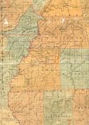
Main Author:
Shepard, J. Jos
Title/Description:
Map of Tallapoosa County, Alabama
Publication Info:
Chicago: Rand McNally & Co., 1885
Viewing Options
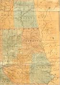
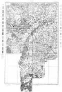
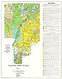
Main Author:
U.S. Department of Agriculture
Title/Description:
Tallapoosa County soil survey map
Publication Info:
Washington: U.S. Department of Agriculture
Viewing Options
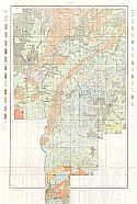
Main Author:
U.S. Department of Agriculture
Title/Description:
Tallapoosa County soil survey map
Publication Info:
Washington: U.S. Department of Agriculture, 1909
Viewing Options
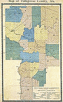
Main Author:
Bethel W. Whitson and Co.
Title/Description:
Whitson's Map of Tallapoosa County, Alabama
Publication Info:
Birmingham: Bethel W. Whitson and Co., [c1930]
Viewing Options
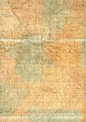
Main Author:
Hall, James R.
Title/Description:
Map of Tallapoosa County, Alabama
Publication Info:
Dadeville, Alabama: James R. Hall, 1931
Original Source:
U of A Office of Land Management
Viewing Options
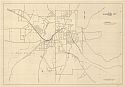
Main Author:
Alexander City Planning Commission and the Alabama State Planning Board
Title/Description:
Map of Alexander City, Alabama
Publication Info:
S.N., 1947
Viewing Options
Main Author:
Brackeen, L.G.
Title/Description:
Tallapoosa County Soil Map
Publication Info:
Alabama Department of Agriculture, 1954
Viewing Options
Main Author:
Alabama Power Company
Title/Description:
General Area of Proposed Horseshoe Bend National Military Park, Tallapoosa County, Alabama
Publication Info:
Birmingham: Alabama Power Company, 1956
Viewing Options
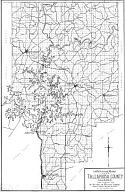
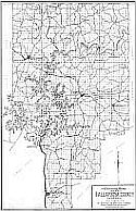
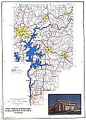
Main Author:
Barnes, W.S.
Title/Description:
General Highway and Transportation Map: Tallapoosa County, Alabama
Publication Info:
Modified Tallapoosa County General Highway Map produced by the Alabama Department of Transportation
Northwest
Northeast

Southwest
Southeast
Main Author:
State of Alabama Highway Department
Title/Description:
Alexander City (4 maps)
Publication Info:
Montgomery: State of Alabama Highway Department, 1975
Viewing Options
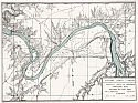
Main Author:
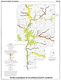
Chandler, Robert V. and G.C. Lines
Title/Description:
Water Availability of Tallapoosa County, Alabama
Publication Info:
Tuscaloosa: Geological Survey of Alabama, 1976; Map 142
Viewing Options
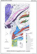
Main Author:
Beg, Mirza A.
Title/Description:
Mineral Resources of Tallapoosa County, Alabama
Publication Info:
Geological Survey of Alabama, Special Map 204

