Use the menu to the right to browse our collection of out-of-print editions of U.S.G.S. Quadrangles. Please keep in mind that map coverage varies and may not be complete for all counties.
Out-of-Print Quadrangles
Main Author
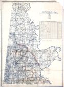
Alabama Highway Dept.
Alabama Highway Dept.
Alabama Highway Dept.
Alabama Highway Dept.
Alabama Highway Dept.
Alabama Highway Dept.
Alabama Highway Dept.
Alabama Highway Dept.
Location
Sumter County
Sumter County
Sumter County
Sumter County
Sumter County
Sumter County
Sumter County
Sumter County
Publication Information
Montgomery: ASHD
Montgomery: ASHD
Montgomery: ASHD
Montgomery: ASHD
Montgomery: ASHD
Montgomery: ASHD
Montgomery: ASHD
Montgomery: ASHD
Date
2008
1999
1991
1982
1971
1950
1938
1937
Scale
1:125,000
1:125,000
1:125,000
1:125,000
1:125,000
1:125,000
1:125,000
1:125,000
Viewing Options
Main Author:
LaTourrette, John
Title/Description:
An Accurate Map of the State of Alabama and West Florida [Sheet 8: Fayette, Greene, Perry, Pickens, Sumter, Tuscaloosa]
Publication Info:
New York: Colton & Co., 1837
Viewing Options
Main Author:
LaTourrette, John
Title/Description:
An Accurate Map of the State of Alabama and West Florida [Sheet 17: Clarke, Greene, Marengo, Sumter, Washington]
Publication Info:
New York: Colton & Co., 1837
Viewing Options
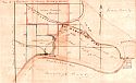
Main Author:
May, Patrick B.
Title/Description:
A Private way from McDowell's Landing to Demopolis & Livingston Road
Publication Info:
Hand drawn map, 1846
Viewing Options
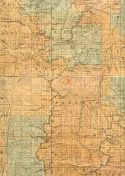
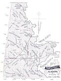
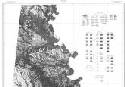
Title/Description:
Map of Sumter County, Alabama Showing the Geological Formations
Publication Info:
New York: Julius Bien, [1881]
Viewing Options
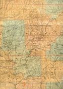
Main Author:
Patton, W.W.
Title/Description:
Map of Sumter County, Alabama
Publication Info:
St. Louis: George D. Barnard, [c1890]
Viewing Options
Viewing Options
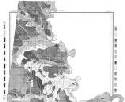
Main Author:
U.S. Department of Agriculture
Title/Description:
Sumter County soil survey map
Publication Info:
Washington: U.S. Department of Agriculture
Viewing Options
Main Author:
U.S. Department of Agriculture
Title/Description:
Sumter County soil survey map
Publication Info:
Washington: U.S. Department of Agriculture
Viewing Options
Main Author:
Alabama State Commission of Forestry
Title/Description:
Sumter County, Alabama
Publication Info:
[Montgomery: 1932]
Viewing Options
Viewing Options
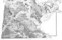
Main Author:
U.S. Department of Agriculture
Title/Description:
Sumter County soil survey map
Publication Info:
Washington: U.S. Department of Agriculture
Viewing Options
Main Author:
U.S. Department of Agriculture
Title/Description:
Sumter County Soil Survey Map
Publication Info:
Washington, D.C.: U.S. Department of Agriculture, 1935
Viewing Options
Main Author:
McLemore, J.T.
Title/Description:
Map of Gainseville, Alabama
Publication Info:
Copied by McLemore from an original map in the possession of Barnes Rogers
Viewing Options
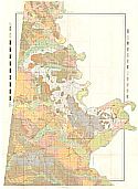
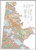
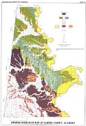
Main Author:
Szabo, M.W., and Herbert S. Chaffin, Jr.
Title/Description:
Mineral Resources Map of Sumter County, Alabama
Publication Info:
Geological Survey of Alabama, Special Map 175
Viewing Options
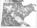
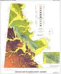
Main Author:
Sanford, Thomas H., Jr. and Jesse S. Ellard
Title/Description:
Geologic Map of Sumter County, Alabama
Publication Info:
Geological Survey of Alabama, Special Map 158, Plate 1
Viewing Options
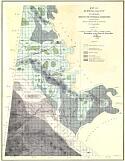
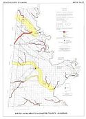
Main Author:
Davis, Marvin E.
Title/Description:
Water Availability in Sumter County, Alabama
Publication Info:
Tuscaloosa: Geological Survey of Alabama, 1978; Map 158 Plate 3
Viewing Options
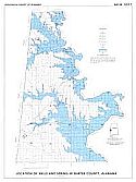
Main Author:
Davis, Marvin E.
Title/Description:
Location of Wells and Spring in Sumter County, Alabama
Publication Info:
Tuscaloosa: Geological Survey of Alabama, 1978; Map 158 Plate 2

