Use the menu to the right to browse our collection of out-of-print editions of U.S.G.S. Quadrangles. Please keep in mind that map coverage varies and may not be complete for all counties.
Out-of-Print Quadrangles
Main Author
Alabama Highway Dept.
Alabama Highway Dept.
Alabama Highway Dept.
Alabama Highway Dept.
Alabama Highway Dept.
Alabama Highway Dept.
Alabama Highway Dept.
Alabama Highway Dept.
Alabama Highway Dept.
Alabama Highway Dept.
Location
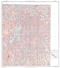
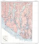
Limestone County
Limestone County
Limestone County
Limestone County
Limestone County
Limestone County
Limestone County
Limestone County
Limestone County
Limestone County
Publication Information
Montgomery: ASHD
Montgomery: ASHD
Montgomery: ASHD
Montgomery: ASHD
Montgomery: ASHD
Montgomery: ASHD
Montgomery: ASHD
Montgomery: ASHD
Montgomery: ASHD
Montgomery: ASHD
Date
2010
2002
1993
1985
1974
1965
1957
1948
1938
1937
Scale
1:125,000
1:125,000
1:125,000
1:125,000
1:125,000
1:125,000
1:125,000
1:125,000
1:125,000
1:125,000
Viewing Options
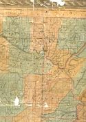
Main Author:
LaTourrette, John
Title/Description:
An Accurate Map of the State of Alabama and West Florida [Sheet 3: Blount, Jackson, Limestone, Madison, Marshall, Morgan]
Publication Info:
New York: Colton & Co., 1837
Viewing Options
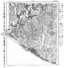
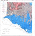
Main Author:
U.S. Department of Agriculture
Title/Description:
Limestone County soil survey map
Publication Info:
Washington: U.S. Department of Agriculture
Viewing Options
Main Author:
U.S. Department of Agriculture
Title/Description:
Limestone County soil survey map
Publication Info:
Washington: U.S. Department of Agriculture, 1914
Viewing Options
Viewing Options
Viewing Options
Viewing Options
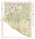
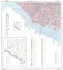
Main Author:
U.S. Department of Agriculture
Title/Description:
Soil Map of Limestone County, Alabama
Publication Info:
Washington, D.C.: U.S. Department of Agriculture, 1941
Viewing Options
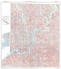
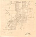
Main Author:
Alabama State Planning Commission
Title/Description:
City of Athens, Alabama
Publication Info:
Montgomery: Alabama State Planning Commission, 1942
Viewing Options
Main Author:
Brackeen, L.G.
Title/Description:
Soil Map Limestone County, Alabama
Publication Info:
Alabama Department of Agriculture, 1955
Viewing Options
Main Author:
Daniel, T. W., Jr. and Earl L. Hastings
Title/Description:
Geologic Map of Limestone County, Alabama
Publication Info:
Geological Survey of Alabama, Special Map 13
Viewing Options
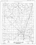
Main Author:
McMaster, William M.
Title/Description:
Map of Athens Area, Alabama Showing Location of Wells and Springs
Publication Info:
Tuscaloosa: Geological Survey of Alabama, 1960; from Information Series 23, Plate 1
Viewing Options
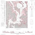
Main Author:
McMaster, William M.
Title/Description:
Geology of the Elkmont Quadrangle, Alabama-Tennessee
Publication Info:
Washington D.C.: Department of the Interior U.S. Geological Survey, 1965
Viewing Options
Main Author:
McMaster, William M.
Title/Description:
Geology of the Salem Quadrangle, Alabama-Tennessee
Publication Info:
Washington D.C.: Department of the Interior, U.S. Geological Survey, 1965
Viewing Options
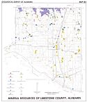
Main Author:
Daniel, T. W., Jr.
Title/Description:
Mineral Resources Map of Limestone County, Alabama
Publication Info:
Geological Survey of Alabama, Special Map 154
Viewing Options
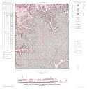
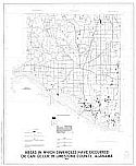
Main Author:
U.S. Department of the Interior, U.S. Geological Survey
Title/Description:
Areas in which sinkholes have occurred or can occur in Limestone County, Alabama
Publication Info:
United States Department of the Interior, U.S. Geological Survey, 1977
Viewing Options
Main Author:
U.S. Department of Agriculture, Soil Conservation Service
Title/Description:
Soil Interpretive Map of Important Farmlands for Limestone County, Alabama
Publication Info:
U.S.D.A., Soil Conservation Service, c1979
Viewing Options
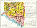
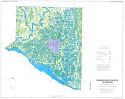
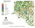
Main Author:
Top of Alabama Regional Council of Governments
Title/Description:
Existing Land Use, Limestone County, Alabama
Viewing Options
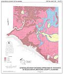
Main Author:
Hunter, Jonathon A.
Title/Description:
Generalized Map Showing Approximate Thickness of Residuum in Limestone County, Alabama
Publication Info:
Tuscaloosa: Geological Survey of Alabama, 1991; Special Map 226 Plate 2

