Historical Maps of the World

1826 - 1850
Before 1700
1700-1750
1751-1800
1801-1825
1826-1850
pg1   pg2
1851-1875
pg1   pg2
1876-1900
After 1900

Previous Page
Next Page

 
  Main Author:   Bradford, T. G. and S. G. Goodrich
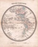
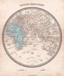
Title/Description:   Western Hemisphere [and] Eastern Hemisphere
Publication Info:   Boston: S. G. Goodrich, 1841; from A Universal Illustrated Atlas, exhibiting a Geographical, Statistical and Historical View of the World, issued 1846
Date:   1841
Scale:    
Original Source:   Courtesy of Antique Atlas
Viewing options:
 
Viewing options:


  Main Author:   Society for the Diffusion of Useful Knowledge
  Title/Description:   The World on Mercator's Projection
  Publication Info:   London: Chapman and Hall, 1841
  Date:   1841
  Scale:   1:61,000,000
  Original Source:   Courtesy of Murray Hudson, Halls, Tennessee
Viewing options:


  Main Author:   Delamarche, Felix
  Title/Description:   Carte de la Géographie Primitive des Grecs d'après Homère et Hésiode et des Systeèmes Géographiques d'Eratosthènes d'Hippourque, de Strabon et de Ptolemée
  Publication Info:   Paris: Felix Delamarche, 1841; from Atlas de la Geographie Ancienne, d Moyen-Age, et Moderne
  Date:   1841
  Scale:   various
  Original Source:   Courtesy of Adams Antiques, Northport, AL
Viewing options:


  Main Author:   Delamarche, Felix
  Title/Description:   Carte du Monde Connu des Anciens au Temps de Ptolemée
  Publication Info:   Paris: Felix Delamarche, 1841; from Atlas de la Geographie Ancienne, d Moyen-Age, et Moderne
  Date:   1841
  Scale:   1:38,650,000
  Original Source:   Courtesy of Adams Antiques, Northport, AL
Viewing options:


  Main Author:   Delamarche, Felix
  Title/Description:   Géographie des Hebreux ou Tableau de la Dispersion des Enfants de Noé
  Publication Info:   Paris: Felix Delamarche, 1841; from Atlas de la Geographie Ancienne, d Moyen-Age, et Moderne
  Date:   1841
  Scale:   1:17,741,000
  Original Source:   Courtesy of Adams Antiques, Northport, AL
Viewing options:


  Main Author:   Delamarche, Felix
  Title/Description:   Carte de L'État du Monde vers La Fin Du Xuème Siècle, LeTracé des Principales Expéditions Maritimes des Scandinaves des Portugais et des Espagnols, jusquevers le Milieu du 16eme Siècle
  Publication Info:   Paris: Felix Delamarche, 1841; from Atlas de la Geographie Ancienne, d Moyen-Age, et Moderne
  Date:   1841
  Scale:   1:83,160,000
  Original Source:   Courtesy of Adams Antiques, Northport, AL
Viewing options:


  Main Author:   Smith, Philip
  Title/Description:   The World as known to the Ancients
  Publication Info:   London: Chapman and Hall, 1842
  Date:   1842
  Scale:   1:17,337,000
  Original Source:   Courtesy of Murray Hudson, Halls, Tennessee
Viewing options:


  Main Author:   Chambers, William & Robert Chambers
  Title/Description:   The World
  Publication Info:   Edinburgh: W. & R. Chambers, c.1842
  Date:   1842
  Scale:   1:92,000,000
  Original Source:   Courtesy of Murray Hudson, Halls, Tennessee
Viewing options:


  Main Author:    
  Title/Description:   Mappemonde
  Publication Info:   Namur: 1842
  Date:   1842
  Scale:   1:217,000,000
  Original Source:   Courtesy of Murray Hudson, Halls, Tennessee
Viewing options:


  Main Author:   L.C. et F.P.B.
  Title/Description:   Mappe Monde
  Publication Info:   Paris: Poussielgue-Rusand, 1842; from Abrégé de Géographie Commerciale et Historique
  Date:   1842
  Scale:   n/a
  Original Source:   Adam's Antiques, Northport, Alabama
Viewing options:


  Main Author:   Perthes, Justus
  Title/Description:   Orbis Veteribus Notus
  Publication Info:   Gotha: Justus Perthes, 1842; from Orbis Terrarum Antiquus
  Date:   1842
  Scale:   1:55,340,000
  Original Source:   University of Alabama Map Library
Viewing options:


  Main Author:   Marzolla, B.
  Title/Description:   Descrizione del Globo in due Emisferi
  Publication Info:   Naples: 1843
  Date:   1843
  Scale:    
  Original Source:   Courtesy of Antique Atlas
Viewing options:


  Main Author:   Woodbridge, William Channing
  Title/Description:   Physical Map of America & Africa and the Atlantic Ocean
  Publication Info:   Hartford: Beklnap & Hamersley, 1843
  Date:   1843
  Scale:   1:44,000,000
  Original Source:   Courtesy of Murray Hudson, Halls, Tennessee
Viewing options:


  Main Author:   Hughes, William
  Title/Description:   The World as known to the Ancients
  Publication Info:   London: Chapman and Hall, 1843
  Date:   1843
  Scale:   1:29,357,000
  Original Source:   Courtesy of Murray Hudson, Halls, Tennessee
Viewing options:


  Main Author:   Woodbridge, William Channing
  Title/Description:   Political Map of South America and Africa
  Publication Info:   Hartford: Belknap & Hamersley, 1843; adapted to Woodbridge's Geography
  Date:   1843
  Scale:   1:44,000,000
  Original Source:   Courtesy of Murray Hudson, Halls, Tennessee
Viewing options:


  Main Author:   Woodbridge, William C.
  Title/Description:   Isothermal Chart or View of the Climates
  Publication Info:   Boston: William C. Woodbridge, 1843; Showing also the Situation of the Principal Plants and Animals of the World
  Date:   1843
  Scale:   1:106,000,000
  Original Source:   Courtesy of Murray Hudson, Halls, Tennessee
Viewing options:


Main Author:   Wyld, James
Titles/Descriptions:   Eastern Hemisphere
Publication Info:   London: James Wyld, 1843; from An Atlas of Modern Geography
Date:   1843
Scale:   1:126,500,000
Original Source:   University of Alabama Map Library
Modern
Ancient
Viewing options:
Viewing options:
JPEG or Plugin
JPEG or Plugin


  Main Author:   Woodbridge, William C.
  Title/Description:   The World
  Publication Info:   Hartford: Belknap and Hamersley, 1843; from School Atlas, to accompany the Modern School Geography
  Date:   1843
  Scale:   120,000,000
  Original Source:   University of Alabama Map Library
Viewing options:


  Main Author:   Woodbridge, William C.
  Title/Description:   Moral and Political Chart of the Inhabited World
  Publication Info:   Hartford: Belknap and Hamersley, 1843; from School Atlas, to accompany the Modern School Geography
  Date:   1843
  Scale:   110,000,000
  Original Source:   University of Alabama Map Library
Viewing options:


  Main Author:   Olney, Jesse
  Title/Description:   Map of the World on a Globular Projection
  Publication Info:   New York: Robinson, Pratt & Co., 1844; to illustrate Olney's School Geography
  Date:   1844
  Scale:   1:93,000,000
  Original Source:   Courtesy of Murray Hudson, Halls, Tennessee
Viewing options:


  Main Author:   Society for the Diffusion of Useful Knowledge
  Title/Description:   Western Hemisphere - Eastern Hemisphere
  Publication Info:   London: Chapman and Hall, 1844
  Date:   1844
  Scale:   1:64,000,000
  Original Source:   Courtesy of Murray Hudson, Halls, Tennessee
Viewing options:
 
Viewing options:
 
JPEG or Plugin


  Main Author:   Olney, Jesse
  Title/Description:   Map of the World on a Globular Projection
  Publication Info:   New York: Robinson, Pratt, and Co., 1844; to illustrate Olney's School Geography
  Date:   1844
  Scale:   1:107,000,000
  Original Source:   Courtesy of Murray Hudson, Halls, Tennessee
Viewing options:


  Main Author:   Binet
  Title/Description:   Monde Ancien
  Publication Info:   Paris: Binet, 1844
  Date:   1844
  Scale:   1:76,850,000
  Original Source:   Courtesy of Murray Hudson, Halls, Tennessee
Viewing options:


  Main Author:   Binet
  Title/Description:   Mappe-Monde
  Publication Info:   Paris: Binet, 1844
  Date:   1844
  Scale:    
  Original Source:   Courtesy of Murray Hudson, Halls, Tennessee
Viewing options:


  Main Author:   Binet
  Title/Description:   Planisphère
  Publication Info:   Paris: Binet, 1844
  Date:   1844
  Scale:    
  Original Source:   Courtesy of Murray Hudson, Halls, Tennessee
Viewing options:


  Main Author:   Woodbridge, William Channing
  Title/Description:   Moral and Political Chart of the Inhabited World Exhibiting the Prevailing Religion, form of Government, Degree of Civilization and Population of each Country
  Publication Info:   Boston: William C. Woodbridge, 1845
  Date:   1845
  Scale:   1:98,955,000
  Original Source:   Courtesy of Murray Hudson, Halls, Tennessee
Viewing options:


  Main Author:   Woodbridge, William Channing
  Title/Description:   Map of the World Adapted to Woodbridge's Geography Exhibiting the Eastern & Western Hemispheres, and the Land Hemispheres together with a Comparative View of the Rivers and Lakes of the Two Continents
  Publication Info:   Boston: William C. Woodbridge, 1845
  Date:   1845
  Scale:   1:146,784,000
  Original Source:   Courtesy of Murray Hudson, Halls, Tennessee
Viewing options:


  Main Author:   Williams, W.
  Title/Description:   Map of the World
  Publication Info:   Boston: William C. Woodbridge, 1845; Adapted to Woodbridge's Geography. Exhibiting the Eastern & Western Hemispheres, and the Land Hemisphere together with a Comparative View, of the Rivers and Lakes of the two Continents
  Date:   1845
  Scale:   1:159,000,000
  Original Source:   Courtesy of Murray Hudson, Halls, Tennessee
Viewing options:


  Main Author:   Hughes, W.
  Title/Description:   Map of the Principal Countries of the Ancient World
  Publication Info:   Edinburgh: A. and C. Black, 1845
  Date:   1845
  Scale:   1:7,286,400
  Original Source:   Courtesy of Murray Hudson, Halls, Tennessee
Viewing options:


  Main Author:   Starling, Thomas
  Title/Description:   A Map of the Principal Rivers Showing their Courses, Countries, and Comparative Lengths
  Publication Info:   London: Charles Knight, 1845; from an atlas by the Society for the Diffusion of Useful Knowledge, an 1835 map corrected to June 1st, 1845
  Date:   1845
  Scale:   1:23,040,000
  Original Source:   From the personal collection of Dr. Douglas Sherman
Viewing options:


  Main Author:   Stieler, A.
  Title/Description:   Planiglob der Antipoden
  Publication Info:   Gotha: c.1846; from Stieler Hand Atlas
  Date:   1846
  Scale:    
  Original Source:   Courtesy of Murray Hudson, Halls, Tennessee
Viewing options:


Main Author:   Sohr, K.
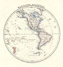
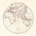
Title/Description:   Westliche Halbkugel and Oestliche Halbkugel
Publication Info:   Glogan und Leipzig: C. Flemming, 1847; from Vollstandiger Hand-Atlas der neueren Erdbeschreibung
Date:   1847
Scale:   N/A
Original Source:   Courtesy of Murray Hudson, Halls, Tennessee
West
East
Viewing options:
Viewing options:
JPEG or Plugin
JPEG or Plugin


  Main Author:   Vuillemin, Alexandre
  Title/Description:   Mappemonde
  Publication Info:   Paris: Combette, [1847]
  Date:   1847
  Scale:   1:54,500,000
  Original Source:   Courtesy of Adams Antiques, Northport, Alabama
Viewing options:


  Main Author:   Levasseur, Victor
  Title/Description:   Planisphere
  Publication Info:   Paris [c. 1847]; from Atlas Illustré
  Date:   1847
  Scale:    
  Original Source:   Courtesy of Antique Atlas
Viewing options:


  Main Author:   Mitchell, Samuel Augustus
  Title/Description:   A New Map of the World on the Globular Projection
  Publication Info:   Philadelphia: S.A. Mitchell, 1847
  Date:   1847
  Scale:   1:123,350,000
  Original Source:   Courtesy of Murray Hudson, Halls, Tennessee
Viewing options:


  Main Author:   Hall, Sidney
  Title/Description:   The World
  Publication Info:   Edinburg: Adam and Charles Black, 1847; from Black's General Atlas
  Date:   1847
  Scale:   1: 114,000,000
  Original Source:   Courtesy of Murray Hudson, Halls, Tennessee
Viewing options:


  Main Author:   Hall, Sidney
  Title/Description:   The World on Mercator's Projection
  Publication Info:   Edinburg: Adam and Charles Black, 1847; from Black's General Atlas
  Date:   1847
  Scale:   1: 105,221,505
  Original Source:   Courtesy of Murray Hudson, Halls, Tennessee
Viewing options:


  Main Author:   Hall, Sidney
  Title/Description:   A Chart of Magnetic Curves of Equal Variation
  Publication Info:   Edinburg: Adam and Charles Black, 1847; from Black's General Atlas
  Date:   1847
  Scale:   1: 88,960,000
  Original Source:   Courtesy of Murray Hudson, Halls, Tennessee
Viewing options:


  Main Author:   Hall, Sidney
  Title/Description:   Chart of Isothermal LInes showing the Mean Annual Temperature of the different parts of the Earth's Surface
  Publication Info:   Edinburg: Adam and Charles Black, 1847; from Black's General Atlas
  Date:   1847
  Scale:   1: 110,000,000
  Original Source:   Courtesy of Murray Hudson, Halls, Tennessee
Viewing options:


  Main Author:   Hall, Sidney
  Title/Description:   Physical Geography
  Publication Info:   Edinburg: Adam and Charles Black, 1847; from Black's General Atlas
  Date:   1847
  Scale:    
  Original Source:   Courtesy of Murray Hudson, Halls, Tennessee
Viewing options:


  Main Author:   Hall, Sidney
  Title/Description:   Physical Geography
  Publication Info:   Edinburg: Adam and Charles Black, 1847; from Black's General Atlas
  Date:   1847
  Scale:    
  Original Source:   Courtesy of Murray Hudson, Halls, Tennessee
Viewing options:


  Main Author:   Mitchell, Samuel Augustus
  Title/Description:   No. 1 The World on an Equatorial Projection - No. 2. The World on a Polar Projection
  Publication Info:   Philadelphia: S.A. Mitchell, 1848
  Date:   1848
  Scale:   1:200,000,000
  Original Source:   Courtesy of Murray Hudson, Halls, Tennessee
Viewing options:


  Main Author:   unknown
  Title/Description:   The World on Mercators Projection
  Publication Info:   London and Glasgow: 1848
  Date:   1848
  Scale:   1:132,000,000
  Original Source:   Courtesy of Murray Hudson, Halls, Tennessee
Viewing options:


  Main Author:   Meyer, Joseph
  Title/Description:   Die Oestliche und Westliche Halbkugel der Erde
  Publication Info:   Hildburghausen: 1849; from Neuster Zetungs Atlas Hildburghausen
  Date:   1849
  Scale:    
  Original Source:   Courtesy of Antique Atlas
Viewing options:


  Main Author:   Frijlink, Hendrik
  Title/Description:   Nederlandsche Bezittingen Buiten Europa (Dutch Foreign Possessions)
  Publication Info:   Amsterdam: Hendrik Frijlink, 1849; from Frijlink's Kleine School- Atlas
  Date:   1849
  Scale:  
  Original Source:   University of Alabama Map Library
Viewing options:


  Main Author:   Jenks, William
  Title/Description:   Missionary Map of The World
  Publication Info:   from The Explanatory Bible Atlas and Scripture Gazetteer (Fourth Edition), 1849
  Date:   1849
  Scale:  
  Original Source:   University of Alabama Map Library
Viewing options:


  Main Author:   Jenks, William
  Title/Description:   The World As Known to the Ancients
  Publication Info:   from The Explanatory Bible Atlas and Scripture Gazetteer (Fourth Edition), 1849
  Date:   1849
  Scale:   1:44,350,000
  Original Source:   University of Alabama Map Library
Viewing options:


  Main Author:   Jenks, William
  Title/Description:   [Ruins of Ancient Cities]
  Publication Info:   from The Explanatory Bible Atlas and Scripture Gazetteer (Fourth Edition), 1849
  Date:   1849
  Scale:   1:Various
  Original Source:   University of Alabama Map Library
Viewing options:


  Main Author:   Frijlink, Hendrik
  Title/Description:   Wereld-Kaart
  Publication Info:   Amsterdam: Hendrik Frijlink, 1849; from Frijlink's Kleine School- Atlas
  Date:   1849
  Scale:  
  Original Source:   University of Alabama Map Library
Viewing options:


  Main Author:   Meyer, Joseph
  Title/Description:   Umrisse der Pflanzen Geographie
  Publication Info:   Hildburghausen: 1849; from Neuster Zetungs Atlas Hildburghausen
  Date:   1849
  Scale:    
  Original Source:   Courtesy of Antique Atlas
Viewing options:


  Main Author:   Meyer, Joseph
  Title/Description:   Welt-Charte in Mercators Projection
  Publication Info:   Hildburghausen: 1849; from Neuster Zetungs Atlas Hildburghausen
  Date:   1849
  Scale:    
  Original Source:   Courtesy of Antique Atlas
Viewing options:


  Main Author:   Meyer, Joseph
  Title/Description:   Ueberfahrts-Karte
  Publication Info:   Germany: Radefeld, 1849; No.17 from Auswanderungs-Atlas
  Date:   1849
  Scale:   1:51,800,000
  Original Source:   Courtesy of Murray Hudson, Halls, Tennessee
Viewing options:


  Main Author:   Houze, Antoine Philippe
  Title/Description:   Atlas Universel Historique et Geographique
  Publication Info:   Paris: c. 1849
  Date:   1849
  Scale:   Various
  Original Source:   Courtesy of Adams Antiques, Northport, Alabama
New April 2014!!!


  Main Author:   Finley, Anthony
  Title/Description:   Orbis Veteribus Notus
  Publication Info:   Philadelphia: Anthony Finley, 1849; from Atlas Classica
  Date:   1849
  Scale:   1:1:63,000,000
  Original Source:   University of Alabama Map Library
Viewing options:


  Main Author:   Bibliographisches Institut
  Title/Description:   Die Oestliche und Westliche Halbkugel der Erde
  Publication Info:   Hildburghausen: Bibliographisches Institut, 1850-1860; from Atlas der Geographie
  Date:   1849
  Scale:  
  Original Source:   University of Alabama Map Library
Viewing options:


  Main Author:   Petermann, Augustus
  Title/Description:   Western Hemisphere - Eastern Hemisphere
  Publication Info:   London: Orr and Company, c.1850
  Date:   1850
  Scale:   1:176,000,000
  Original Source:   Courtesy of Murray Hudson, Halls, Tennessee
Viewing options:


  Main Author:   Tallis, John
  Title/Description:   Western Hemisphere and Eastern Hemisphere
  Publication Info:   London: The London Printing and Publishing Company, c.1850
  Date:   1850
  Scale:   1:88,000,000
  Original Source:   Courtesy of Murray Hudson, Halls, Tennessee
Viewing options:


  Main Author:   Petermann, Augustus
  Title/Description:   Hydrographical Map of the World
  Publication Info:   London: Orr and Company, 1850; Chiefly with Regard to the Division of the Ocean and the Boundaries of the Rivers Systems
  Date:   1850
  Scale:   1:86,340,000
  Original Source:   Courtesy of Murray Hudson, Halls, Tennessee
Viewing options:


  Main Author:   unknown
  Title/Description:   Map of the World, as Known to the Ancients and Sacred Writers
  Publication Info:   [Edinburgh]: c.1850
  Date:   1850
  Scale:   1:28,385,000
  Original Source:   Courtesy of Murray Hudson, Halls, Tennessee
Viewing options:


Main Author:   Petermann, Augustus
Title/Description:   Western Hemisphere - Eastern Hemisphere
Publication Info:   London: Orr and Company, 1850
Date:   1850
Scale:   1:91,000,000
Original Source:   Courtesy of Murray Hudson, Halls, Tennessee
Western Hemisphere
Eastern Hemisphere
Viewing options:
Viewing options:
JPEG or Plugin
JPEG or Plugin


  Main Author:   unknown
  Title/Description:   The World
  Publication Info:   New York: T. Ensign, c.1850
  Date:   1850
  Scale:    
  Original Source:   Courtesy of Murray Hudson, Halls, Tennessee
Viewing options:


  Main Author:   Burr, David H.
  Title/Description:   The World on Mercator's Projection
  Publication Info:   Boston: J. Haven, c.1850
  Date:   1850
  Scale:    
  Original Source:   Courtesy of Murray Hudson, Halls, Tennessee
Viewing options:


  Main Author:   Johnston, A.K.
  Title/Description:   Hyetographic or Rain Map of the World
  Publication Info:   Edinburgh: William Blackwood and Sons, 1850
  Date:   1850
  Scale:   1:145,000,000
  Original Source:   Personal Collection of Murray Hudson, Halls, Tennessee
Viewing options:


  Main Author:   Andriveau-Goujon, J.
  Title/Description:   Mappe Monde en deux Hemispheres
  Publication Info:   Paris: J. Andriveau-Goujon, 1850; from Atlas de Geographie Moderne
  Date:   1850
  Scale:   1:94,000,000
  Original Source:   Courtesy of Adams Antiques, Northport, Alabama
Viewing options:


  Main Author:   Spruner, Karl V..
  Title/Description:   Orbis Terrarum Veteribus Notus
  Publication Info:   Gotha: Justus Perthes, 1850; from Historisch-Geographischer Hand-Atlas, Erste Abtheilung: Atlas Antiquus
  Date:   1850
  Scale:   1:44,035,000
  Original Source:   University of Alabama Map Library
Viewing options:
 

Previous Page
Next Page


© University of Alabama
To purchase map reproductions, submit a quote request.
Download MrSID Plugin