Historical Maps of the World

1826 - 1850
Before 1700
1700-1750
1751-1800
1801-1825
1826-1850
pg1   pg2
1851-1875
pg1   pg2
1876-1900
After 1900

Previous Page
Next Page

  Main Author:   Unknown Author
  Title/Description:   The World
  Publication Info:   Boston: Hilliard, Gray, Little and Wilkins; from an atlas accompanying Worcester's Epitome of Geography
  Date:   1826
  Scale:   1:148,800,000
  Original Source:   Courtesy of Murray Hudson, Halls, Tennessee
Viewing options:


  Main Author:   Thomson, John  
  Title/Description:   Chart of the World on Mercator's Projection
  Publication Info:   Edinburgh: J. Thomson and Company, 1827
  Date:   1827
  Scale:    
  Original Source:   Birmingham Public Library Cartography Collection
Viewing options:


  Main Author:   Smiley, Thomas T.
  Title/Description:   The World
  Publication Info:   Philadelphia: T. Smiley, 1827; from An Easy Introduction to the Study of Geography
  Date:   1827
  Scale:   1:110,000,000
  Original Source:   Courtesy of Murray Hudson, Halls, Tennessee
Viewing options:


  Main Author:   Hart, Joseph C.
  Title/Description:   The World on Mercator's Projection
  Publication Info:   New York: R. Lockwood, 1828; from A Modern Atlas of Fourteen Maps, 7th edition
  Date:   1828
  Scale:   1:98,000,000
  Original Source:   Courtesy of Murray Hudson, Halls, Tennessee
Viewing options:


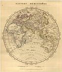
  Main Author:   Malte-Brun, M.
  Title/Description:   Eastern Hemisphere
  Publication Info:   Philadelphia: John Grigg, 1828; from A New General Atlas, Exhibiting the Five Great Divisions of the Globe
  Date:   1828
  Scale:   1:105,000,000
  Original Source:   Courtesy of Murray Hudson, Halls, Tennessee
Viewing options:


  Main Author:   Steiler, Adolf
  Title/Description:   Planiglob in Mercator's Projection
  Publication Info:   Gotha: Justus Perthus, 1828; No. 9 from Hand Atlas
  Date:   1828
  Scale:   1:140,000,000
  Original Source:   Courtesy of Murray Hudson, Halls, Tennessee
Viewing options:


Main Author:   Arrowsmith, A.
Titles/Descriptions:   Eastern Hemisphere
Publication Info:   London: A. Arrowsmith, 1828; from A Comparative Atlas of Ancient and Modern Geography
Date:   1828
Scale:   1:95,040,000
Original Source:   University of Alabama Map Library
Modern
Ancient
Viewing options:
Viewing options:
JPEG or Plugin
JPEG or Plugin


  Main Author:   Young and Delleker
  Title/Description:   The World on Mercator's Projection
  Publication Info:   Philadelphia: Anthony Finley, 1829
  Date:   1829
  Scale:   1:146,000,000
  Original Source:   Courtesy of Murray Hudson, Halls, Tennessee
Viewing options:


  Main Author:   Finley, Anthony
  Title/Description:   Eastern Hemisphere
  Publication Info:   Philadelphia: Anthony Finley, 1829; from A New General Atlas Comprising a Complete Set of Maps Representing the Grand Divisions of the Globe
  Date:   1829
  Scale:   1:92,000,000
  Original Source:   Courtesy of Murray Hudson, Halls, Tennessee
Viewing options:


  Main Author:   Finley, Anthony
  Title/Description:   State of Nations at the Christian Era
  Publication Info:   Philadelphia: Anthony Finley, 1829; from Atlas Classica
  Date:   1829
  Scale:   n/a
  Original Source:   University of Alabama Map Library
Viewing options:


  Main Author:   Unknown Author
  Title/Description:   The World
  Publication Info:   London: Longman and Company, 1830
  Date:   1830
  Scale:   1:165,500,000
  Original Source:   Courtesy of Murray Hudson, Halls, Tennessee
Viewing options:


  Main Author:   Butler, Samuel
  Title/Description:   The World
  Publication Info:   London: Longman, Rees, Orme, Brown and Green, c. 1830; from An Atlas of Modern Geography
  Date:   1830
  Scale:   1:109,813,466
  Original Source:   University of Alabama Map Library
Viewing options:


  Main Author:   Hall, Sidney
  Title/Description:   The World on Mercator's Projection
  Publication Info:   London: Longman, Rees, Orme, Brown and Green, 1830
  Date:   1830
  Scale:   1:81,547,000
  Original Source:   Courtesy of Murray Hudson, Halls, Tennessee
Viewing options:


  Main Author:   Unknown Author
  Title/Description:   Geography, Western Hemisphere-Eastern Hemisphere
  Publication Info:   Edinburgh: W. and D. Lizars, c.1831; Plate CCLXVIII
  Date:   1831
  Scale:   1:107,000,000
  Original Source:   Courtesy of Murray Hudson, Halls, Tennessee
Viewing options:


  Main Author:   Lizars, Daniel
  Title/Description:   Chart of the World on Mercator's Projection
  Publication Info:   Edinburgh: John Hamilton, c.1831; from the Edinburgh Geographical and Historical Atlas
  Date:   1831
  Scale:   1:51,806,100
  Original Source:   Birmingham Public Library Cartography Collection
Viewing options:


  Main Author:   Heck, J. G.
  Title/Description:   Etat du monde avant et pendant la De'covuerte des deux Indes
  Publication Info:   Paris: Engelmann and Company, c. 1832
  Date:   1832
  Scale:    
  Original Source:   Courtesy of Antique Atlas
Viewing options:


  Main Author:   Heck, J. G.
  Title/Description:   Carte generale des Pays Connus par les Ancients
  Publication Info:   Paris: Engelmann and Company, 1832
  Date:   1832
  Scale:    
  Original Source:   Courtesy of Antique Atlas
Viewing options:


  Main Author:   Carey, Mathew
  Title/Description:   The World (on Mercator's Projection)
  Publication Info:   Philadelphia: Carey and Lea, 1832; from The Family Cabinet Atlas, First American Edition
  Date:   1832
  Scale:   1:325,000,000
  Original Source:   Courtesy of Murray Hudson, Halls, Tennessee
Viewing options:


  Main Author:   Carey, Mathew
  Title/Description:   The World, Showing Eastern and Western Hemispheres
  Publication Info:   Philadelphia: Carey and Lea, 1832; from The Family Cabinet Atlas, First American Edition
  Date:   1832
  Scale:   1:338,000,000
  Original Source:   Courtesy of Murray Hudson, Halls, Tennessee
Viewing options:


  Main Author:   Carey, Mathew
  Title/Description:   The World, Showing the North and South Polar Regions
  Publication Info:   Philadelphia: Carey and Lea, 1832; from The Family Cabinet Atlas, First American Edition
  Date:   1832
  Scale:   1:338,000,000
  Original Source:   Courtesy of Murray Hudson, Halls, Tennessee
Viewing options:


  Main Author:   Malte-Brun, Conrad
  Title/Description:   Mappe Monde en Deux hemispheres
  Publication Info:   Paris: 1833
  Date:   1833
  Scale:    
  Original Source:   Courtesy of Antique Atlas
Viewing options:


  Main Author:   Lesage, A
  Title/Description:   Mappemonde Historique
  Publication Info:   Paris: Leclere, 1833; from Atlas Historique, Généalogique, Chronologique et Géographique
  Date:   1833
  Scale:   1:73,920,000
  Original Source:   University of Alabama Map Library
Viewing options:


  Main Author:   Lesage, A
  Title/Description:   Le Monde Connu Des Anciens d'après Marin de Tyr, rétabli par Mr.Gosselin
  Publication Info:   Paris: Leclere, 1833; from Atlas Historique, Généalogique, Chronologique et Géographique
  Date:   1833
  Scale:   1:49,280,000
  Original Source:   University of Alabama Map Library
Viewing options:


  Main Author:   Delamarche, Félix
  Title/Description:   Mappe Monde ou Carte Generale du Globe Terrestre
  Publication Info:   Paris: Félix, Delamarche, 1834; No.1 from Atlas De La Géographie Ancienne, du moyen âge, et modern, Adopté Par Le Conseil Royal
  Date:   1834
  Scale:   1:96,860,000
  Original Source:   Courtesy of Adams Antiques, Northport, Alabama
Viewing options:


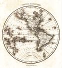
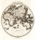
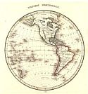
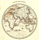
Main Author:   Malte-Brun, Conrad
Titles/Descriptions:   Western Hemisphere; Eastern Hemisphere
Publication Info:   Boston: Samuel Walker, 1834; from A System of Universal Geography
Date:   1834
Scale:   N/A
Original Source:   University of Alabama Map Library
Western
Eastern
Viewing options:
Viewing options:
JPEG or Plugin
JPEG or Plugin


  Main Author:   Smith, Roswell, C.
  Title/Description:   A Chart Exhibiting the Actual and Comparative Size of Each Country, Nation, or Kingdom; it's Populations as a Whole and to a Square Mile; Also the Different States of Society, forms of Government; Religion, &c.
  Publication Info:   Philadelphia: W. Marshall, 1835; from An Atlas for Schools, Academics and Families
  Date:   1835
  Scale:   1:61,300,000
  Original Source:   Courtesy of Murray Hudson, Halls, Tennessee
Viewing options:


  Main Author:   Unknown Author
  Title/Description:   Comparative Lengths of Rivers and Distribution of Vegetables and Snow Line
  Publication Info:   Boston: T.G. Bradford, 1835
  Date:   1835
  Scale:    
  Original Source:   Courtesy of Murray Hudson, Halls, Tennessee
Viewing options:


  Main Author:   Unknown Author
  Title/Description:   Comparative Heights of Mountains
  Publication Info:   Boston: T.G. Bradford, 1835
  Date:   1835
  Scale:    
  Original Source:   Courtesy of Murray Hudson, Halls, Tennessee
Viewing options:


  Main Author:   Huntington, Eleazor
  Title/Description:   The World
  Publication Info:   Hartford: Nathaniel Gilbert Huntington, 1835
  Date:   1835
  Scale:   1:162,000,000
  Original Source:   Courtesy of Murray Hudson, Halls, Tennessee
Viewing options:


Main Author:   Bradford, Thomas G.
Title/Description:   Western Hemisphere / Eastern Hemisphere
Publication Info:   Boston: William D. Ticknor, 1835; from A Comprehensive Atlas Geographical, Historical & Commercial
Date:   1835
Scale:   Various
Original Source:   Courtesy of Murray Hudson, Halls, Tennessee
Western Hemisphere
Eastern Hemisphere
Viewing options:
Viewing options:
JPEG or Plugin
JPEG or Plugin


  Main Author:   Bradford, Thomas G.
  Title/Description:  

Northern Hemisphere / Southern Hemisphere

  Publication Info:   Boston: William D. Ticknor, 1835; from A Comprehensive Atlas Geographical, Historical, and Commercial
  Date:   1835
  Scale:   Various
  Original Source:   Courtesy of Murray Hudson, Halls, Tennessee
Viewing options:


  Main Author:   Bradford, Thomas G.
  Title/Description:   Athens, Rome, Jerusalem and Vicinity, Peninsula of Mt. Sinai
  Publication Info:   Boston: William D. Ticknor, 1835; from A Comprehensive Atlas Geographical, Historical, and Commercial
  Date:   1835
  Scale:   Various
  Original Source:   Courtesy of Murray Hudson, Halls, Tennessee
Viewing options:


  Main Author:   Bradford, Thomas G.
  Title/Description:   The Countries of The Ancient World Exhibiting the Probable Settlement of the Descendants of Noah
  Publication Info:   Boston: William D. Ticknor, 1835; from A Comprehensive Atlas Geographical, Historical, and Commercial
  Date:   1835
  Scale:   1:38,966,400
  Original Source:   Courtesy of Murray Hudson, Halls, Tennessee
Viewing options:


  Main Author:   Binet
  Title/Description:   Mappe-Monde
  Publication Info:   Paris: 1836
  Date:   1836
  Scale:   1:210,000,000
  Original Source:   Courtesy of Murray Hudson, Halls, Tennessee
Viewing options:


  Main Author:   Monin, Charles V. and A.R. Fremin
  Title/Description:   Planisphere Indiquant les Possessions Francaises dans les Diverses Parties du Monde
  Publication Info:   Paris: Binen, 1836
  Date:   1836
  Scale:   1:176,000,000
  Original Source:   Courtesy of Murray Hudson, Halls, Tennessee
Viewing options:


  Main Author:   Goodrich, S. Griswold
  Title/Description:   Western Hemisphere - Eastern Hemisphere - Northern Hemisphere - Southern Hemisphere
  Publication Info:   Hartford: F.J. Hunitngton, 1836; from The Malte-Brun School Geography
  Date:   1836
  Scale:   1:192,000,000
  Original Source:   Courtesy of Murray Hudson, Halls, Tennessee
Viewing options:


  Main Author:   Malte-Brun, Conrad
  Title/Description:   Mappe Monde sur la projection reduite de Mercator
  Publication Info:   Paris: 1837
  Date:   1837
  Scale:    
  Original Source:   Courtesy of Antique Atlas
Viewing options:


  Main Author:   Olney, Jesse
  Title/Description:   The World on a Globular Projection
  Publication Info:   New York: Robinson, Pratt and Company, 1837; from A School Geography
  Date:   1837
  Scale:   1:200,000,000
  Original Source:   Courtesy of Murray Hudson, Halls, Tennessee
Viewing options:


  Main Author:   Olney, Jesse
  Title/Description:   The World on a Globular Projection
  Publication Info:   New York: Robinson, Pratt and Company, 1837; from A New and Improved School Atlas
  Date:   1837
  Scale:   1:100,000,000
  Original Source:   Courtesy of Murray Hudson, Halls, Tennessee
Viewing options:


  Main Author:   Malte Brun, Conrad
  Title/Description:   Systemes Geographiques de Ptolemee de Strabon & d' Erastostheine
  Publication Info:   Paris: Aime Andre, 1837
  Date:   1837
  Scale:   Varies
  Original Source:   Courtesy of Antique Atlas
Viewing options:


  Main Author:   Hall, Sidney
  Title/Description:   The World, Mercator's Projection
  Publication Info:   London: Longman, Orme and Company, 1838
  Date:   1838
  Scale:   1:81,547,000
  Original Source:   Courtesy of Murray Hudson, Halls, Tennessee
Viewing options:


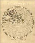
  Main Author:   Unknown Author
  Title/Description:   Orbis Veteribus Notus
  Publication Info:   Gotha: Justus Perthes, 1839; from Schul-Atlas der Alten Welt
  Date:   1839
  Scale:   1:46,250,000
  Original Source:   University of Alabama Map Library
Viewing options:


  Main Author:   Mitchell, S. Augustus
  Title/Description:   The World
  Publication Info:   Philadelphia: Thomas, Cowperthwait and Company, 1839; from A School Atlas
  Date:   1839
  Scale:    
  Original Source:   Courtesy of Murray Hudson, Halls, Tennessee
Viewing options:


  Main Author:   Scott, R.
  Title/Description:   The Countries of the Ancient World Exhibiting the Probable Settlement of the Descendants of Noah
  Publication Info:   Glasgow: Archibald Fullarton and Company, c.1840
  Date:   1840
  Scale:   1:37,224,000
  Original Source:   Courtesy of Murray Hudson, Halls, Tennessee
Viewing options:
 

Previous Page
Next Page


© University of Alabama
To purchase map reproductions, submit a quote request.
Download MrSID Plugin