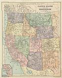
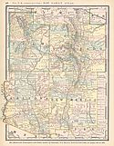
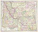
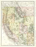
Viewing Options
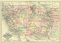
Main Author:
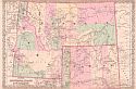
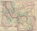
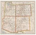
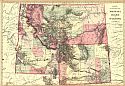
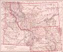
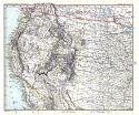
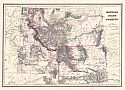
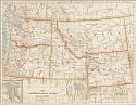
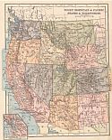
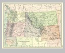
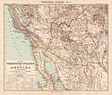
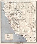
Colton, George W.
Title/Description:
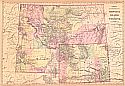
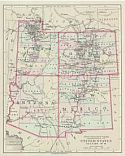
Colton's Montana, Idaho & Wyoming
Publication Info:
New York: G.W. & C.B. Colton, c1876
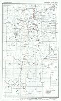
Viewing Options
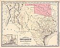
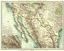
Main Author:
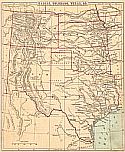
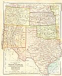
McNally, Francis
Title/Description:
Texas, New Mexico and Indian Territory
Publication Info:
New York: A.S. Barnes and Company, 1876; from An Improved System of Geography
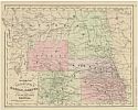
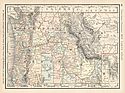
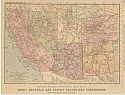
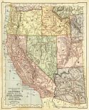
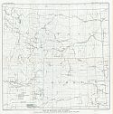
Viewing Options
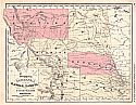
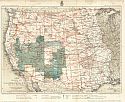
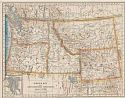
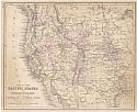
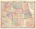
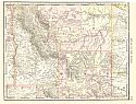
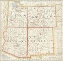
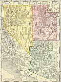
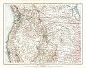
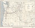
Main Author:
McNally, Francis
Title/Description:
Wyoming, Nebraska, Kansas, Dakota, Colorado and Montanta
Publication Info:
New York: A.S. Barnes and Company, 1876; from An Improved System of Geography
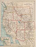
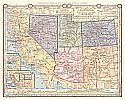
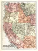
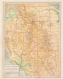
Viewing Options
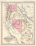
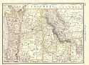
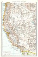
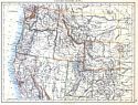
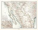
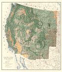
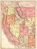
Main Author:
McNally, Francis
Title/Description:
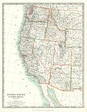
Washington, Oregon, Idaho, Nevada, Utah, and Arizona
Publication Info:
New York: A.S. Barnes and Co., 1876; from An Improved System of Geography
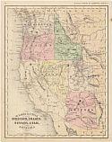
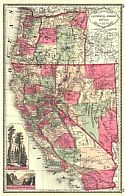
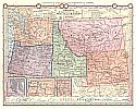
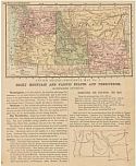
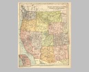
Viewing Options
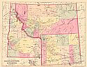
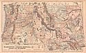
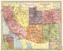
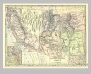
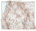
Main Author:
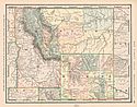
Gray, Ormando W.
Title/Description:
Gray's Idaho, Montana and Wyoming
Publication Info:
Philadelphia: O.W. Gray and Son, 1876; from Gray's National Atlas with Descriptions
Viewing Options
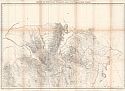
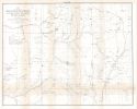
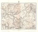
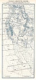
Main Author:
Ludlow, William
Title/Description:
reconnaissance from Carroll Montana Territory, on the Upper Missouri, to the Yellowstone National Park
Publication Info:
Washington: Government Printing Office, 1876; from Report of a Reconnaissance from Carroll Montana Territory, on the Upper Missouri, to the Yellowstone National Park
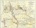
Viewing Options
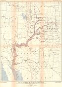
Main Author:
Hayden, F.V.
Title/Description:
Parts of Western Wyoming, Southeastern Idaho and Northeastern Utah
Publication Info:
Washington D.C.: U.S. Geological and Geographical Survey of the Territories, 1877
Viewing Options
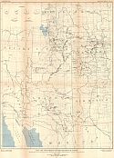
Main Author:
Hayden, F.V.
Title/Description:
Parts of Western Wyoming, Southeastern Idaho and Northeastern Utah
Publication Info:
Washington: U.S. Geological and Geographical Survey of the Territories, 1877; from Maps and Panoramas: Twelfth Annual Report of the United States Geological and Geographical Survey of the Territories, 1878
Viewing Options
Main Author:
Hayden, F.V.
Title/Description:
Parts of Western Wyoming and Southeastern Idaho
Publication Info:
Washington D.C.: U.S. Geological and Geographical Survey of the Territories, 1878
Viewing Options
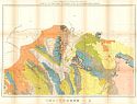
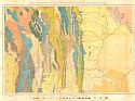
Main Author:
Hayden, F.V.
Title/Description:
Parts of Western Wyoming and Southeastern Idaho (Geologic Map)
Publication Info:
Washington D.C.: U.S. Geological and Geographical Survey of the Territories, 1878
Viewing Options
Main Author:
Hayden, F.V.
Title/Description:
Parts of Western Wyoming and Southeastern Idaho
Publication Info:
Washington: U.S. Geological and Geographical Survey of the Territories; from Maps and Panoramas: Twelfth Annual Report of the United States Geological and Geographical Survey of the Territories, 1878
Viewing Options
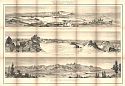
Main Author:
Hayden, F.V.
Title/Description:
Panoramic Views in the Wind River and Teton Mountains
Publication Info:
Washington: U.S. Geological and Geographical Survey of the Territories, 1878; from Maps and Panoramas: Twelfth Annual Report of the Geological and Geographical Survey of the Territories
Viewing Options
Main Author:
U.S. Geological Survey
Title/Description:
Map of the Region Occupied by the Ancient Ruins in Southern Colorado, Utah and Northern New Mexico and Arizona
Publication Info:
Washington: Department of the Interior, U.S. Geological Survey of the Territories, 1878; 10th Annual Report
Viewing Options
Main Author:
Cornell, Sarah Sophia
Title/Description:
Kansas, Colorado, Texas, & C.
Publication Info:
New York: D. Appleton & Co., 1879; from Cornell's Intermediate Geography
Viewing Options
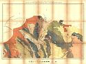
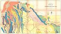
Main Author:
Hayden, F.V.
Title/Description:
Parts of Western Wyoming, Southeastern Idaho and Northeastern Utah (Geologic Map)
Publication Info:
Washington D.C.: U.S. Geological and Geographical Survey of the Territories, 1879
Viewing Options
Main Author:
Hayden, F.V.
Title/Description:
Geological Map of Portions of Wyoming, Idaho and Utah
Publication Info:
Washington D.c: U.S. Geological and Geographical Survey of the Territories, 1879
Viewing Options
Main Author:
Hayden, F.V.
Title/Description:
Economic Map of Portions of Wyoming, Idaho and Utah
Publication Info:
Washington D.c: U.S. Geological and Geographical Survey of the Territories, 1879
Viewing Options
Main Author:
Hayden, F.V.
Title/Description:
Parts of Southern Colorado and Northern New Mexico
Publication Info:
Washingotn D.c: U.S. Geological and Geographical Survey of the Territories, 1879
Viewing Options
Main Author:
Hayden, F.V.
Title/Description:
Part of North Central New Mexico
Publication Info:
Washington D.c: U.S. Geological and Geographical Survey of the Territories, 1879
Viewing Options
Main Author:
U.S. House of Represenatives
Title/Description:
U.S. Telegraph Lines in California, Arizona, New Mexico, and Texas
Publication Info:
Washington: Government Printing Office, 1879; from Report of the Chief Signal Officer, 3rd Session of the Forty Fifth Congress
Viewing Options
Main Author:
Wheeler, George M.
Title/Description:
U.S. Geographical Surveys West of the 100th Meridan, Parts of Eastern Arizona and Western New Mexico
Publication Info:
Washington: U.S. Army Corps of Engineers, 1879
Viewing Options
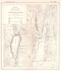
Main Author:
U.S. Geological Survey
Title/Description:
Map of Bear Lake and a portion of the Bear River Region
Publication Info:
Washington: Department of the Interior, U.S. Geological Survey of the Territories, 1879; 11th Annual Report
Viewing Options
Viewing Options
Viewing Options
Viewing Options
Viewing Options
Viewing Options
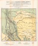
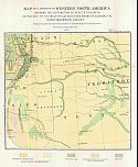
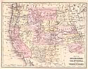
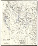
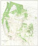
Main Author:
Gannett, Henry
Title/Description:
Map of a Portion of Western North America showing the Distribution of Vegetation with Reference to the Multiplication of and Means of Subduing the Rocky Mountain Locust, Map 1, Northwestern Section
Publication Info:
Washington: U.S. Government Printing Office, 1879; from Second Report of the U.S. Entomological Commission for 1878-1879
Viewing Options
Main Author:
Swinton, William
Title/Description:
United States Section 4 - Texas, Kansas, S. Nebraska, Colorado, New Mexico, Indian Territory
Publication Info:
New York: Ivison, Blakeman, Taylor & Co., 1880
Viewing Options
Main Author:
Hayden, F.V.
Title/Description:
General Geologic Map of the Area Explored and Mapped
Publication Info:
Washington: United States Geological Survey, Department of the Interior, 1880
Viewing Options
Main Author:
Wheeler, George M.
Title/Description:
Progress Map of the U.S. Geographical Surveys West of the 100th Meridan
Publication Info:
[Washington]: U.S. Army Corps of Engineers, 1880
Viewing Options
Viewing Options
Viewing Options
Viewing Options
Viewing Options
Viewing Options
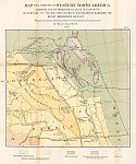
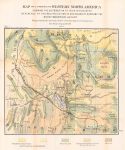
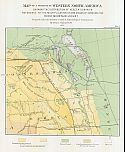
Main Author:
United States Entomological Commision
Title/Description:
Map of a Portion of Western North America showing distribution of vegetation with reference to the multiplication of a means of subduing the Rocky Mountain Locust
Publication Info:
Washington: Government Printing Office, 1880; Second Report prepared under the direction of Henry Gannett
Viewing Options
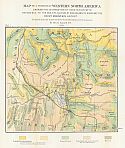
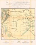
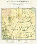
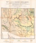
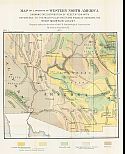
Main Author:
Mitchell, Samuel Augustus
Title/Description:
County and Township Map - Montana, Idaho, and Wyoming
Publication Info:
Philadelphia: S.A. Mitchell, 1881
Viewing Options
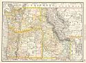
Main Author:
Bradley, William M.
Title/Description:
County Map of Idaho, Montana and Wyoming
Publication Info:
Philadelphia: Bradley & Co., c1881
Viewing Options
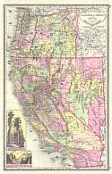
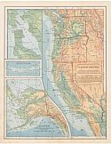
Main Author:
Tunison, Henry C.
Title/Description:
Tunison's California, Oregon, and Nevada
Publication Info:
Jacksonville, IL: H.C. Tunison, 1881
Viewing Options
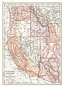
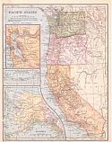
Main Author:
Swinton, William
Title/Description:
Pacific States and Territories
Publication Info:
New York: Ivison, Blakeman, Taylor and Company, 1881; from Swinton's Grammar School Geography
Viewing Options
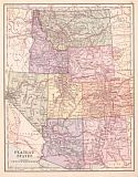
Main Author:
von Steinwehr, A.
Title/Description:
Map of the Western States
Publication Info:
Cincinnati: Von Antwerp, Bragg and Company, 1881; from Eclectic Series, School Geography No. 3
Viewing Options
Main Author:
McNally, Francis
Title/Description:
Washington, Oregon, Idaho, Nevada, Utah and Arizona
Publication Info:
Chicago: A.S. Barnes and Company, 1882; from McNally's System of Geography
Viewing Options
Main Author:
McNally, Francis
Title/Description:
Wyoming, Nebraska, Kansas, Dakota, Colorado and Montana
Publication Info:
Chicago: A.S. Barnes and Company, 1882; from McNally's System of Geography
Viewing Options
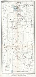
Title/Description:
Colorado and Western Territories
Publication Info:
Cincinnati: Von Antwerp, Bragg and Company, 1883; from The Eclectic Complete Geography
Viewing Options
Title/Description:
Oregon and Northwestern Territories
Publication Info:
Cincinnati: Von Antwerp, Bragg and Company, 1883; from The Eclectic Complete Geography
Viewing Options
Main Author:
Gannett, Henry and G.B. Chittenden
Title/Description:
Drainage Map showing portions of Wyoming, Idaho and Utah
Publication Info:
Washington: Department of the Interior, U.S. Geological Survey of the Territories, 1883; 12th Annual Report, Part I
Viewing Options
Main Author:
Watson, Gaylord
Title/Description:
Idaho, Montana and Wyoming
Publication Info:
Boston: Perry and Spaulding, 1883; from New Indexed Family Atlas of the United States with Maps of the World
Viewing Options
Main Author:
Watson, Gaylord
Title/Description:
Utah, Colorado, Arizona and New Mexico
Publication Info:
Boston: Perry and Spaulding, 1883; from New Indexed Family Atlas of the United States with Maps of the World
Viewing Options
Main Author:
Watson, Gaylord
Title/Description:
Washington, Oregon and Idaho
Publication Info:
Boston: Perry and Spaulding, 1883; from New Indexed Family Atlas of the United States with Maps of the World
Viewing Options
Main Author:
Ivison, Blakeman, Taylor and Company
Title/Description:
Pacific States and Territories
Publication Info:
New York: Ivison, Blakeman, Taylor and Company,1883; from Handy Atlas of the World
Viewing Options
Main Author:
Weller, Edward
Title/Description:
Part of the United States and Canada
Publication Info:
London: Cassell and Company, 1884; to accompany Life and harbour in the Far, Far West by W. Henry Barneby
Viewing Options
Main Author:
Mitchell, S. Augustus
Title/Description:
County and Township Map, Montana, Idaho and Wyoming
Publication Info:
Philadelphia: William M. Bradley and Bro., 1884; from Mitchell's Atlas of the World
Viewing Options
Title/Description:
Map of the Pacific States and Territories
Publication Info:
Philadelphia: Cowperthwait and Company, 1884; from Warren's Common-School Geography
Viewing Options
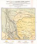
Main Author:
Donaldson, Thomas
Title/Description:
Map Showing Private Land Claims, Patented or Unpatented or Confirmed in New Mexico, Colorado, and Arizona, to June 30, 1883
Publication Info:
[Washington]: Government Printing Office, 1884; from The Public Domain, Its History
Viewing Options
Main Author:
Tunison, Henry Cuthbert
Title/Description:
California, Oregon and Nevada
Publication Info:
Jacksonville, IL: H.C. Tunison, 1885
Viewing Options
Main Author:
Monteith, James
Title/Description:
Western States and Territories
Publication Info:
New York: A.S. Barnes and Company, 1885; from Monteith's Independent Course Comprehensive Geography
Viewing Options
Main Author:
U.S. Coast and Geodetic Survey
Title/Description:
Isogonic Lines for the Year 1783
Publication Info:
Washington: U.S. Coast and Geodetic Survey, 1886
Viewing Options
Main Author:
Monteith, James
Title/Description:
Oregon, Washington, Idaho, Montana, and Wyoming
Publication Info:
New York: A.S. Barnes and Co., 1886; from Barnes' Complete Geography
Viewing Options
Main Author:
Monteith, James
Title/Description:
California, Nevada, Utah, Colorado, Arizona, and New Mexico
Publication Info:
New York: A.S. Barnes and Co., 1886; from Barnes' Complete Geography
Viewing Options
Title/Description:
Idaho, Montana and Wyoming
Publication Info:
Philadelphia: Stedman and Brown, 1886; from The National Atlas
Viewing Options
Main Author:
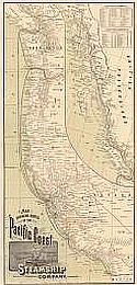
Rand McNally & Company
Title/Description:
Map Showing Routes of the Pacific Coast Steamship Company
Publication Info:
San Francisco: Pacific Coast Steamshiip Co., 1887
Viewing Options
Main Author:
Mitchell, S. Augustus
Title/Description:
Map of Oregon, Kansas, California and the Territories
Publication Info:
Philadelphia: E.H. Butler and Company, 1888; from Mitchell's a System of Modern Geography
Viewing Options
Main Author:
Hardesty, H.H.
Title/Description:
Washington, Oregon, Idaho and Parts of Montana & Wyoming
Publication Info:
Richmond, V.A.: H.H. Hardesty & Co., 1889; from Hardesty's Atlas of the World
Viewing Options
Main Author:
Johnson, Alvin J.
Title/Description:
Map of Arizona, California, Colorado, Nevada, New Mexico, and Utah
Publication Info:
New York: A.J. Johnson, 1889; Drawn and Engraved on Copper-Plate expressly for Johnson's Cyclopaedia
Viewing Options
Main Author:
Rand McNally and Company
Title/Description:
Idaho, Montana and Wyoming
Publication Info:
Chicago: The Continental Publishing Company, 1889; from The Standard Atlas of the World
Viewing Options
Main Author:
Rand McNally and Company
Title/Description:
Washington, Oregon and Idaho
Publication Info:
Chicago: The Continental Publishing Company, 1889; from The Standard Atlas of the World
Viewing Options
Main Author:
Mast, Crowell and Kirkpatrick
Title/Description:
Map of Washington, Oregon, Montana, Idaho and Wyoming
Publication Info:
Springfield, Ohio: Mast, Crowell and Kirkpatrick, 1889; from Peerless Atlas of the World
Viewing Options
Main Author:
Tunison, Henry C.
Title/Description:
Tunison's California, Nevada and Oregon
Publication Info:
Jacksonville, IL: H.C. Tunison, 1890
Viewing Options
Main Author:
Bartholomew, John
Title/Description:
California, Nevada, Oregon, Washington, Idaho, Utah, Arizona and Part of Montana
Publication Info:
London: MacMillan and Co., 1890; from The Library Reference Atlas of the World
Viewing Options
Title/Description:
(Washington, Oregon and Idaho)
Publication Info:
New York: John B. Alden, 1890
Viewing Options
Main Author:
Colton, J.H.
Title/Description:
United States, Section No. 13 (Washington, Oregon, Idaho, Montana and Wyoming)
Publication Info:
New York: Sheldon and Company, 1890; from Colton's Common School Geography
Viewing Options
Main Author:
Colton, J.H.
Title/Description:
United States, Section No. 14 (Utah, Colorado, Arizona and New Mexico)
Publication Info:
New York: Sheldon and Company, 1890; from Colton's Common School Geography
Viewing Options
Main Author:
Johnston, W. and A.K.
Title/Description:
United States of North America (Western Sheet)
Publication Info:
London: W. and A.K. Johnston, c. 1890
Viewing Options
Title/Description:
Drainage Basin Lower Colorado River
Publication Info:
Washington: U.S. Senate, 1890; from a Senate Report on Irrigation
Viewing Options
Main Author:
U.S. Geological Survey
Title/Description:
Drainage Basin Rio Grande
Publication Info:
Washington: U.S. Department of the Interior, USGS, 1890; from Report on Irrigation
Viewing Options
Main Author:
Stieler, Adolf
Title/Description:
West-Indien
Publication Info:
Gotha: Justus Perthes, 1891 from his Hand Atlas of 1891
Viewing Options
Main Author:
U.S. Department of Agriculture
Title/Description:
Map Illustrating the Progress of Irrigation within the Arid and Semi-Arid Region of the United States West of the 97th Degree of Longitude West of Greenwich
Publication Info:
Washington, D.c: U.S. Department of Agriculture, 1891; an Office of Irrigation Inquiry
Viewing Options
Main Author:
Appleton, D.
Title/Description:
Rocky Mountain and Pacific States and Territories - Northern Division
Publication Info:
New York: D. Appleton and Company, c. 1891; from Appleton's Standard Higher Geography
Viewing Options
Main Author:
Appleton, D.
Title/Description:
Rocky Mountain and Pacific States and Territories - Southern Division
Publication Info:
New York: D. Appleton and Company, c. 1891; from Appleton's Standard Higher Geography
Viewing Options
Main Author:
Bartholomew, J.
Title/Description:
California, Nevada, Oregon, Washington, Idaho, Utah, Arizona and Part of Montana
Publication Info:
New York: Thomas Nelson and Sons, 1891; from The Popular Hand Atlas of the World
Viewing Options
Main Author:
Swinton, William
Title/Description:
California, Oregon, Nevada, Utah, Arizona, W. Wyoming, S. Idaho, S. Montana
Publication Info:
New York: Ivison, Blakeman and Company, 1892; from A Complete Course in Geography
Viewing Options
Main Author:
Fisk & Company
Title/Description:
Montana, Idaho and Wyoming
Publication Info:
New York: Hunt & Eaton, 1892; from the Columbian Atlas of the World We Live In
Viewing Options
Title/Description:
Rocky Mountain and Pacific States and Territories
Publication Info:
New York: University Publishing Company, 1892; from Manual of Geography
Orginal Source:
Geological Survey of Alabama
Viewing Options
Main Author:
Bradley, William M.
Title/Description:
Montana, Idaho, and Wyoming
Publication Info:
New York: John E. Potter and Company, 1894; from Potter - Bradley Atlas of the World
Viewing Options
Title/Description:
United States, Western
Publication Info:
London: "The Times" Printing House, 1895; from the first edition of "The Times Atlas"
Viewing Options
Title/Description:
The South-Western States
Publication Info:
New York: American Book Company, 1896; from the Eclectic Complete Geography
Viewing Options
Main Author:
Frye, Alexis Everett
Title/Description:
Southwestern Group
Publication Info:
Boston: Ginn and Company, 1896; from Frye's Complete Geography
Viewing Options
Title/Description:
The North-Western States
Publication Info:
New York: American Book Company, 1896; from the Eclectic Complete Geography
Viewing Options
Main Author:
Johnston, William and Alexander Keith
Title/Description:
United States (N.W.)
Publication Info:
Edinburgh: W. and A.K. Johnston, 1897
Viewing Options
Main Author:
Rand McNally & Company
Title/Description:
Nevada, Utah, and Arizona
Publication Info:
Chicago: Rand McNally & Co., 1898
Viewing Options
Main Author:
Gannett, Henry
Title/Description:
Map of the Cordilleran Region Showing the Distribution of Woods and Forest
Publication Info:
Washington D.c: Department of the Interior, U.S. Geological Survey, 1898; 19th Annual Report, Part V, PL II
Viewing Options
Main Author:
Darton, N.H.
Title/Description:
Contour Map of Upper Missouri River Region Showing Factors bearing on prospects for deep underground waters
Publication Info:
Washington: US Geological Survey, 1898; Nineteenth Annual Report Part IV PL CXI
Viewing Options
Main Author:
U.S. Geological Survey
Title/Description:
Map Showing Location and Extent of the Forest Reserves and National Parks in Western United States
Publication Info:
Washington D.C.: U.S. Geological Survey, 1899
Viewing Options
Main Author:
Matthews - Northrup Company
Title/Description:
Official Railroad Map of the Pacific Coast, Compiled Expressly for the Railroad Gazetteer
Publication Info:
San Francisco: H.S. Crocker Company, 1900
Viewing Options
Main Author:
Rand McNally & Company
Title/Description:
New Commercial Map, Denver to the West Coast
Publication Info:
Chicago: Rand McNally & Company, 1900
Viewing Options
Title/Description:
Rocky Mountain and Pacific States and Territories
Publication Info:
New York: University Publishing Company, 1901; from Maury's Manual of Geography
Viewing Options
Title/Description:
Nordwestliche Vereinigte Staaten und Südwestliches Canada
Publication Info:
Leipzig: Velhagen and Klasing, 1901; from Andrees Allgemeiner Handatlas
Viewing Options
Title/Description:
Südwestliche Vereinigte Staaten und Nördliches Mexico
Publication Info:
Leipzig: Velhagen and Klasing, 1901; from Andrees Allgemeiner Handatlas
Viewing Options
Main Author:
Frye, Alexis Everett
Title/Description:
Southwestern Group
Publication Info:
Boston: Ginn and Company, 1902; from Frye's Elements of Geography
Original Source:
Geological Survey of Alabama
Viewing Options
Main Author:
Frye, Alexis Everett
Title/Description:
Northwestern Group
Publication Info:
Boston: Ginn and Company, 1902; from Frye's Elements of Geography
Original Source:
Geological Survey of Alabama
Viewing Options
Title/Description:
Sudwestliche vereinigte Staaten und Nordliches Mexico
Publication Info:
Leipzig: Verlag von Velhagen and Klasing: from Andreas Allgemeiner Handatlas
Viewing Options
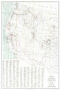
Main Author:
Potter, Albert F.
Title/Description:
Grazing Lands, Western United States
Publication Info:
Washington: Department of Agriculture, 1905
Viewing Options
Main Author:
Habenicht, H.
Title/Description:
Vereinigte Staaten (Northwest)
Publication Info:
Gotha: Justus Perthes, 1905; from Stielers Hand-Atlas
Viewing Options
Main Author:
Habenicht, H.
Title/Description:
Vereinigte Staaten (Southwest)
Publication Info:
Gotha: Justus Perthes, 1905; from Stielers Hand-Atlas
Viewing Options
Title/Description:
Denver to Pacific Coast
Publication Info:
Chicago: Rand McNally and Company from the Business Atlas and Shippers Guide
Viewing Options
Main Author:
The International Text Book Company
Title/Description:
Railway Mail Service
Publication Info:
Scranton, PA: International Correspondence Schools, 1908
Viewing Options
Main Author:
The International Text Book Company
Title/Description:
Railway Mail Service
Publication Info:
Scranton, PA: International Correspondence Schools, 1908
Viewing Options
Main Author:
Hammond, C.S.
Title/Description:
Western United States, showing Forest Reserves and reclamation projects
Publication Info:
New York: C.S. Hammond & Co. 1908; from Hammond's Handy Atlas of the World
Viewing Options
Main Author:
Bartholomew, J.G.
Title/Description:
United States. Section 5
Publication Info:
New York: Thomas Nelson and Sons, 1908; from The Globe Hand Atlas
Viewing Options
Main Author:
U.S. Geological Survey
Title/Description:
Coal and Lignite Areas of Montana, Wyoming, and Idaho
Publication Info:
Washington: Department of the Interior, U.S. Geological Survey, 1910; from Mineral Resources of the United States, 1910 Part II Plate VII
Viewing Options
Main Author:
U.S. Geological Survey
Title/Description:
Coal Areas of Arizona and New Mexico
Publication Info:
Washington: Department of the Interior, U.S. Geological Survey, 1910; from Mineral Resources of the United States, 1910 Part II Plate VIII
Viewing Options
Main Author:
Rand McNally and Company
Title/Description:
Denver to Pacific Coast
Publication Info:
Chicago: Rand McNally and Company, 1911; from Rand McNally Indexed Atlas
Viewing Options
Main Author:
U.S. Geological Survey
Title/Description:
Map of Montana and Wyoming showing location of limekilns and quarries of limestone, sandstone, marble and granite
Publication Info:
Washington: Department of the Interior, U.S. Geological Survey, 1912; from Mineral Resources of the United States, 1912 Part II Plate IV
Viewing Options
Main Author:
U.S. Geological Survey
Title/Description:
Map of Colorado and New Mexico showing location of limekilns and quarries of limestone, sandstone, marble, slate and granite
Publication Info:
Washington: Department of the Interior, U.S. Geological Survey, 1912; from Mineral Resources of the United States, 1912 Part II Plate VII
Viewing Options
Main Author:
Redway, Jaques W. and Russell Hinman
Title/Description:
Plateau Section
Publication Info:
New York: American Book Company, 1913; from Natural School Geography
Viewing Options
Main Author:
Redway, Jaques W. and Russell Hinman
Title/Description:
Pacific Section
Publication Info:
New York: American Book Company, 1913; from Natural School Geography
Viewing Options
Main Author:
Redway, Jaques W. and Russell Hinman
Title/Description:
Pacific States
Publication Info:
New York: American Book Company, 1913; from Natural School Geography
Viewing Options
Main Author:
Redway, Jaques W. and Russell Hinman
Title/Description:
Plateau States
Publication Info:
New York: American Book Company, 1913; from Natural School Geography
Viewing Options
Main Author:
U.S. Geological Survey
Title/Description:
Map of Arizona and Utah showing location of limekilns and quarries of limestone, sandstone, marble, slate, light volcanic rock, dark volcanic rock and granite
Publication Info:
Washington: Department of the Interior, U.S. Geological Survey, 1913; from Mineral Resources of the United States, 1913 Part II Plate V
Viewing Options
Main Author:
U.S. Geological Survey
Title/Description:
Map of California and Nevada Showing Location of Lime Kilns and Quarries of Limestone, Sandstone, Marble, Slate, Light Volcanic Rock, Dark Volcanic Rock and Granite
Publication Info:
Washington D.C.: U.S. Department of the Interior, U.S. Geological Survey, 1914; Mineral REsources1913, Part II Plate VI
Viewing Options
Main Author:
U.S. Geological Survey
Title/Description:
Map of Idaho, Oregon and Washington Showing the Location of Lime Kilns and Quarries of Limestone, Sandstone, Marble, Slate, Light Volcanic Rock, Dark Volcanic Rock and Granite
Publication Info:
Washington D.C.: U.S. Department of the Interior, U.S. Geological Survey, 1914; Mineral Resources, Part II Plate VII
Viewing Options
Main Author:
U.S. Geological Survey
Title/Description:
Map of Colorado River and its tributaries showing volume of discharge
Publication Info:
Washington: Department of the Interior, U.S. Geological Survey, 1916; Water Supply Paper No. 395 Plate 20
Viewing Options
Main Author:
U.S. Geological Survey
Title/Description:
Map of Colorado River Drainage Basin showing reservoiirs and water-power sites developed and undeveloped to 1915, and points of diversion from drainage basin
Publication Info:
Washington: Department of the Interior, U.S. Geological Survey, 1916; Water Supply Paper No. 395 Plate 13
Viewing Options
Main Author:
U.S. Geological Survey
Title/Description:
Reconnaissance Map showing irrigable lands along Colorado River between Bulls Head Rock and Cibola Valley
Publication Info:
Washington: Department of the Interior, U.S. Geological Survey, 1916; Water Supply Paper No. 395 Plate 11
Viewing Options
Main Author:
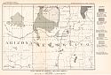
U.S. Geological Survey
Title/Description:
Map showing the Location of the Petroleum Reserves, Naval Oil-Shale Reserve and Classified Oil-Shale Lands in Parts of Wyoming, Utah and Colorado
Publication Info:
Washington: Department of the Interior, U.S. Geological Survey, 1919; Bulletin 702 Plate XVI
Viewing Options
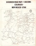
Main Author:
The B.F. Goodrich Company
Title/Description:
Goodrich Road Map of Arizona, Colorado, New Mexico, Utah
Publication Info:
Akron: Touring Bureau, B.F. Goodrich Company, 1919
Viewing Options
Main Author:
Philip, George
Title/Description:
United States: V. West
Publication Info:
London: George Philip and Son, 1921, from Philip's New Handy General Atlas and Gazetteer
Viewing Options
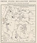
Main Author:
Department of the Interior
Title/Description:
Part of United States west of the Mississippi River showing activities of Bureaus of the Department of the Interior
Publication Info:
Washington: Department of the Interior, 1926
Viewing Options
Main Author:
U.S. Geological Survey
Title/Description:
Map of the Green River Basin showing utilization of Water Resources
Publication Info:
Washington: Department of the Interior, U.S. Geological Survey, 1929; Water Supply Paper No. 618 Plate 1
Viewing Options
Title/Description:
Map of Nitrate occurances in Arizona, New Mexico and Texas
Publication Info:
Washington: Department of the Interior, US Geological Survey, 1932; Bulletin 838, Plate 4
Viewing Options
Main Author:
National Power Survey, Federal Power Commission
Title/Description:
Service Areas of the Principal Electric Utility Systems in the United States (Western Sheet)
Publication Info:
Washington D.C.: Federal Power Commission, 1935; based on reports and maps filed by the Utility Companies and the Municipal System
Viewing Options
Main Author:
Corps of Engineers, U.S. Army
Title/Description:
Bellingham
Publication Info:
Washington: Corps of Engineers, U.S. Army, 1939
Viewing Options
Main Author:
Corps of Engineers, U.S. Army
Title/Description:
Mt. Shasta
Publication Info:
Washington: Corps of Engineers, U.S. Army, 1939
Viewing Options
Main Author:
Corps of Engineers, U.S. Army
Title/Description:
Klamath Falls
Publication Info:
Washington: Corps of Engineers, U.S. Army, 1939
Viewing Options
Main Author:
Corps of Engineers, U.S. Army
Title/Description:
Portland
Publication Info:
Washington: Corps of Engineers, U.S. Army, 1939
Viewing Options
Main Author:
Corps of Engineers, U.S. Army
Title/Description:
San Francisco
Publication Info:
Washington: Corps of Engineers, U.S. Army, 1939
Viewing Options
Main Author:
Corps of Engineers, U.S. Army
Publication Info:
Washington: Corps of Engineers, U.S. Army, 1940
Viewing Options
Main Author:
Corps of Engineers, U.S. Army
Title/Description:
Casper
Publication Info:
Washington: Corps of Engineers, U.S. Army, 1940
Viewing Options
Main Author:
Corps of Engineers, U.S. Army
Title/Description:
Del Rio
Publication Info:
Washington: Corps of Engineers, U.S. Army, 1940
Viewing Options
Main Author:
Corps of Engineers, U.S. Army
Title/Description:
Denver
Publication Info:
Washington: Corps of Engineers, U.S. Army, 1940
Viewing Options
Main Author:
Corps of Engineers, U.S. Army
Title/Description:
Douglas
Publication Info:
Washington: Corps of Engineers, U.S. Army, 1940
Viewing Options
Main Author:
Corps of Engineers, U.S. Army
Title/Description:
El Paso
Publication Info:
Washington: Corps of Engineers, U.S. Army, 1940
Viewing Options
Main Author:
Corps of Engineers, U.S. Army
Publication Info:
Washington: Corps of Engineers, U.S. Army, 1940
Viewing Options
Main Author:
Corps of Engineers, U.S. Army
Title/Description:
Glacier Park
Publication Info:
Washington: Corps of Engineers, U.S. Army, 1940
Viewing Options
Main Author:
Corps of Engineers, U.S. Army
Title/Description:
Grand Canyon
Publication Info:
Washington: Corps of Engineers, U.S. Army, 1940
Viewing Options
Main Author:
Corps of Engineers, U.S. Army
Title/Description:
Grand Junction
Publication Info:
Washington: Corps of Engineers, U.S. Army, 1940
Viewing Options
Main Author:
Corps of Engineers, U.S. Army
Title/Description:
Kootenai
Publication Info:
Washington: Corps of Engineers, U.S. Army, 1940
Viewing Options
Main Author:
Corps of Engineers, U.S. Army
Title/Description:
Mt. Whitney
Publication Info:
Washington: Corps of Engineers, U.S. Army, 1940
Viewing Options
Main Author:
Corps of Engineers, U.S. Army
Title/Description:
La Grande
Publication Info:
Washington: Corps of Engineers, U.S. Army, 1940
Viewing Options
Main Author:
Corps of Engineers, U.S. Army
Title/Description:
Los Angles
Publication Info:
Washington: Corps of Engineers, U.S. Army, 1940
Viewing Options
Main Author:
Corps of Engineers, U.S. Army
Title/Description:
Phoenix
Publication Info:
Washington: Corps of Engineers, U.S. Army, 1940
Viewing Options
Main Author:
Corps of Engineers, U.S. Army
Title/Description:
Pocatello
Publication Info:
Washington: Corps of Engineers, U.S. Army, 1940
Viewing Options
Main Author:
Corps of Engineers, U.S. Army
Title/Description:
Prescott
Publication Info:
Washington: Corps of Engineers, U.S. Army, 1940
Viewing Options
Main Author:
Corps of Engineers, U.S. Army
Publication Info:
Washington: Corps of Engineers, U.S. Army, 1940
Viewing Options
Main Author:
Corps of Engineers, U.S. Army
Title/Description:
Salt Lake City
Publication Info:
Washington: Corps of Engineers, U.S. Army, 1940
Viewing Options
Main Author:
Corps of Engineers, U.S. Army
Title/Description:
Seattle
Publication Info:
Washington: Corps of Engineers, U.S. Army, 1940
Viewing Options
Main Author:
Corps of Engineers, U.S. Army
Title/Description:
Spokane
Publication Info:
Washington: Corps of Engineers, U.S. Army, 1940
Viewing Options
Main Author:
Corps of Engineers, U.S. Army
Title/Description:
Trinidad
Publication Info:
Washington: Corps of Engineers, U.S. Army, 1940
Viewing Options
Main Author:
Corps of Engineers, U.S. Army
Title/Description:
Yellowstone Park
Publication Info:
Washington: Corps of Engineers, U.S. Army, 1940
Viewing Options
Main Author:
Corps of Engineers, U.S. Army
Title/Description:
San Diego
Publication Info:
Washington: Corps of Engineers, U.S. Army, 1943