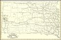
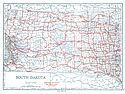
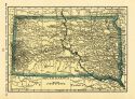
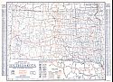
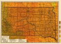
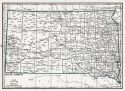
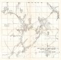
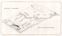
Viewing Options
Main Author:
Rand McNally and Company
Title/Description:
South Dakota- Black and White Mileage Map
Publication Info:
Chicago: Rand McNally and Company, 1921; from The Commercial Atlas of America
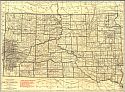
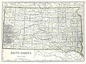
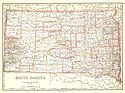
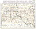
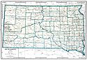
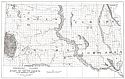
Viewing Options
Main Author:
Rand McNally and Company
Title/Description:
South Dakota
Publication Info:
Chicago: Rand McNally and Company, 1921; from The Commercial Atlas of America
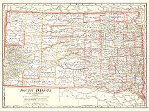
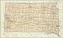
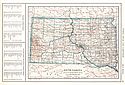
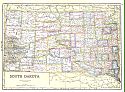
Viewing Options
Main Author:
Cram, George F.
Title/Description:
South Dakota
Publication Info:
Chicago: George F. Cram Company, 1921; from Cram's Unrivaled Atlas of the World
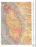
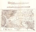
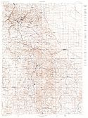
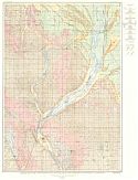
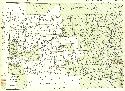
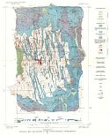
Viewing Options
Main Author:
U.S. Geological Survey
Title/Description:
Areal Geology, Central Black Hills Region, South Dakota
Publication Info:
Washington: Department of the Interior, U.S. Geological Survey, 1921
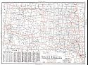
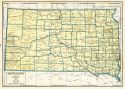
Viewing Options
Main Author:
National Map Company
Title/Description:
South Dakota
Publication Info:
Indianapolis: National Map Company, 1921; from Auto Trails and Commercial Survey of the United States
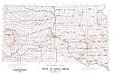
Viewing Options
Main Author:
National Map Company
Title/Description:
South Dakota
Publication Info:
Indianapolis: National Map Company, 1921; from Auto Trails and Commercial Survey of the United States
Viewing Options
Main Author:
C.S. Hammond
Title/Description:
South Dakota
Publication Info:
New York: C.S. Hammond and Company, 1922; from The New World Looseleaf Atlas
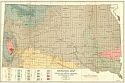
Viewing Options
Main Author:
South Dakota Geological and Natural History Survey
Title/Description:
South Dakota
Publication Info:
Vermillion: South Dakota Geological and Natural History Survey, 1922; Bulletin No. 10
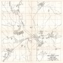
Viewing Options
Main Author:
U.S. Geological Survey
Title/Description:
South Dakota, Central Black Hills Region
Publication Info:
Washington: Department of the Interior, U.S. Geological Survey, 1922
Viewing Options
Main Author:
Cram, George F.
Title/Description:
South Dakota
Publication Info:
Chicago: George F. Cram Company, 1923; from Cram's Unrivaled Atlas of the World
Viewing Options
Main Author:
Funk and Wagnalls Company
Title/Description:
South Dakota
Publication Info:
New York: Funk and Wagnalls Company, 1923; from Atlas of the World and Gazetteer
Viewing Options
Main Author:
Reynolds, Francis J.
Title/Description:
South Dakota
Publication Info:
New York: P.F. Collier and Son Company, 1924; from The New World Atlas and Gazetteer
Viewing Options
Main Author:
Clason Map Company
Title/Description:
Best Roads of South Dakota
Publication Info:
Chicago: Clason Map Company, c. 1927; from Clason's Touring Atlas
Viewing Options
Main Author:
Rand McNally and Company
Title/Description:
South Dakota
Publication Info:
Chicago: Rand McNally and Company, 1925; from Premier Atlas of the World
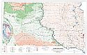
Viewing Options
Main Author:
National Map Company
Title/Description:
South Dakota
Publication Info:
Indianapolis: National Map Company, 1930; from Official Paved Road and Commercial Survey of the United States
Viewing Options
Main Author:
Clason Map Company
Title/Description:
Clason's Road Map of South Dakota
Publication Info:
Denver: The Clason Map Company, 1930; from Clason's Touring Atlas of the United States and Canada

Viewing Options
Main Author:
C.S. Hammond and Company
Title/Description:
South Dakota
Publication Info:
New York: C.S. Hammond and Company, c. 1930; from The New World Loose Leaf Atlas, Sixth Edition
Viewing Options
Main Author:
C.S. Hammond and Company
Title/Description:
South Dakota
Publication Info:
New York: C.S. Hammond and Company, c. 1930; from The New World Loose Leaf Atlas, Sixth Edition
Viewing Options
Main Author:
Geographical Publishing Company
Title/Description:
South Dakota
Publication Info:
Chicago: Geographical Publishing Company1931; from Commercial Atlas of the World
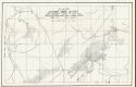
Viewing Options
Main Author:
U.S. Geological Survey
Title/Description:
Geologic Map of the Vicinity of the Outlet of Glacial Lake Agassiz, North Dakota, South Dakota and Minnesota
Publication Info:
Washington: Department of the Interior, US Geological Survey, 1932; Professional Paper 161, Plate 5
Viewing Options
Main Author:
Kirby, Maurice E.
Title/Description:
Geologic Map, State of South Dakota
Publication Info:
Vermillion: South Dakota State Geological Survey, 1932
Viewing Options
Main Author:
Branom, Frederick K. and Lloyd Edwin Smith
Title/Description:
South Dakota
Publication Info:
Chicago: Geographical Publishing Company, 1936; from Capper's 1936 Atlas of the World
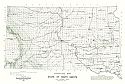
Viewing Options
Main Author:
Rand McNally and Company
Title/Description:
Standard Map of South Dakota
Publication Info:
Chicago: Rand McNally and Company, 1936
Viewing Options
Main Author:
South Dakota State Planning Board
Title/Description:
Map Showing Approximate Locations of Mining Claims, Custer District, Custer County, South Dakota
Publication Info:
Rapid City: South Dakota School of Mines, 1937; Bulletin 17
Viewing Options
Main Author:
South Dakota State Planning Board
Title/Description:
Keystone Mining District Showing Approximate Locations of Mining Claims
Publication Info:
Rapid City: South Dakota School of Mines, 1937; Bulletin 17
Viewing Options
Main Author:
South Dakota State Planning Board
Title/Description:
Map of Hill City Mining District Showing Approximate Location of Mining Claims
Publication Info:
Rapid City: South Dakota School of Mines, 1937; Bulletin 17
Viewing Options
Title/Description:
Physiographic Features of the State of South Dakota
Publication Info:
South Dakota State Geological Survey, 1938

Viewing Options
Main Author:
U.S. Geological Survey
Title/Description:
State of South Dakota
Publication Info:
Washington: Department of the Interior, U.S. Geological Survey, 1940; compiled 1920 and 1921
Viewing Options
Main Author:
U.S. Geological Survey
Title/Description:
Geologic map and section of the Tinton District, South Dakota
Publication Info:
Washington: Department of the Interior, US Geological Survey, 1941; Bulletin 922, Plate 90
Viewing Options
Main Author:
Geographical Publishing Company
Title/Description:
South Dakota
Publication Info:
Chicago: Geographical Publishing Company, 1942; from The New International Atlas of the World, War Edition
Viewing Options
Main Author:
State Geological Survey
Title/Description:
Physical Features, State of South Dakota
Publication Info:
Vermillion: South Dakota Geological Survey, 1943; Bulletin No. 13
Viewing Options
Main Author:
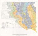
Petsch, Bruno C.
Title/Description:
Geologic Map, State of South Dakota
Publication Info:
Vermillion: State Geological Survey, 1953
Viewing Options
Main Author:
Petsch, Bruno C.
Title/Description:
Structure Map, State of South Dakota
Publication Info:
Vermillion: South Dakota Geological Survey, 1953
Viewing Options
Main Author:
Petsch, Bruno C.
Title/Description:
Pre-Cambrian surface, State of South Dakota
Publication Info:
Vermillion: South Dakota Geological Survey, 1953
Viewing Options
Main Author:
U.S. Geological Survey
Title/Description:
Map of the Glaciated Region of South Dakota
Publication Info:
Washington: Department of the Interior, U.S. Geological Survey; Professional Paper 262

