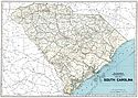
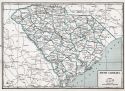
Viewing Options
Main Author:
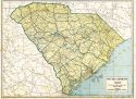
Geographical Publishing Company
Title/Description:
South Carolina
Publication Info:
Chicago: Geographical Publishing Company1931; from Commercial Atlas of the World
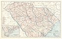
Viewing Options
Main Author:
C.S. Hammond and Company
Title/Description:
South Carolina
Publication Info:
New York: C.S. Hammond and Company, 1931
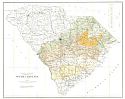
Viewing Options
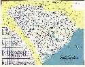
Main Author:
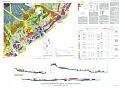
Cooke, C. Wythe
Title/Description:
Cretaceous and Tertiary Formations of South Carolina
Publication Info:
Washington: Department of the Interior, US Geological Survey, 1936; Bulletin 867. Plate2
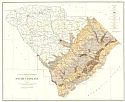
Viewing Options
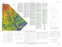
Main Author:
Cooke, C. Wythe
Title/Description:
Quaternary Formations and Terraces of South Carolina
Publication Info:
Washington: Department of the Interior, US Geological Survey, 1936; Bulletin 867. Plate 1
Viewing Options
Main Author:
Branom, Frederick K. and Lloyd Edwin Smith
Title/Description:
South Carolina
Publication Info:
Chicago: Geographical Publishing Company, 1936; from Capper's 1936 Atlas of the World
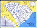
Viewing Options
Main Author:
Rand McNally and Company
Title/Description:
Standard Map of South Carolina
Publication Info:
Chicago: Rand McNally and Company, 1936

Viewing Options
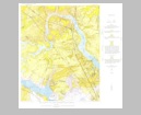
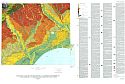
Main Author:
U.S. Geological Survey
Title/Description:
Geologic map of the Aiken area, South Carolina
Publication Info:
Washington: Department of the Interior, US Geological Survey, 1938; Bulletin 901. Plate 2
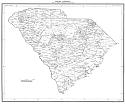
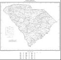
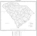
Viewing Options
Main Author:
South Carolina State Highway Department
Title/Description:
Map of South Carolina State Highway System
Publication Info:
[Columbia: South Carolina State Highway Department], 1939
Viewing Options
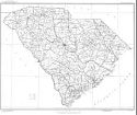
Main Author:
U.S. Department of Commerce, Bureau of the Census
Title/Description:
South Carolina Minor Civil Divisions - Townships and School Districts (1940 Census)
Publication Info:
Washington: U.S. Government Printing Office, 1941
Viewing Options
Main Author:
Geographical Publishing Company
Title/Description:
South Carolina
Publication Info:
Chicago: Geographical Publishing Company, 1942; from The New International Atlas of the World, War Edition
Viewing Options
Main Author:
Hassan, A.F.
Title/Description:
South Carolina
Publication Info:
Washington: Department of the Interior, U.S. Geological Survey, 1943
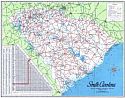
Viewing Options
Main Author:
State Highway Department
Title/Description:
South Carolina State Highway Primary System
Publication Info:
Columbia: State Highway Department, 1950
Original Source:
Murray Hudson
Viewing Options
Main Author:
U.S. Department of Commerce, Bureau of the Census
Title/Description:
South Carolina minor Divisions- Townships and School Districts
Publication Info:
Washington: U.S. Government Printing Office, 1952
Viewing Options
Main Author:
U.S. Geological Survey
Title/Description:
Geologic Map of the Ladson Quadrangle, South Carolina
Publication Info:
Washington: Department of the Interior, U.S. Geological Survey, 1959; Bulletin 1079 Plate 1
Viewing Options
Main Author:
U.S. Department of Commerce, Bureau of the Census
Title/Description:
South Carolina County Divisions (1960 census)
Publication Info:
Washington: U.S. Government Printing Office, 1961
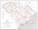
Viewing Options
Main Author:
State Highway Commission
Title/Description:
South Carolina State Highway Primary System
Publication Info:
State Highway Commission, 1962
Viewing Options
Main Author:
U.S. Post Office Depatment
Title/Description:
State Postal Map, South Carolina
Publication Info:
Washington: U.S. Government Printing Office, 1970
Viewing Options
Main Author:
McCartan, Lucy, E.M. Lemon, Jr., and R.E. Weems
Title/Description:
Geologic Map of the Area Between Charleston and Orangeburg, South Carolina
Publication Info:
Washington: Department of the Interior, U.S. Geological Survey; Miscellaneous Investigations Series (Sheet 1 of 2) Map I-1472
Viewing Options
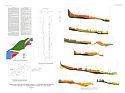
Main Author:
Owens, James P., Andrew E. Grosz and Julie C. Fisher
Title/Description:
Aeroradiometric Map and Geologic Interpretation of Part of the Florence and Georgetown 1 x 2 Quadrangles, South Carolina
Publication Info:
Washington: Department of the Interior, U.S. Geological Survey, 1989; Miscellaneous Investigations Series Map I-1948-B
Viewing Options
Main Author:
Owens, James P.
Title/Description:
Geologic Map of the Cape Fear Region, Florence 1 x 2 Quadrangle and Northern Half of the Georgetown 1 x 2 Quadrangle, North Carolina and South Carolina
Publication Info:
Washington: Department of the Interior, U.S. Geological Survey, 1989; Miscellaneous Investigations Series Map I-1948-A (Sheet 1 of 2)
Viewing Options
Main Author:
Owens, James P.
Title/Description:
Geologic Map of the Cape Fear Region, Florence 1 x 2 Quadrangle and Northern Half of the Georgetown 1 x 2 Quadrangle, North Carolina and South Carolina
Publication Info:
Washington: Department of the Interior, U.S. Geological Survey, 1989; Miscellaneous Investigation Series Map I-1948-A (Sheet 2 of 2)

