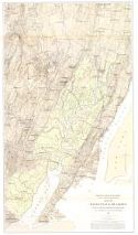
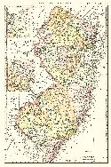
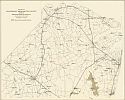
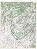
Viewing Options
Main Author:
Vermeule, C.C.
Title/Description:
Map of Hackensack Meadows to Illustrate Report on Drainage
Publication Info:
Geological Survey of New Jersey, 1896
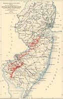
Viewing Options
Main Author:
Geological Survey of New Jersey
Title/Description:
Map showing the Distribution of the Pensauken Formation Within area Where Detailed Mapping has been Done
Publication Info:
Trenton: Geological Survey of New Jersey, 1896; from the Annual Report of 1895
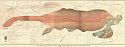
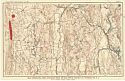
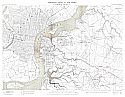
Viewing Options
Main Author:
Westgate, Lewis G.
Title/Description:
A Geological map of the Northern Part of Jenny Jump Mountain
Publication Info:
Trenton: Geological Survey of New Jersey, 1896; from the Annual Report of 1895
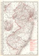
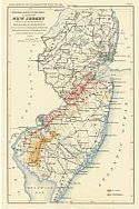
Viewing Options
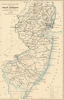
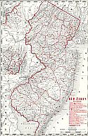
Main Author:
Rand McNally and Company
Title/Description:
New Jersey
Publication Info:
Chicago: Rand McNally and Company, 1896; from Enlarged Business Atlas
Viewing Options
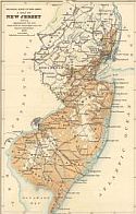
Main Author:
Rand McNally and Company
Title/Description:
New Jersey
Publication Info:
Chicago: Rand McNally and Company, 1896; from Indexed Atlas of the World
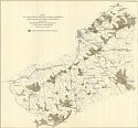
Viewing Options
Title/Description:
Map Showing the Distribution of Eruptive Rocks in Sussex Co., N.J.
Publication Info:
Trenton: Geological Survey of New Jersey, 1897; from the Annual Report of 1896
Viewing Options
Main Author:
Knapp, George N.
Title/Description:
Map of Western Part of Salem and Cumberland Counties Showing Distribution of Gravel
Publication Info:
Trenton: Geological Survey of New Jersey, 1897; from the Annual Report of 1896
Viewing Options
Main Author:
Knapp, George N.
Title/Description:
Map of Western Burlington, Camden and Gloucester Counties Showing Distribution of Gravels Available for Roads
Publication Info:
Trenton: Geological Survey of New Jersey, 1897; from the Annual Report of 1896
Viewing Options
Main Author:
Knapp, George N.
Title/Description:
Map of Northern Monmouth County Showing Distribution of Gravel
Publication Info:
Trenton: Geological Survey of New Jersey, 1897; from the Annual Report of 1896
Viewing Options
Main Author:
Geological Survey of New Jersey
Title/Description:
A Map of New Jersey Showing the Distribution of the Pensauken Formation so far as known, and the Fravel Member of the Beacon Hill Formation
Publication Info:
Trenton: Geological Survey of New Jersey, 1897; from the Annual Report of 1896

Viewing Options
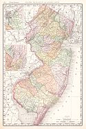
Main Author:
Cram, George F.
Title/Description:
New Jersey
Publication Info:
Chicago: George F. Cram, 1898; from Cram's Universal Atlas, Geographical, Astronomical and Historical
Viewing Options
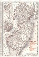
Main Author:
Rand McNally & Company
Title/Description:
Rand McNally and Co.'s New 11 x 14 Map of New Jersey
Publication Info:
Chicago: Rand McNally & Co., 1898; from Rand McNally and Co.'s Library Atlas of the World
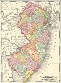
Viewing Options
Main Author:
Mast, Crowell and Kirckpatrick
Title/Description:
Map of New Jersey
Publication Info:
Philadelphia: Mast, Crowell, & Kirkpatrick, 1898; from Peerless Atlas of the World
Viewing Options
Main Author:
Salisbury, Rollin D.
Title/Description:
A Map of New Jersey Showing Lines of Equal Magnetic Declination from 1888
Publication Info:
Trenton: Geological Survey of New Jersey, 1898; from the Physical Geography of New Jersey, Vol 4
Viewing Options
Main Author:
Salisbury, Rollin D.
Title/Description:
Map of New Jersey showing approximately the area which would be submerged were the land to sink 100 feet
Publication Info:
Trenton: Geological Survey of New Jersey, 1898; from the Physical Geography of New Jersey, vol 4
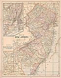
Viewing Options
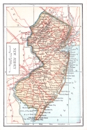
Main Author:
Rand McNally and Company
Title/Description:
New Jersey
Publication Info:
Chicago: Rand McNally and Company, c.1898
Viewing Options
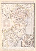
Main Author:
Rand McNally & Co.
Title/Description:
Rand McNally & Co.'s New Jersey RailRoads
Publication Info:
Chicago: Rand McNally & Co., 1899

Viewing Options
Main Author:
Smith, Benjamin E.
Title/Description:
New Jersey
Publication Info:
New York: The Century Company, 1899; from The Century Atlas of the World
Viewing Options
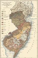
Main Author:
Geological Survey of New Jersey
Title/Description:
Preliminary Map of the Surface Formations of the State
Publication Info:
Trenton: Geological Survey of New Jersey, 1899; from the Annual Report of 1898
Viewing Options
Main Author:
Cram, George F.
Title/Description:
New Jersey
Publication Info:
Chicago: George F. Cram, 1899; from The Standard American Railway System Atlas
Viewing Options
Main Author:
The Bradstreet Company
Title/Description:
New Jersey
Publication Info:
New York: The Bradstreet Company, 1899; from Bradstreet's Pocket Atlas of the United States
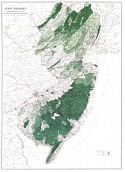
Viewing Options
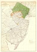
Main Author:
Geological Survey of New Jersey
Title/Description:
New Jersey Showing Forest Areas and its Relation to the Principal Watersheds
Publication Info:
Trenton: Geological Survey of New Jersey, 1900
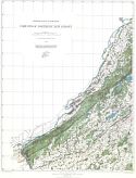
Northwest Sheet
North Central Sheet
Northeast Sheet
Southwest Sheet
South Central Sheet
Southeast Sheet
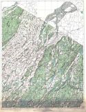
Main Author:
Geological Survey of New Jersey
Title/Description:
Forests of Northern New Jersey
Publication Info:
Trenton: Geological Survey of New Jersey, 1900
Viewing Options
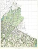
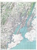
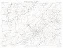
Main Author:
Geological Survey of New Jersey
Title/Description:
Camden Sheet
Publication Info:
Geological Survey of New Jersey, 1900
Viewing Options
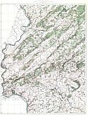
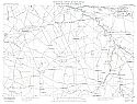
Main Author:
Geological Survey of New Jersey
Title/Description:
Woodbury Sheet
Publication Info:
Geological Survey of New Jersey, 1900
Viewing Options
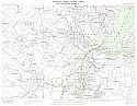
Main Author:
Geological Survey of New Jersey
Title/Description:
Plainfield Sheet
Publication Info:
Geological Survey of New Jersey, 1900
Viewing Options
Main Author:
Geological Survey of New Jersey
Title/Description:
Mount Holly Sheet
Publication Info:
Geological Survey of New Jersey, 1900
Viewing Options
Main Author:
Geological Survey of New Jersey
Title/Description:
Elizabeth Sheet
Publication Info:
Geological Survey of New Jersey, 1900
Viewing Options
Main Author:
Rand McNally & Company
Title/Description:
New Jersey Railroads
Publication Info:
Chicago: Rand McNally & Company, 1900
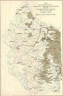
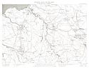
Viewing Options
Main Author:
Salisbury, Rollin D. from the annual report of the State Geologist, 1893
Title/Description:
Map Showing the Distribution of Intra-Morainic and Extra-Morainic Glacial Drift
Publication Info:
Geological Survey of New Jersey, 1893

