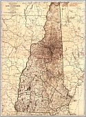
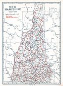
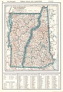
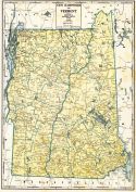
Viewing Options
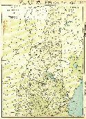
Main Author:
Rand McNally and Company
Title/Description:
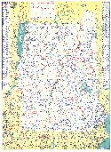
New Hampshire
Publication Info:
Chicago: Rand McNally and Company, 1921; from the Commercial Atlas of America
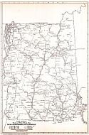
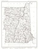
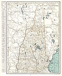
Viewing Options
Main Author:
Rand McNally and Company
Title/Description:
New Hampshire and Vermont- Black and White Mileage Map
Publication Info:
Chicago: Rand McNally and Company, 1921; from the Commercial Atlas of America
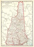
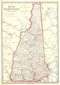
Viewing Options
Main Author:
Cram, George F.
Title/Description:
New Hampshire
Publication Info:
Chicago: George F. Cram Company, 1921; from Cram's Unrivaled Atlas of the World
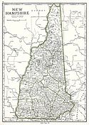
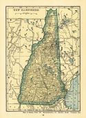
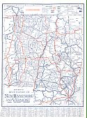
Viewing Options
Main Author:
National Map Company
Title/Description:
New Hampshire
Publication Info:
Indianapolis: National Map Company, 1921; from Auto Trails and Commercial Survey of the United States
Viewing Options
Main Author:
National Map Company
Title/Description:
New Hampshire
Publication Info:
Indianapolis: National Map Company, 1921; from Auto Trails and Commercial Survey of the United States
Viewing Options
Main Author:
U.S. Geological Survey
Title/Description:
New Hampshire and Vermont
Publication Info:
Washington: Department of the Interior, U.S. Geological Survey, 1922
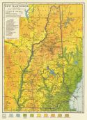
Viewing Options
Main Author:
Cram, George F.
Title/Description:
New Hampshire
Publication Info:
Chicago: George F. Cram Company, 1923; from Cram's Unrivaled Atlas of the World
Viewing Options
Main Author:
Funk and Wagnalls Company
Title/Description:
New Hampshire
Publication Info:
New York: Funk and Wagnalls Company, 1923; from Atlas of the World and Gazetteer
Viewing Options
Main Author:
Reynolds, Francis J.
Title/Description:
New Hampshire and Vermont
Publication Info:
New York: P.F. Collier and Son Company, 1924; from The New World Atlas and Gazetteer
Viewing Options
Main Author:
Rand McNally and Company
Title/Description:
New Hampshire
Publication Info:
Chicago: Rand McNally and Company, 1925; from Premier Atlas of the World
Viewing Options
Main Author:
Clason Map Company
Title/Description:
Best Roads of New Hampshire and Vermont
Publication Info:
Chicago: Clason Map Company, c. 1927; from Clason's Touring Atlas
Viewing Options
Main Author:
C.S. Hammond and Company
Title/Description:
New Hampshire
Publication Info:
New York: C.S. Hammond and Company, c. 1930; from The New World Loose Leaf Atlas, Sixth Edition
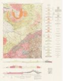
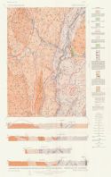
Viewing Options
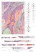
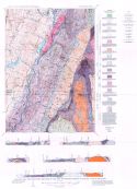
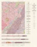
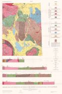
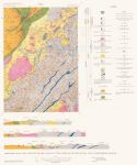
Main Author:
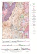
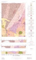
Billings, Marland
Title/Description:
Geologic Map and Structure Sections of the Moosilauke Quadrangle, New Hampshire
Publication Info:
Concord: State Planning and Development Commission, 1935
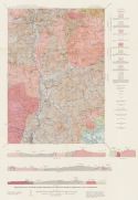
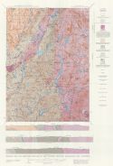
Viewing Options
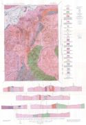
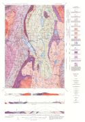
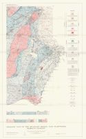
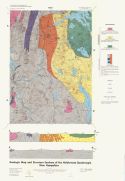
Main Author:
Billings, Marland P. and Charles R. Williams
Title/Description:
Geologic Map and Structure Sections of the Franconia Quadrangle, New Hampshire
Publication Info:
Concord: State Planning and Development Commission, 1935
Viewing Options
Main Author:
Branom, Frederick K. and Lloyd Edwin Smith
Title/Description:
New Hampshire and Vermont
Publication Info:
Chicago: Geographical Publishing Company, 1936; from Capper's 1936 Atlas of the World
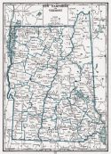
Viewing Options
Main Author:
New Hampshire State Planning and Development Commission
Title/Description:
Map of New Hampshire and Vermont
Publication Info:
New York: General Drafting Company, 1936
Original Source:
Murray Hudson
Viewing Options
Main Author:
Rand McNally and Company
Title/Description:
Standard Map of New Hampshire
Publication Info:
Chicago: Rand McNally and Company, 1936
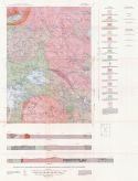
Viewing Options
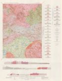
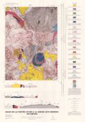
Main Author:
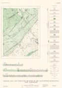
Hadley, Jarvis B. and Carleton A. Chapman
Title/Description:
Geologic Map and Structure Sections of the Mt. Cube Quadrangle, New Hampshire
Publication Info:
Concord: State Planning and Development Commission, 1939
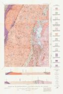
Viewing Options
Main Author:
Hadley, Jarvic B. and Carleton A. Chapman
Title/Description:
Geologic Map and Structure Sections of the Mascoma Quadrangle, New Hampshire
Publication Info:
Concord: State Planning and Development Commission, 1939
Viewing Options
Main Author:
Smith, Althea Page, Louise Kingsley and Alonzo Quinn
Title/Description:
Geologic Map and Structure Sections of the Mount Chocorua Quadrangle, New Hampshire
Publication Info:
Concord: New Hampshire Planning and Development Commission, 1939
Viewing Options
Main Author:
Standard Oil of New York
Title/Description:
New Hampshire and Vermont
Publication Info:
New York: General Drafting Company, 1939
Original Source:
Murray Hudson
Viewing Options
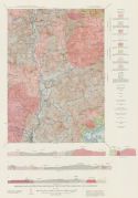
Main Author:
Page, Lincoln R.
Title/Description:
Geologic Map and Structure Sections of the Rumney Quadrangle, New Hampshire
Publication Info:
Concord: State Planning and Development, 1940
Viewing Options
Main Author:
Fowler-Billings, Katharin and Louise Kings
Title/Description:
Geologic Map and Structure Sections of the Cardigan Quadrangle, New Hampshire
Publication Info:
Concord: State Planning and Development Commission, 1942
Viewing Options
Main Author:
Quinn, Alonzo
Title/Description:
Geologic Map and Structure Sections of the Winnipesaukee Quadrangle, New Hampshire
Publication Info:
Concord: New Hampshire Planning and Development Commission, 1941
Viewing Options
Main Author:
Geographical Publishing Company
Title/Description:
New Hampshire and Vermont
Publication Info:
Chicago: Geographical Publishing Company, 1942; from The New International Atlas of the World, War Edition
Viewing Options
Main Author:
Billing, Marland P. et. al.
Title/Description:
Geologic Map and Structure Sections of the Mt. Washington Quadrangle, New Hampshire
Publication Info:
Concord: State Planning and Development Commission, 1946
Viewing Options
Main Author:
Moke, Charles B.
Title/Description:
Geologic Map and Structure Sections of the Plymouth Quadrangle, New Hampshire
Publication Info:
Concord: State Planning and Development Commission, 1946
Viewing Options
Main Author:
Kruger, Fredrick C.
Title/Description:
Geologic Map and Structure Sections of the Bellows Falls Quadrangle, New Hampshire
Publication Info:
Concord: State Planning and Development Commission, 1946
Viewing Options
Main Author:
Chapman, Randolph W.
Title/Description:
Geologic Map and Structure Sections of the Percy Quadrangle, New Hampshire
Publication Info:
Concord: State Planning and Development Commission, 1949
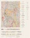
Viewing Options
Main Author:
Fowler-Billings, Katharine
Title/Description:
Geologic Map and Structure Sections of the Monadnock Quadrangle, New Hampshire
Publication Info:
Concord: State Planning and Development Commission, 1949
Viewing Options
Main Author:
Moore, George E. Jr.
Title/Description:
Geologic Map and Structure Sections of the Keene and Brattleboro Quadrangles, New Hampshire
Publication Info:
Concord: State Planning and Development Commission, 1949
Viewing Options
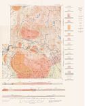
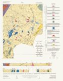
Main Author:
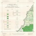
Goldthwait, James Walter
Title/Description:
Surficial Geology of New Hampshire
Publication Info:
Concord: New Hampshire State Planning and Development Commission, 1950
Viewing Options
Main Author:
Freedman, Jacob
Title/Description:
Geologic Map and Structure Sections of the Mt. Pawkuckaway Quadrangle, New Hampshire
Publication Info:
Concord: State Planning and Development Commission, 1950
Viewing Options
Main Author:
Heald, Milton T.
Title/Description:
Geologic Map and Structure Sections of the Lovewell Mountain Quadrangle, New Hampshire
Publication Info:
Concord: State Planning and Development Commission, 1950
Viewing Options
Main Author:
Quinn, Alonzo
Title/Description:
Geologic Map and Structure Sections of the Wolfeboro Quadrangle, New Hampshire
Publication Info:
Concord: State Planning and Development Commission, 1953
Viewing Options
Main Author:
Chapman, Carleton L.
Title/Description:
Geologic Map and Structure Sections of the Sunapee Quadrangle, New Hampshire
Publication Info:
Concord: State Planning and Development Commission, 1953
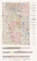
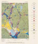
Viewing Options
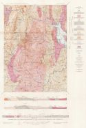
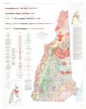
Main Author:
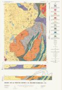
Billings, Marland P.
Title/Description:
Geologic Map of New Hampshire
Publication Info:
Concord: New Hampshire State Planning and Development Commission, 1956
Viewing Options
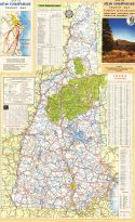
Main Author:
New Hampshire State Planning and Development Commission
Title/Description:
1958-59 New Hampshire Tourist Map
Publication Info:
Concord: New Hampshire State Planning and Development Commission, 1958
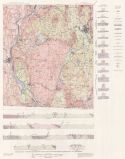
Viewing Options
Title/Description:
Geologic Map and Structure Sections of the Hanover Quadrangle, Vermont and New Hampshire
Publication Info:
Concord: State Planning and Development Commission, 1958
Viewing Options
Main Author:
U.S. Geological Survey
Title/Description:
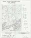
Map of Surficial Geology of the Canaan Area, New Hampshire
Publication Info:
Washington: Department of the Interior, U.S. Geological Survey, 1958; Bulletin 1061c Plate 4
Viewing Options
Main Author:
Stewart, Glenn W.
Title/Description:
Geological Map and Structure Sections, Alton Quadrangle, New Hampshire
Publication Info:
Concord: The New Hampshire State Planning and Development Commission, 1961
Viewing Options
Main Author:
Hatch, Norman Lowrie, Jr.
Title/Description:
Geologic Map and Structure Sections of the Dixville Quadrangle, New Hampshire
Publication Info:
Concord: New Hampshire Department of Resources and Economic Development, 1963; Bulletin No. 1
Viewing Options
Main Author:
Sriramadas, Alura
Title/Description:
Geologic Map and Structure Sections of the Manchester Quadrangle, New Hampshire
Publication Info:
Concord: New Hampshire Department of Resources and Economic Development, 1966
Viewing Options
Main Author:
Swift, Charles Moore, Jr.
Title/Description:
Geologic Map Southeast Portion of the Averill Quadrangle, New Hampshire - Vermont
Publication Info:
Concord: New Hampshire Department of Resources and Economic Development, 1966
Viewing Options
Main Author:
Wilson, James Robert
Title/Description:
Geologic Map and Structure Sections of the Ossipee Lake Quadrangle, New Hampshire
Publication Info:
Concord: New Hampshire Department of Resources and Economic Development, 1969; Bulletin No. 3
Viewing Options
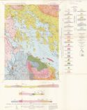
Main Author:
Novotny, Robert F.
Title/Description:
Geologic Map of the Seacoast Region, New Hampshire, Bedrock Geology
Publication Info:
Concord: New Hampshire Department of Resources and Economic Development, 1969

Viewing Options
Main Author:
Greene, Robert C.
Title/Description:
Geologic Map and Structure Sections of the Peterborough Quadrangle, New Hampshire
Publication Info:
Concord: New Hampshire Department of Resources and Economic Development, 1970; Bulletin No. 4
Viewing Options
Main Author:
Sundeen, Daniel Alvin
Title/Description:
Geologic Map and Structure Sections of the Haverhill Quadrangle, New Hampshire
Publication Info:
Concord: New Hampshire Department of Resources and Economic Development, 1971; Bulletin No. 5
Viewing Options
Main Author:
Newton, Robert M.
Title/Description:
Surficial Geologic Map of the Ossipee Lake Quadrangle, New Hampshire
Publication Info:
Concord: Department of Resources and Economic Development, 1974
Viewing Options
Main Author:
Billings, Marland P. and Katharine Fowler-Billings
Title/Description:
Geologic Map and Structure Sections of the Gorham Quadrangle, New Hampshire - Maine
Publication Info:
Concord: New Hampshire Department of Resources and Economic Development, 1975; Bulletin No. 6
Viewing Options
Main Author:
England, Evan John
Title/Description:
Geologic Map and Structure Section of the Holderness Quadrangle, New Hampshire
Publication Info:
Concord: New Hampshire Department of Resources and Economic Development, 1976; Bulletin No.7
Viewing Options
Main Author:
Henderson, Donald H., et. al.
Title/Description:
Geologic Map and Structure Sections of the Crawford Notch Quadrangle, New Hampshire
Publication Info:
Concord: New Hampshire Department of Resources and Economic Development, 1977
Viewing Options
Main Author:
Moke, Charles B.
Title/Description:
Geologic Map and Structure Sections of the Plymouth Quadrangle, New Hampshire
Publication Info:
Concord: New Hampshire Department of Resources and Economic Development, 1979
Viewing Options
Main Author:
Nielson, Dennis L.
Title/Description:
Geologic Map and Structure Sections of the Hillsboro Quadrangle, New Hampshire
Publication Info:
Concord: New Hampshire Department of Resources and Economic Development, 1981; Bulletin No. 8

