Viewing Options
Main Author:
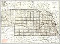
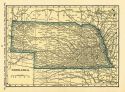
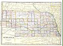
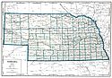
Rand McNally and Company
Title/Description:
Nebraska
Publication Info:
Chicago: Rand McNally and Company, 1921; from the Commercial Atlas of America
Viewing Options
Main Author:
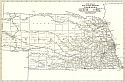
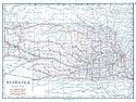
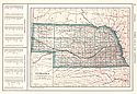
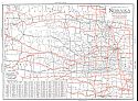
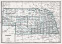
Rand McNally and Company
Title/Description:
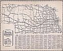
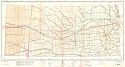
Nebraska- Black and White Mileage Map
Publication Info:
Chicago: Rand McNally and Company, 1921; from the Commercial Atlas of America
Viewing Options
Main Author:
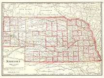
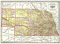
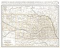
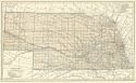
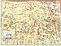
Cram, George F.
Title/Description:
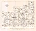
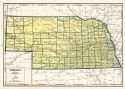
Nebraska
Publication Info:
Chicago: George F. Cram Company, 1921; from Cram's Unrivaled Atlas of the World
Viewing Options
Main Author:
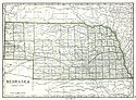
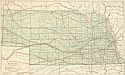
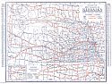
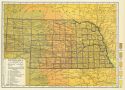
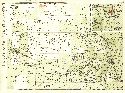
National Map Company
Title/Description:
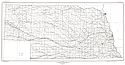
Nebraska
Publication Info:
Indianapolis: National Map Company, 1921; from Auto Trails and Commercial Survey of the United States
Viewing Options
Main Author:
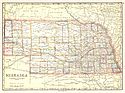
National Map Company
Title/Description:
Nebraska
Publication Info:
Indianapolis: National Map Company, 1921; from Auto Trails and Commercial Survey of the United States
Viewing Options
Main Author:
The Geographical Publishing Co.
Title/Description:
Nebraska
Publication Info:
Chicago: The Geographical Publishing Co., 1922; from New International Atlas of the World
Viewing Options
Main Author:
C.S. Hammond and Company
Title/Description:
Nebraska
Publication Info:
New York: C.S. Hammond and Company, 1922; from the New World Loose-leaf Atlas
Viewing Options
Main Author:
Cram, George F.
Title/Description:
Nebraska
Publication Info:
Chicago: George F. Cram Company, 1923; from Cram's Unrivaled Atlas of the World
Viewing Options
Main Author:
Funk and Wagnalls Company
Title/Description:
Nebraska
Publication Info:
New York: Funk and Wagnalls Company, 1923; from Atlas of the World and Gazetteer
Viewing Options
Main Author:
Reynolds, Francis J.
Title/Description:
Nebraska
Publication Info:
New York: P.F. Collier and Son Company, 1924; from The New World Atlas and Gazetteer
Viewing Options
Main Author:
Rand McNally and Company
Title/Description:
Nebraska
Publication Info:
Chicago: Rand McNally and Company, 1925; from Premier Atlas of the World
Viewing Options
Main Author:
Clason Map Company
Title/Description:
Best Roads of Nebraska
Publication Info:
Chicago: Clason Map Company, c. 1927; from Clason's Touring Atlas
Viewing Options
Main Author:
National Map Company
Title/Description:
Nebraska
Publication Info:
Indianapolis: National Map Company, 1930; from Official Paved Road and Commercial Survey of the United States
Viewing Options
Main Author:
Clason Map Company
Title/Description:
Clason's Road Map of Nebraska
Publication Info:
Denver: The Clason Map Company, 1930; from Clason's Touring Atlas of the United States and Canada
Viewing Options
Main Author:
C.S. Hammond and Company
Title/Description:
Nebraska
Publication Info:
New York: C.S. Hammond and Company, c. 1930; from The New World Loose Leaf Atlas, Sixth Edition
Viewing Options
Main Author:
C.S. Hammond and Company
Title/Description:
Nebraska
Publication Info:
New York: C.S. Hammond and Company, c. 1930; from The New World Loose Leaf Atlas, Sixth Edition
Viewing Options
Main Author:
Geographical Publishing Company
Title/Description:
Nebraska
Publication Info:
Chicago: Geographical Publishing Company, 1931; from Commercial Atlas of the World
Viewing Options
Main Author:
Branom, Frederick K. and Lloyd Edwin Smith
Title/Description:
Nebraska
Publication Info:
Chicago: Geographical Publishing Company, 1936; from Capper's 1936 Atlas of the World
Viewing Options
Main Author:
Shell Oil Company
Title/Description:
Official Road Map, Nebraska
Publication Info:
Chicago: H.M. Gousha Company, 1936
Original Source:
Murray Hudson
Viewing Options
Main Author:
Rand McNally and Company
Title/Description:
Standard Map of Nebraska
Publication Info:
Chicago: Rand McNally and Company, 1936
Viewing Options
Main Author:
Mid-West Map Company
Title/Description:
Sears Official Road Map, Nebraska
Publication Info:
Aurora, MO: Mid-West Map Company, c.1937
Viewing Options
Main Author:
U.S. Geological Survey
Title/Description:
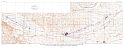
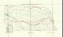
Map showing the location of Irrigation and domestic wells and river pumping plants in the Platte Valley, Nebraska, with lines indicating depth to water level
Publication Info:
Washington: Department of the Interior, U.S. Geological Survey, 1938; Water Supply Paper No. 779 Plate 10
Viewing Options
Main Author:
U.S. Geological Survey
Title/Description:
Map showing contours on the water table for south-central Nebraska
Publication Info:
Washington: Department of the Interior, U.S. Geological Survey, 1938; Water Supply Paper No. 779 Plate 8
Viewing Options
Main Author:
U.S. Geological Survey
Title/Description:
State of Nebraska
Publication Info:
Washington: Department of the Interior, U.S. Geological Survey, 1939; compiled 1920-1921
Viewing Options
Main Author:
U.S. Coast and Geodetic Survey
Title/Description:
Lincoln Sectional Aeronautical Chart
Publication Info:
Washington: U.S. Coast and Geodetic Survey, 1942
Viewing Options
Main Author:
Geographical Publishing Company
Title/Description:
Nebraska
Publication Info:
Chicago: Geographical Publishing Company, 1942; from The New International Atlas of the World, War Edition
Viewing Options
Main Author:
Bureau of the Census
Title/Description:
Nebraska Irrigation by Drainage Basin, 1940
Publication Info:
Washington: U.S. Government Printing Office, 1942
Viewing Options
Title/Description:
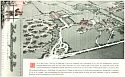
Father Flanagan's Boys Town
Publication Info:
Boys Town, NE: 1948
Viewing Options
Main Author:
U.S. Geological Survey
Title/Description:
Geologic Map of Franklin County, Nebraska
Publication Info:
Washington: Department of the Interior, U.S. Geological Survey, 1964; Bulletin 1165 Plate 1
Viewing Options
Main Author:
U.S. Geological Survey
Title/Description:
Geologic Map of Webster County, Nebraska
Publication Info:
Washington: Department of the Interior, U.S. Geological Survey, 1964; Bulletin 1165 Plate 2
Viewing Options
Main Author:
U.S. Geological Survey
Title/Description:
Geologic Map of Nuckolis County, Nebraska
Publication Info:
Washington: Department of the Interior, U.S. Geological Survey, 1964; Bulletin 1165 Plate 3

