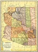
Viewing Options
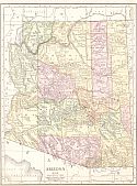
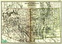
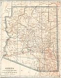
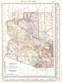
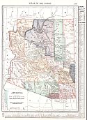
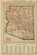
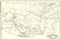
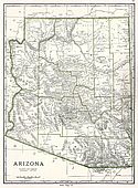
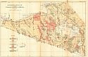
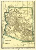
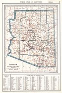
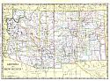
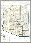
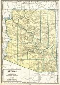
Main Author:
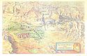
C.S. Hammond and Company
Title/Description:
Arizona
Publication Info:
New York: C.S. Hammond and Company, 1911; from Hammond's Modern Atlas of the World
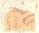
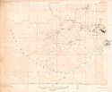
Viewing Options
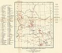
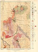
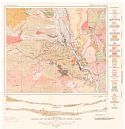
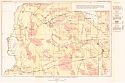
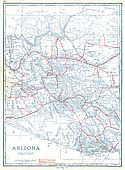
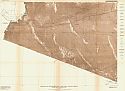
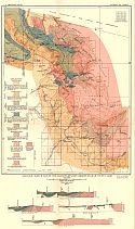
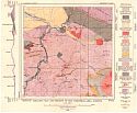
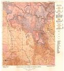
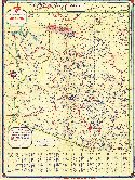
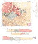
Main Author:
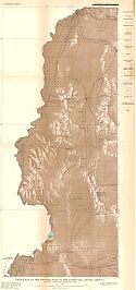
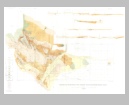
U.S. Geological Survey
Title/Description:
Geological Reconnaissance Map of a Part of Central Western Arizona
Publication Info:
Washington: Department of the Interior, U.S. Geological Survey, 1911; Bulletin 451 Plate I
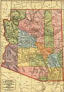
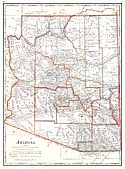
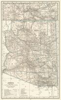
Viewing Options
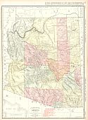
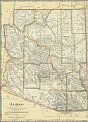
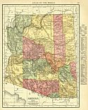
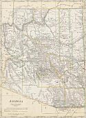
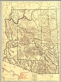
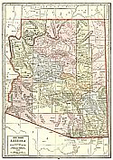
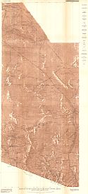
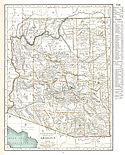
Main Author:
Geographical Publishing Company
Title/Description:
Arizona
Publication Info:
Chicago: The Geographical Publishing Company, 1911
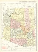
Viewing Options
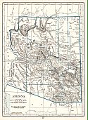
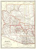
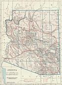
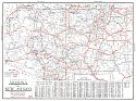
Main Author:
Rand McNally and Company
Title/Description:
Arizona
Publication Info:
Chicago: Rand McNally and Company, 1911; from Rand McNally's Indexed Atlas
Viewing Options
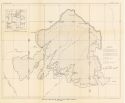
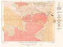
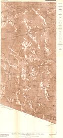
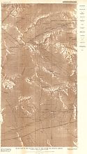
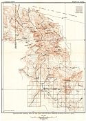
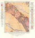
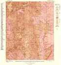
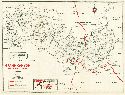
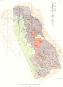
Main Author:
Campbell, M.R.
Title/Description:
Map of the Black Mesa Coal Field, Arizona
Publication Info:
Washington: Department of the Interior, U.S. Geological Survey, 1911; Bulletin 431
Viewing Options
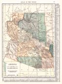
Main Author:
Cram, George F.
Title/Description:
Arizona
Publication Info:
Chicago: George F. Cram, 1911; from Cram's Unrivaled Atlas of the World
Viewing Options
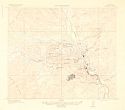
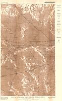
Main Author:
Department of the Interior, U.S. Geological Survey
Title/Description:
Miami Copper Belt, Gila County, Arizona
Publication Info:
Washington: Department of the Interior, U.S. Geological Survey, 1912
Viewing Options
Main Author:
Department of the Interior, U.S. Geological Survey
Title/Description:
Ray and Vicinity, Pinal County, Arizona
Publication Info:
Washington: Department of the Interior, U.S. Geological Survey, 1912
Viewing Options
Main Author:
Rand McNally and Company
Title/Description:
Arizona
Publication Info:
Chicago: Rand McNally and Company, 1912; from The Rand McNally Imperial Atlas of the World
Viewing Options
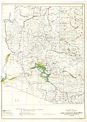
Main Author:
U.S. Geological Survey
Title/Description:
Map of Arizona, Showing Locations of Mining Districts
Publication Info:
Washington: Department of the Interior, U.S. Geological Survey, 1912; Bulletin 507, Plate III
Viewing Options
Main Author:
Rand McNally and Company
Title/Description:
Arizona
Publication Info:
Chicago: Rand McNally and Company, 1912: from the Library Atlas of the World
Viewing Options
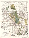
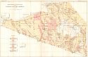
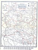
Main Author:
Berthrong, L.P.
Title/Description:
State of Arizona
Publication Info:
Washington: U.S. Department of the Interior, General Land Office, 1912; Senate Doc. 316. 64th Congress, 1st Session
Viewing Options
Main Author:
The Century Company
Title/Description:
Arizona and New Mexico
Publication Info:
New York: The Century Company, 1913; from The Century Atlas of the World
Viewing Options
Main Author:
Cram, George F.
Title/Description:
Arizona
Publication Info:
Chicago: George F. Cram, 1913; from Cram's Unrivaled Atlas of the World
Viewing Options
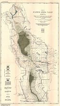
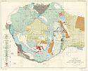
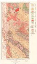
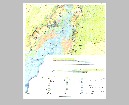
Main Author:
U.S. Geological Survey
Title/Description:
Map of Sulphur Spring Valley, Arizona showing depth to water, elevation of the ground water table and location of pumping plants, flowing wells and rainfall stations
Publication Info:
Washington: Department of the Interior, U.S. Geological Survey, 1913; Water Supply Paper No. 320 Plate 2
Viewing Options
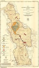
Main Author:
U.S. Geological Survey
Title/Description:
Map of Sulphur Spring Valley, Arizona showing geology and vegetation
Publication Info:
Washington: Department of the Interior, U.S. Geological Survey, 1913; Water Supply Paper No. 320 Plate 1
Viewing Options
Main Author:
Reynolds, Francis J.
Title/Description:
Arizona
Publication Info:
New York: P.F. Collier and Son, 1914; from The New Encyclopedic Atlas and Gazatteer of the World
Viewing Options
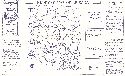
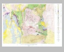
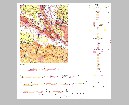
Main Author:
U.S. Geological Survey
Title/Description:
Geologic Map and Sections of the Shinumo Quadrangle, Arizona
Publication Info:
Washington: Department of the Interior, U.S. Geological Survey, 1914; Bulletin 459 Plat I
Viewing Options
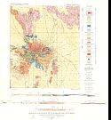
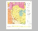
Main Author:
U.S. Geological Survey
Title/Description:
Geologic Map of Helvetia Camp and Vicinity
Publication Info:
Washington: Department of the Interior, U.S. Geological Survey, 1914; Bulletin 582 Plate VIII
Viewing Options
Main Author:
U.S. Geological Survey
Title/Description:
Topographic Map of the Santa Rita and Patagonia Mountains, Arizona
Publication Info:
Washington: Department of the Interior, U.S. Geological Survey, 1914; Bulletin 582 Plate I
Viewing Options
Main Author:
U.S. Geological Survey
Title/Description:
Geologic Map of the Santa Rita and Patagonia Mountains, Arizona
Publication Info:
Washington: Department of the Interior, U.S. Geological Survey, 1914; Bulletin 582 Plate II
Viewing Options
Main Author:
C.S Hammond and Company
Title/Description:
Arizona
Publication Info:
New York: C.S. Hammond and Company, 1914; from Hammond's Commercial and Library Atlas of the World
Viewing Options
Main Author:
Rand McNally and Company
Title/Description:
Arizona
Publication Info:
Chicago: Rand McNally and Co., 1916; from the Ideal Atlas of the World
Viewing Options
Main Author:
U.S. Geological Survey
Title/Description:
Map of Navajo Country in Arizona, New Mexico, and Utah
Publication Info:
Washington: U.S. Deparment of the Interior, Geological Survey, 1916
Viewing Options
Main Author:
U.S. Geological Survey
Title/Description:
Geologic Map of Navajo Country in Arizona, New Mexico, and Utah
Publication Info:
Washington: U.S. Deparment of the Interior, Geological Survey, 1916
Viewing Options
Main Author:
C.S. Hammond and Company
Title/Description:
Arizona
Publication Info:
New York: C.S. Hammond and Company, 1917; from the New Universal Atlas of the World
Viewing Options
Main Author:
U.S. Geological Survey
Title/Description:
Map of Rodeo Area, San Simon Valley, Arizona-New Mexico. Showing location of wells and springs and depths to ground water table
Publication Info:
Washington: Department of the Interior, U.S. Geological Survey, 1917; Water Supply Paper No. 425 Plate 3
Viewing Options
Main Author:
U.S. Geological Survey
Title/Description:
Map of San Simon and Bowie Areas, San Simon Valley, Arizona-New Mexico Showing location of deep wells, flowing well areas, and lands irrigated with well waters
Publication Info:
Washington: Department of the Interior, U.S. Geological Survey, 1917; Water Supply Paper No. 425 Plate 2
Viewing Options
Main Author:
C.S. Hammond and Company
Title/Description:
Arizona
Publication Info:
New York: C.S. Hammond and Company, 1918; from Hammonds Pictorial Atlas of the World
Viewing Options
Main Author:
U.S. Geological Survey
Title/Description:
Geologic Map and Sections of the Ray District, Arizona
Publication Info:
Washington: U.S. Deparment of the Interior, Geological Survey, 1919
Viewing Options
Main Author:
U.S. Geological Survey
Title/Description:
Geologic Map of the Miami District, Arizona
Publication Info:
Washington: U.S. Deparment of the Interior, Geological Survey
Viewing Options
Main Author:
U.S. Geological Survey
Title/Description:
Geologic Map of the Globe-Ray Region, Arizona
Publication Info:
Washington: U.S. Deparment of the Interior, Geological Survey
Viewing Options
Main Author:
Reynolds, Francis J.
Title/Description:
Arizona
Publication Info:
New York: P.F. Collier and Son Company, 1920; from The New World Atlas and Gazetteer
Viewing Options
Main Author:
Cram, George F.
Title/Description:
Arizona
Publication Info:
Chicago: James R. Gray and Company, 1920; from Cram's Unrivaled Atlas of the World
Viewing Options
Main Author:
C.S. Hammond and Company
Title/Description:
Arizona
Publication Info:
New York: C.S. Hammond and Company, 1920; from The New Reference Atlas of the World
Original Source:
Courtesy of Shawn Carter
Viewing Options
Main Author:
Leslie-Judge Company
Title/Description:
Arizona
Publication Info:
New York: Leslie-Judge Company, 1920; from Leslie's New World Atlas
Viewing Options
Main Author:
Rand McNally and Company
Title/Description:
Arizona and New Mexico- Black and White Mileage Chart
Publication Info:
Chicago: Rand McNally and Company, 1921; from the Commercial Atlas of America
Viewing Options
Main Author:
U.S. Geological Survey
Title/Description:
Reconnaissance Map of the Lower Gila Region, Arizona
Publication Info:
Washington: U.S. Deparment of the Interior, Geological Survey
Viewing Options
Main Author:
Rand McNally and Company
Title/Description:
Arizona
Publication Info:
Chicago: Rand McNally and Company, 1921; from the Commercial Atlas of America
Viewing Options
Main Author:
Cram, George F.
Title/Description:
Arizona
Publication Info:
Chicago: George F. Cram Company, 1921; from Cram's Unrivaled Atlas of the World
Viewing Options
Main Author:
National Map Company
Title/Description:
Arizona
Publication Info:
Indianapolis: National Map Company, 1921; from Auto Trails and Commercial Survey of the United States
Viewing Options
Main Author:
National Map Company
Title/Description:
Arizona
Publication Info:
Indianapolis: National Map Company, 1921; from Auto Trails and Commercial Survey of the United States
Viewing Options
Main Author:
The Geographical Publishing Co.
Title/Description:
Arizona
Publication Info:
Chicago: The Geographical Publishing Co., 1922; from New International Atlas of the World
Viewing Options
Main Author:
C.S. Hammond and Company
Title/Description:
Arizona
Publication Info:
New York: C.S. Hammond and Company, 1922; from the New World Looseleaf Atlas
Viewing Options
Main Author:
U.S. Geological Survey
Title/Description:
Reconnaissance Geologic Map of the Papago Country, Arizona
Publication Info:
Washington: Department of the Interior, U.S. Geological Survey, 1922; Bulletin 730 Plate 9
Viewing Options
Main Author:
U.S. Geological Survey
Title/Description:
Relief map of the Western Part of the Papago Country, Arizona showing desert watering places
Publication Info:
Washington: Department of the Interior, U.S. Geological Survey, 1922; Water Supply Paper No. 499 Plate 2
Viewing Options
Main Author:
U.S. Geological Survey
Title/Description:
Relief Map of the Eastern Part of the Papago Country, Arizona showing desert watering places
Publication Info:
Washington: Department of the Interior, U.S. Geological Survey, 1922; Water Supply Paper No. 499 Plate 4
Viewing Options
Main Author:
U.S. Geological Survey
Title/Description:
Relief Map of the Central Part of the Papago Country, Arizona showing desert watering places
Publication Info:
Washington: Department of the Interior, U.S. Geological Survey, 1922; Water Supply Paper No. 499 Plate 3
Viewing Options
Main Author:
U.S. Geological Survey
Title/Description:
Relief map of the Western part of the Lower Gila Region, Arizona
Publication Info:
Washington: Department of the Interior, U.S. Geological Survey, 1922; Water Supply Paper No. 498 Plate 2
Viewing Options
Main Author:
U.S. Geological Survey
Title/Description:
Relief Map of the Central Part of the Lower Gila Region, Arizona
Publication Info:
Washington: Department of the Interior, U.S. Geological Survey, 1922; Water Supply Paper No. 498 Plate 3
Viewing Options
Main Author:
U.S. Geological Survey
Title/Description:
Relief Map of the Eastern Part of the Lower Gila Region, Arizona showing desert watering places
Publication Info:
Washington: Department of the Interior, U.S. Geological Survey, 1922; Water Supply Paper No. 498 Plate 4
Viewing Options
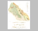
Viewing Options
Main Author:
Darton, N.H.
Title/Description:
State of Arizona
Publication Info:
Washington, D.C.: Department of the Interior, U.S. Geological Survey, 1923
Viewing Options
Main Author:
U.S. Geological Survey
Title/Description:
Geologic Map of the Oatman District, Arizona
Publication Info:
Washington: Department of the Interior, U.S. Geological Survey, 1923; Bulletin 743 Plate 1
Viewing Options
Main Author:
U.S. Geological Survey
Title/Description:
Reconnaissance Geologic Map of Lower Gila Region, Arizona
Publication Info:
Washington: Department of the Interior, U.S. Geological Survey, 1923; Water Supply Paper No. 498 Plate 6
Viewing Options
Main Author:
Cram, George F.
Title/Description:
Arizona
Publication Info:
Chicago: George F. Cram Company, 1923; from Cram's Unrivaled Atlas of the World
Viewing Options
Main Author:
Funk and Wagnalls Company
Title/Description:
Arizona
Publication Info:
New York: Funk and Wagnalls Company, 1923; from Atlas of the World and Gazetteer
Viewing Options
Main Author:
U.S. Geological Survey
Title/Description:
Geologic Sketch Map of the Aravaipa-Stanley Region, Graham County, Arizona
Publication Info:
Washington: Department of the Interior, U.S. Geological Survey, 1924; Bulletin 763 Plate 1
Viewing Options
Main Author:
U.S. Geological Survey
Title/Description:
Topographic Sketch Map of the Aravaipa-Stanley Region, Graham County, Arizona
Publication Info:
Washington: Department of the Interior, U.S. Geological Survey, 1924; Bulletin 763 Plate 2
Viewing Options
Main Author:
U.S. Geological Survey
Title/Description:
Reconnaissance Geology of the Papago Country, Arizona
Publication Info:
Washington: Department of the Interior, U.S. Geological Survey, 1924; Water Supply Paper No. 499 Plate 9
Viewing Options
Main Author:
Reynolds, Francis J.
Title/Description:
Arizona
Publication Info:
New York: P.F. Collier and Son Company, 1924; from The New World Atlas and Gazetteer
Viewing Options
Main Author:
U.S. Geological Survey
Title/Description:
Geologic Map and Section of the Christmas Area, Arizona
Publication Info:
Washington: Department of the Interior, U.S. Geological Survey, 1925; Bulletin 771 Plate 1
Viewing Options
Main Author:
U.S. Geological Survey
Title/Description:
Geologic Map of the Part of the Barner Mining District which lies within the Ray Quadrangle, Gila and Pinal Counties, Arizona
Publication Info:
Washington: Department of the Interior, U.S. Geological Survey, 1925; Bulletin 771 Plate 17
Viewing Options
Main Author:
Rand McNally and Company
Title/Description:
Arizona
Publication Info:
Chicago: Rand McNally and Company, 1925; from Premier Atlas of the World
Viewing Options
Main Author:
U.S. Geological Survey
Title/Description:
Geologic Map of the Jerome Quadrangle, Arizona
Publication Info:
Washington: Department of the Interior, U.S. Geological Survey, 1926; Bulletin 782 Plate 1
Viewing Options
Main Author:
U.S. Geological Survey
Title/Description:
Geologic Map of the Bradshaw Mountains Quadrangle, Arizona
Publication Info:
Washington: Department of the Interior, U.S. Geological Survey, 1926; Bulletin 782 Plate 2
Viewing Options
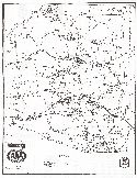
Main Author:
Clason Map Company
Title/Description:
Best Roads in Arizona
Publication Info:
Chicago: Clason Map Company, c. 1927; from Clason's Touring Atlas
Viewing Options
Main Author:
C.S. Hammond and Company
Title/Description:
Arizona
Publication Info:
New York: C.S. Hammond and Company, c. 1930; from The New World Loose Leaf Atlas, Sixth Edition
Viewing Options
Main Author:
National Map Company
Title/Description:
Arizona and New Mexico
Publication Info:
Indianapolis: National Map Company, 1930; from Official Paved Road and Commercial Survey of the United States
Viewing Options
Main Author:
Clason Map Company
Title/Description:
Clason's Road Map of Arizona and New Mexico
Publication Info:
Denver: The Clason Map Company, 1930; from Clason's Touring Atlas of the United States and Canada
Viewing Options
Main Author:
C.S. Hammond and Company
Title/Description:
Arizona
Publication Info:
New York: C.S. Hammond and Company, c. 1930; from The New World Loose Leaf Atlas, Sixth Edition
Viewing Options
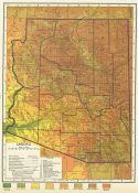
Main Author:
Miller, E.V.
Title/Description:
Arizona
Publication Info:
Phoenix: Arizona Automobile Association, 1930
Original Source:
Murray Hudson
Viewing Options
Main Author:
Geographical Publishing Company
Title/Description:
Arizona
Publication Info:
Chicago: Geographical Publishing Company1931; from Commercial Atlas of the World
Viewing Options
Main Author:
Continental Oil Company
Title/Description:
Official Road Map
Publication Info:
Chicago: H.M. Gousha Company, c. 1933
Original Source:
Murray Hudson
Viewing Options
Main Author:
Continental Oil Company
Title/Description:
Grand Canyon National Park, Arizona
Publication Info:
Chicago: H.M. Gousha Company, c. 1933
Original Source:
Murray Hudson
Viewing Options
Main Author:
Highway Map Company
Title/Description:
Highway Map of Arizona
Publication Info:
Topeka: Highway Map Company, c. 1933
Original Source:
Murray Hudson
Viewing Options
Main Author:
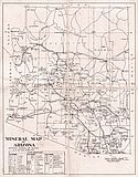
Castelan, J.
Title/Description:
Mineral Map of Arizona
Publication Info:
Arizona Bureau of Mines, 1935

Viewing Options
Main Author:
Gulf Refining Company
Title/Description:
1935 Official Road Map, Arizona and New Mexico
Publication Info:
Chicago: Rand McNally and Company, 1935
Original Source:
Murray Hudson
Viewing Options
Main Author:
Branom, Frederick K. and Lloyd Edwin Smith
Title/Description:
Arizona
Publication Info:
Chicago: Geographical Publishing Company, 1936; from Capper's 1936 Atlas of the World
Viewing Options
Main Author:
Rand McNally and Company
Title/Description:
Standard Map of Arizona
Publication Info:
Chicago: Rand McNally and Company, 1936
Viewing Options
Main Author:
Department of the Interior, U.S. Geological Survey
Title/Description:
Arizona
Publication Info:
Washington: Department of the Interior, U.S. Geological Survey, 1903
Viewing Options
Main Author:
U.S. Geological Survey
Title/Description:
State of Arizona
Publication Info:
Washington, D.C.: Department of the Interior, U.S. Geological Survey, 1940; compiled 1919, revised 1939
Viewing Options
Main Author:
Wilson, Eldred D.
Title/Description:
Mineral Map of Arizona
Publication Info:
University of Arizona, Bureau of Mines, 1941
Viewing Options
Main Author:
Geographical Publishing Company
Title/Description:
Arizona
Publication Info:
Chicago: Geographical Publishing Company, 1942; from The New International Atlas of The World, War Edition
Viewing Options
Main Author:
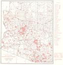
Bureau of the Census
Title/Description:
Arizona Irrigation by Drainage Basin, 1939
Publication Info:
Washington: U.S. Government Printing Office, 1942
Viewing Options
Main Author:
U.S. Geological Survey
Title/Description:
Geologic Map and Sections of the Ajo Mining District, Pima City, Arizona
Publication Info:
Washington: Department of the Interior, U.S. Geological Survey, 1946; Professional paper 209, Plate 20
Viewing Options
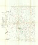
Main Author:
U.S. Bureau of Reclamation
Title/Description:
Water Resources Development, Colorado Basin, Arizona
Publication Info:
Washington: Department of the Interior, U.S. Bureau of Reclamation, 1946; from The Colorado River, A Natural Menace Becomes a Natural Resource
Viewing Options
Main Author:
U.S. Geological Survey
Title/Description:
Geologic Map and Sections of the Ajo Quadrangle, Pima County, Arizona
Publication Info:
Washington: Department of the Interior, U.S. Geologic Survey, 1946; Professional Paper 209, Plate 3
Viewing Options
Main Author:
U.S. Geological Survey
Title/Description:
Geologic Map and Sections of the Area Along Maggie Canyon and the Upper Part of Chapin Wash, Artillery Mountains, Arizona
Publication Info:
Washington: Department of the Interior, US Geological Survey, 1949; Bulletin 961, Plate 2
Viewing Options
Main Author:
U.S. Geological Survey
Title/Description:
Geologic Map and Sections of the Artillery Mountains Manganese Region, Arizona
Publication Info:
Washington: Department of the Interior, US Geological Survey, 1949; Bulletin 961, Plate 1
Viewing Options
Title/Description:
Geologic Map of the Wallapai Mining District, Mohave County, Arizona
Publication Info:
Washington: Department of the Interior, U.S. Geologic Survey, 1950; Bullitin 978, Plate 18
Viewing Options
Main Author:
U.S. Geological Survey
Title/Description:
Geologic Map of the Wallapai Mining District, Mohave County, Arizona
Publication Info:
Washington: Department of the Interior, U.S. Geological Survey, 1951; Bulletin 978-E Plate 18
Viewing Options
Main Author:
U.S. Geological Survey
Title/Description:
Geologic Map of the Castle Dome Area, Gila County, Arizona
Publication Info:
Washington: Department of the Interior, U.S. Geological Survey, 1951; Bulletin 971 Plate 1
Viewing Options
Main Author:
Arizona State Highway Commission
Title/Description:
Road Map of Arizona
Publication Info:
Phoenix: Arizona State Highway Commission, 1956
Viewing Options
Main Author:
U.S. Geological Survey
Title/Description:
Geologic Map and Sections of the San Carlos Indian Reservation, Arizona
Publication Info:
Washington: Department of the Interior, U.S. Geological Survey, 1956; Bulletin 1027-N Plate 52
Viewing Options
Main Author:
U.S. Geological Survey
Title/Description:
Geologic Map Showing Swale in the Monument No. 2 Area, Apache County, Arizona
Publication Info:
Washington: Department of the Interior, U.S. Geological Survey, 1956; Bulletin 1030-C Plate 6
Viewing Options
Main Author:
U.S. Geological Survey
Title/Description:
Geologic Map of the Clarkdale Quadrangle, Arizona
Publication Info:
Washington: Department of the Interior, U.S. Geological Survey, 1957; Bulletin 1021-N Plate 45
Viewing Options
Main Author:
Salt River Report
Title/Description:
Salt River Project and Central Arizona
Publication Info:
Phoenix: Salt River Project, Circa 1960

Viewing Options
Main Author:
U.S. Geological Survey
Title/Description:
Preliminary Geologic Map of the Eastern Part of Pima Mining District, Pima County, Arizona
Publication Info:
Washington: Department of the Interior, U.S. Geological Survey, 1960; Bulletin 1112-G Plate 1
Viewing Options
Main Author:
U.S. Geological Survey
Title/Description:
Geologic Map of the House Rock Valley Area, Coconino County, Arizona
Publication Info:
Washington: Department of the Interior, U.S. Geological Survey, 1960; Bulletin 1081-D Plate 4
Viewing Options
Main Author:
U.S. Geological Survey
Title/Description:
Geologic Map of the Monument Valley Area, Arizona
Publication Info:
Washington: Department of the Interior, U.S. Geological Survey, 1963; Bulletin 1103 Plate 1
Viewing Options
Main Author:
U.S. Geological Survey
Title/Description:
Geologic Map and Sections of the Lees Ferry Area, Coconino County, Arizona (North Half)
Publication Info:
Washington: Department of the Interior, U.S. Geological Survey, 1963; Bulletin 1137 Plate 1
Viewing Options
Main Author:
U.S. Geological Survey
Title/Description:
Geologic Map and Sections of the Lees Ferry Area, Coconino County, Arizona (South Half)
Publication Info:
Washington: Department of the Interior, U.S. Geological Survey, 1963; Bulletin 1137 Plate 1
Viewing Options
Main Author:
U.S. Geological Survey
Title/Description:
Geologic Map and Sections of the Christmas Quadrangle, Arizona
Publication Info:
Washington: Department of the Interior, U.S. Geological Survey, 1964; Bulletin 1161-E Plate 1
Viewing Options
Main Author:
U.S. Geological Survey
Title/Description:
Geologic Map and Sections of the Pinal Ranch Quadrangle, Arizona
Publication Info:
Washington: Department of the Interior, U.S. Geological Survey, 1964; Bulletin 1141-H Plate 1

