|
|
| 1910-1945 |
| Previous Page |
 |
 |
|
||||||||||||||||||||
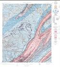
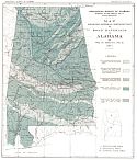
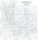
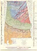
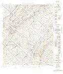
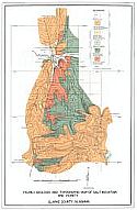
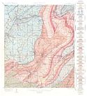
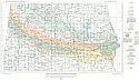
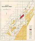
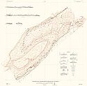
Areal Geology |
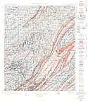
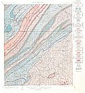
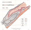
Economic Geology |
|||||||||||||||||||||
| Viewing options: |
Viewing options: |
|||||||||||||||||||||
 |
 |
|||||||||||||||||||||
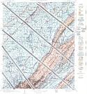
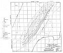
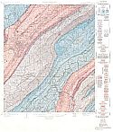
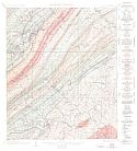
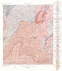
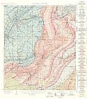
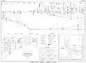
Structure Sectons |
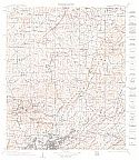
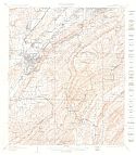
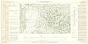
Topography |
|||||||||||||||||||||
| Viewing options: |
Viewing options: |
|||||||||||||||||||||
 |
|
||||||||||||||||||||||||
|
 |
|
||||||||||||||||||||||||
|
 |
|
||||||||||||||||||||||||
|
 |
|
||||||||||||||||||||||||
|
 |
|
||||||||||||||||||||||||
|
 |
|
||||||||||||||||||||||||
|
 |
|
||||||||||||||||||||||||
|
 |
|
||||||||||||||||||||||||
|
 |
|
||||||||||||||||||||||||
|
 |
|
||||||||||||||||||||||||
|
 |
|
||||||||||||||||||||||||
|
 |
|
||||||||||||||||||||||||
|
 |
|
||||||||||||||||||||||||
|
 |
|
||||||||||||||||||||||||
|
 |
|
||||||||||||||||||||||||
|
 |
 |
|
||||||||||||||||||||
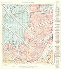
Areal Geology |
Economic Geology |
|||||||||||||||||||||
| Viewing options: |
Viewing options: |
|||||||||||||||||||||
 |
 |
|||||||||||||||||||||
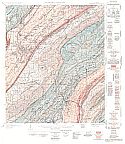
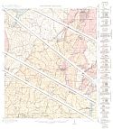
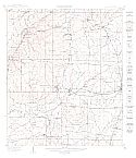
Structure Sectons |
Topography |
|||||||||||||||||||||
| Viewing options: |
Viewing options: |
|||||||||||||||||||||
 |
 |
|
||||||||||||||||||||
Areal Geology |
Economic Geology |
|||||||||||||||||||||
| Viewing options: |
Viewing options: |
|||||||||||||||||||||
 |
 |
|||||||||||||||||||||
Structure Sectons |
Topography |
|||||||||||||||||||||
| Viewing options: |
Viewing options: |
|||||||||||||||||||||
 |
|
||||||||||||||||||||||||
|
 |
|
||||||||||||||||||||||||
|
 |
|
||||||||||||||||||||||||
|
 |
|
||||||||||||||||||||||||
|
 |
|
||||||||||||||||||||||||
|
 |
|
||||||||||||||||||||||||
|
 |
|
||||||||||||||||||||||||
|
 |
|
||||||||||||||||||||||||
|
 |
|
||||||||||||||||||||||||
|
 |
|
||||||||||||||||||||||||
|
 |
 |
 |
|
|||||||||||||||||||||
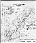
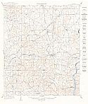
Areal Geology |
Structure Sectons |
Topography |
||||||||||||||||||||||
| Viewing options: |
Viewing options: |
Viewing options: |
||||||||||||||||||||||
 |
 |
|
||||||||||||||||||||
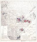
Areal Geology |
Economic Geology |
|||||||||||||||||||||
| Viewing options: |
Viewing options: |
|||||||||||||||||||||
 |
 |
|||||||||||||||||||||
Structure Sectons |
Topography |
|||||||||||||||||||||
| Viewing options: |
Viewing options: |
|||||||||||||||||||||
 |
|
||||||||||||||||||||||||
|
 |
|
||||||||||||||||||||||||
|
 |
|
||||||||||||||||||||||||
|
 |
|
||||||||||||||||||||||||
|
 |
|
||||||||||||||||||||||||
|
 |
|
||||||||||||||||||||||||
|
 |
|
||||||||||||||||||||||||
|
| Previous Page |