Use the menu to the right to browse our collection of out-of-print editions of U.S.G.S. Quadrangles. Please keep in mind that map coverage varies and may not be complete for all counties.
Out-of-Print Quadrangles
Main Author
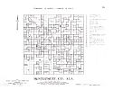
Alabama Highway Dept.
Alabama Highway Dept.
Alabama Highway Dept.
Alabama Highway Dept.
Alabama Highway Dept.
Alabama Highway Dept.
Alabama Highway Dept.
Alabama Highway Dept.
Alabama Highway Dept.
Location
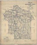
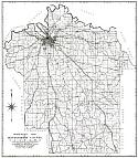
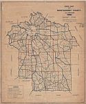
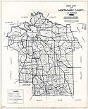
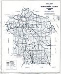
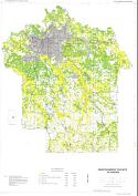
Montgomery County
Montgomery County
Montgomery County
Montgomery County
Montgomery County
Montgomery County
Montgomery County
Montgomery County
Montgomery County
Publication Information
Montgomery: ASHD
Montgomery: ASHD
Montgomery: ASHD
Montgomery: ASHD
Montgomery: ASHD
Montgomery: ASHD
Montgomery: ASHD
Montgomery: ASHD
Montgomery: ASHD
Date
2011
2002
1992
1985
1975
1963
1948
1938
1937
Scale
1:125,000
1:125,000
1:125,000
1:125,000
1:125,000
1:125,000
1:125,000
1:125,000
1:125,000
Viewing Options
Main Author:
U.S. Department of Agriculture
Title/Description:
Soil Map of Montgomery County, Alabama
Publication Info:
Washington, D.C.: U.S. Department of Agriculture, 1926
Viewing Options
Main Author:
U.S. Geological Survey
Title/Description:
Montgomery Quadrangle (Preliminary Edition)
Publication Info:
Washington, D.C.: Department of the Interior, U.S. Geological Survey, c.1927
Viewing Options
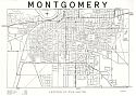
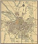
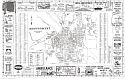
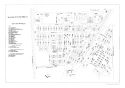
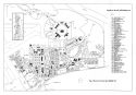
Title/Description:
Map of Montgomery, Alabama
Publication Info:
Montgomery: Office of City Engineer, 1927; blueprint reproduction
Original Source:
Montgomery County Archives
Viewing Options
Main Author:
Edwards, Thomas H. and Farrow, C.M.
Title/Description:
Road Map of Montgomery County, Alabama
Publication Info:
Montgomery: Thomas H. Edwards, 1928
Viewing Options
Title/Description:
Montgomery, Center of the South
Publication Info:
Montgomery: Montgomery Chamber of Commerce, 1929
Viewing Options
Main Author:
Bethel W. Whitson and Co.
Title/Description:
Whitson's Map Montgomery County, Alabama
Publication Info:
Birmingham: Bethel W. Whitson and Co., [c1930]
Viewing Options
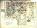
Main Author:
Olmsted Brothers
Title/Description:
State Capital Grounds-Montgomery, Alabama-General Plan for Improvement
Publication Info:
Brookline, MA: Olmsted Brothers, 1930
Viewing Options
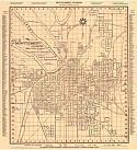
Main Author:
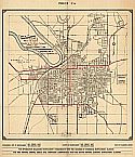
Gillette, F.A.
Title/Description:
City of Montgomery, Alabama
Publication Info:
Montgomery: The Brown Printing Company, 1933
Viewing Options
Title/Description:
Montgomery, Alabama - City and Suburbs
Publication Info:
Montgomery: The Brown Printing Co., c1936
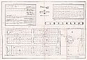
Main Author:
Works Progress Administration
Title/Description:
Montgomery County Property Ownership Maps
Publication Info:
Montgomery: Alabama State Highway Department, 1936
Viewing Options
Main Author:
Edwards, Thomas H. and Farrow, C.M.
Title/Description:
Road Map of Montgomery County, Alabama
Publication Info:
Montgomery: Thomas H. Edwards, 1936
Viewing Options
Main Author:
Edwards, Thomas H. and Farrow, C.M.
Title/Description:
Road Map of Montgomery County, Alabama
Publication Info:
Montgomery: Thomas H. Edwards, 1940
Viewing Options
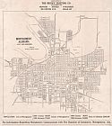
Main Author:
Gillette, F.A.
Title/Description:
Map of Montgomery, Alabama
Publication Info:
Montgomery: City of Montgomery, Alabama, 1942
Viewing Options
Main Author:
Gillette, F.A.
Title/Description:
Map of Montgomery, Alabama
Publication Info:
Montgomery: City of Montgomery, 1945
Viewing Options
Main Author:
Edwards, Thomas H. and Jones, Sam C.
Title/Description:
Road Map of Montgomery County, Alabama
Publication Info:
Montgomery: Thomas H. Edwards, 1945
Viewing Options
Title/Description:
Plat of Section 2 of Cloverdale
Viewing Options
Main Author:
Hale, Fletcher
Title/Description:
Map of Montgomery, Alabama 1842-1850
Publication Info:
Hand-drawn, 1949
Viewing Options
Main Author:
Edwards, Thomas H. and Holloway, J.O.
Title/Description:
Road Map of Montgomery County, Alabama
Publication Info:
Montgomery: Thomas H. Edwards, 1949
Viewing Options
Main Author:
Brendel, Karl
Title/Description:
Partial Map of Montgomery Showing Defences of 1865
Publication Info:
c1950; blueprint copy of original
Viewing Options
Main Author:
Farron, Maynard
Title/Description:
Road Map of Montgomery County, Alabama
Publication Info:
Montgomery: Thomas H. Edwards, 1950; 1928 base map corrected to 1950
Original Source:
Montgomery County Archives
Viewing Options
Title/Description:
Montgomery
Publication Info:
Brownsville, TX: American Publishers, c.1956
Viewing Options
Main Author:
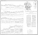
Reade, Jr., H.L. and John C. Scott
Title/Description:
Profile Showing Geology Along Highway 331, Montgomery County, Alabama
Publication Info:
Tuscaloosa: Geological Survey of Alabama, 1959; Map 10
Viewing Options
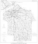
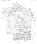
Main Author:
Knowles, Doyle B., H.L. Reade and John C. Scott
Title/Description:
Map of Montgomery County, Alabama Showing Location of Wells
Publication Info:
Tuscaloosa: Geological Survey of Alabama, 1960; from Bulletin 68-B, Plate 1
Viewing Options
Main Author:
US Air Force
Title/Description:
Map of Gunter Air Force Base Building Area
Publication Info:
US Air Force,
Original Source:
Courtesy of Neil Franklin of Montgomery, AL
Viewing Options
Main Author:
US Air Force
Title/Description:
Map of Maxwell Air Force Base Building Area
Publication Info:
US Air Force,
Original Source:
Courtesy of Neil Franklin of Montgomery, AL
Viewing Options
Main Author:
US Air Force
Title/Description:
Map of Montgomery, Alabama
Publication Info:
US Air Force,
Original Source:
Courtesy of Neil Franklin of Montgomery, AL
Viewing Options
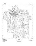
Main Author:
U.S. Geological Survey
Title/Description:
Geological Map Showing Location of Wells of Montgomery County, Alabama
Publication Info:
Washington D.C.: Department of the Interior, U.S. Geological Survey, c.1964; Water Supply Paper 1606, Plate I
Viewing Options
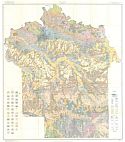
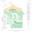
Main Author:
U.S. Geologial Survey
Title/Description:
Map Showing Physiographic Divisions of Montgomery County, Alabama
Publication Info:
Washington: Department of the Interior, U.S. Geologial Survey, 1964; from Water Supply Paper 1606, Plate 2
Viewing Options
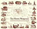
Main Author:
Montgomery Area Chamber of Commerce
Title/Description:
Tour Historic Montgomery
Publication Info:
Montgomery: Montgomery Area Chamber of Commerce, 1971
Northwest
North
Northeast
West
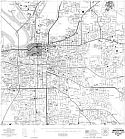
Central
East
Southwest
South
Southeast
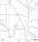
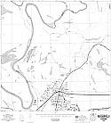
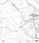
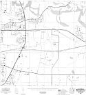
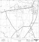
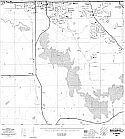
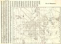
Main Author:
State of Alabama Highway Department
Title/Description:
Montgomery (9 maps)
Publication Info:
Montgomery: State of Alabama Highway Department, 1974
Viewing Options
Title/Description:
City of Montgomery Council District Map
Publication Info:
Montgomery: Office of the City Engineer, 1976
Viewing Options
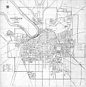
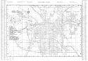
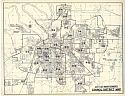
Title/Description:
Map of Montgomery, Alabama
Publication Info:
Montgomery: Office of the City Engineer, 1976
Viewing Options
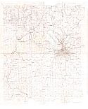
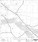
Main Author:
U.S. Geological Survey
Title/Description:
Montgomery County
Publication Info:
Washington, D.C.: Department of the Interior, U.S. Geological Survey, 1974; advance sheet for eventually unpublished map series
Viewing Options
Main Author:
U.S. Department of Agriculture, Soil Conservation Service
Title/Description:
Soil Interpretive Map of Important Farmlands for Montgomery County, Alabama
Publication Info:
U.S.D.A., Soil Conservation Service, c1978
Viewing Options
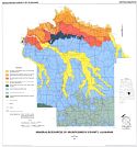
Main Author:
Dean, Lewis S.
Title/Description:
Mineral Resources of Montgomery County, Alabama
Publication Info:
Geological Survey of Alabama, Special Map 222