Use the menu to the right to browse our collection of out-of-print editions of U.S.G.S. Quadrangles. Please keep in mind that map coverage varies and may not be complete for all counties.
Out-of-Print Quadrangles
Main Author
Alabama Highway Dept.
Alabama Highway Dept.
Alabama Highway Dept.
Alabama Highway Dept.
Alabama Highway Dept.
Alabama Highway Dept.
Alabama Highway Dept.
Alabama Highway Dept.
Alabama Highway Dept.
Alabama Highway Dept.
Alabama Highway Dept.
Alabama Highway Dept.
Alabama Highway Dept.
Alabama Highway Dept.
Location
Mobile County
Mobile County
Mobile County
Mobile County (N)
Mobile County (S)
Mobile County (N)
Mobile County (S)
Mobile County (N)
Mobile County (S)
Mobile County (N)
Mobile County (S)
Mobile County
Mobile County (N)
Mobile County (S)
Publication Information
Montgomery: ASHD
Montgomery: ASHD
Montgomery: ASHD
Montgomery: ASHD
Montgomery: ASHD
Montgomery: ASHD
Montgomery: ASHD
Montgomery: ASHD
Montgomery: ASHD
Montgomery: ASHD
Montgomery: ASHD
Montgomery: ASHD
Montgomery: ASHD
Montgomery: ASHD
Date
2011
2001
1993
1982
1982
1966
1966
1962
1962
1952
1952
1938
1937
1937
Scale
1:125,000
1:125,000
1:125,000
1:125,000
1:125,000
1:125,000
1:125,000
1:125,000
1:125,000
1:125,000
1:125,000
1:125,000
1:125,000
1:125,000
Viewing Options
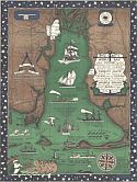
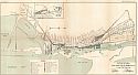
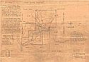
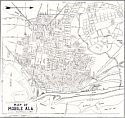
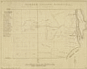
Title/Description:
Map of Mobile County, Alabama
Publication Info:
Unknown, 1916; blueprint of original map
Viewing Options
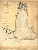
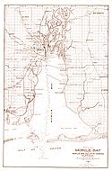
Main Author:
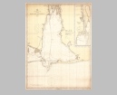
U.S. Coast and Geodetic Survey
Title/Description:
Mobile Bay and Entrance, Alabama
Publication Info:
Washington: U.S. Coast and Geodetic Survey, 1916
Viewing Options
Main Author:
Duffee, L.W.
Title/Description:
Duffee's Road Map of the Southern Part of Mobile County, Alabama
Publication Info:
Mobile: L.W. Duffee, 1918; blueprint of original map

Viewing Options
Main Author:
Hauser, J.J. and K.R.
Title/Description:
Chickasaw Suburb
Publication Info:
Mobile: J.J. and K.R. Hauser, 1919
Viewing Options
Main Author:
U.S. Coast and Geodetic Survey
Title/Description:
Mobile Bay and Entrance
Publication Info:
Washington: U.S. Coast and Geodetic Survey, 1920
Viewing Options
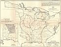
Main Author:
U.S. Army Corps of Engineers
Title/Description:
Territories Served by the Ports of Mobile, Ala. And Pensacola, Fla.
Publication Info:
Washington: Board of Engineers for Rivers and Harbors, 1922
Viewing Options
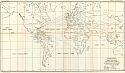
Main Author:
U.S. Army Corps of Engineers
Title/Description:
Origin of Imports and Destination of Exports at Moile, Ala. During 1921
Publication Info:
Washington: Board of Engineers for Rivers and Harbors, 1922
Viewing Options
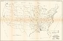
Main Author:
U.S. Army Corps of Engineers
Title/Description:
Origin of Exports and Destination of Imports at Monile during 1921
Publication Info:
Washington: Board of Engineers for Rivers and Harbors, 1922
Viewing Options
Main Author:
U.S. Army Corps of Engineers
Title/Description:
Port Facilities at Mobile, Ala.
Publication Info:
Washington: Board of Engineers for Rivers and Harbors, 1922
Viewing Options
Main Author:
Scott, Robert Haras
Title/Description:
Mobile Bay and Parts of Mobile and Baldwin Counties Alabama
Publication Info:
New Orleans: Robert Haras Scott, 1926
Viewing Options
Viewing Options
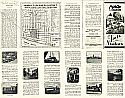
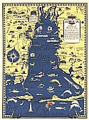
Main Author:
Scott, Richard Joseph
Title/Description:
Mobile, Alabama, Facts for Visitors
Publication Info:
Mobile: Mobile Chamber of Commerce, c.1928
Viewing Options
Main Author:
Hewlett, Thomas
Title/Description:
Mount Vernon Barracks
Publication Info:
Montgomery: Department of Archives and History, 1928; Original was surveyed in 1891 by Lt. C. G. Treat
Viewing Options
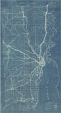
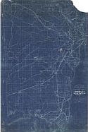
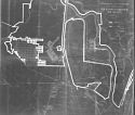
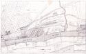
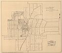
Main Author:
Chickasaw Land Company
Title/Description:
Chickasaw Land Company Map Showing Chickasaw Subdivision and Vicinity
Publication Info:
Blueprint copy of original map dated 1930, revised 1933, issued by the Land Department of the Tennessee Coal, Iron and Railroad Company
Northern Half
Southern Half
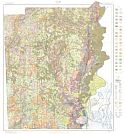
Main Author:
U.S. Department of Agriculture
Title/Description:
Soil Map of Mobile County, Alabama
Publication Info:
Washington, D.C.: U.S. Department of Agriculture, 1930

Viewing Options
Main Author:
Alabama State Commission of Forestry
Title/Description:
Mobile County, Alabama
Publication Info:
Montgomery: Alabama State Commission of Forestry, 1935
Viewing Options
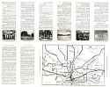
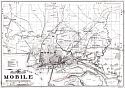
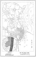
Main Author:
Peavy, John R.
Title/Description:
Map of Mobile, Alabama
Publication Info:
Published by the Author, 1936
Viewing Options
Main Author:
Scott, Richard J.
Title/Description:
Industrial Mobile
Publication Info:
Mobile: Alabama State Docks Commission, 1938
Viewing Options
Main Author:
Scott, Richard J.
Title/Description:
Alabama State Docks, Mobile, Ala.
Publication Info:
Mobile: Department of State Docks and Terminal, 1940
Viewing Options
Main Author:
Alabama State Planning Commission
Title/Description:
Town of Citronelle, Alabama
Publication Info:
Montgomery: Alabama State Planning Commission, 1942
Viewing Options
Main Author:
Hale, Fletcher
Title/Description:
Mobile County, Alabama
Publication Info:
A tracing by Fletcher Hale in 1947 from the original survey of 1820 by cc Storn showing landowners of Mobile
Viewing Options
Main Author:
Peterson, Carl G.B.
Title/Description:
Map of Mobile, Alabama (Showing the Location of Wells)
Publication Info:
Tuscaloosa: Geological Survey of Alabama, 1947; from Bulletin 58, Plate 1
Viewing Options
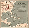
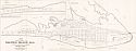
Title/Description:
The Port of Mobile
Publication Info:
New Orleans: T. Fitzwilliams and Co., 1950
Viewing Options
Main Author:
Acker, Marian
Title/Description:
Mobile and Baldwin Counties, Alabama
Publication Info:
Mobile: Marian Acker, 1950
Viewing Options
Main Author:
Richard Scott and Associates
Title/Description:
1953 Subdivision of Dauphin Island, Alabama
Publication Info:
Richard Scott and Associates
Viewing Options
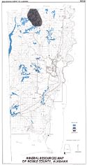
Main Author:
Clarke, O.M. Jr., D.B. Moore and M.W. Szabo
Title/Description:
Mineral Resources of Mobile County, Alabama
Publication Info:
Geological Survey of Alabama, Special Map 89
Viewing Options
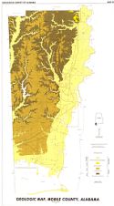
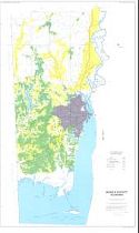
Title/Description:
Geologic Map, Mobile County, Alabama
Publication Info:
Geological Survey of Alabama, Special Map 93
Viewing Options
Main Author:
Geological Survey of Alabama
Title/Description:
Water Availability, Mobile County, Alabama
Publication Info:
Tuscaloosa: Geological Survey of Alabama, 1972; Map 121
Sheet 1
Sheet 2
Sheet 3
Sheet 4
Sheet 5
Sheet 6
Sheet 7
Sheet 8
Sheet 9
Sheet 10
Sheet 11
Sheet 12
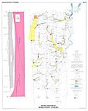
Main Author:
State of Alabama Highway Department
Title/Description:
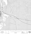
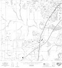
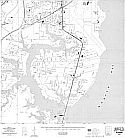
Mobile (12 maps)
Publication Info:
Montgomery: State of Alabama Highway Department, 1977
Viewing Options
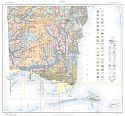
Main Author:
U.S. Department of Agriculture, Soil Conservation Service
Title/Description:
Soil Interpretive Map of Important Farmlands for Mobile County, Alabama
Publication Info:
Washington: U.S. Department of Agriculture, 1982