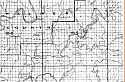
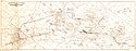
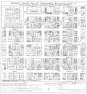
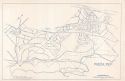
Use the menu to the right to browse our collection of out-of-print editions of U.S.G.S. Quadrangles. Please keep in mind that map coverage varies and may not be complete for all counties.
Out-of-Print Quadrangles
Main Author
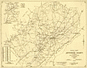
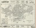
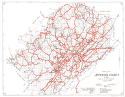
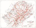
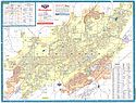
Alabama Highway Dept.
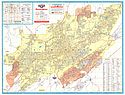
Alabama Highway Dept.
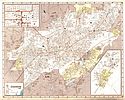
Alabama Highway Dept.
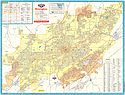
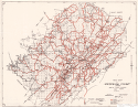
Alabama Highway Dept.
Alabama Highway Dept.
Alabama Highway Dept.
Alabama Highway Dept.
Location
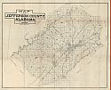
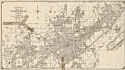
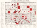
Jefferson County
Jefferson County
Jefferson County
Jefferson County
Jefferson County
Jefferson County
Jefferson County
Publication Information
Montgomery: ASHD
Montgomery: ASHD
Montgomery: ASHD
Montgomery: ASHD
Montgomery: ASHD
Montgomery: ASHD
Montgomery: ASHD
Date
2005
1995
1983
1967
1960
1942
1937
Scale
1:125,000
1:125,000
1:125,000
1:125,000
1:125,000
1:125,000
1:125,000
Viewing Options
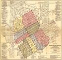
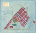
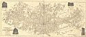
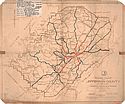
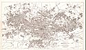
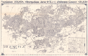
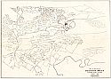
Main Author:
Kelley, George B.
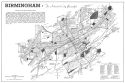
Title/Description:
Map of Birmingham, Alabama and Adjacent Suburbs
Publication Info:
Birmingham, 1903
Viewing Options
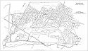
Main Author:
Cram, George F.
Title/Description:
Birmingham
Publication Info:
Chicago: George F. Cram, 1903
Viewing Options
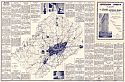
Main Author:
Kelley, George B.
Title/Description:
Kelley's Map of the District of Birmingham, Alabama
Publication Info:
George B. Kelley, 1904
Viewing Options
Viewing Options
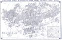
Main Author:
U.S. Department of Agriculture
Title/Description:
Jefferson County soil survey map, eastern half
Publication Info:
Washington: U.S. Department of Agriculture
Viewing Options
Main Author:
U.S. Department of Agriculture
Title/Description:
Jefferson County soil survey map
Publication Info:
Washington: U.S. Department of Agriculture, 1908
Viewing Options
Main Author:
Tennessee Coal, Iron and Railroad
Title/Description:
Birmingham District
Publication Info:
Tennessee Coal, Iron and Railroad, 1908
Viewing Options
Title/Description:
Republic Iron and Steel Co., Southern District, Thomas Estate
Publication Info:
Birmingham: Republic Iron and Steel Company, 1909
Viewing Options
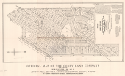
Main Author:
Meade and Huey
Title/Description:
Map of Cory Land Co.'s First Subdivision of Corey
Publication Info:
Birmingham, 1910
Viewing Options
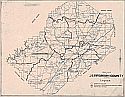
Main Author:
Chambers, G.W.
Title/Description:
Map of Jefferson County, Alabama
Publication Info:
[Birmnigham: G.W. Chambers, c. 1910]
Viewing Options
Title/Description:
Kelley's Map of Birmingham, Alabama
Publication Info:
Birmingham: Kelley Company, 1911
Viewing Options
Main Author:
Meade and Huey
Title/Description:
First Preliminary Plan of Westleigh
Publication Info:
Birmingham: Central Park Land Co., 1911
Viewing Options
Main Author:
Meade and Huey
Title/Description:
Revised Map of Corey Land Co's First Subdivision of Cory
Publication Info:
Birmingham: Corey Land Company, 1911
Viewing Options
Main Author:
Cox, J.W. after Andrew, S.G.
Title/Description:
A Tracing of the Birmingham Sheet of T.C. and R.R. Co.
Publication Info:
Birmingham: 1913; blue print copy of original
Viewing Options
Main Author:
Frisco Lines
Title/Description:
Frisco Lines Birmingham Belt Railroad Alignment and Right of Way Through Part of Birmingham, Jefferson County, Alabama
Publication Info:
Birmingham, AL, July 9, 1913; blue print copy of original
Main Author:
Andrew, S.G.
Title/Description:
A Tracing of the Birmingham Sheet of T.C.I. and R.R. Co.
Publication Info:
Birmingham: 1913
Viewing Options
Title/Description:
Grefenkamp's Map of Birmingham, Alabama
Publication Info:
Birmingham: A.J. Grefenkamp & Co., 1914
Viewing Options
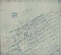
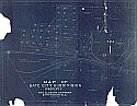
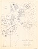
Main Author:
Lockwood, O.L.
Title/Description:
Map of Gate City Subdivision Property of the Alabama Company, Birmingham, Alabama
Publication Info:
Birmingham: The Alabama Company, 1914; blue print of original map

Viewing Options
Title/Description:
Grefenkamp's Map of Birmingham, Alabama
Publication Info:
Birmingham: A.J. Grefenkamp and Co., 1914
Viewing Options
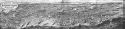
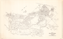
Main Author:
Matthews Northrup Works
Title/Description:
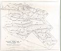
Bird's-Eye View of the Birmingham District
Publication Info:
Buffalo: Matthews Northrup Works, c. 1915
Viewing Options
Main Author:
Land Department, Tennessee Coal, Iron, and Railroad Company
Title/Description:
Road Map of Jefferson County, Alabama
Publication Info:
[Birmingham], 1916; Issued by the Board of Revenue
Viewing Options
Main Author:
Tennessee Coal, Iron and Railroad Company
Title/Description:
Pratt Field of the Warrior Coal Basin
Publication Info:
Land Department, Tennessee Coal, Iron and Railroad Company, 1917
Viewing Options
Main Author:
Batson, S.R.
Title/Description:
Road Map of Jefferson County, Alabama
Publication Info:
Birmingham: Jefferson County Board of Revenue, 1919
Viewing Options
Main Author:
Totten, Robert L.
Title/Description:
Totten's Map of Birmingham and Vicinity
Publication Info:
Birmingham: Roberts and Son, 1921; annotated with overlay of original land owners of 1870
Viewing Options
Main Author:
Putnam, H.E.
Title/Description:
Thomas Estate (Republic Iron and Steel Company)
Publication Info:
Birmingham: Land Department, Republic Iron and Steel Company, 1921; blueprint copy of original
Viewing Options
Main Author:
Rogers, C.J.
Title/Description:
Road Map of Jefferson County, Alabama
Publication Info:
Issued by the Board of Revenue

Viewing Options
Main Author:
Whitson, Bethel W.
Title/Description:
Map of the Fairfield Land Co's First Subdivision of Fairfield
Publication Info:
Birmingham: Meade and Huey, 1922
Viewing Options
Main Author:
Whitson, Bethel W.
Title/Description:
Map of Shades Cliff
Publication Info:
Birmingham: Bethel W. Whitson, 1923
Viewing Options
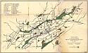
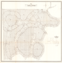
Main Author:
Olmstead Brothers
Title/Description:
Outline Plan of Proposed Park System for Birmingham
Publication Info:
Boston: Walker Lith., 1924
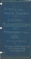
Main Author:
Whitson, Bethel W.
Title/Description:
Whitson's Ownership Block Book of Central Business District of Birmingham, Ala.
Publication Info:
Birmingham: Bethel W. Whitson, 1924
Viewing Options
Main Author:
Olmstead Brothers
Title/Description:
Outline Map Showing Present and Proposed Park Areas within the City
Publication Info:
Boston: Walker Lith., [1925]
Viewing Options
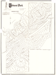
Main Author:
Glander, J.H.
Title/Description:
Redmont Park
Publication Info:
Birmingham: Jemison and Company, 1925
Viewing Options
Title/Description:
G.B. McCormack and Erskine Ramsey New-Castle Mines Surface Map showing buildings, roads, mine openings, railroads, etc. (blueprint copy of original)
Viewing Options
Main Author:
Whitson, Bethel W.
Title/Description:
Map of Mountain Brook Village
Publication Info:
Birmingham: Jemison Realty Company 1925
Viewing Options
Main Author:
Jemison and Company
Title/Description:
Business District of Birmingham
Publication Info:
Birmingham: Jemison and Company 1925
Viewing Options
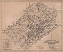
Title/Description:
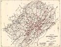
Street Map of Jefferson County, Alabama
Publication Info:
Birmingham: Office of the City Engineer, 1926
Viewing Options
Main Author:
Jefferson County Commission
Title/Description:
Road Map of Jefferson County
Publication Info:
[S.l.] Jefferson County Commissions, 1927, rev. 1946
Viewing Options
Main Author:
Totten, Robert L.
Title/Description:
Totten's map of Shades Valley, Jefferson County, Ala.
Publication Info:
Birmingham: Robert L. Totten Inc., 1927
Viewing Options
Main Author:
Jefferson County Commission
Title/Description:
Road Map of Jefferson County
Publication Info:
Birmingham: Jefferson County Commission, The Board of Revenue, 1927
Viewing Options
Main Author:
The Elmwood Corporation
Title/Description:
Map of Elmwood Cemetery
Publication Info:
Birmingham: The Elmwood Corporation, 1928
Viewing Options
Main Author:
Glander, J.H.
Title/Description:
Mountain Brook Bridle Trails
Publication Info:
Birmingham: The Jemison Companies, 1928
Viewing Options
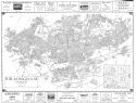
Main Author:
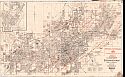
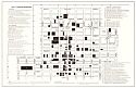
Nirenstein, Nathan
Title/Description:
Birmingham, Alabama (Cadastral Map of Downtown Businesses)
Publication Info:
Birmingham: Nathan Nirenstein, 1929
Viewing Options
Title/Description:
New Commercial Map of Jefferson County, Alabama
Publication Info:
[Birmingham: c. 1930]
Viewing Options
Main Author:
Whitson, Bethel W.
Title/Description:
Whitson's Map Northside Business District
Publication Info:
Birmingham: Bethel W. Whitson, c.1930
Viewing Options
Main Author:
Glander, J.H.
Title/Description:
Mountain Brook Land Company Proposed General Plan
Publication Info:
Blueprint copy of original
Viewing Options
Title/Description:
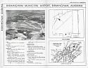
Birmingham Municipal Airport
Publication Info:
Unknown
Viewing Options
Title/Description:
Map of Birimngham, Alabama and Vicinity
Publication Info:
Glendale, CA: Western Map company, c. 1932
Viewing Options
Title/Description:
Location of Railroads, Structures and Rolling Mill, Bessemer, Alabama
Publication Info:
Tennessee Coal, Iron and Railroad Company, 1932
Viewing Options
Main Author:
Whitson, Bethel W.
Title/Description:
Whitson's Map of Birmingham, Ala
Publication Info:
Birmingham: Bethel W. Whitson, 1932
Viewing Options
Title/Description:
Road Map of Jefferson County, Alabama
Publication Info:
overprinted with plans for convict camps
Viewing Options
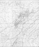
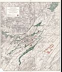
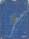
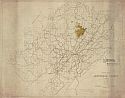
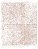
Main Author:
U.S. Geological Survey
Title/Description:
Port Birmingham Quadrangle
Publication Info:
Washington, D.C.: Department of the Interior, U.S. Geological Survey, c.1935
Viewing Options
Main Author:
Birmingham-Bessemer Terminal Area Co-Ordinating Committee
Title/Description:
Tracks and Facilities of various railroads within Birmingham-Bessemer Terminal Area
Publication Info:
1935; Blueprint reproduction
Viewing Options
Main Author:
Bethel W. Whitson Company
Title/Description:
Industrial Map Showing Location of Some of The Industries in the Birmingham District, Birmingham, Alabama
Publication Info:
Birmingham: Bethel W. Whitson Company 1935
Viewing Options
Main Author:
Nirenstein, Nathan
Title/Description:
Birmingham, Alabama
Publication Info:
Birmingham: Nathan Nirenstein, c.1937
Viewing Options
Main Author:
Whitson, Bethel W.
Title/Description:
Whitson's Tenant Map of Birmingham Business District
Publication Info:
Birmingham: Bethel W. Whitson, 1937
Viewing Options
Main Author:
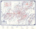
Alabama State Highway Department
Title/Description:
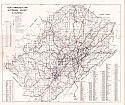
Traffic Flow Map, Jefferson County, Alabama
Publication Info:
S.N., 1938
Viewing Options
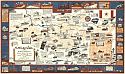
Main Author:
Coleman, Kate Kilby
Title/Description:
A Map of Birmingham Wherein Vulcan turns the Pages of Life and Legend in the Magic City
Viewing Options
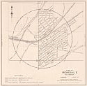
Main Author:
Alabama State Planning Commission
Title/Description:
Town of Irondale, Alabama
Publication Info:
Montgomery: Alabama State Planning Commission, 1939
Viewing Options
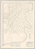
Main Author:
Alabama State Planning Commission
Title/Description:
Town of Brighton, Alabama
Publication Info:
Montgomery: Alabama State Planning Commission, 1940
Viewing Options
Main Author:
Alabama State Planning Commission
Title/Description:
Town of Cardiff, Alabama
Publication Info:
Montgomery: Alabama State Planning Commission, 1940
Viewing Options
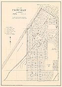
Main Author:
Alabama State Planning Commission
Title/Description:
City of Fairfield
Publication Info:
Montgomery: Alabama State Planning Commission, 1940
Viewing Options
Main Author:
Whitson, Bethel W.
Title/Description:
Whitson's Southside Map, Birmingham, Alabama
Publication Info:
Birmingham: Bethel W. Whitson Co., 1940
Viewing Options
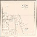
Main Author:
Alabama State Planning Commission
Title/Description:
Town of Brookside, Alabama
Publication Info:
Montgomery: Alabama State Planning Commission, 1941
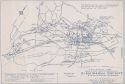
Viewing Options
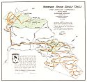
Main Author:
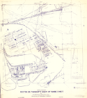
Birmingham ELectric Company
Title/Description:
Transportation Map of Birmingham
Publication Info:
Birmingham: Birmingham Electric Company, 1941
Viewing Options
Main Author:
Western Map Company
Title/Description:
Birmingham, Alabama
Publication Info:
Memphis: C.A. Davis Printing Company 1941
Viewing Options
Title/Description:
Map of Mountain Brook, Jefferson County
Publication Info:
Unknown
Viewing Options
Main Author:
Western Map Company
Title/Description:
Birmingham, Alabama
Publication Info:
Memphis: C.A. Davis Printing Co., 1944
Viewing Options
Main Author:
Homewood City Planning Commission
Title/Description:
City of Homewood, Jefferson County, Alabama
Publication Info:
Montgomery: Alabama State Planning Board, 1945
Viewing Options
Main Author:
First National Bank of Birmingham
Title/Description:
General Highway and Transportation Map, Jefferson County, Alabama
Publication Info:
Cleveland: Western States Publishing Co., 1945
Viewing Options
Main Author:
Western Map Company
Title/Description:
Birmingham, Alabama
Publication Info:
Memphis: C.A. Davis Printing Company 1945
Viewing Options
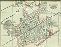
Main Author:
Mountain Brook City Planning Commission
Title/Description:
Mountain Brook, Jefferson County, Alabama
Publication Info:
Montgomery: Alabama State Planning Board, 1945
Viewing Options
Main Author:
Birmingham Chamber of Commerce
Title/Description:
Birmingham
Publication Info:
Birmingham: Birmingham Chamber of Commerce, 1946
Viewing Options
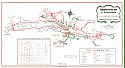
Main Author:
Ashburn, J. Foster
Title/Description:
Transportation Map of Birmingham District
Publication Info:
Birmingham: Birmingham Electric Company, 1947

Viewing Options
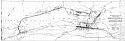
Title/Description:
Birmingham Mineral Railroad's Red Mountain Route at Peak Mileage Prior to June 30, 1917
Publication Info:
unknown c. 1950
Viewing Options
Title/Description:
Map of Downtown Birmingham
Publication Info:
Birmingham: Birmingham Chamber of Commerce, 1952
Viewing Options
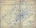
Title/Description:
Road Map of Jefferson County, Alabama
Publication Info:
Birmingham: 1927, Revised to 1952
Viewing Options
Main Author:
General Drafting Company
Title/Description:
Birmingham
Publication Info:
Convent Station, N.J.: General Drafting Company, 1952; for the Standard Oil Company
Viewing Options
Main Author:
Ashburn, J. Foster
Title/Description:
Birmingham City Map
Publication Info:
[Birmingham]: J. Foster Ashburn, 1953
Viewing Options
Main Author:
General Drafting Company
Title/Description:
Birmingham
Publication Info:
Convent Station, N.J.: General Drafting Company, 1955; for the Standard Oil Company
Viewing Options
Title/Description:
Road Map of Jefferson County, Alabama
Publication Info:
Birmingham: 1927, Revised to 1956
Viewing Options
Title/Description:
Road Map of Jefferson County, Alabama
Publication Info:
Birmingham: 1927, Revised to 1956
Viewing Options
Main Author:
Clancy, Joe W.
Title/Description:
Elyton (Frog Level) Alabama, 1870-1880's
Publication Info:
blueprint of original map
Viewing Options
Main Author:
Ashburn, J. Foster
Title/Description:
Birmingham City Map
Publication Info:
[Birmingham]: J. Foster Ashburn, 1957
Viewing Options
Main Author:
General Drafting Company
Title/Description:
Birmingham
Publication Info:
Convent Station, N.J.: General Drafting Company, 1957; for the Standard Oil Company
Viewing Options
Title/Description:
Map of the City of Mountain Brook, Jefferson County, Alabama
Publication Info:
Unknown, 1963
Viewing Options
Main Author:
Whitson, Bethel W.
Title/Description:
Whitson's Road Map of Jefferson County, Alabama
Publication Info:
Birmingham: Bethel W. Whitson Organization, 1964
Viewing Options
Main Author:
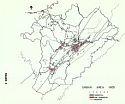
Birmingham-Jefferson County Regional Planning Commission
Title/Description:
Greater Birmingham Urban Area 1890
Viewing Options
Main Author:
Birmingham-Jefferson County Regional Planning Commission
Title/Description:
Greater Birmingham Urban Area 1905
Viewing Options
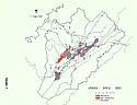
Main Author:
Birmingham-Jefferson County Regional Planning Commission
Title/Description:
Greater Birmingham Urban Area & Streetcar System 1905 & 1925
Viewing Options
Main Author:
Birmingham-Jefferson County Regional Planning Commission
Title/Description:
Greater Birmingham Urban Area 1925
Viewing Options
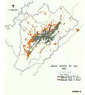
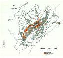
Main Author:
Birmingham-Jefferson County Regional Planning Commission
Title/Description:
Greater Birmingaham Urban Areas Served by Bus, 1950
Viewing Options
Main Author:
Birmingham-Jefferson County Regional Planning Commission
Title/Description:
Greater Birmingham Urban Area 1950
Viewing Options
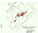
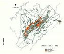
Main Author:
Birmingham-Jefferson County Regional Planning Commission
Title/Description:
Greater Birmingham Urban Area 1960
Viewing Options
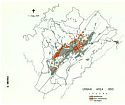
Main Author:
Birmingham-Jefferson County Regional Planning Commission
Title/Description:
Greater Birmingham Urban Area 1965
Viewing Options
Main Author:
Bethel W. Whitson Organization
Title/Description:
Whitson's Tenant Map of Birmingham Business District
Publication Info:
Birmingham: Bethel W. Whitson Organization, 1970
Viewing Options
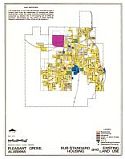
Title/Description:
Sub-Standard Housing and Existing Land Use, Pleasant Grove, Alabama
Publication Info:
Birmingham: Birmingham Regional Planning Commission, 1973
Viewing Options
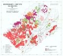
Main Author:
Birmingham Regional Planning Commission
Title/Description:
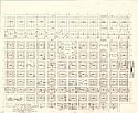
Jefferson County, Alabama Large Landholders
Publication Info:
Birmingham: Birimingham Regional Planning Commission, 1975
Viewing Options
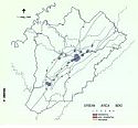
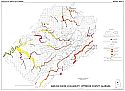
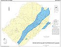
Main Author:
Knight, Alfred A.
Title/Description:
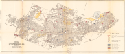
Surface- Water Availability, Jefferson County, Alabama
Publication Info:
Tuscaloosa: Geological Survey of Alabama, 1976; Map 167 Plate 2
Viewing Options
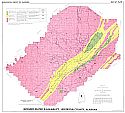
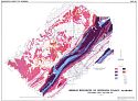
Main Author:
Knight, Alfred L.
Title/Description:
Ground-Water Availability, Jefferson County Alabama
Publication Info:
Tuscaloosa: Geological Survey of Alabama, 1976; Map 167 Plate I
Viewing Options
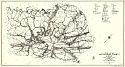
Main Author:
U.S. Department of the Interior, U.S. Geological Survey
Title/Description:
Areas in which sinkholes have occurred or can occur in Jefferson County, Alabama
Publication Info:
United States Department of the Interior, U.S. Geological Survey, 1977
Viewing Options
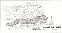
Main Author:
Barnett, Robert L.
Title/Description:
Coal Resources of Jefferson County, Alabama
Publication Info:
Geological Survey of Alabama, Special Map 192, Plate 1
Viewing Options
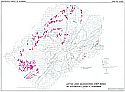
Main Author:
Barnett, Robert L.
Title/Description:
Active and Abandoned Strip Mines in Jefferson County, Alabama
Publication Info:
Tuscaloosa: Geological Survey of Alabama, 1979; Map 192, Plate 2
Viewing Options
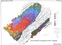
Main Author:
Rheams, Lawrence J.
Title/Description:
Mineral Resources of Jefferson County, Alabama
Publication Info:
Geological Survey of Alabama, Special Map 187
Viewing Options
Main Author:
Hunter, Johnathon A. and Paul H. Moser
Title/Description:
Ground-Water Availability in Jefferson County, Alabama
Publication Info:
Tuscaloosa: Geological Survey of Alabama, 1990; Special Map 224