Use the menu to the right to browse our collection of out-of-print editions of U.S.G.S. Quadrangles. Please keep in mind that map coverage varies and may not be complete for all counties.
Out-of-Print Quadrangles
Main Author
Alabama Highway Dept.
Alabama Highway Dept.
Alabama Highway Dept.
Alabama Highway Dept.
Alabama Highway Dept.
Alabama Highway Dept.
Alabama Highway Dept.
Alabama Highway Dept.
Alabama Highway Dept.
Alabama Highway Dept.
Location
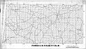
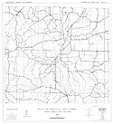
Franklin County
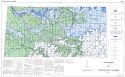
Franklin County
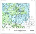
Franklin County
Franklin County
Franklin County
Franklin County
Franklin County
Franklin County
Franklin County
Franklin County
Publication Information
Montgomery: ASHD
Montgomery: ASHD
Montgomery: ASHD
Montgomery: ASHD
Montgomery: ASHD
Montgomery: ASHD
Montgomery: ASHD
Montgomery: ASHD
Montgomery: ASHD
Montgomery: ASHD
Date
2012
2005
1996
1987
1977
1965
1959
1949
1938
1937
Scale
1:125,000
1:125,000
1:125,000
1:125,000
1:125,000
1:125,000
1:125,000
1:125,000
1:125,000
1:125,000
Viewing Options
Main Author:
LaTourrette, John
Title/Description:
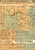
An Accurate Map of the State of Alabama and West Florida [Sheet 4: Franklin, Lauderdale, Lawrence, Marion, Walker]
Publication Info:
New York: Colton & Co., 1837
Viewing Options
Main Author:
Bacon, Delos H.
Title/Description:
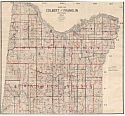
Map of Colbert and Franklin Counties, Ala
Publication Info:
Florence: Delos H. Bacon, 1908
Viewing Options
Main Author:
U.S. Department of Agriculture
Title/Description:
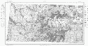
Franklin County soil survey map
Publication Info:
Washington: U.S. Department of Agriculture, 1927
Viewing Options
Main Author:
U.S. Department of Agriculture
Title/Description:
Franklin County soil survey map
Publication Info:
Washington: U.S. Department of Agriculture, 1927
Viewing Options
Title/Description:
Whitson's Map of Franklin County
Publication Info:
Birmingham: Bethel W. Whitson & Co., 1930
Viewing Options
Main Author:
Burchard, E.F.
Title/Description:
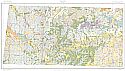
Geologic Map of the Russellville Brown Iron Ore District, Franklin County, Alabama
Publication Info:
Tuscaloosa: Geological Survey of Alabama, 1931; Bulletin Plate 1
Viewing Options
Main Author:
Brackeen, L.G.
Title/Description:
Soil Map Franklin County, Alabama
Publication Info:
Montgomery: Alabama Department of Agriculture, 1956
Viewing Options
Main Author:
Burchard, E.F.
Title/Description:
Ore Deposits in the Russellville Brown Iron Ore District, Franklin County, Alabama
Publication Info:
Tuscaloosa: Geological Survey of Alabama, 1960; Bulletin 70 overprinted on 1927 U.S.D.A soil survey map
Viewing Options
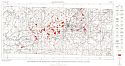
Main Author:
Peace, Richard R., Jr.
Title/Description:
Map of Russellville Area, Alabama Showing Location of Wells and Springs
Publication Info:
Tuscaloosa: Geological Survey of Alabama, 1962; from Information Series 28, Plate 1
Viewing Options
Main Author:
Peace, Richard R, Jr.
Title/Description:
Geologic Map of Franklin County, Alabama
Publication Info:
Tuscaloosa: Geological Survey of Alabama, Special Map 22
Viewing Options
Main Author:
Peace, Richard R. Jr,
Title/Description:
Geologic Map of the Russellville Area Alabama
Publication Info:
Tuscaloosa: Geological Survey of Alabama, 1962; Bulletin 77 Plate 1
Viewing Options
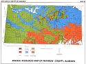
Main Author:
Chaffin, Herbert S. Jr.
Title/Description:
Mineral Resources Map of Franklin County, Alabama
Publication Info:
Tuscaloosa: Geological Survey of Alabama, Special Map 113

Viewing Options
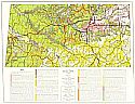
Title/Description:
Existing Land Use, Town of Phil Campbell, Alabama
Publication Info:
Muscle Shoals Council of Local Government, 1972
Viewing Options
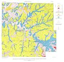
Main Author:
United States Geological Survey
Title/Description:
Areas in which sinkholes have occurred or can occur in Franklin County, Alabama
Publication Info:
Washington: Department of the Interior, U.S. Geological Survey, 1977
Viewing Options
Main Author:
U.S. Department of Agriculture, Soil Conservation Service
Title/Description:
Soil Interpretive Map of Important Farmlands for Franklin County, Alabama
Publication Info:
Washington: U.S. Department of Agriculture, 1979

