Historical Maps of Other Southeastern States

Selected West Virginia Out-of-Print Quadrangles
Before 1900
Before 1900
1900-1915
1916-1925
After 1925

 
Next Page
  Main Author:   Hardesty, H.H.
  Title/Description:   Map of Wood County, West Virginia
  Publication Info:   New York: H.H. Hardesty, 1882
  Date:   1882
  Scale:   not indicated
  Original Source:   University of Alabama Map Library
Viewing options:


  Main Author:   Hardesty, H.H.
  Title/Description:   Map of Pleasants County, West Virginia
  Publication Info:   New York: H.H. Hardesty, 1882
  Date:   1882
  Scale:   not indicated
  Original Source:   University of Alabama Map Library
Viewing options:


  Main Author:   Rand McNally and Company
  Title/Description:   West Virginia
  Publication Info:   Chicago: Rand McNally and Company, 1889; from The Enlarged Business Atlas and Shippers Guide
  Date:   1889
  Scale:   1:950,400
  Original Source:   Courtesy of Murray Hudson, Halls, Tennessee
Viewing options:


  Main Author:   unknown
  Title/Description:   West Virginia
  Publication Info:   New York: L.L. Poates Engraving Company, 1890
  Date:   1890
  Scale:   1:2,028,000
  Original Source:   Birmingham Public Library Cartography Collection
Viewing options:


Main Author:   Rand McNally and Company
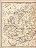
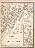
Title/Description:   New Map of West Virginia
Publication Info:   Chicago: Rand McNally and Company, 1890; from The Family Atlas of the World
Date:   1890
Scale:   1:950,400
Original Source:   University of Alabama Map Library
West
East
Viewing options:
Viewing options:
JPEG or Plugin
JPEG or Plugin


  Main Author:   Taylor, D.F.
  Title/Description:   Map of the Property of the Charlestown Mining, Manufacturing and Improvement Company
  Publication Info:   Washington: D.J. Howell, 1891
  Date:   1891
  Scale:   1:5,700
  Original Source:   Courtesy of Murray Hudson, Halls, Tennessee
Viewing options:


  Main Author:   Rand McNally and Company
  Title/Description:   West Virginia
  Publication Info:   Chicago: Rand McNally and Company, 1893; from The Universal Atlas of the World
  Date:   1893
  Scale:   1:1,414,285
  Original Source:   University of Alabama Map Library
Viewing options:


  Main Author:   Rand McNally and Company
  Title/Description:   West Virginia
  Publication Info:  

Chicago: Rand McNally and Company, 1893; from The Enlarged Business Atlas and Shippers Guide

  Date:   1893
  Scale:   1:887,000
  Original Source:   Courtesy of Murray Hudson, Halls, Tennessee
Viewing options:


  Main Author:   Rand McNally and Company
  Title/Description:   West Virginia
  Publication Info:   Chicago: Rand McNally and Company, 1895; from The New General Atlas of the World
  Date:   1895
  Scale:   1:1,412,928
  Original Source:   Courtesy of Murray Hudson, Halls, Tennessee
Viewing options:
 

  Main Author:   Cram, George F.
  Title/Description:   Map of Parkersburg, West Virginia and Vicinity
  Publication Info:   Chicago: George F. Cram, 1898; from The Universal Atlas, Geographical, Astronomical and Historical
  Date:   1898
  Scale:   1:2,500
  Original Source:   Courtesy of Adams Antiques, Northport, Alabama
Viewing options:


  Main Author:   Rand McNally and Company
  Title/Description:   Rand McNally and Company's New Map of West Virginia
  Publication Info:   Chicago: Rand McNally and Company, 1898
  Date:   1898
  Scale:   1:1,394,000
  Original Source:   Courtesy of Murray Hudson, Halls, Tennessee
Viewing options:


  Main Author:   Morris, Russell, L.
  Title/Description:   Map of West Virginia
  Publication Info:   Morgantown: West Virginia Geological and Economic Survey, 1899
  Date:   1899
  Scale:   1:633,600
  Original Source:   Geological Survey of Alabama
Viewing options:


  Main Author:   Smith, Benjamin E.
  Title/Description:   West Virginia
  Publication Info:   New York: The Century Company, 1899; from The Century Atlas of the World
  Date:   1899
  Scale:   1:1,267,200
  Original Source:   University of Alabama Map Library
Viewing options:


  Main Author:   U.S. Army Corps of Engineers
  Title/Description:   West Fork River, West Virginia
  Publication Info:   Washington: U.S. House of Representatives, 56th Congress, 1st Session, Doc. No. 88
  Date:   1899
  Scale:   1:60,000
  Original Source:   Courtesy of Murray Hudson, Halls, Tennessee
Viewing options:


  Main Author:   U.S. Army Corps of Engineers
  Title/Description:   Geological Map,West Fork River, West Virginia
  Publication Info:   Washington: U.S. House of Representatives, 56th Congress, 1st Session, Doc. No. 88, 1899
  Date:   1899
  Scale:   1:72,000
  Original Source:   Courtesy of Murray Hudson, Halls, Tennessee
Viewing options:


Next Page


© University of Alabama
To purchase map reproductions, submit a quote request.
Download MrSID Plugin