Historical Maps of Other Southeastern States

Previous Page

  Main Author:   Atwood, J.M.  
  Title/Description:   Map of the State of Louisiana
  Publication Info:   Philadelphia: T.H. Butler and Co., 1881
  Date:   1881
  Scale:   1:1,500,000
  Original Source:   Alabama Department of Archives and History
Viewing options:


  Main Author:   Lockett, S.H.  
  Title/Description:   The Louisiana State University Topographical Map of Louisiana
  Publication Info:   NY: G.W. and C.B. Colton and Co., 1883
  Date:   1883
  Scale:   1:633,000
  Original Source:   Birmingham Public Library Cartography Collection
Viewing options:


  Main Author:   Hardesty, H.H.
  Title/Description:   Map of Louisiana
  Publication Info:   New York: H.H. Hardesty & Compay, 1883; from Hardesty's Historical and Geographical Encyclopedia
  Date:   1883
  Scale:   1:1,457,000
  Original Source:   Courtesy of Murray Hudson, Halls, Tennessee
Viewing options:


  Main Author:    
  Title/Description:   Louisiana
  Publication Info:   Philadelphia: O.W. Gray and Son, 1883; from The National Atlas
  Date:   1883
  Scale:   1:1,200,000
  Original Source:   Courtesy of Murray Hudson, Halls, Tennessee
Viewing options:


  Main Author:    
  Title/Description:   Louisiana
  Publication Info:   Chicago: Rand McNally and Co., 1884; from Rand McNally Indexed Atlas of the World
  Date:   1884
  Scale:   1:2,090,000
  Original Source:   From the personal collection of Dr. Gerald Webster
Viewing options:


  Main Author:   Rand McNally and Company
  Title/Description:   Louisiana
  Publication Info:   Chicago: Rand McNally and Co., c. 1885
  Date:   1885
  Scale:   1:2,091,000
  Original Source:   Courtesy of Murray Hudson, Halls, Tennessee
Viewing options:


  Main Author:   Watson, Gaylord
  Title/Description:   Watson's Atlas Map of Louisiana
  Publication Info:   New York: Gaylord Watson, 1885; from Watson's New and Complete Illustrated Atlas of the World
  Date:   1885
  Scale:   1:1,901,000
  Original Source:   University of Alabama Map Library
Viewing options:


  Main Author:   Cram, George F.
  Title/Description:   Louisiana
  Publication Info:   Chicago: George F. Cram, 1887
  Date:   1887
  Scale:   1:2,028,000
  Original Source:   Courtesy of Murray Hudson, Halls, Tennessee
Viewing options:


  Main Author:    
  Title/Description:   Railroad and County Map of Louisiana
  Publication Info:   New York: A.A. Grant, 1887; from Grant's Standard American Atlas of the World
  Date:   1887
  Scale:   1:1,140,480
  Original Source:   Courtesy of Murray Hudson, Halls, Tennessee
Viewing options:


  Main Author:   People's Publishing Co.
  Title/Description:   Louisiana
  Publication Info:   Rochester: W.H. Stewart & Co., 1888; from The People's Illustrated & Descriptive Family Atlas of the World
  Date:   1888
  Scale:   1:1,901,000
  Original Source:   University of Alabama Map Library
Viewing options:


  Main Author:    
  Title/Description:   Louisiana
  Publication Info:   Chicago: Rand McNally and Company, 1889; from the Enlarged Business Atlas and Shippers Guide
  Date:   1889
  Scale:   1:1,457,280
  Original Source:   Courtesy of Murray Hudson, Halls, Tennessee
Viewing options:


  Main Author:   Mast, Crowell, and Kirkpatrick
  Title/Description:   Map of Louisiana
  Publication Info:   New York: Mast, Crowell, and Kirkpatrick, 1893
  Date:   1893
  Scale:   1:1,900,000
  Original Source:   University of Alabama Map Library
Viewing options:


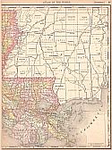
Main Author:   Rand McNally & Co.
Title/Description:   Louisiana
Publication Info:   Chicago: Rand McNally & Co., 1893; from Rand McNally & Co.'s Universal Atlas of the World
Date:   1893
Scale:   1:1,454,900
Original Source:   University of Alabama Map Library
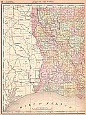
West
East
Viewing options:
Viewing options:
JPEG or Plugin
JPEG or Plugin


  Main Author:   Rand McNally  
  Title/Description:   Rand McNally & Co.'s New 11 x 14 Map of Louisiana
  Publication Info:   Chicago: Rand McNally & Co., 1895
  Date:   1:2,091,000
  Scale:   1895
  Original Source:   W. S. Hoole Special Collections Library
Viewing options:


  Main Author:   Rand McNally and Company
  Title/Description:   Louisiana
  Publication Info:   Chicago: Rand McNally and Company 1895; From Rand McNally's New General Atlas of the World
  Date:   1895
  Scale:   1:1,995,840
  Original Source:   Courtesy of Murray Hudson, Halls, Tennessee
Viewing options:


  Main Author:   Cram, George F.
  Title/Description:   Louisiana
  Publication Info:   Chicago: George F. Cram, 1898; from Cram's Universal Atlas, Geographical, Astronomical and Historical
  Date:   1898
  Scale:   1:1,774,000
  Original Source:   Courtesy of Adams Antiques, Northport, Alabama
Viewing options:


  Main Author:    
  Title/Description:   Louisiana
  Publication Info:   New York: Funk & Wagnalls Company, 1898; from A Standard Atlas of the World
  Date:   1898
  Scale:   1:2,534,400
  Original Source:   University of Alabama Map Library
Viewing options:


  Main Author:   Cram, George F.
  Title/Description:   Louisiana
  Publication Info:   Chicago: George F. Cram, 1899; from 1899 Standard American Railway Atlas
  Date:   1899
  Scale:   1:1,200,000
  Original Source:   University of Alabama Map Library
Viewing options:


  Main Author:   Smith, Benjamin E.
  Title/Description:   Louisiana
  Publication Info:   New York: The Century Company, 1899; from The Century Atlas of the World
  Date:   1899
  Scale:   1: 171,020
  Original Source:   University of Alabama Map Library
Viewing options:


  Main Author:   Servoss, R.D.?
  Title/Description:   Louisiana
  Publication Info:   New York: The Snow-Church Surety Company, 1900
  Date:   1900
  Scale:   1:2,534,000
  Original Source:   Courtesy of Murray Hudson, Halls, Tennessee
Viewing options:


  Main Author:   Cram, George F.
  Title/Description:   Louisiana
  Publication Info:   Chicago: The Fort DearbornPublishing Company, 1901; from The National Standard Family and Business Atlas of the World
  Date:   1901
  Scale:   1:1,774,080
  Original Source:   Courtesy of Murray Hudson, Halls, Tennessee
Viewing options:


  Main Author:    
  Title/Description:   Louisiana
  Publication Info:   Chicago: Rand McNally and Company, 1901; from Enlarged Business Atlas and Shippers Guide
  Date:   1901
  Scale:   1:950,400
  Original Source:   Courtesy of Murray Hudson, Halls, Tennessee
Viewing options:


  Main Author:   Rand McNally and Company
  Title/Description:   Louisiana
  Publication Info:   Chicago: Rand McNally and Company, 1901; from the Universal Atlas of the World
  Date:   1901
  Scale:   1:2,090,880
  Original Source:   Courtesy of Murray Hudson, Halls, Tennessee
Viewing options:


  Main Author:   The Century Co.
  Title/Description:   Louisiana
  Publication Info:   Buffalo: The Matthew-Northrup Co., 1902; from the 1902 edition of The Century Atlas.
  Date:   1902
  Scale:   1:1,710,000
  Original Source:   From the personal collection of Dr. Robert Burckhalter
Viewing options:


  Main Author:    
  Title/Description:   Map of Louisiana
  Publication Info:   Chicago: George F. Cram, 1903; from Cram's Modern Atlas
  Date:   1903
  Scale:   1:1,267,200
  Original Source:   Courtesy of Murray Hudson, Halls, Tennessee
Viewing options:


  Main Author:   Miller, J. Martin
  Title/Description:   Louisiana
  Publication Info:   unknown, 1904; from the Twentieth Century Atlas and Illustrated World
  Date:   1904
  Scale:   1:1,774,080
  Original Source:   Courtesy of Murray Hudson, Halls, Tennessee
Viewing options:


  Main Author:    
  Title/Description:   Louisiana
  Publication Info:   Chicago: Rand McNally and Company, 1906; from the Business Atlas and Shippers Guide
  Date:   1906
  Scale:   1:950,400
  Original Source:   Courtesy of Murray Hudson, Halls, Tennessee
Viewing options:


  Main Author:   Cram, George F.
  Title/Description:   Map of Louisiana
  Publication Info:   Chicago: George F. Cram, 1907; from Cram's Standard American Atlas
  Date:   1907
  Scale:   1:1,393,920
  Original Source:   University of Alabama Map Library
Viewing options:


  Main Author:   Cram, George F.
  Title/Description:   Louisiana
  Publication Info:   Chicago: George F. Cram
  Date:   1908
  Scale:   1:1,774,000
  Original Source:   Courtesy of Murray Hudson, Halls, Tennessee
Viewing options:


  Main Author:    
  Title/Description:   Louisiana
  Publication Info:   New York: The Crowell Publishing Company, 1908; from The Twentieth Century Peerless Atlas
  Date:   1908
  Scale:   1:1,900,800
  Original Source:   Courtesy of Murray Hudson, Halls, Tennessee
Viewing options:


  Main Author:   Patten, William and J.E. Homas
  Title/Description:   Louisiana
  Publication Info:   New York: P.F. Collier and Son, 1909; from The New Encyclopedic Atlas and Gazetteer of the World
  Date:   1909
  Scale:   1: 2,280,960
  Original Source:   University of Alabama Map Library
Viewing options:


  Main Author:    
  Title/Description:   Louisiana
  Publication Info:   Chicago: Rand McNally and Company, 1911; from the Commercial Atlas of America
  Date:   1911
  Scale:   1: 950,400
  Original Source:   Courtesy of Murray Hudson, Halls, Tennessee
Viewing options:


  Main Author:    
  Title/Description:   Louisiana
  Publication Info:   New York: The Century Company, 1913; from the Century Atlas of the World
  Date:   1913
  Scale:   1: 1,710,720
  Original Source:   University of Alabama Map Library
Viewing options:


  Main Author:   Rand McNally and Company
  Title/Description:   Rand McNally New Commercial Atlas Map of Louisiana
  Publication Info:   Chicago: Rand McNally and Co., 1914; from the New Commercial Atlas of America
  Date:   1914
  Scale:   1:950,000
  Original Source:   Courtesy of Murray Hudson, Halls, Tennessee
Viewing options:


  Main Author:   Rand McNally and Company
  Title/Description:   Louisiana
  Publication Info:   Chicago: Rand McNally and Company, 1916; from the Ideal Atlas of the World
  Date:   1916
  Scale:   1:2,090,880
  Original Source:   Courtesy of Murray Hudson, Halls, Tennessee
Viewing options:


  Main Author:   Rand McNally and Company
  Title/Description:   Rand McNally Standard Map of Louisiana
  Publication Info:   Chicago: Rand McNally and Company
  Date:   1920
  Scale:    
  Original Source:   W. S. Hoole Special Collections Library
Viewing options:


  Main Author:   Louisiana. Board of Commissioners of the Port of New Orleans
  Title/Description:   Map showing New Orleans harbor improvements from Southport to Port Chalmette / drawn by Robert H. Scott
  Publication Info:   New Orleans : Board of Commissioners, Port of New Orleans, 1921.
  Date:   1921
  Scale:    
  Original Source:   W. S. Hoole Special Collections Library
Viewing options:


  Main Author:   Rand McNally and Company
  Title/Description:   Louisiana
  Publication Info:   Chicago: Rand McNally and Company
  Date:   1921
  Scale:   1: 950,400
  Original Source:   University of Alabama Map Library
Viewing options:


  Main Author:   Rand McNally and Company
  Title/Description:   Louisiana- Black and White Mileage Map
  Publication Info:   Chicago: Rand McNally and Company
  Date:   1921
  Scale:   95,357
  Original Source:   University of Alabama Map Library
Viewing options:


  Main Author:   The Geographical Publishing Company
  Title/Description:   Louisiana
  Publication Info:   Chicago: The Geographical Publishing Company, 1922; from the New International Atlas of the World
  Date:   1922
  Scale:   1:2,027,520
  Original Source:   Courtesy of Murray Hudson, Halls, Tennessee
Viewing options:


  Main Author:   Dufilho, N.E.
  Title/Description:   Salt Dome Map (overprinted on a U.S.G.S. 1:500,000 base map from 1922)
  Publication Info:   (Louisiana) Department of Conservation, Minerals Division, 1927
  Date:   1927
  Scale:   1:500,000
  Original Source:   Geological Survey of Alabama
Viewing options:


  Main Author:   Bureau of the Census
  Title/Description:   Louisiana Minor Civil Divisions (1930 Census)
  Publication Info:   Washington: Government, Printing Office, 1930
  Date:   1930
  Scale:   1:1,013,000
  Original Source:  

Birmingham Public Library Cartography Collection

Viewing options:


  Main Author:   U.S. Department of the Interior
  Title/Description:   State of Louisiana
  Publication Info:   Washington: Government Printing Office, 1930
  Date:   1930
  Scale:   1:760,000
  Original Source:  

Birmingham Public Library Cartography Collection

Viewing options:


  Main Author:   Louisiana Geological Survey
  Title/Description:   Map of Louisiana showing oil, gas and sulphur fields, salt domes, ect.
  Publication Info:   Louisiana Geological Survey, 1935
  Date:   1935
  Scale:   1:1,107,000
  Original Source:   Geological Survey of Alabama
Viewing options:


  Main Author:   Hassan, A. F.
  Title/Description:   Louisiana
  Publication Info:   Washington: Dept. of the Interior, U.S. Geological Survey, 1936. Reprinted in 1944.
  Date:   1936
  Scale:   1:1,000,000
  Original Source:   W. S. Hoole Special Collections Library
Viewing options:


  Main Author:   Coignet, G.O.
  Title/Description:   Oil and Gas Map of Louisiana
  Publication Info:   [Baton Rouge]: Louisiana Geological Survey, 1947
  Date:   1947
  Scale:   1:500,000
  Original Source:   University of Alabama Map Library
Viewing options:


  Main Author:   Bureau of the Census
  Title/Description:   Louisiana Minor Civil Divisions - Police Jury Wards (1960 census)
  Publication Info:   Washington: Government Printing Office, 1961
  Date:   1960
  Scale:   1:760,000
  Original Source:   Birmingham Public Library Cartography Collection
Viewing options:
 

Previous Page