1876 - 1890
Before 1825
1825-1835
1836-1850
1851-1875
1876-1890
1891-1900
After 1900

Previous Page

  Main Author:   Mitchell, Samuel Augustus
  Title/Description:   Map of Europe Showing its [Greater] Political Divisions
  Publication Info:   Philadelphia: S. Augustus Mitchell, 1876
  Date:   1876
  Scale:   1:19,000,000
  Original Source:   Birmingham Public Library Cartography Collection
Viewing options:


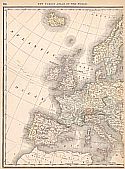
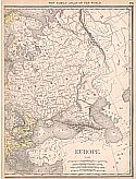
  Main Author:   Gray, Ormando W.
  Title/Description:   Europe
  Publication Info:   Philadelphia: O.W. Gray, 1876
  Date:   1876
  Scale:   1:13,600,000
  Original Source:   Courtesy of Murray Hudson, Halls, Tennessee
Viewing options:


  Main Author:   Menke, Theodor
  Title/Description:   Reich der Franken unter Karl dem Grossen und Sienen Nachkommem bis 900
  Publication Info:   Gotha: Justus Perthes, 1876; Merolinger-Kerolinger No.11; Spruner-Menke Historical Handatlas No. 30
  Date:   1876
  Scale:   1:5,300,000
  Original Source:   Courtesy of Murray Hudson, Halls, Tennessee
Viewing options:


  Main Author:   McNally, Francis
  Title/Description:   Austria, Italy, Turkey, and Greece
  Publication Info:   New York: A.S. Barnes and Company, 1876; from An Improved System of Geography
  Date:   1876
  Scale:   1:7,920,000
  Original Source:   University of Alabama Map Library
Viewing options:


  Main Author:   McNally, Francis
  Title/Description:   Europe
  Publication Info:   New York: A.S. Barnes and Company, 1876; from An Improved System of Geography
  Date:   1876
  Scale:   1:20,275,000
  Original Source:   University of Alabama Map Library
Viewing options:


  Main Author:   Gray, Ormando W.
  Title/Description:   Gray's New Map of Europe
  Publication Info:   Philadelphia: O.W. Gray, 1877
  Date:   1877
  Scale:   1:15,000,000
  Original Source:   Courtesy of Murray Hudson, Halls, Tennessee
Viewing options:


  Main Author:   von Stienwehr, A. , D.G. Brinton
  Title/Description:   Physical and Political map of Europe
  Publication Info:   Cincinnati,van Antwerp, Bragg and Co; from An Intermediate Geography with Lessons in Map Drawing, 1877
  Date:   1877
  Scale:   1:19,008,000
  Original Source:   Courtesy of Murray Hudson, Halls, Tennessee
Viewing options:


  Main Author:   von Stienwehr, A. , D.G. Brinton
  Title/Description:   Western and Southern Europe
  Publication Info:   Cincinnati,van Antwerp, Bragg and Co; from An Intermediate Geography with Lessons in Map Drawing, 1877
  Date:   1877
  Scale:   1:12,672,000
  Original Source:   Courtesy of Murray Hudson, Halls, Tennessee
Viewing options:


  Main Author:   von Spruner, K.
  Title/Description:   Historisch - Geographischer Schul - Atlas
  Publication Info:   Gotha: Justus Perthes, 1877
  Date:   1877
  Scale:   Various
  Original Source:   University of Alabama Map Library


  Main Author:   Drieux and Leroy
  Title/Description:   Monarchies Comparées de Cyrus de Darius et D' Alexandre
  Publication Info:   Paris: Librairie Classique D'Eugene Belin, 1878
  Date:   1878
  Scale:   1:17,799,200
  Original Source:   Courtesy of Murray Hudson, Halls, Tennessee
Viewing options:


  Main Author:   Drieux and Leroy
  Title/Description:   Empire des Arabes
  Publication Info:   Paris: Librairie Classique D'Eugene Belin, 1878
  Date:   1878
  Scale:   1:27,522,000
  Original Source:   Courtesy of Murray Hudson, Halls, Tennessee
Viewing options:


  Main Author:   Drieux and Leroy
  Title/Description:   Europe A L' Epoque des Croisades
  Publication Info:   Paris: Librairie Classique D'Eugene Belin, 1878
  Date:   1878
  Scale:   1:13,300,700
  Original Source:   Courtesy of Murray Hudson, Halls, Tennessee
Viewing options:


  Main Author:   Drieux and Leroy
  Title/Description:   Europe Féodale
  Publication Info:   Paris: Librairie Classique D'Eugene Belin, 1878
  Date:   1878
  Scale:   1:13,300,700
  Original Source:   Courtesy of Murray Hudson, Halls, Tennessee
Viewing options:


  Main Author:   Drieux and Leroy
  Title/Description:   Europe Pendant la derniere Periode Du Moyen-Age
  Publication Info:   Paris: Librairie Classique D'Eugene Belin, 1878
  Date:   1878
  Scale:   1:13,300,700
  Original Source:   Courtesy of Murray Hudson, Halls, Tennessee
Viewing options:


  Main Author:   Drieux and Leroy
  Title/Description:   Europe á l' epoque de Charles-Quint
  Publication Info:   Paris: Librairie Classique D'Eugene Belin, 1878
  Date:   1878
  Scale:   1:13,239,700
  Original Source:   Courtesy of Murray Hudson, Halls, Tennessee
Viewing options:


  Main Author:   Drieux and Leroy
  Title/Description:   Europe depius l' abdication de Charles Quint jusqu a la fin de la guerre de Trente Ans.
  Publication Info:   Paris: Librairie Classique D'Eugene Belin, 1878
  Date:   1878
  Scale:   1:13,263,600
  Original Source:   Courtesy of Murray Hudson, Halls, Tennessee
Viewing options:


  Main Author:   Drieux and Leroy
  Title/Description:   Europe en 1715
  Publication Info:   Paris: Librairie Classique D'Eugene Belin, 1878
  Date:   1878
  Scale:   1:10,636,500
  Original Source:   Courtesy of Murray Hudson, Halls, Tennessee
Viewing options:


  Main Author:   Drieux and Leroy
  Title/Description:   Europe 1715-1789
  Publication Info:   Paris: Librairie Classique D'Eugene Belin, 1878
  Date:   1878
  Scale:   1:13,137,000
  Original Source:   Courtesy of Murray Hudson, Halls, Tennessee
Viewing options:


  Main Author:   Drieux and Leroy
  Title/Description:   Europe Pour les Guerres de la République et de L' Empire
  Publication Info:   Paris: Librairie Classique D'Eugene Belin, 1878
  Date:   1878
  Scale:   1:11,837,400
  Original Source:   Courtesy of Murray Hudson, Halls, Tennessee
Viewing options:


  Main Author:   Drieux and Leroy
  Title/Description:   Carte Physique de L' Europe
  Publication Info:   Paris: Librairie Classique D'Eugene Belin, 1878
  Date:   1878
  Scale:   1:15,840,000
  Original Source:   Courtesy of Murray Hudson, Halls, Tennessee
Viewing options:


  Main Author:    
  Title/Description:   Europe Physique
  Publication Info:   Paris: Furne, Jouvet et Compagnie, 1878; from Atlas de Geographie Militaire
  Date:   1878
  Scale:   1:22,800,100
  Original Source:   Adams Antiques
Viewing options:


  Main Author:   Fisk & See
  Title/Description:   Western, Central, & Southern Europe
  Publication Info:   New York: Sheldon & Company, 1880; Map No.18 from Colton's Common School Geography
  Date:   1880
  Scale:   1:12,105,000
  Original Source:   Courtesy of Murray Hudson, Halls, Tennessee
Viewing options:


  Main Author:   Mitchell, S. Augustus
  Title/Description:   Map of Europe showing its Geopolitical Divisions
  Publication Info:   Philadelphia: S. Augustus Mitchell, 1880; from Mitchell's New General Atlas
  Date:   1880
  Scale:   1: 17,134,319
  Original Source:   Courtesy of Murray Hudson, Halls, Tennessee
Viewing options:


  Main Author:   The University Publishing Company
  Title/Description:   Europe - Political Map
  Publication Info:   New York: Russell and Struthers, c. 1880
  Date:   1880
  Scale:   1:22,176,000
  Original Source:   Courtesy of Murray Hudson, Halls, Tennessee
Viewing options:


  Main Author:   The University Publishing Company
  Title/Description:   Central Europe
  Publication Info:   New York: Russell and Struthers, c. 1880
  Date:   1880
  Scale:   1:9,504,000
  Original Source:   Courtesy of Murray Hudson, Halls, Tennessee
Viewing options:


  Main Author:   Spruner, Karl and Theodor Menke
  Title/Description:   Europa zur Zeit Odovacars (476-493.)
  Publication Info:   Gotha: Justus Perthes, 1880; from Hand-Atlas für die Geschichte des Mittelatters und die Neueren Zeit
  Date:   1880
  Scale:   1:15,000,000
  Original Source:   University of Alabama Map Library
Viewing options:


  Main Author:   Spruner, Karl and Theodor Menke
  Title/Description:   Europa gegen Ende von Justinians Regierung (um 560 n. Ch. G.)
  Publication Info:   Gotha: Justus Perthes, 1880; from Hand-Atlas für die Geschichte des Mittelatters und die Neueren Zeit
  Date:   1880
  Scale:   1:15,000,000
  Original Source:   University of Alabama Map Library
Viewing options:


  Main Author:   Spruner, Karl and Theodor Menke
  Title/Description:   Europa zur Zeit Karls des Grossen (768-814.)
  Publication Info:   Gotha: Justus Perthes, 1880; from Hand-Atlas für die Geschichte des Mittelatters und die Neueren Zeit
  Date:   1880
  Scale:   1:15,000,000
  Original Source:   University of Alabama Map Library
Viewing options:


  Main Author:   Spruner, Karl and Theodor Menke
  Title/Description:   Europa zur Zeit der Herstellung des abendländischen Kaiserthums durch Otto I. 962.
  Publication Info:   Gotha: Justus Perthes, 1880; from Hand-Atlas für die Geschichte des Mittelatters und die Neueren Zeit
  Date:   1880
  Scale:   1:15,000,000
  Original Source:   University of Alabama Map Library
Viewing options:


  Main Author:   Spruner, Karl and Theodor Menke
  Title/Description:   Europa zur Zeit des dritten Kreuzzuges 1190
  Publication Info:   Gotha: Justus Perthes, 1880; from Hand-Atlas für die Geschichte des Mittelatters und die Neueren Zeit
  Date:   1880
  Scale:   1:15,000,000
  Original Source:   University of Alabama Map Library
Viewing options:


  Main Author:   Spruner, Karl and Theodor Menke
  Title/Description:   Europa um die Mitte des Vierzehnten Jahrhunderts
  Publication Info:   Gotha: Justus Perthes, 1880; from Hand-Atlas für die Geschichte des Mittelatters und die Neueren Zeit
  Date:   1880
  Scale:   1:15,000,000
  Original Source:   University of Alabama Map Library
Viewing options:


  Main Author:   Spruner, Karl and Theodor Menke
  Title/Description:   Europa nach seinen kirchlichen Verhältnissen im Mittelalter
  Publication Info:   Gotha: Justus Perthes, 1880; from Hand-Atlas für die Geschichte des Mittelatters und die Neueren Zeit
  Date:   1880
  Scale:   1:15,000,000
  Original Source:   University of Alabama Map Library
Viewing options:


  Main Author:   Spruner, Karl and Theodor Menke
  Title/Description:   Europa während des Zeitraums der Reformation und der Übermacht des Hauses Habsburg 1492-1618.
  Publication Info:   Gotha: Justus Perthes, 1880; from Hand-Atlas für die Geschichte des Mittelatters und die Neueren Zeit
  Date:   1880
  Scale:   1:15,000,000
  Original Source:   University of Alabama Map Library
Viewing options:


  Main Author:   Spruner, Karl and Theodor Menke
  Title/Description:   Europa vom Westfälischen Frieden 1648 bis zur Zersplitterung der grossen spanischen Monarchie 1700 (Zeitraum der Übermacht Frankreichs)
  Publication Info:   Gotha: Justus Perthes, 1880; from Hand-Atlas für die Geschichte des Mittelatters und die Neueren Zeit
  Date:   1880
  Scale:   1:15,000,000
  Original Source:   University of Alabama Map Library
Viewing options:


  Main Author:   Spruner, Karl and Theodor Menke
  Title/Description:   Europa um 1740.
  Publication Info:   Gotha: Justus Perthes, 1880; from Hand-Atlas für die Geschichte des Mittelatters und die Neueren Zeit
  Date:   1880
  Scale:   1:15,000,000
  Original Source:   University of Alabama Map Library
Viewing options:


  Main Author:   Spruner, Karl and Theodor Menke
  Title/Description:   Europa zur Zeit Napoleon I's (um 1810.)
  Publication Info:   Gotha: Justus Perthes, 1880; from Hand-Atlas für die Geschichte des Mittelatters und die Neueren Zeit
  Date:   1880
  Scale:   1:15,000,000
  Original Source:   University of Alabama Map Library
Viewing options:


  Main Author:   Spruner, Karl and Theodor Menke
  Title/Description:   Europa nach dem Wiener Congress 1815.
  Publication Info:   Gotha: Justus Perthes, 1880; from Hand-Atlas für die Geschichte des Mittelatters und die Neueren Zeit
  Date:   1880
  Scale:   1:15,000,000
  Original Source:   University of Alabama Map Library
Viewing options:


  Main Author:   Spruner, Karl and Theodor Menke
  Title/Description:   Europa nach seinen Ethnographischen Verhältnissen in der Mitte des XIX Jahrhunderts.
  Publication Info:   Gotha: Justus Perthes, 1880; from Hand-Atlas für die Geschichte des Mittelatters und die Neueren Zeit
  Date:   1880
  Scale:   1:15,000,000
  Original Source:   University of Alabama Map Library
Viewing options:


  Main Author:   Spruner, Karl and Theodor Menke
  Title/Description:   Reich der Franken unter den Merowingern und bis auf Karl den Grossen 486-768
  Publication Info:   Gotha: Justus Perthes, 1880; from Hand-Atlas für die Geschichte des Mittelatters und die Neueren Zeit
  Date:   1880
  Scale:   1:5,300,000
  Original Source:   University of Alabama Map Library
Viewing options:


  Main Author:   Spruner, Karl and Theodor Menke
  Title/Description:   Reich der Franken unter Karl dem Grossen und semen Nachkommen bis 900
  Publication Info:   Gotha: Justus Perthes, 1880; from Hand-Atlas für die Geschichte des Mittelatters und die Neueren Zeit
  Date:   1880
  Scale:   1:5,300,000
  Original Source:   University of Alabama Map Library
Viewing options:


  Main Author:   Spruner, Karl and Theodor Menke
  Title/Description:   Kaiserthum Frankreich in seiner weitesten Ausdehnung unter Napoleon I.
  Publication Info:   Gotha: Justus Perthes, 1880; from Hand-Atlas für die Geschichte des Mittelatters und die Neueren Zeit
  Date:   1880
  Scale:   1:5,300,000
  Original Source:   University of Alabama Map Library
Viewing options:


  Main Author:   von Steinwehr, A.
  Title/Description:   Physical and Political Map of Europe
  Publication Info:   Cincinnati: Van Antwerp, Bragg and Company, 1881; from Eclectic Series, School Geography No. 3
  Date:   1881
  Scale:   1:19,008,000
  Original Source:   Courtesy of Murray Hudson, Halls, Tennessee
Viewing options:


  Main Author:   von Steinwehr, A.
  Title/Description:   Map of Western Europe
  Publication Info:   Cincinnati: Van Antwerp, Bragg and Company, 1881; from Eclectic Series, School Geography No. 3
  Date:   1881
  Scale:   1:9,504,000
  Original Source:   Courtesy of Murray Hudson, Halls, Tennessee
Viewing options:


  Main Author:   Mitchell, Samuel Augustus
  Title/Description:   Map of Europe Showing Its Greater Political Divisions
  Publication Info:   Philadelphia: S. Augustus Mitchell, 1881
  Date:   1881
  Scale:   1:19,000,000
  Original Source:   Birmingham Public Library Cartography Collection
Viewing options:


  Main Author:   Johnson, Alvin J.
  Title/Description:   (Various Maps of Europe)
  Publication Info:   New York: A.J. Johnson, 1881
  Date:   1881
  Scale:   1:34,000,000
  Original Source:   Courtesy of Murray Hudson, Halls, Tennessee
Viewing options:


  Main Author:   Mitchell, Samuel Augustus
  Title/Description:   Map of the Austrian Empire, Italian States, Turkey in Europe and Greece
  Publication Info:   Philadelphia: S.A. Mitchell, 1881
  Date:   1881
  Scale:   1:7,920,000
  Original Source:   Courtesy of Murray Hudson, Halls, Tennessee
Viewing options:


  Main Author:   Stieler, Adolf
  Title/Description:   Europa
  Publication Info:   Gotha: Justus Perthes, c.1881; from Adolf Stieler's Hand Atlas
  Date:   1881
  Scale:   1:15,000,000
  Original Source:   Courtesy of Murray Hudson, Halls, Tennessee
Viewing options:


  Main Author:   Stieler, Adolf
  Title/Description:   Hohen-Karte von Mittel Europa
  Publication Info:   Gotha: Justus Perthes, c.1881; from Adolf Stieler's Hand Atlas
  Date:   1881
  Scale:   1:5,000,000
  Original Source:   Courtesy of Murray Hudson, Halls, Tennessee
Viewing options:


  Main Author:   Swinton, William
  Title/Description:   Europe, Political Map
  Publication Info:   New York: Ivision, Blakeman, Taylor and Company, 1881; from Swinton's Grammer School Geography
  Date:   1881
  Scale:   1:22,176,000
  Original Source:   Courtesy of Murray Hudson, Halls, Tennessee
Viewing options:


  Main Author:    
  Title/Description:   Comparative Chart of cities Showing their Sewerage Systems
  Publication Info:   Washington: U.S. House of Representatives, 1881; from the Report on European Sewage Systems, 47th Congress, 1st Session, House Ex. Doc. 13
  Date:   1881
  Scale:   1:63,360
  Original Source:   Courtesy of Murray Hudson, Halls, Tennessee
Viewing options:


  Main Author:   McNally, Francis
  Title/Description:   Europe
  Publication Info:   Chicago: A.S. Barnes and Company, 1882; from McNally's System of Geography
  Date:   1882
  Scale:   1:19,641,600
  Original Source:   Courtesy of Murray Hudson, Halls, Tennessee
Viewing options:


  Main Author:   Gray, Frank A.
  Title/Description:   Europe
  Publication Info:   Philadelphia: O.W. Gray and Son, 1883; from the National Atlas
  Date:   1883
  Scale:   1: 15,000,000
  Original Source:   Courtesy of Murray Hudson, Halls, Tennessee
Viewing options:


  Main Author:   Ivison, Blakeman, Taylor and Company
  Title/Description:   Europe and Part of Western Asia
  Publication Info:   New York: Ivison, Blakeman, Taylor and Company,1883; from Handy Atlas of the World
  Date:   1883
  Scale:   1:26,600,000
  Original Source:   University of Alabama Map Library
Viewing options:


  Main Author:   Watson, Gaylord
  Title/Description:   Europe
  Publication Info:   Boston: Perry and Spaulding, 1883; from New Indexed Family Atlas of the United States with Maps of the World
  Date:   1883
  Scale:   1:12,672,000
  Original Source:   University of Alabama Map Library
Viewing options:


  Main Author:   Van Antwerp, Bragg and Company
  Title/Description:   Europe
  Publication Info:   New York: American Book Company, 1883; from The Eclectic Complete Geography
  Date:   1883
  Scale:   1:20,000,000
  Original Source:   University of Alabama Map Library
Viewing options:


  Main Author:   Bartholomew, J.
  Title/Description:   Europe
  Publication Info:   Edinburgh: Blackie and Son, [c. 1884]
  Date:   1884
  Scale:   1:20,000,000
  Original Source:   Courtesy of Adams Antiques, Northport, Alabama
Viewing options:


  Main Author:    
  Title/Description:   Europe
  Publication Info:   Chicago: Rand McNally and Co., 1884; from Rand McNally Indexed Atlas of the World
  Date:   1884
  Scale:   1:1,077,000
  Original Source:   From the personal collection of Dr. Gerald Webster
Viewing options:


  Main Author:    
  Title/Description:   General Map of Europe
  Publication Info:   London: Letts, Son and Company, 1884; from Lett's Complete Popular Atlas
  Date:   1884
  Scale:   1:14,572,800
  Original Source:   Courtesy of Murray Hudson, Halls, Tennessee
Viewing options:


  Main Author:   Mitchell, S. Augustus
  Title/Description:   Map of Europe showing its greater political divisions
  Publication Info:   Philadelphia; Wm. M. Bradley and Bro, 1884
  Date:   1884
  Scale:   1:20,592,000
  Original Source:   Courtesy of Murray Hudson, Halls, Tennessee
Viewing options:


  Main Author:   Meissas, Achille et Auguste Michelot
  Title/Description:   Europe Physique
  Publication Info:   Paris: Librairie Hachette et Cie., 1884; from Petit Atlas Universel de Geographie
  Date:   1884
  Scale:   1:22,000,000
  Original Source:   University of Alabama Map Library
Viewing options:


  Main Author:   Meissas, Achille et Auguste Michelot
  Title/Description:   Europe Politique
  Publication Info:   Paris: Librairie Hachette et Cie., 1884; from Petit Atlas Universel de Geographie
  Date:   1884
  Scale:   1:22,000,000
  Original Source:   University of Alabama Map Library
Viewing options:


  Main Author:   Watson, Gaylord
  Title/Description:   Watson's Atlas Map of Europe in the Time of Napoleon I
  Publication Info:   New York: Gaylord Watson, 1885; from Watson's New and Complete Illustrated Atlas of the World
  Date:   1885
  Scale:   1:12,672,000
  Original Source:   University of Alabama Map Library
Viewing options:


  Main Author:   Watson, Gaylord
  Title/Description:   Watson's Atlas Map of Europe
  Publication Info:   New York: Gaylord Watson, 1885; from Watson's New and Complete Illustrated Atlas of the World
  Date:   1885
  Scale:   1:15,206,000
  Original Source:   University of Alabama Map Library
Viewing options:


  Main Author:   Monteith, James
  Title/Description:   Europe
  Publication Info:   New York: A.S. Barnes and Company, 1885; from Monteith's Independent Course Comprehensive Geography
  Date:   1885
  Scale:   1:21,500,000
  Original Source:   University of Alabama Map Library
Viewing options:


  Main Author:   Monteith, James
  Title/Description:   Europe
  Publication Info:   New York: A.S. Barnes and Company, 1886; from Barnes' Complete Geography
  Date:   1886
  Scale:   1:21,500,000
  Original Source:   University of Alabama Map Library
Viewing options:


  Main Author:   Johnston, Keith
  Title/Description:   Europe showing the general direction of the Barbarian inroads on the fall of the Roman Empire
  Publication Info:   Boston: Ginn and Company, 1886; from Ginn and Company's Classical Atlas
  Date:   1886
  Scale:   1:16,570,000
  Original Source:   Courtesy of Murray Hudson, Halls, Tennessee
Viewing options:


  Main Author:   Butler, George
  Title/Description:   Europe
  Publication Info:   London: Longmans, Green, and Company, 1886; from the Public Schools Atlas of Modern Geography
  Date:   1886
  Scale:   1:20,654,000
  Original Source:   University of Alabama Map Library
Viewing options:


  Main Author:   Blackie, Walter Graham
  Title/Description:   Europe
  Publication Info:   London: Blackie and Son, 1886; from The Comprehensive Atlas & Geography of the World
  Date:   1886
  Scale:   1:12,672,000
  Original Source:   University of Alabama Map Library
Viewing options:


  Main Author:   Andree, Richard
  Title/Description:   Europa zur Zeit der Volkerwanderung
  Publication Info:   Leipzig: Verlag von Velhagen and Klasing, 1886; from Droysens Allgemeiner Historischer Handatlas
  Date:   1886
  Scale:   Various
  Original Source:   University of Alabama Map Library
Viewing options:


  Main Author:   Andree, Richard
  Title/Description:   Mitteleuropa zur Zeit der Karolinger
  Publication Info:   Leipzig: Verlag von Velhagen and Klasing, 1886; from Droysens Allgemeiner Historischer Handatlas
  Date:   1886
  Scale:   1:7,500,000
  Original Source:   University of Alabama Map Library
Viewing options:


  Main Author:   Andree, Richard
  Title/Description:   Europa z.z. der Sächs, und Fränk. Kaiser
  Publication Info:   Leipzig: Verlag von Velhagen and Klasing, 1886; from Droysens Allgemeiner Historischer Handatlas
  Date:   1886
  Scale:   1:12,000,000
  Original Source:   University of Alabama Map Library
Viewing options:


  Main Author:   Andree, Richard
  Title/Description:   Die Kirchenprovinzen Mitteleuropas um 1500
  Publication Info:   Leipzig: Verlag von Velhagen and Klasing, 1886; from Droysens Allgemeiner Historischer Handatlas
  Date:   1886
  Scale:   1:9,000,000
  Original Source:   University of Alabama Map Library
Viewing options:


  Main Author:   Andree, Richard
  Title/Description:   Europa zur Zeit der Reformation
  Publication Info:   Leipzig: Verlag von Velhagen and Klasing, 1886; from Droysens Allgemeiner Historischer Handatlas
  Date:   1886
  Scale:   1:12,000,000
  Original Source:   University of Alabama Map Library
Viewing options:


  Main Author:   Andree, Richard
  Title/Description:   Europa nach dem Westfälischen Frieden
  Publication Info:   Leipzig: Verlag von Velhagen and Klasing, 1886; from Droysens Allgemeiner Historischer Handatlas
  Date:   1886
  Scale:   1:12,000,000
  Original Source:   University of Alabama Map Library
Viewing options:


  Main Author:   Andree, Richard
  Title/Description:   Europa im Jahre 1740
  Publication Info:   Leipzig: Verlag von Velhagen and Klasing, 1886; from Droysens Allgemeiner Historischer Handatlas
  Date:   1886
  Scale:   1:12,000,000
  Original Source:   University of Alabama Map Library
Viewing options:


  Main Author:   Andree, Richard
  Title/Description:   Napoleonische Staatenbildungen 1795-1809
  Publication Info:   Leipzig: Verlag von Velhagen and Klasing, 1886; from Droysens Allgemeiner Historischer Handatlas
  Date:   1886
  Scale:   1:10,000,000
  Original Source:   University of Alabama Map Library
Viewing options:


  Main Author:   Andree, Richard
  Title/Description:   Schlachtenpläne zu den Kriegen 1864-1871
  Publication Info:   Leipzig: Verlag von Velhagen and Klasing, 1886; from Droysens Allgemeiner Historischer Handatlas
  Date:   1886
  Scale:   1:Various
  Original Source:   University of Alabama Map Library
Viewing options:


  Main Author:   Andree, Richard
  Title/Description:   Europa zur Zeit der grossten Machtentfaltung Napoleons
  Publication Info:   Leipzig: Verlag von Velhagen and Klasing, 1886; from Droysens Allgemeiner Historischer Handatlas
  Date:   1886
  Scale:   1:8,000,000
  Original Source:   University of Alabama Map Library
Viewing options:


  Main Author:   Philip, George and Son
  Title/Description:   Europe
  Publication Info:   London: George Philip and Son, 1886; from Philips' Elementary Atlas and Geography
  Date:   1886
  Scale:   1:28,500,000
  Original Source:   University of Alabama Map Library
Viewing options:


  Main Author:   Cram, George
  Title/Description:   Europe
  Publication Info:   Chicago: George F. Cram, 1887; from Cram's Unrivaled Atlas of the World
  Date:   1887
  Scale:   1:15,840,000
  Original Source:   University of Alabama Map Library
Viewing options:


  Main Author:   Mitchell, S. Augustus
  Title/Description:   Russia in Europe, Sweden and Norway; Map of Denmark; Map of Holland and Belgium
  Publication Info:   Philadelphia: William M. Bradley & Bro., 1888; from Mitchell's New General Atlas
  Date:   1887
  Scale:   Various
  Original Source:   Courtesy of Murray Hudson, Halls, Tennessee
Viewing options:


  Main Author:   Mitchell, S. Augustus
  Title/Description:   Map of the Austrian Empire, Italian States, Turkey in Europe, and Greece
  Publication Info:   Philadelphia: William M. Bradley & Bro., 1888; from Mitchell's New General Atlas
  Date:   1887
  Scale:   1: 7,603,200
  Original Source:   Courtesy of Murray Hudson, Halls, Tennessee
Viewing options:


  Main Author:   Mitchell Jr., S. Augustus
  Title/Description:   Map of Europe Showing its Geopolitical Divisions
  Publication Info:   Philadelphia: Bradley and Bro., 1887
  Date:   1887
  Scale:   1: 19,641,600
  Original Source:   Courtesy of Murray Hudson, Halls, Tennessee
Viewing options:


  Main Author:    
  Title/Description:   Turkey in Europe
  Publication Info:   New York: A.A. Grant, 1887; from Grant's Standard American Atlas of the World
  Date:   1887
  Scale:   1:1,900,800
  Original Source:   Courtesy of Murray Hudson, Halls, Tennessee
Viewing options:


  Main Author:    
  Title/Description:   Europe
  Publication Info:   New York: A.A. Grant, 1887; from Grant's Standard American Atlas of the World
  Date:   1887
  Scale:   1:9,504,000
  Original Source:   Courtesy of Murray Hudson, Halls, Tennessee
Viewing options:


  Main Author:    
  Title/Description:   Central & Southern Europe
  Publication Info:   New York: Harper & Brothers, 1888; to illustrate Harper's Gazetteer
  Date:   1888
  Scale:   1:9,500,000
  Original Source:   Courtesy of Murray Hudson, Halls, Tennessee
Viewing options:


  Main Author:   Cram, George F.
  Title/Description:   Principle Cities of the Old World, Comparing Their Latitude With Point On The American Continent
  Publication Info:   Chicago: Peolpe's Publishing Company, 1888
  Date:   1888
  Scale:   various scales
  Original Source:   Courtesy of Murray Hudson, Halls, Tennessee
Viewing options:


  Main Author:   Mitchell, S. Augustus
  Title/Description:   Map of Europe
  Publication Info:   Philadelphia: E.H. Butler and Company, 1888; from Mitchell's A System of Modern Geography
  Date:   1888
  Scale:   1:20,592,000
  Original Source:   Courtesy of Murray Hudson, Halls, Tennessee
Viewing options:


  Main Author:   Bradley, William M.
  Title/Description:   Europe
  Publication Info:   Philadelphia: William M. Bradley and Brother, 1888; from Bradley's Atlas of the World
  Date:   1888
  Scale:   1:9,526,000
  Original Source:   Courtesy of Murray Hudson, Halls, Tennessee
Viewing options:


  Main Author:    
  Title/Description:   Europe
  Publication Info:   London: Longmans, Green and Company, 1889; from Longmans New Atlas, Political and Physical
  Date:   1889
  Scale:   1:20,000,000
  Original Source:   University of Alabama Map Library
Viewing options:


  Main Author:    
  Title/Description:   Western Europe
  Publication Info:   London: Longmans, Green and Company, 1889; from Longmans New Atlas, Political and Physical
  Date:   1889
  Scale:   1:12,000,000
  Original Source:   University of Alabama Map Library
Viewing options:


  Main Author:   Mast, Crowell and Kirkpatrick
  Title/Description:   Europe
  Publication Info:   Springfield, Ohio: Mast, Crowell and Kirkpatrick, 1889; from Peerless Atlas of the World
  Date:   1889
  Scale:   1:20,592,000
  Original Source:   University of Alabama Map Library
Viewing options:


Main Author:   Rand McNally & Co.
Title/Description:   Europe
Publication Info:   Chicago: Rand McNally & Co., 1890; from Rand McNally & Co.'s Family Atlas of the World
Date:   1890
Scale:   1:12,672,000
Original Source:   University of Alabama Map Library
West
East
Viewing options:
Viewing options:
JPEG or Plugin
JPEG or Plugin


  Main Author:   Raymond & Whitcomb
  Title/Description:   Europe: A Grand Tour by Special Train Through Europe
  Publication Info:   Paris: Maison Andriveau-Goujon, 1890
  Date:   1890
  Scale:   1: 10,700,000
  Original Source:   Geological Survey of Alabama
Viewing options:


  Main Author:    
  Title/Description:   Europe Politique
  Publication Info:   Paris: Librerie Hachette et Cie, c. 1980; from Atlas de Geographie Moderne
  Date:   1890
  Scale:   1: 15,000,000
  Original Source:   University of Alabama Map Library
Viewing options:


  Main Author:   Bartholomew, John
  Title/Description:   Europe
  Publication Info:   London: MacMillan and Company, 1890; from the Library Reference Atlas of the World
  Date:   1890
  Scale:   1: 15,840,000
  Original Source:   Courtesy of Murray Hudson, Halls, Tennessee
Viewing options:


  Main Author:   Bartholomew, John
  Title/Description:   Plans of European Towns
  Publication Info:   London: MacMillan and Company, 1890; from the Library Reference Atlas of the World
  Date:   1890
  Scale:   Various
  Original Source:   Courtesy of Murray Hudson, Halls, Tennessee
Viewing options:


Previous Page


© University of Alabama
To purchase map reproductions, submit a quote request.
Download MrSID Plugin